Эверест. История восхождений

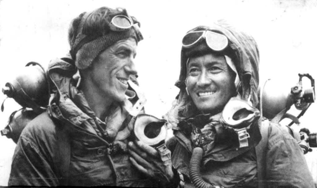
Источник фото: журнал Life, июль 1953 года
- 1854–1921. Альпинизм – пока не про Гималаи
- 1921–1952. Британская монополия на Эверест как факт. Рождение легенд
- 1950-е – конец 1960-х. «Золотой век» гималайского альпинизма
- 1970 – 1996. Спортивный период
- С 1996 года по наши дни. Торжество коммерческого альпинизма
- Эверест. 18 маршрутов
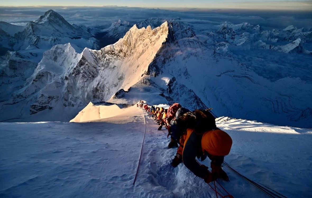
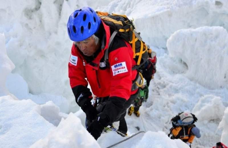
За столетие, прошедшее с первой попытки восхождения на Эверест, на гребнях и стенах этой горы появилось почти два десятка маршрутов. Пройдены все гребни, все стены, все основные кулуары. Однако бо́льшая часть современных восходителей – тысячи из них – выбирают из всего многообразия лишь два: с юга или с севера. Об остальных они часто даже не слышали. Поэтому мы решили напомнить краткую историю освоения склонов высочайшей горы мира и имена людей, выбиравших идти в неизвестное. Об этом в нашем обзоре.
1854–1921. Альпинизм – пока не про Гималаи
Символично, что начало «золотого века» альпинизма практически совпадает с открытием вершины Эвереста. В конце 40-х годов XIX века английские геодезисты проводили измерения высоты вершин, расположенных на границе Тибета и Непала. Достаточно долго, несколько лет обрабатывали материалы, лишь в 1856 году появился отчет, в котором содержалась информация о том, что вершина под номером XV достигает высоты 29002 фута или 8840 метров. Надо сказать, что тогда ни Непал, ни Тибет не пускали тогда на свою территорию иностранцев. Поэтому измерения проводились с расстояния 170–190 км, с вершин приграничных гор. Погрешность в этом случае определяется в пределах 300 метров. Так что точность была почти невероятной.
Тогда же начались споры о названии высочайшей вершины мира. Эти споры продолжаются до сих пор. Английские картографы настояли на своём выборе, назвать её именем выдающегося топографа, организатора соответствующей службы в Индии Джорджа Эвереста. Другие варианты – Джомолунгма, Чомолунгма и Сагарматха также широко распространены. Но для альпинистов Эверест он и есть Эверест.
Официально «Золотой век» альпинизма историки отмеряют с первого восхождения на вершину Веттерхорн в Швейцарии группы известного лондонского юриста и состоятельного джентльмена Альфреда Уиллса в 1854 году. Это был период активного освоения гор Альпийского региона. И рождением альпинизма, как общественного явления спортивного характера. После того, как были совершены первые восхождения на абсолютное большинство альпийских вершин, альпинисты стали больше внимания обращать на другие горные районы. Дошла очередь до Кавказа, Анд, гор США и Азии.

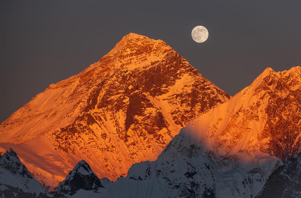
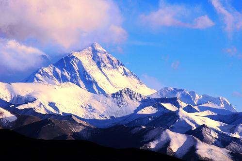
Вид на Эверест с территории Тибета
В 1905 году альпинисты впервые поднимаются на семитысячник. А в 1909 году гид экспедиции герцога Абруццкого Жозеф Петигакс достиг высоты 7670 метров на склонах горы Чоголиза в Каракоруме. Это достижение было превышено только англичанами на Эвересте.
Лидеры и авторитеты английского альпинизма (К. Дент и Д. Фрешфильд) ещё в 80-е годы XIX века начинают обсуждать возможность восхождения на Эверест. Но район труднодоступен по политическим причинам, экспедиции требуют огромных средств, пока идёт разведка. И её ведут профессиональные разведчики. Именно главного шпиона британской короны в горных регионах Азии Фрэнсиса Янгхазбенда можно смело назвать главным инициатором и движущей силой первых экспедиций на Эверест 1921–1924 годов.
В этот период попыток восхождения не могло быть предпринято по политическим причинам. В Тибет и Непал проникали лишь единицы путешественников и разведчиков.
1921–1952. Британская монополия на Эверест как факт. Рождение легенд
Первые английские экспедиции на Эверест 1921 и 1922 года провели детальную разведку и определили маршрут, стратегию и тактику восхождения. Достигнуты новые рубежи – 8170 метров без кислорода и 8320 метров с дополнительным кислородом и без него.
А 1924 год стал для Эвереста эпохальным. В этот год была предпринята первая серьезная попытка достичь вершины. И альпинисты вписали выдающуюся страницу в истории освоения Земли. Они создали историю ставшей легендой, изначальным мифом, вокруг которого стала создаваться вся альпинистская аура вершины мира. Во время первой попытки штурма вершины Эдвард Нортон достиг высоты 8575 метров, это новый рекорд. Скорее всего, примерно такой же высоты достигла вторая двойка Джордж Мэллори и Эндрю Ирвин. Но это точно неизвестно, так как альпинисты живыми вниз не спустились.
Месторасположение тела Мэллори, найденного в 1999 году, и другие детали позволяют представить наиболее вероятный ход событий в тот трагический день 8 июня 1924 года. Достигнув в районе двух часов дня подножья «Второй ступени», альпинисты с лёгкой душой повернули обратно. Они поняли, что этот маршрут просто непроходим, по крайней мере, без специального снаряжения. Уходить в обход на маршрут Нортона было явно поздно. Однако, правильно рассчитать силы Мэллори и Ирвин не смогли. Без закончившегося кислорода, они спускались медленно. В наступившей темноте двигаться было опасно, всё закончилось срывом и гибелью как минимум одного из них – Мэллори. Ирвин, чьи поиски продолжаются, либо замёрз, либо также сорвался.

Британская команда восходителей 1924 года. Джордж Мэллори – второй слева во втором ряду
До начала Второй мировой войны Великобритания сохраняла монополию на организацию альпинистских экспедиций на Эверест. Хотя и для них договариваться с тибетскими властями было делом непростым. Особенно после трагических случаев 1922 и 1924 годов. Однако в последующих экспедициях британские альпинисты были очень далеки от успеха. Почему-то с каждой экспедицией всё дальше!
В 1933 году альпинисты достигли высоты примерно такой же, как в 1924 году. Находящиеся в хорошей форме альпинисты П. Ван Харрис, Л. Уэйджер и Ф. Смайс были остановлены на гребне одним видом Второй ступени, которая очевидно была непреодолима. Попытки обойти её также имели небольшие перспективы. Последующие экспедиции 1935, 1936 и 1938 годов были далеки от успеха, по разным причинам.
В этот период восьмитысячники Гималаев и Каракорума пока не пускают к себе альпинистов, несмотря на множественные попытки. Рано еще…
В этот период британцы приступили к штурму Эверест со свойственной им отвагой. Однако со снаряжением тех лет, особенно это касается кислородного оборудования, достижение вершины было проблематично. В течение этого периода выходы на штурм вершины осуществлялись разными вариантами.
Рекорд высоты рос таким образом:
- 22 сентября 1921 года было впервые достигнуто Северное Седло (7000 метров)
- 23 мая 1922 года Дж. Мэллори, Э. Нортон и Т. Сомервелл – 8170 метров
- 27 мая 1922 года Дж. Брюс и Дж. Финч — 8326 метров
- 4 июня 1924 года Э. Нортон – 8572 метра, примерно такой же высоты предположительно достигли Дж. Мэллори и Э. Ирвин 6 июня.
1950-е – конец 1960-х. «Золотой век» гималайского альпинизма
Важнейшей вехой стало открытие Непала для посещения альпинистами. Особенно с учётом закрытия Тибета. В 1950 году, с восхождения на Аннапурну, начался «Золотой век гималайского альпинизма». Это время, когда новости о совершаемых первых восхождениях на восьмитысячники однозначно ставились на первые полосы газет. И это было предметом национальной гордости.
Гималайские гиганты сдаются один за другим. Эверест стал одним из первых в этом списке. Успеху предшествовали две разведывательные британские экспедиции и две серьезные попытки швейцарцев.
Британской экспедиции под руководством полковника Джона Ханта удалось достичь победы благодаря отличной организации и изобретению относительно эффективной кислородной аппаратуры. Историческим стал день 29 мая 1953 года, когда на высочайшую вершину планеты поднялись новозеландец Эдмунд Хиллари и шерпа Тенцинг Норгей. Швейцарцам удалось повторить маршрут в 1956 году.

Связка Хиллари и Тенцинга при подъёме на вершину. Фото было опубликовано в журнале Life почти сразу после успешного восхождения — в июле 1953 года
Восхождение китайцев на Эверест с севера в 1960 году следует считать недостоверным, как это и было сделано специалистами сразу по получении информации. Перечисление моментов, которые вызывают сомнение в успехе, займёт целую страницу. Воздержимся от этого. Китайцы впервые прошли Северный маршрут в 1975 году и это сомнения не вызывает.
Окончание «Золотого века» гималайского альпинизма логично закончить восхождением китайской команды на последний «непокоренный» и самый низкий из восьмитысячников – Шиша-Пангму в 1964 году. Но сюда же отнесем историческую американскую экспедицию 1963 года на Эверест. Главным достижением был первый траверс, с прохождением нового маршрута по Западному гребню. И очень удачную индийскую экспедицию 1965 года. Это было первое довольно массовое восхождение, когда вершины достигло 9 человек.
Время первовосхождений прошло, нужны новые идеи.
В первой серьезной попытке штурма Эвереста с юга 28 мая 1952 года швейцарец Р. Ламбер и шерпа Тенцинг Норгей достигли высоты 8540 метров. 26 мая 1953 года англичане Т. Бурдийон и Ч. Эванс поднялись на Южную вершину Эвереста – 8760 метров. И, наконец, 29 мая 1953 года первые представители человечества оказались на высочайшей вершине планеты – 8848 метров. Это были новозеландец Эдмунд Хиллари и шерп Тенцинг Норгей. В этот период на северном маршруте китайцы в 1960 году, вероятно, остановились на высоте около 8570 метров, у подножья Второй ступени.
1970 – 1996. Спортивный период
В этот период сильнейшие альпинисты мира испытывали свои силы в поисках новых путей и новых подходов к восхождениям на высочайшие вершины мира. Эверест находится в центре внимания. Строго говоря, он начался с американской экспедиции 1963 года. Но регулярные экспедиции начались с 1969 года, когда для восхождения на Эверест начала выстраиваться очередь из команд на годы вперед.
Вкратце перечислим самые значительные из достижений.
- 1970 год принес Эвересту премию “Оскар” в номинации документальных фильмов благодаря отважному Юичиро Миуре, который спустился с Южного Седла на лыжах. Тогда же было совершено первое японское восхождение на вершину.
- В 1973 году японцы впервые в истории поднялись на Эверест в осенний период, в октябре.
- Но ещё ранее, с 1969 года, начались поиски сложных маршрутов и прежде всего во внимание альпинистов попала юго-западная стена Эвереста. Она была пройдена после нескольких неудачных попыток в 1975 году британской командой во главе с Крисом Бонингтоном.
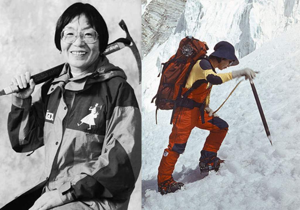
- В это же год было совершено первое женское восхождение – Юнко Табей из Японии, а китайцы проложили маршрута с севера, смонтировав металлическую лестницу на Второй ступени.
- Эпохальным можно считать 1978 год, когда Райнхольд Месснер и Петер Хабелер совершили немыслимый ранее подвиг – первое восхождение без применения дополнительного кислорода.
- В 1979 году отличились югославские альпинисты, которые впервые прошли западный гребень, без всяких обходов.
- 1980 год. Польские альпинисты неожиданно для всех совершили первое зимнее восхождение на Эверест. 17 февраля на вершину поднялись Кшиштоф Велицкий и Лешек Чихи, участники экспедиции, которой руководил Анджей Завада. Позже поляки открыли и новый маршрут вдоль южного гребня.
- Японские альпинисты прошли очень смелый маршрут по кулуару с севера с выходом к вершине по пути Хорнбайна.
- Но главным событием года стало сенсационное соло-восхождение Райнхольда Месснера на Эверест с севера в муссонный период. Его смело можно назвать главным достижением высотного альпинизма ХХ века. Месснер поднялся на вершину в одиночку, совсем без посторонней помощи, без искусственного кислорода и по новому маршруту. В этот год Китай впервые открыл Тибет для иностранных альпинистов и японцы (Ясуо Като) поднялись на вершину по классическому маршруту через Вторую ступень.
- В 1982 году впервые в Гималаи выбрались альпинисты советской школы. Сборная СССР открыла сложнейший маршрут по левой части юго-западной стены. Сразу 11 альпинистов достигли вершины.
- 1983 год. Состоялось первое прохождение восточной, Канчунгской стены. Американские альпинисты удачно прошли очень красивый, но и очень опасный маршрут.
- 1984 год. Австралийцы проходят маршрут, который они назвали «Уайт Лимбо» с выходом через кулуар Нортона (по пути Месснера). Тим Маккартни-Снейп и Грег Мортимер достигли вершины без использования дополнительного кислорода. А американец Фил Эршлер первым среди своих соотечественников поднимается на Эверест по северной стене, в одиночку.
- 1988 год. Состоялось открытие (без кислорода) частично нового маршрута с ледника Канчунг и через Южное Седло.
Своё бескислородное соло-восхождение на Эверест с севера Райнхольд Месснер в подробностях описал в своей книге “Хрустальный горизонт”. В ней он анализирует чужие экспедиции к вершине, а также ведёт хронику собственного восхождения. Команда проекта «Библиотека Спорт-Марафон» перевела на русский язык актуальное издание, в оригинале названное «Everest solo: “Der gläserne Horizont”».
В этот период вырастает поколение шерпов, которые по много раз поднимаются на вершину. Анг Рита первым 10 раз поднимается на вершину, 9 из них без искусственного кислорода. Устанавливаются рекорды скорости, совершается полёт на параплане и разные варианты спуска на лыжах. Стоит отметить, что первый непрерывный спуск с вершины Эвереста на сноуборде – по Большому кулуару северной стены – удался лишь в 2001 году: уроженцу Шамони Марко Сиффреди.
Подробности той экспедиции и последующей, в которой Сиффреди пропал без следа, можно прочесть в книге Джереми Эванса “До завтра. На сноуборде с Эвереста. Жизнь и исчезновение Марко Сиффреди“.
Завершить этот период можно первым полным прохождением многострадального северо-восточного гребня в 1995 году. Японцы прошли его до конца, после нескольких попыток и нескольких трагедий на пути к вершине.

Райнхольд Месснер и Петер Хабелер в базовом лагере у подножия Эвереста

Сборная СССР в базовом лагере Эвереста в 1982 году
Прохождение российской командой северной стены в 2004 году проходило уже в других условиях, в окружении коммерческих экспедиций. Тем не менее, отметим, что это, пожалуй, самый сложный из пройденных маршрутов на Эверест.
В этот период пройдены 14 из 18 маршрутов, совершены первые бескислородные и зимние восхождения. Достигнуть вершины Эвереста в этот период, значит войти в число альпинистской элиты.
С 1996 года по наши дни. Торжество коммерческого альпинизма
Американец Дик Басс в начале 80-х годов показал всему миру, что деньги всё-таки могут помочь подняться на вершину Эвереста. Он неоднократно пытался взойти в составе разных экспедиций, оплачивая все расходы наличными. В конце концов, это ему удалось.
В начале 90-х непальским и китайским властям постепенно стало ясно, что в их владениях лежит неиссякаемый источник доходов. И они стали давать разрешения (пермиты) сначала нескольким экспедициям одновременно, потом и всем желающим. При этом практически каждый год стоимость этих «пермитов» увеличивается.
В экспедициях на Эверест спортсменов постепенно сменяют состоятельные люди либо спонсируемые энтузиасты. Их количество растет из года в год. Каждая страна считает необходимым послать свою команду или отдельных представителей, взойти высочайшую вершину мира. Сняты почти все ограничения по количеству восходителей. Формируется группа профессиональных гидов и команд, фирмы, которые занимаются всем комплексом организации экспедиций. Изменяется стиль восхождения и проведения акклиматизации. Количество восходителей возрастает в разы, очереди становятся нормой. Постепенно входит в норму полное провешивание маршрута перильными веревками. Совершенствуется кислородное оборудование, которое используется во всё большем объёме. Всё остальное снаряжение становится легче и эффективнее. Стоимость восхождения возрастает за этот период примерно в десять раз.
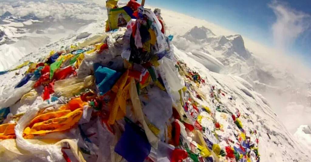
Формируется целое сообщество обслуживающего персонала, состоящее почти исключительно из представителей народа шерпов. Они во многом диктуют свою волю приезжим альпинистам. В частности, болезненно и враждебно относятся они ко всем, кто пытается совершить восхождение дешевым способом и отказывается от каких-то услуг. Несмотря на все усилия по очистке, Эверест страдает от большого количества мусора, а неубранные вмерзшие тела мертвых альпинистов производят жуткое впечатление. Благо, что восхождения теперь совершаются преимущественно ночью.
Эверест стал доступен для новичков, совершенно неподготовленных в альпинистском плане. Количество восхождений резко увеличилось. Гибель участников уже не считается чрезвычайным происшествием, это просто статистический процент. Многих альпинистов современное состояние дел на Эвересте приводит в ужас. Но это отражение общей ситуации в мире. Спортивная составляющая ушла в тень.
Эверест. 18 маршрутов
1. Через Южное седло по юго-юго-восточному гребню
29 мая 1953 года
Вершина: Тенцинг Норгей (Непал – Индия) и Эдмунд Хиллари (Новая Зеландия).
Руководитель экспедиции: Джон Хант (Великобритания).
2. По северо-восточному гребню с перевала Чанг Ла (Северное Седло)
25 мая 1960 года. Три человека, по официальной версии.
Или (более вероятно) 27 мая 1975 года, девять человек.
Китайские национальные экспедиции.
3. По западному гребню и по кулуару северной стены
22 мая 1963 года
Вершина: Вилли Ансилд и Том Хорнбайн (США).
Американская национальная экспедиция. Руководитель: Норман Диренфурт.
4. По юго-западной стене, по центральной части
24 сентября 1975 года
Вершина: Дугал Хэстон и Даг Скотт (Великобритания).
Руководитель: Кристофер Бонингтон (Великобритания).
5. По западному гребню с перевала Лхо Ла
13 мая 1979 года
Вершина: Йерней Заплотник и Андрей Штремфель (Югославия). Всего 5 восходителей.
Спуск по кулуару Хорнбайна.
Команда Югославии, руководитель: Тоне Шкаря.
6. По кулуарам северной стены (Японский/Хорнбайна)
10 мая 1980 года
Вершина: Цунео Шигехиро и Такаши Озаки.
Команда Японского Альпинистского Клуба. Руководитель: Х. Ватанабе.
7. По южному контрфорсу
19 мая 1980 года
Вершина: Ежи Кукучка и Анджей Чок.
Польская национальная экспедиция, руководитель Анджей Завада.
8. С севера через Северное Седло и Большой кулуар (Нортона)
20 августа 1980 года
Соло: Райнхольд Месснер (Италия), без искусственного кислорода.
9. Левый контрфорс юго-западной стены
4 мая 1982 года
Владимир Балыбердин и Эдуард Мысловский. Всего 11 восходителей.
Сборная команда альпинистов СССР. Руководитель: Евгений Тамм.
10. По центру восточной стены (Канчунг)
8 октября 1983 года
Вершина: Лу Рейхардт, Ким Момб и Карлос Булер. Всего 7 восходителей.
Экспедиция США. Руководитель: Д. Моррисей.
11. По Большому кулуару северной стены (кулуар Нортона, маршрут White Limbo)
3 октября 1984 года
Вершина: Тим Макартни-Снейп и Грег Мортимер, без искусственного кислорода.
Экспедиция Австралии.
12. По северной стене и кулуару Нортона
20 октября 1984 года
Фил Эршлер, первый американец, поднявшийся на Эверест по северной стене.
Соло.
13. С ледника Ронгбук через Западное плечо и кулуар Хорнбайна
20 мая 1986 года
Вершина: Шарон Вуд и Дуэйн Конгден (Канада).
Экспедиция Канады. Руководитель: Дж. Элцинга.
14. По юго-восточному гребню с подъёмом на Южное Седло с востока
12 мая 1988 года
Вершина: Стивен Венейблс (Великобритания).
Международная экспедиция. Руководитель: Р. Андерсон.
15. По северо-восточному гребню с ледника Канчунг
11 мая 1995 года
Вершина: Кийоши Фуруно, Шигеки Имото (Оба — Япония), Дава Тшеринг, Пасанг и Нима (все – Непал).
Японская экспедиция. Руководитель: Т. Канзаки.
16. По северо-западному гребню с подъёмом по Большому кулуару (кулуар Захарова) с ледника Восточный Ронгбук
20 мая 1996 года
Петр Кузнецов, Валерий Коханов и Григорий Семиколенов.
Россия (Красноярск). Руководитель: Николай Захаров.
17. По центру северной стены
Вершина 30 мая 2004 года: Павел Шабалин, Андрей Мариев, Ильяс Тухватуллин. Всего 8 восходителей.
Команда России. Руководитель: Виктор Козлов.
18. По западной части юго-западной стены. «Маршрут Парка»
20 мая 2009 года
Вершина: Чжин Чжан Чан, Кан Ки Сок, Шин Дон Мин и Пак Янг Сок
Корейская экспедиция. Руководитель Парк Янг Сок.

Маршруты на Эверест с севера. Источник фото: nationalgeographic.com

Маршруты на Эверест с юга. Источник фото: adventureconsultants.com

Канчунгская, восточная стена Эвереста. Фото из архива американской экспедиции 1983 года
На сегодняшний день зафиксировано более 11300 человеко-восхождений (это примерно шесть тысяч человек, так как некоторые поднимались неоднократно), из них абсолютное большинство по двум классическим маршрутам – более 98%. На маршруты отличные от классических приходится 267 человеко-восхождений. Последнее из них, по нашим данным, совершено в 2009 году. Половину из неклассических маршрутов после первопрохождения вообще ни разу не пытались повторить. Примерно две трети всех восходителей пробуют свои силы на южной, непальской, стороне Эвереста. Чуть более двухсот восхождений было совершено без использования дополнительного кислорода. Погибло 311 альпинистов, больше трети из них – шерпы.
© Спорт-Марафон, 2023 Данная публикация является объектом авторского права.
Запрещается копирование текста на другие сайты и ресурсы в Интернете без предварительного
согласия правообладателя — blog@sport-marafon.ru
Если вам понравилась статья, поделитесь ею со своими друзьями
в социальных сетях

Мне нравится
Статьи по теме
Обновлен: 06.01.2023
Эверест (Джомолунгма) – самая высокая гора на планете. Ее официально признанная высота – 8848,86 метров над уровнем моря. Координаты высочайшей точки Земли 27°59’23″N 86°55’37″E, она находится на Евразийском континенте.
Что такое Эверест
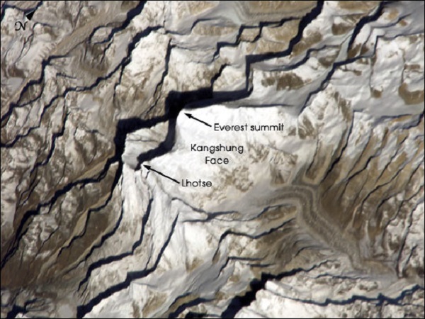
Относительная высота Эвереста от подножия до вершины – около 3550 метров. Пик венчает массивную трёхгранную пирамиду горы. Ее южный склон скалист и обрывист, свободен от снега, как и ребра пирамиды. На восток массив круто обрывается стеной Кангшунг высотой в 3350 метров.
Массив Эверест (Джомолунгма) составляют ряд отдельных пиков. Южная вершина (8760 м) Эвереста лежит на границе Непала и Китая, Главная вершина (8848 м) – на территории Китая.
К югу от пика Эверест расположился пик Лхоцзе (8516 м), их соединяет перевал Южное седло (7906 м). С запада к Лхоцзе примыкает гора Нуптзе (7861), название которой так и переводится “западный пик”. К северу от главной вершны Эвереста находится вершина Чангзе (7543 м), к которой идет круто спадающий гребень Северное седло (7020 м). Высота Северо-восточного плеча 8393 метров.
Ледники, стекающие с массива, оканчиваются на высоте около пяти тысячи метров над уровнем моря. Эверест (Джомолунгма) частично входит в состав непальского национального парка Сагарматха. Из-за больших высот регион малозаселен. Ближе всего к Эвересту где живут люди в буддийском храме Ронгбук, основаном в 1902 году.
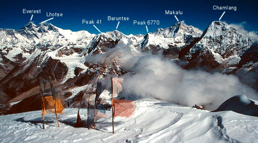
Эверест среди восьмитысячников Гималаев
Эверест расположен в горной системе Гималаи в части Кхумбу-Гимал хребта Махалангур-Химал. На санскрите «Гималаи» означает «обитель снегов». Средняя высота их хребтов около шести километров, максимальная в 8848 метров – на Эвересте.
Гималаи включают 10 из 14 восьмитысячников мира — вершин более восьми тысяч метров над уровнем моря. Помимо Эвереста это Канченджанга (8586м), Лхоцзе (8516), Макалу (8485), Чо-Ойю (8201), Дхаулагири (8167), Манаслу (8156), Нангапарбат; (8126), Аннапурна (8091), Шишабангма (8027).
Оставшиеся четыре находятся в этом же регионе, в соседствующей с северо-запада с Гималаями горной системе Каракорум. Здесь расположилась, в том числе вторая по высоте вершина планеты Чогори или К2 (8614м).
Гималаи расположены на стыке Центральной и Южной Азии между Тибетским нагорьем с севера и Индо-Гангской равниной на юге. Протяженность горной системы – свыше 2900 километров. Гималаи простираются на территории Индии, Непала, Китая, Пакистана, их предгорья заходят на север Бангладеш.
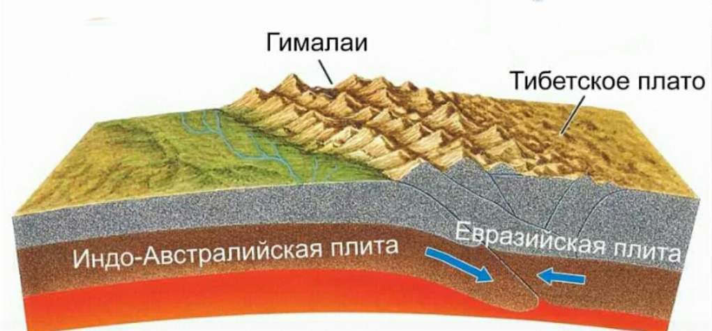
Как появились Эверест и Гималаи
Породы, слагающие Эверест – осадочные отложения, прежде были частью морского дна. В них находят отпечатки древних морских обитателей, возрастом до 450 миллионов лет.
Гималаи и собственно Эверест, а также Тибетское нагорье поднялись там, где Индостанская тектоническая плита сталкивается с Евразийской. Этот процесс начался 50-55 миллионов лет назад.
Прежде Индостанская плита, как и Африка, Австралия, Антарктида, Южная Америка были частью доисторического континета Гондваны.
Тектонические плиты – части земной коры продолжают движение. Индийская плита перемещается на северо-восток на 5 см/год. Она медленно погружается под Евразийскую плиту, которая движется на север на 2 сантиметра в год. Благодаря этому тектоническому процессу ежегодно Эверест становится на четыре миллиметра выше.
Другие претенденты на звание самой высокой точки Земли
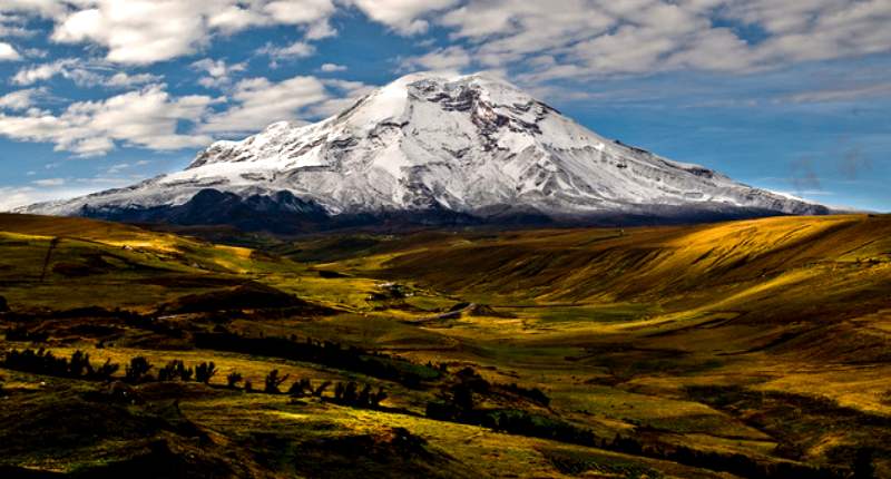
До того, как Эверест (Джомолунгма) получил всеобщее признание, были и другие претенденты на звание высшего пика мира. В течение почти трехсот лет самой высокой из известных точек на Земле считался вулкан Чимборасо в горной системе Анды в Южной Америке. Его высота составляет 6267 метров.
В XIX веке самой высокой точкой планеты стали называть пик Нанда Деви в Индии высотой 7816 метров. Ныне эта вершина лишь на 23 месте среди самых высоких гор.
Когда выяснили что Эверест – высочайшая точка Земли
Что Эверест, тогда еще «Пик XV» – высочайший в мире в 1852 году с помощью тригонометрических расчётов определил математик и топограф Радханат Сикдар. Будучи сотрудником геодезической службы Британской Индии, он смог это сделать, находясь в 240 км от Джомолунгмы.
Высоту вершины Радханат Сикдар определил в 29 000 футов (8839 м). При публикации измерений в 1856 году обьявили, что высота Джомолунгмы – 29 002 фута (8840 м), чтобы их точность не казалось не высокой.
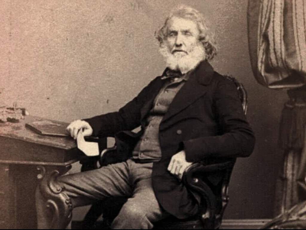
Тогда руководитель геодезической службы Эндрю Во и предложил назвать гору Эверестом в честь своего предшественника. Джордж Эверест руководил геодезической службой Британской Индии в 1830-1843 годах.
Высочайший в мире пик имеет несколько имен. Если англичане назвали его Эверест, то тибетцы – Джомолунгма – «Божественная Мать жизни». Эти два названия наиболее распространены. Непальцы именуют гору Сагарматха, что означает «Мать богов». На китайском название горы будет звучать как Шэнмуфэн.
Последующие измерения высоты Эвереста
В дальнейшем высоту горы Эверест неоднократно пытались уточнить. В 1950-х годах индийские топографы при помощи теодолитов вновь измерили высоту Джомолунгмы. Она по их расчетам составила 29 028 футов (8848 метров) над уровнем моря.
В 1975 году китайская экспедиция уточнила высоту вершины до 8848,13 метров.
В 2005 году государственное управление геодезии и картографии Китая опубликовало новые результаты измерений. Высота Эвереста (Джомолунгмы) по отметке твердых пород составила 8844,43 м (±21 см) над уровнем моря.
С 8 апреля 2010 года официальная высота Джомолунгмы фиксируется на отметке 8848 м над уровнем моря, а высота твёрдой породы составляет 8844 метров.
После непальского землетрясения 2015 года были сомнения, что высота Эвереста могла измениться. Так консорциум геофизических исследований UNAVCO посчитал, что Эверест стал примерно на 1 дюйм или 2,54 сантиметра ниже.
Требовались новые данные. Непал измерил высоту Эвереста весной 2019 года. Китай провел точные измерения высоты в мае 2020 года.
8 декабря 2020 года власти Непала и Китая объявили результаты совместных измерений высоты горы Эверест. Теперь точная высота Эвереста определена как 8848,86 метров. Об этом сообщили министр иностранных дел Непала Прадип Кумар Гьявали и его китайский коллега Ван И. Можно сказать, что в результате измерений Эверест «подрос» на 86 сантиметров.
Эверест как мечта альпинистов
Подъем на Эверест как высочайшую вершину Земли – хрустальная мечта многих альпинистов. Каждый год Эверест пытаются покорить около полутысячи человек.
Сколько человек поднялось на Эверест за историю восхождений
В 2022 году на Эверест со стороны Непала поднялись 254 клиентов и 406 сопровождавших их шерпа. Соотношение количества шерпов и клиентов составляло 1:1,7 – самый высокий показатель за историю восхождений на Эверест.
За историю восхождений на Эверест на его вершину на конец 2022 года поднялись 11384 человек, если учитывать только уникальные восхождения, без повторных восхождений одного и того же альпиниста. С южной непальской стороны – 7733 восхождения, с северной – 3651.
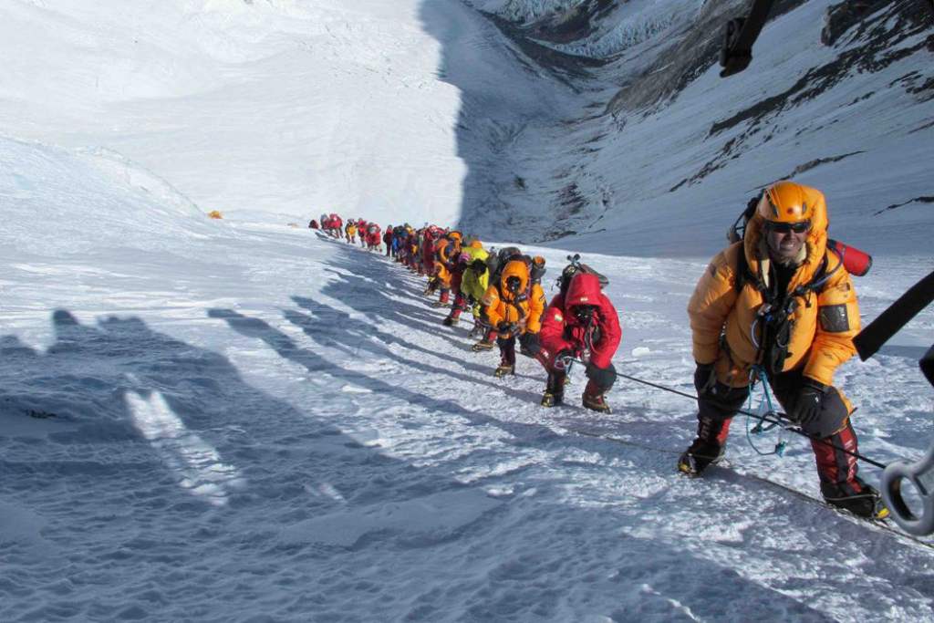
В 1983 году вершины достигли всего восемь человек, в 1990 – около сорока. А только за один удачный день 2012 года на Эверест поднялось 234 альпиниста. Из-за количества восходителей на классическом маршруте порой случаются пробки, как на оживленной трассе в час пик.
И если в 2019 году на Эверест поднялись рекордные 871 человек, то в 2020 из-за пандемии коронавируса всего 28.

Успех экспедиции во многом зависит от погоды, акклиматизации альпинистов и экипировки. Для страховки используют веревки диаметром в 10 миллиметров. Скольжение ботинок на льду предотвращают металлические шипы – «кошки». Ледорубы остановят возможное падение на скалистой и ледяной поверхности.
Важно иметь подготовку, опыт восхождения на другие вершины. Гидами и носильщиками на Эвересте чаще всего работают жители запада Непала – шерпы. Они хорошо адаптированы к высоте.
Сколько времени нужно, чтобы подняться на Эверест
Экспедиция на гору Эверест занимает в среднем около 2 месяцев. До двух недель уйдет на подъём из столицы Непала – города Катманду до базового лагеря. Есть вариант сократить путь, добравшись воздушным транспортом до аэропорта в Лукле.
Ещё около месяца уходит на акклиматизацию к высоте. Необходимо, чтобы организм приспособился к низким атмосферному давлению, содержанию кислорода. Ее продолжительность зависит от подготовки и опыта альпинистов.
На сам штурмовой выход понадобится около недели, чтобы подняться из базового лагеря до вершины. Еще дней пять займет спуск в базовый лагерь.
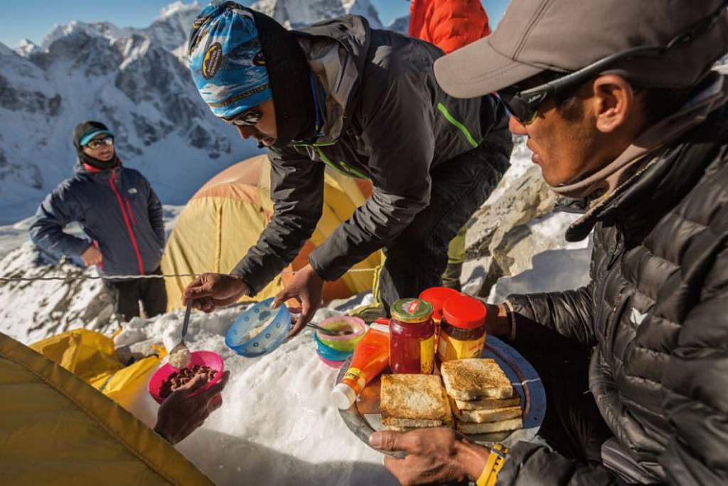
Обычно альпинисты тратят более 10 тысяч калорий ежедневно. Во время штурма вершины это число удваивается. В среднем горовосходители в ходе экспедиции теряют 10—15 килограммов веса.
Классический маршрут подъема на Эверест
К вершине Эвереста проложено 18 маршрутов различной сложности. Если осенью на Эверест поднимаются с юга – со стороны Непала, то весной еще и по северному склону – из Китая, в эти сезоны нет муссонов.
Самый популярный и наиболее простой маршрут – классический с юга с базового лагеря на высоте 5364 метров. Им шли еще первые покорители вершины.

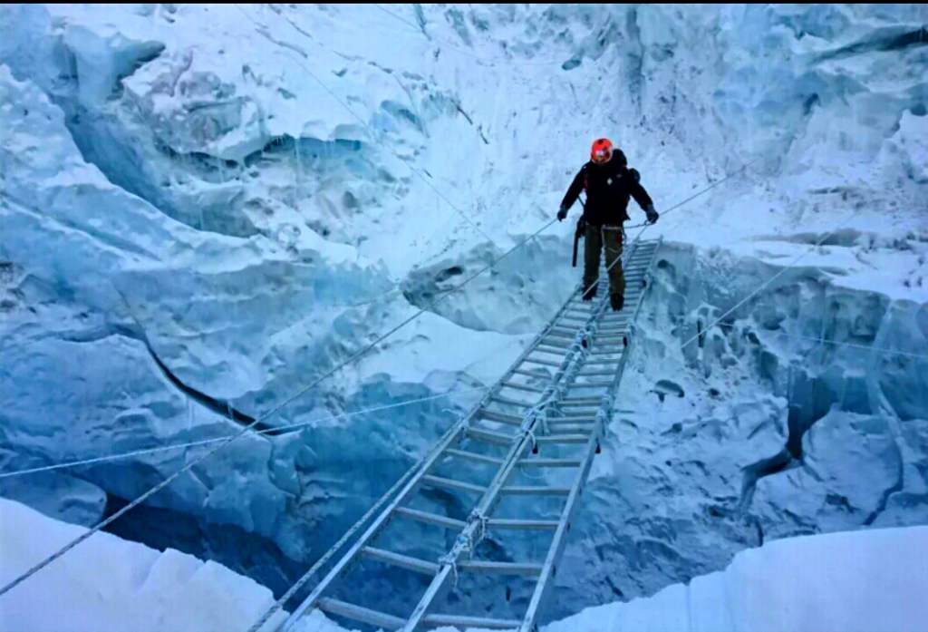
Прежде всего нужно преодолеть ледопад Кхумбу, месиво ледяных глыб с глубокими трещинами. После ледопада ставится первый высотный лагерь.
Затем нужно пройти через Западный цирк ко второму высотному лагерю, через стену Лхоцзе к третьему. Путь к четвертому – последнему высотному лагерю лежит на Южное седло Эвереста. Отсюда по Южному гребню и идут на штурм вершины.

Самый сложный участок восхождения на Эверест — последние 300 метров. Их альпинисты заслуженно назвали «самой длинной милей на Земле». Это крутой гладкий каменный склон, прикрытый снегом.
Первые попытки восхождений
До первого успешного восхождения на пик Эвереста (Джомолунгму) в 1953 году состоялось около полусотни экспедиций в Гималаи и Каракорум. Их целью был сам Эверест, а также Чогори, Канченджанга, Нангапарбат и др. Тогда удалось взойти на ряд местных семитысячников. Первым восьмитысячником, покоренным альпинистами, стала Аннапурна. На нее в 1950 году поднялись участники французской экспедиции.
До 1949 года альпинисты пытались взойти на Эверест с севера, со стороны Тибета. Дальше всех в те годы продвинулись англичане. Джордж Финч и Джеффри Брюс в экспедиции 1922 года достигли отметки в 8320 метров, впервые использовав кислород.
В 1924 году Нортон поднялся до 8565 метров. В том же году Джордж Мэллори и Эндрю Ирвин побывали на отметке более 8600 метров. Живыми их видели в бинокль в разрыве облаков в 150 метрах от вершины Эвереста. Тело Мэллори было обнаружено лишь в 1999 году. Существует спорная версия, что они все-таки достигли вершины.
В 1933 году П.Вин-Харрис, Л.Уэйгер и Ф.Смит достигли высоты в 8565 метров. В 1934 году Морис Уилсон погиб на высоте около 7 тысяч метров, но есть мнение, что ему принадлежит палатка, позже найденная на 8,5 тысячах метров. Последующие британские экспедиции предприняты в 1936 и 1938 годах.
Лишь в 1949 году англичане смогли провести первую разведку маршрута на Эверест с юга. Ведь территория Непала до 1948 года была закрыта для европейцев. В 1950 же году для европейцев стали невозможны восхождения уже с севера – со стороны Тибетского нагорья.
Первое успешное восхождение на Эверест
Первыми на Эверест 29 мая 1953 года поднялись новозеландец Эдмунд Хиллари и непальский шерп Тенцинг Норгэй, проведя на вершине горы всего 15 минут.
Они поднялись со стороны Непала через Южное седло — по пути, разведанному накануне швейцарцами. Восходители пользовались кислородными приборами. В экспедиции принимали участие более трех десятков шерпов.
Низкие температуры и сильный ветер задержали восхождение на несколько дней, но не смогли ему помешать. Свое достижение Эдмунд Хиллари посвятил коронации королевы Великобритании Елизаветы II. Теперь 29 мая отмечается в Непале и других странах как день Эвереста.
Новыми маршрутами на Эверест
1 мая 1963 года первым американцем на вершине Эвереста стал Джим Уиттакер (Jim Whittaker). Через три недели вторая группа той же экспедиции совершила первопрохождение Западного ребра Эвереста.

24 сентября 1975 года экспедиция британцев, руководимая Крисом Бонингтоном впервые прошла Юго-Западную стену Эвереста. Взошли на пик Даг Скотт и Дугал Хэстон. 26 сентября их путь на Эверест повторили Питер Бордман и шерп Петемба.
Первые женщины на вершине
В 1976 году первой женщиной, поднявшейся на Эверест, стала японская альпинистка Дзюнко Табэй.
В 1978 году первой европейкой на вершине стала полька Ванда Руткевич. Первая попытка подъема женской экспедиции состоялась еще в 1975 году.
На Эверест без кислородных баллонов
Без использования дополнительного кислорода первыми в 1978 году смогли подняться на Эверест итальянец Рейнхольд Месснер и немец Питер Хабелер.

В 1980 году вновь Рейнхольд Месснер впервые поднялся на Эверест в одиночку, не прибегая к помощи высотных носильщиков. Впервые ему удалось подняться в период муссонов. Шел он уже по традиции без кислорода. От базового лагеря на высоте 6,5 км, он по новому варианту пути с Севера добрался до вершины всего за 3 дня.
Первой женщиной, достигнувшей вершины Эвереста без кислородного прибора стала в 1988 году новозеландка Лидия Брэйди.
В 1996 году шерп Анг Рита десять раз побывал на вершине без кислородных баллонов. Спустя 4 года его рекорд побил шерп Аппа Тенцинг, достигший вершины в 11-й раз.
Всего без кислорода на вершину Эвереста поднялось около двух сотен альпинистов, что составляет 2,7% от всех восхождений на пик.
Впервые зимой на вершине Джомолунгмы
Первыми зимой в 1979-1980 году на вершину Эвереста поднялась польская группа – Лешек Циха и Кшиштоф Велицкий по юго-восточному гребню при температурах ниже пятидесяти градусов по Цельсию.
Через несколько месяцев (весной 1980 года) поляки Анджей Чок и Ежи Кукучка проложили новый маршрут по южному контрфорсу на Эверест. Оба восхождения проходили под руководством Анджея Завады.
Восхождения на Эверест советских и российских альпинистов
В мае 1982 года 11 участников советской экспедиции альпинистов поднялись на Эверест по ранее непроходимой юго-западной стене. Маршрут – один из сложнейших в истори, причём, два восхождения на пик были совершены ночью.
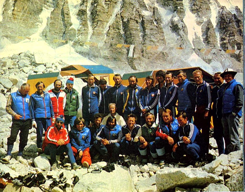
Советская экспедиция была 25-й по счету, достигшей вершины. До всех ее участников Эверест стал первым восьмитысячником. Руководитель экспедиции – Евгений Тамм, старший тренер – Анатолий Овчинников, тренер – Борис Романов, капитаны штурмовых четвёрок – Валентин Иванов, Ерванд Ильинский, Эдуард Мысловский.
Первыми на вершину поднялись Владимир Балыбердин и Эдуард Мысловский. Балыбердин – без кислородного аппарата. Впервые ночью на вершину Джомолунгмы 4 мая 1982 года поднялся Сергей Бершов в связке с Михаилом Туркевичем. 5 мая поднялись на Эверест Валентин Иванов и Сергей Ефимов. Ночью с 8 на 9 мая – Казбек Валиев, Валерий Хрищатый. А в День Победы 9 мая – Валерий Хомутов, Владимир Пучков и Юрий Голодов.
В 1990 году первой советской альпинисткой, достигнувшей вершины стала Екатерина Иванова.
В 1992 году российская команда альпинистов «Лада-Эверест» из Тольятти совершила групповое восхождение на Эверест. 12 мая 1992 года на вершине побывало 32 человека.
Весной-летом 2004 года российские альпинисты поднялись на вершину самым сложным маршрутом по центру Северной стены.
В команду вошли два десятка лучших альпинистов страны под руководством Виктора Козлова. Экспедиция – значимое событие российского альпинизма, наряду с восхождением на Эверест в 1982 году, траверсом Канченджанги (1989 г) и первопроходом Южной стены Лхоцзе (1990 г).
Без кислорода и в альпийском стиле
В 1984 году на вершину Эвереста впервые поднялась австралийская команда, проложив маршрут White Limbo по Северной стене. Шли альпийским стилем без кислорода и помощи носильщиков. 3 октября на вершину поднялись Тим Макартни-Снейп и Грег Мортимер.
Чаще всех и дольше всех на вершине Эвереста

7 мая 2022 года непальский альпинист Ками Рита Шерпа установил новый рекорд числа восхождений на вершину Эвереста. Он взошел на высшую точку планеты в 26-й раз! Ками Рита Шерпа был руководителем группы, провешивающей перила с непальской стороны. 52-летний Ками побил свой же рекорд 2021 года, когда поднялся на Эверест в 25-й раз. На его счету пять двойных восхождений за сезон: в 2009, 2010, 2012, 2013 и 2019 годах.
Женский рекорд по числу восхождений на Эверест принадлежит непальской альпинистке Лакпа Шерпа. 12 мая 2022 года в возрасте 48 лет она поднялась на самую высокую вершину мира в рекордный десятый раз.
12 и 19 мая 2012 года жительница Непала по имени Чхурим поставила рекорд, дважды за неделю зайдя на Эверест.
В 1999 году шерп Бабу Шири провёл на вершине 21 час. Этот рекорд побил в мае 2011 года непалец Бхакта Кумар Рай, находясь на вершине 32 часа.
21 мая 2004 года Пемба Дордже установил рекорд скоростного восхождения на Эверест: 8 часов 10 минут от базового лагеря возле ледника Кхумбу.
Из женщин самой быстрой оказалась альпинистка из Гонконга Цанг Инь Хунг, совершившая весной 2021 года восхождение на вершину Эвереста менее чем за 26 часов.
Самые возрастные и юные, взошедшие на Эверест
Самыми возрастными альпинистами, побывавшими на вершине Эвереста стали японцы. Среди мужчин – 80-летний Миура Ючиро, поднявшийся на вершину 23 мая 2013 года. Самая пожилая женщина на вершине Джомолунгмы – Тамае Ватанабе, совершившая восхождение в возрасте 73 лет.
Самым возрастным альпинистом, взошедшим на Эверест с севера (в 72 года, 25 мая 2014 года ) и юга (в 67 лет, 23 мая 2009 года) стал американец Билл Берк.
Самый молодым из поднявшихся на вершину стал 13-летний американский школьник Джордан Ромеро. Он взошел вместе с отцом с северной стороны 22 мая 2010 года.
Джордан побил рекорд 15-летней Мин Кипа Шерпа из Непала, поднявшейся в 2003 году. Самой же юной, взошедшей на Эверест в 13 лет, 11 месяцев 24 мая 2014 года стала Пурна Малаватх (Индия).
Самое эффектное завершение программы Семи вершин
В 2001 году восхождение на Эверест совершил незрячий американец Эрик Вейхенмайер. Здесь он завершил программу семи вершин, побывал на самых высоких горных пиках всех континентов.
С Эвереста на лыжах и сноуборде
В 1969 году японец Миура, чудом остался в живых, пытавшись первым спуститься с вершины на горных лыжах.
В 1992 году с южной вершины по склону Эвереста на лыжах спустился француз Пьер Тардевель, преодолев 3 км за 3 часа. Через 4 года итальянский лыжник Ханс Каммерландер спустился с высоты 6400 м по северному склону. Он был у подножия «Крыши мира» через 17 часов. В 2000 году съехал с Джомолунгмы на горных лыжах словенец Даво Карничар.
Француз Кирил Десремо совершил первый спуск с вершины на сноуборде в 1998 году.

В мае 2001 года француз Марко Сиффреди спустился с вершины Эвереста на сноуборде по Кулуару Нортона, добравшись до базового лагеря за два с половиной часа. Через год Марко пропал без вести при попытке спуска с Эвереста на сноуборде по Кулуару Хорнбайна.
Полеты над Джомолунгмой
Первые полеты на самолетах над Эверестом состоялись 3 апреля 1933 года. Тогда над вершиной пролетели два биплана британцев маркиза Клайдсдейла и Дэвида Макинтайра.
На параплане‑тандеме с вершины Джомолунгмы первыми слетели супруги из Франции, Бертран и Клер Бернье в 2001 году. Мировой же рекорд высоты полета установили непальцы Сано Бабу и Лапка Шерпа 21 мая 2011 года, пролетев в 30 метрах над вершиной.

Впервые полёт на дельтаплане над Эверестом совершил в мае 2004 года итальянец Анджело Д’Арриго.
Вертолёт на эту вершину впервые успешно посадил 14 мая 2005 года лётчик-испытатель Дидье Дельсаль. Эта была машина марки Eurocopter AS 350 Ecureuil.
В 2008 году 3 парашютиста (Венди Смит, Холли Бадж и Нейл Джонс) приземлились на вершину, прыгнув с самолёта с высоты чуть менее 9 км – на 142 м выше пика Эвереста.
На 400 метров над Эверестом – рекорд дронов
27 мая 2022 года китайская группа смогла поднять беспилотник над Эверестом на рекордную высоту в 9232 метра.

Команда 8KRAW достигла вершины на рассвете 27 мая. Была хорошая погода, относительно теплый день. Затем они запустили беспилотник, сверхлегкий DJI Mavic 3.
В течение последних лет несколько дронов летали над вершинами Гималаев и Каракорума. Однако, пролет на высоте более 400 метров над вершиной Эвереста — новый рекорд среди дронов.
Эверест и пандемия коронавируса
В 2020 году пандемия коронавируса фактически сорвала сезон восхождений на Эверест. На высочайшую вершину планеты за тот год поднялось лишь 28 альпинистов. Все – со стороны Китая в составе трех китайских экспедиций. Все восхождения уложились в отрезок с 26 по 28 мая. Это самый поздний старт сезона за 32 года коммерческих экспедиций.
Во второй пандемийный 2021 год Непал вновь открыл Эверест для посещения, но из-за ряда ограничений, альпинистов было меньше чем обычно. Согласно подсчетам Алана Арнетта в сезон 2021 года на Эверест поднялось, по крайней мере, 534 человека – 195 альпинистов с 339 шерпами. Все они взошли с южной непальской стороны. Китай, поначалу разрешивший подъем ряду национальных групп, в итоге закрыл Эверест с севера, опасаясь контакта с зараженными COVID-19 альпинистами из Непала. А больные короновирусом альпинисты с непальской стороны, действительно, поднимались на вершину Эвереста.
Сколько альпинистов погибло на Эвересте
На конец 2020 года (с 1921 года) погибшими на Эвересте официально считаются 306 человек. 196 альпинистов погибло при восхождении с южной стороны, 109 человек – с севера. Ведется даже список погибших на Эвересте.
В 2021 году этот список пополнился именами еще 5 жертв. Общее их число достигло 311 погибших.
Учитывая число поднявшихся свыше 10 тысяч человек, более чем на три десятка успешно поднявшихся приходится одна смерть. На текущий момент процент смертности на Эвересте составляет 2,98%. В 1990-ые годы коэффициент смертности составлял внушительные 5,6%.
Причина смерти чаще всего недостаток кислорода, сердечная недостаточность, обморожения, а также лавины, ледовые обвалы и камнепады.
Из-за трудности эвакуации тела погибших часто остаются на склонах горы, оставаясь в сохранности из-за климата.

Некоторые служат ориентиром. Как, например, «Зелёные ботинки» – тело одного из погибших в 1996 году, пролежало более 17 лет на высоте в 8500 метров. Недавно оно исчезло с тропы, вероятно его похоронил в снегу и камнях кто-то из альпинистов.
В 2021 году впервые на Эвересте тело погибшего альпиниста смогли эвакуировать с высоты более 8 650 метров. 10 человек смогли снять погибшего от изнеможения Абдула Варайча.
Случаи массовой гибели на Эвересте
Не менее 19 альпинистов погибли (все — в Базовом лагере Эвереста) и несколько десятков пострадали 25 апреля 2015 года из-за схода снежных лавин в результате разушительного землетрясения. Всего в Непале и соседних странах землетрясение унесло жизни более чем 8 тысяч человек.
18 апреля 2014 года в результате схода лавины чуть ниже первого высотного лагеря на высоте около 5800 метров погибли 16 шерпов-проводников, тела трех из них так и не нашли.
15 альпинистов не вернулось с восхождения в мае 1996-го года из-за внезапного бурана. На Южном склоне тогда погибло 8 из 22 участников экспедиций фирм «Горное безумие» и «Консультанты по приключениям». В спасении людей участвовали инструкторы Анатолий Букреев и Нил Бейдлман, удостоенные Призов Дэвида Соулза от Американского Альпийского клуба.

События 1996 года описаны в книге «В разреженном воздухе» участника восхождения журналиста Джона Кракауэра (США). Анатолий Букреев в соавторстве с Вестоном Де Уолтом опубликовал в ответ книгу «Восхождение». Вышел ряд фильмов, в том числе «Эверест» в сентябре 2015 года, посвященных этим событиям.
Многочисленной по числу жертв стала и неудачная экспедиция 2011-го года, когда погибли 11 человек.
Из-за очередей на пути к вершине в майский сезон 2019 года буквально за неделю на Эвересте погибло одиннадцать альпинистов.
Почему гибнут на Эвересте, «зона смерти» выше 8 тысяч метров
Трудность восхождения обусловлена экстремальными климатическими условиями вследствие значительной высоты. Содержание кислорода настолько низко, что граничит со смертельными значениями. В разрежённом воздухе развивается так называемая горная болезнь. Уменьшается сопротивляемость организма, нарушается концентрация внимания, могут быть провалы в памяти и галлюцинации. Смертельно опасные осложнения горной болезни – отек мозга или легких.
«Зона смерти», где организм не может восстановить силы после физических нагрузок, начинается на высоте в 7925 метров. Выше в воздухе содержится лишь треть кислорода, от той, что присутствует на уровне моря. Долгое нахождение здесь окончится неминуемой гибелью. В «зоне смерти» альпинисты, как правило, используют кислородные маски. Это позволяет им ощущать себя, как на высоте в почти тысячу метров ниже, значительно облегчая восхождение. Кстати, из-за низкого атмосферного давления всего в 326 мбар температура кипения воды на вершине горы Эверест (Джомолунгма) всего 70° C.
Опасны и низкие температуры. Среднемесячная температура воздуха в январе на вершине Эвереста −36 °C (ночью может понижаться и до −50…−60 °C), в июле она не поднимается выше 0 °C. Температуры в минус 60 градусов отягощенные сильными ветрами до 200 км/ч могут субъективно ощущаться как минус 100—120 градусов. Подробнее про ветро-холодовой индекс можно узнать здесь.На таких высотах интенсивна солнечная радиация. Опасны лавины, пропасти и расщелины.
Стоимость восхождения на Эверест
Значительную часть горовосходителей составляют состоятельные туристы, не всегда с большим опытом альпинизма.
Если подниматься самостоятельно – своей группой от 15 человек и выше то можно уложиться в 30 тысяч долларов США на восходителя. Восхождение в коммерческой группе с оборудованием, транспортом, гидами и носильщиками обойдется от 40 до 80 тысяч долларов.
Стоимость разрешения на восхождение (пермит) от правительства Непала зависит от размера группы. Оно составляет от 10 до 25 тысяч долларов на человека. Несколько дешевле подняться на Джомолунгму со стороны Китая.
Даже с высокими сборами, ограничивающими количество туристов, на склонах Эвереста остаются десятки тонн мусора.
Поэтому каждый альпинист, поднимающийся на Эверест, должен вынести со склона горы не менее 8 килограммов мусора. Эта норма была введена в 2014 году постановлением Министерством туризма и гражданской авиации Непала.
Инфографика

Шокирующая правда
Напоминая по форме пирамиду, поднявшуюся на многие километры над уровнем моря из-за движения литосферных плит, Эверест возвышается над Азией прямо на границе Китая и Непала. Этот пик по праву считается одним из самых великолепных по красоте, но, в то же время, трагических и опасных мест в мире. Его скалистый силуэт неизменно привлекает многочисленных отважных и мужественных покорителей, которые пытаются достичь вершины ценой огромных усилий, а иногда — даже ценой собственной жизни.
К сожалению, многие скалолазы так и остались навечно среди снегов и скалистых ущелий. Более 235 альпинистов и местных жителей погибли при попытке покорить самый высокий пик земного шара (хотя точное число погибших на сегодня остается неизвестным, ведь не все из них официально зарегистрировали свое восхождение). Сложность заключается не только в повышенном атмосферном давлении и разреженном воздухе, которым невозможно дышать в течение длительного времени, но и в опасности самого маршрута. Тем не менее, несмотря на все эти сложности, многие люди продолжают рисковать жизнью для того, чтобы провести считанные минуты на вершине мира. Есть в ней что-то такое, что неодолимо влечет отважных альпинистов…

Сколько стоит подняться на Эверест?
Этот вопрос сегодня очень популярен. Всем известно, что высотные экспедиции требуют не только серьезной физической и тактической подготовки участников, но и вложений немалых средств. Средняя цена составляет около $30.000, если вы идете сами по себе или своей организованной и независимой группой. Туристические компании предлагают собственные экспедиции, и цена на их услуги составляет около $60.000. Цена экспедиции уровня VIP, которая включает в себя постоянный доступ в Интернет и телефонную связь, зачастую выше, чем $90.000. В целом, все зависит от гида и количества и качества услуг, входящих в пакет. Тем не менее, при выборе инструктора и компании важно учитывать не только цену и имидж фирмы. Всегда лучше всего самостоятельно и очень скрупулезно изучить этот вопрос. В частности, не лишним будет обратить внимание, входит ли в пакет стоимость перелета и услуги шерпов. Дело в том, что иногда за участие местных «помощников» приходится платить на месте, когда вы уже находитесь в базовом лагере, поэтому, чтобы избежать неожиданных сюрпризов, всегда лучше заранее изучить детали.
Почему так дорого?
Правительство Непала взимает обязательный сбор со всех иностранцев, которые хотят подняться на Эверест. В зависимости от размера группы и периода времени размер сбора может варьироваться от $11000 до $25000.
Многие читатели наверняка возмутятся: «Откуда такие цены??!» Но, с другой стороны, судите сами: даже с такими сборами на склонах — десятки тонн мусора; при восхождении на Эверест более 200 человек погибло… Представьте себе, что бы произошло, если бы эта плата не взималась, — количество альпинистов, разумеется, резко возросло бы, и вершина стала бы походить на нечто ужасное.
Еще один важный момент заключается в правильном подборе необходимого оборудования, которое также стоит немалых денег. Расходы на услуги гидов, инструкторов и шерпов часто зависят от размера группы, поэтому из года в год цены меняются.

Факты об Эвересте
- Эверест, часть цепи Гималайских гор, составляет 29,035 футов (8848 метров) в высоту.
- Малоподвижный вулкан на Гавайских островах, Мауна-Кеа, занимает первое место в рейтинге самых высоких гор мира, не считая уровня моря.
- Возраст Эвереста — более 60 миллионов лет, он был сформирован за счет толчков Индийской тектонической плиты в направлении Азиатской. В силу сейсмической активности в регионе Эверест с каждым годом становится примерно на четверть дюйма (0,25 «) выше.
- Пик расположен прямо на линии границы Непала с юга и Китая, также известного как Тибет, с северной стороны.
- Джомолунгма (в переводе с тибетского) буквально означает «святая мать вселенной».
- Чтобы сохранить тепло, альпинистам рекомендуется использовать кислород на вершине. Что касается пищи, то еще до восхождения полезно есть много риса и лапши, поскольку понадобится серьезный запас энергии для такой экспедиции. В среднем альпинисты тратят более 10000 калорий ежедневно, и это число удваивается во время восхождения на вершину; на протяжении всей экспедиции ее участники теряют от 10 до 20 фунтов веса.
- За всю историю попыток покорить вершину официально известно, что 282 человека (в том числе 169 западных альпинистов и 113 шерпов) погибли на Эвересте за период с 1924-го по август 2015-го года. Если говорить о причинах гибели, то 102 альпиниста пострадали при попытке восхождения без использования дополнительного кислорода. Большинство тел до этих дней остаются в снегах и ущельях, хотя представители Китая сообщили о том, что много тел было снято. Наиболее распространенной причиной смерти являются снежные обвалы и камнепады, на втором месте — лавины и на третьем — горная болезнь.
- Самый молодой человек из когда-либо поднявшихся на вершину — это американский школьник по имени Джордан Ромеро. Свое восхождение он совершил в возрасте 13 лет, 23 мая 2010 года (поднимался на пик с северной стороны).
- 14 альпинистам удалось перейти с одной стороны пика на другую.
- Скорость ветра на вершине может достигать отметки 200 миль в час.
- В среднем необходимо около 40 дней, чтобы совершить восхождение. Дело в том, что человеческому организму нужно некоторое время для того, чтобы привыкнуть к нахождению на такой высоте над уровнем моря и акклиматизироваться непосредственно перед восхождением.
- Первыми альпинистами, которым удалось подняться на пик Эвереста без использования дополнительного кислорода в баллонах, стала связка Рейнольда Месснера и Питера Хаблера (Италия) еще в 1978-м году. Позже последовавшим их примеру 193 альпинистам также удалось подняться на вершину, не прибегая к дополнительному кислороду (это составляет 2,7% от всех восхождений на пик). В каждом вдохе на вершине Эвереста кислорода на 66% меньше, чем во вдохе, сделанном на уровне моря.
- На сегодняшний день было совершено около 7000 восхождений на пик Эвереста, во всех известных маршрутах участвовало более 4000 человек.
- Самым пожилым альпинистом, сумевшим завоевать гору, был Миура Ючиро (Япония), совершивший восхождение в возрасте 80 лет 23 мая 2013-го года.
- Есть 18 различных официальных маршрутов для восхождения к вершине Эвереста.
- Первая женщина, которая покорила вершину Эвереста, — японская альпинистка Джанко Taбеи (1975-й год).
- Для того чтобы не сорваться со скал и ледников, альпинисты используют нейлоновые веревки диаметром в 10 миллиметров. На подошвы ботинок надеваются специальные металлические шипы («кошки»), предотвращающие скольжение. Кроме того, используются ледорубы, которые смогут остановить возможное падение на скалистой и ледяной поверхности. Что касается одежды, альпинисты выбирают толстые люксы, которые заполнены гусиными перьями.
- Шерпы — это собирательное название людей, которые живут на западе Непала. Первоначально, несколько столетий назад, они мигрировали со стороны Тибета. Сегодня они помогают альпинистам в подготовке к восхождению: помогают нести еду, палатки и другие принадлежности в промежуточные лагеря, расположенные над базовым лагерем.
- Альпинисты начинают использовать баллоны с кислородом на высоте 7925 м (26000 футов). но так достигается всего лишь 915 м (3000 футов) разницы в том, как они чувствуют. В принципе, на высоте 8230 м (27 000 футов) человек будет чувствовать себя, как на 7315 м (24 000 фут) над уровнем моря, что, по сути, не составит существенной разницы в самочувствии альпинистов.
- Температура на пике может опускаться до отметки –62C (80F ниже нуля).

История
Эверест появился на земной поверхности около 60 миллионов лет назад. Гора имеет довольно долгую историю «первых альпинистов», начиная с неудачной попытки, которая была предпринята еще в 1921-м году британской экспедицией Джорджа Мэллори и Гай Баллока. Многим позднее, в 1953-м году, наивысший пик Земли все-таки был покорен храброй связкой итальянских альпинистов Эдмунда Хиллари и Тенцинга Норгэй. История восхождений и новых свершений продолжается и по сегодняшний день. Но самый высокий пик в мире — не только обзорная точка или серьезный вызов для альпинистов, но также и дом для горцев, шерпов, которые живут там более 500 лет. Эта маленькая нация — лучшие гиды и носильщики для туристов и профессионалов, которые решили бросить вызов судьбе и подняться на самую высокую и наиболее сложную для восхождения вершину нашей планеты.
Где расположен Эверест?
Эверест — не только самая высокая гора, это еще и самая высокая точка, расположенная на границе двух стран. Гора находится между территориями Китая и Непала, но ее вершина — в Китае, а точнее — в Тибетском автономном районе. Эверест входит в горную систему Гималаев и является лишь одним из девяти пиков этого горного массива. Интересно, что Гималаи состоят из тридцати девяти наивысших высоких пиков в мире, поэтому Эверест имеет много молодых «братьев». Вместе они образуют забор между плато тибетской и индийской субконтинентальных плит.
Вся горная система находится в Южной Азии и проходит через Пакистан, Бутан, Тибет, Индию и Непал. Это и стало причиной того, что Эверест имеет несколько названий. В Тибете его называют «Джомолунгма», китайская версия названия — «Shèngmǔ Fēng». Местные жители в Дарджилинге называют его «Deodungha», что переводится как «Святая Гора». Много лет считалось, что наивысший пик мира находится в Андах, и только в 1852-м году математик из Индии смог открыть миру действительно самую высокую гору.

Как он получил свое имя?
Наивысшая гора была обнаружена Джорджем Эверестом, который занимал пост Индийского Генерального секретаря, в 1841-м году. С тех пор официальное название, которое было дано наивысшему пику Земли, произошло от фамилии первооткрывателя. До этого в разных странах вершину называли по-разному, исходя из местных языков и диалектов. Но поскольку наивысшая точка планеты должна иметь единое и понятное всем название, то имя официально ее открывшего и стало признано на международном уровне.

В какой стране находится Эверест?
В разные моменты своей истории Эверест считался частью как Китая, так и Непала. После аннексии в мае 1959-го года отношения между Непалом и Китаем стали абсолютно дружелюбными, и тот факт, что граница между странами проходит на пике наивысшей горы мира, — символическое тому подтверждение. Поэтому, теоретически, пик, который находится ближе всего к космосу, не принадлежит одной конкретной стране, а является общим достоянием Непала и Китая. Каждый турист, который решил хотя бы взглянуть на Эверест со стороны, не говоря уже о восхождении на вершину, может на свое усмотрение выбрать, с какой стороны удобнее это сделать. Но справедливо ради нужно отметить, что вид со стороны Непала намного красивее, да и восхождение на порядок легче.

Какова высота Эвереста?
Представьте себе, что вы живете в мире, где нет горы Эверест, ее еще не открыли, и в школе учитель говорит вам, что самая высокая гора — та, что называется Канченджанга, или Дхаулагири, например. Даже в 19-м веке многие были убеждены, что самая высокая точка на нашей планете — это что угодно, кроме Эвереста. Только в 1852-м году было подтверждено, что Эверест — наивысшая точка нашей планеты. Высота горы составляет 8848 метров над уровнем моря и
ежегодно увеличивается на 4 миллиметра в силу движения плит. Кроме того, землетрясения в Непале могут сдвигать Эверест и даже изменять его высоту. Так, современные ученые продолжают утверждать, что ни одно из измерений высоты Эвереста ни с китайской, ни с непальской стороны не является верным. Джомолунгма продолжает расти. Континентальные плиты не стоят на месте, они постоянно толкают Эверест все выше.
Любопытно, что точная высота горы до сих пор является предметом спора. Еще в 1856-м году, когда британским исследователям впервые удалось измерить высоту пика с помощью теодолита, было записано, что она составляет 8.840 м (или 22.002 фута). В настоящее время официальной высотой Эвереста объявлена цифра 8.848 м (29.029 футов).
Чтобы представить себе, насколько высок Эверест, достаточно понять, что его наивысшая точка расположена практически на уровне полета самолета-истребителя. Поэтому совсем не удивительно, что склоны этой горы не населены животными и птицами из-за высокого давления и разреженного воздуха. Впрочем, Эверест является домом для одного редкого вида паука, который скрывается в щелях гор. Это насекомое питается другими замороженными насекомыми, которые попадают на вершину с ветрами и снежными массами.

Окрестности
Массив Эверест состоит из нескольких отдельных пиков, таких как Чангзе высотой 7,580 м (24,870 футов), Нуптсе — 7.855 м (58.772 фута) и Лхоцзе — 8,516 м, или 27,940 футов. На момент открытия этих вершин было весьма непросто измерить высоту горного пика с точностью. Тогда для измерения высоты использовались специальные приборы, называемые теодолиты, вес которых составлял более 500 кг (1.100 фунтов), и для передвижения такого устройства требовались силы 10-15 человек. Было предпринято несколько попыток измерить точную высоту горного пика Эверест, и только лишь в 1949-м, незадолго до первого восхождения, наконец удалось получить точные данные.
Ближайшее место, где живут люди, — Ронгбук, буддийский храм, который был основан еще в 1902-м году. Он был реконструирован не так давно после полного разрушения в 70-х годах прошлого века, во время гражданской войны. В настоящее время это место становится последним жилым помещением на пути альпинистов к вершине мира. В Ронгбуке можно остановиться в небольшом отеле и даже поужинать в крошечном ресторане.

О высоте
В течение почти трехсот лет самой высокой из известных точек на Земле был Чимборасо, вулкан в Андах. Его высота составляет «всего-навсего» 6,267 метров. В XIX веке данная версия была разрушена, поскольку миру стал известен новый чемпион — пик Нанда Деви в Индии с высотой 7,816 метров. Это может показаться смешным, но сегодня Нанда Деви занимает только 23-е место в списке самых высоких гор мира. Но есть причина тому, что перечисленные вершины и вправду были наиболее высокими точками известного на то время мира: ведь Непал, который неспроста называют крышей мира, был закрыт для всех в течение длительного времени.
Интересно узнать
Эверест официально считается одной из самых загрязненных гор в мире из-за отсутствия инфраструктуры и присутствия постоянного притока туристов. Многочисленные группы оставляют после себя огромное количество мусора, начиная от простых пакетов от еды и заканчивая кислородными баллонами и старым оборудованием, которые хранятся и накапливаются десятилетиями на склонах этой горы, считающейся священной для местных жителей.
Ученые постоянно находят останки морских обитателей, которые окаменели в структуре горных пород 450 миллионов лет назад, в то время, когда поверхность Эвереста еще не была вершиной или горой, а оставалась частью морского дна. Гималаи образовались всего-то 60 миллионов лет назад. Рекордсменами по посещению пика Эвереста являются два шерпа: Апа Шерпа и Таши Пурба, которые сумели взойти на пик 21 раз, получив возможность любоваться высокогорным ландшафтом Гималайских гор с наивысшей точки.
Смертность
К сожалению, гора Эверест оказалась очень сложным местом для восхождений и по праву считается одним из опаснейших пиков на Земле. Опасность заключается в рекордно низких температурах и воздухе с пониженным содержанием кислорода, частых обвалах и лавинах, которые забрали множество жизней местных жителей и альпинистов, решивших преодолеть эту высоту. Величайшая трагедия в истории Эвереста произошла в 2014-м году, когда огромная лавина убила 16 местных непальских гидов. Это произошло возле одного из базовых лагерей. Второй по величине стала трагедия 1996-го года, когда с восхождения не вернулось 15 альпинистов.
Эти люди погибли в силу различных причин, некоторые — из-за пользования не соответствующим оборудованием, другие — из-за недостатка кислорода в баллонах или неожиданных изменений погодных условий, сделавших невозможным возвращение в базовый лагерь. Третьей по числу жертв стала неудачная экспедиция 2011-го года, когда 11 человек остались навсегда в снегах Гималайских гор. Все они погребены в снегах и льдах Эвереста. Лавины и камнепады являются наиболее частыми причинами смертности на склонах Эвереста.

Базовые лагеря Эвереста
Для тех, кто решил подняться на Эверест, существует, как уже говорилось ранее, два варианта — начать восхождение со стороны Китая либо пойти по непальскому маршруту. Для того чтобы привыкнуть к атмосферному давлению и акклиматизироваться на высоте, обустроены два основных базовых лагеря. В любом из них каждый турист сможет провести необходимое количество времени, чтобы организм привык к новым условиям, поскольку акклиматизация в данном случае поможет предотвратить горную болезнь. В обоих лагерях есть врачи, которые могут дать совет альпинистам и оценить состояние здоровья каждого перед восхождением. Пребывание в течение некоторого времени в базовом лагере помогает избежать возникновения проблем со здоровьем, связанных с изменением давления.
Южный лагерь расположен со стороны Непала, а Северный — на тибетской (китайской) стороне Эвереста. Несмотря на то, что в северный лагерь в летние дни можно добраться даже на машине, все более и более популярным становится лагерь на южной стороне. И, конечно, все жители окрестных деревень, которые ранее были заняты в сельском хозяйстве и животноводстве, в настоящее время полностью сосредоточены на предоставлении посетителям всего необходимого. Они помогают в транспортировке вещей и припасов в верхние промежуточные контрольные пункты, в приготовлении пищи, предлагают различные продукты. В дополнение к основным промежуточным лагерям на пути к Эвересту есть несколько других, расположенных как перед, так и после основных двух. Они представляют собой промежуточные станции на пути к покорению вершины мира.
Поставка продовольствия и снаряжения в южный базовый лагерь происходит посредством носильщиков шерпов, поскольку транспортное сообщение в этом регионе невозможно. Продукты, лекарства и все необходимое доставляется с помощью яков, местных вьючных животных.

Восхождение
Если вы думаете, что каждый может подняться на Эверест, стоит только очень захотеть, — вы сильно ошибаетесь.
Во-первых, это очень дорого, около 60 000 долларов. Восхождение на самую высокую гору в мире — не просто забавное приключение. Важно понимать, что это не обычный уютный туризм, а вызов и риск смертельной опасности. Каждый год несколько туристов погибают в попытке завоевать этот скалистый пик: кто-то срывается в пропасть или щель между ледниками, кто-то не выдерживает высоких температур, а кто-то заболевает горной болезнью.
Естественно, для такого сложного испытания понадобится серьезная подготовка и огромное количество специального оборудования: обувь, одежда, инструменты и гаджеты. Обязательны также большая группа экспертов и помощников для должной организации путешествия и многолетний опыт восхождения на другие вершины. Но если говорить о самом процессе, то это, конечно, необыкновенно увлекательно. Независимо от того, какой маршрут вы выберете, рекомендуется путешествовать с компаньоном-шерпом. Сегодня этот регион является домом для примерно 3000 шерпов, и все из них являются первоклассными гидами, помощниками и носильщиками, к тому же завоевателями вершин. Если коротко, шерпы — нация горцев. Если вы видели знаменитую фотографию первого восхождения человека на Эверест, то поймете, какими потрясающими, невыразимыми с помощью слов могут быть чувства на вершине. Как признавался Тенцинг Норгэй, «мне хотелось прыгать, танцевать, это были лучшие чувства в моей жизни, поскольку я стоял над всем миром».
Самый популярный сезон для восхождения на Эверест — весна. Осенние экспедиции менее популярны. На сегодняшний день наиболее популярным способом подняться на Эверест является экспедиция под руководством гида. Это гарантирует, что с группой будет профессионал, который знает самый надежный путь к вершине. К тому же на его знания и опыт можно положиться даже в самых непредсказуемых ситуациях, он надежная опора и поддержка для группы. Гид сможет объяснить участникам все, что нужно знать, прежде чем начать восхождение, поможет выбрать необходимое оборудование и проверит физическое состояние, а также состояние здоровья участников, заранее.

План
Самый первый шаг для восхождения на Эверест — начать должную подготовку, в том числе, получить серьезный опыт восхождения на другие вершины. Это очень важные требования, так как подобная экспедиция достаточно рискованна и опасна и требует определенных навыков. Она начинается в одном из базовых лагерей (на южном или северном склоне), который выбирается в зависимости от маршрута и плана восхождения. Так, чтобы добраться до базового лагеря, расположенного на высоте примерно 5.000 м (16.000 футов) над уровнем моря, участникам понадобится около недели. Здесь они могут поговорить с опытными гидами, проверить свое физическое состояние и немного отдохнуть перед восхождением на Эверест. Затем, за дополнительную плату, альпинисты могут прибегнуть к помощи горцев шерпа, которые помогут донести необходимое снаряжение, продукты и баллоны с кислородом в промежуточные лагеря.
Сколько времени потребуется, чтобы подняться на Эверест?
Конечно, восхождение на вершину мира вовсе не подразумевает прогулку по живописным заснеженным склонам. Для менее подготовленных альпинистов и для тех, у кого существует хоть минимальный риск развития какого-либо заболевания, период акклиматизации на средней высоте (в базовом лагере на высоте 5100 метров над уровнем моря) в некоторых случаях может достигать 30-40 дней. На протяжении целого месяца вы будете окружены шерпа и вашими спутниками, пока ваше тело не привыкнет к давлению атмосферы и недостатку кислорода. Только после этого вы можете продолжать восхождение.
В среднем, когда дело доходит до туристических экспедиций, длительность всего восхождения (от момента вашего прибытия в Катманду и заканчивая нахождением на самой высокой точке земного шара) составит около 60 дней. Когда все подготовлено, понадобится около 7 дней, чтобы подняться из базового лагеря до вершины. После этого еще ориентировочно 5 дней потратится на спуск в базовый лагерь.

Первый человек, который покорил Эверест
Хотя первым человеком, которому удалось ступить на вершину мира, стал Эдмунд Хиллари, еще задолго до него было предпринято множество попыток восхождения на Эверест. Еще в двадцатые годы специальная экспедиция недавно созданного Комитета Эвереста разрабатывала наиболее оптимальные маршруты подъема. Не удивительно, что члены этой экспедиции и стали первыми, кто ступил на вершину «священной горы», каким Эверест был для местных жителей. И все же двое совершенно разных людей, сэр Эдмунд Хиллари и непальский альпинист Тенцинг Норгэй, совместно совершили первое успешное восхождение на вершину с южной стороны и наконец смогли очутиться там, где до них никогда не ступала нога человека.
В 1953-м году, когда наконец-то свершилось это выдающееся событие, Китай закрыл Эверест для любых посещений, и мировое сообщество разрешило совершать не более одной экспедиции в год. В условиях низких температур, постоянно терзаемые сильными порывами ветра, Тенцинг и Хиллари, несмотря на необходимость оставаться в одном месте несколько дней к ряду, смогли все-таки покорить наивысшую точку планеты. Свое достижение Эдмунд Хиллари посвятил коронации королевы Великобритании Елизаветы II, и это был лучший подарок в честь знакового события в Великобритании. Хотя Хиллари и Тенцинг провели на вершине горы всего 15 минут, эти 15 минут сегодня сопоставимы разве что с первыми шагами на Луне.
Самый молодой человек, который когда-либо достиг вершины, — это американский восьмиклассник из Калифорнии. Ему было всего 13 лет в день восхождения. Жительница Непала, 15-летняя девочка по имени Мин Кипа Шира, стала второй в рейтинге наиболее юных альпинистов, сумевших покорить Эверест. Ее восхождение увенчалось успехом в 2003-м году. Самым пожилым из мужчин, взошедших на вершину Эвереста, стал 80-летний Миура Ючиро из Японии, а самой пожилой женщиной — Тамае Ватанабе из Японии, совершившая восхождение в возрасте 73 лет.
Если вам понравилась эта статья, то Вы определенно оцените это: Удивительные фотографии, невероятные истории, сказочные места
Видео
Фото

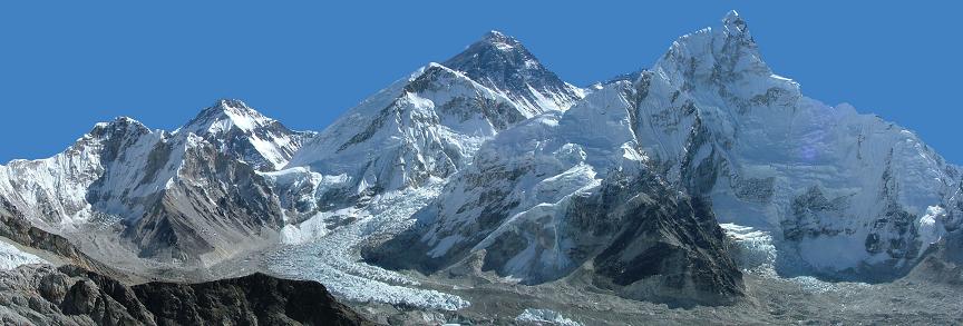

Фото: prudek, bbbbar, blasbike, kiwisoul, muha04, OSHI, v.apl / depositphotos.com
Поделитесь!
Видео: «Эверест. Обещание»
Содержание
- Месторасположение и особенности
- Как вычислялась высота Эвереста
- Кто они, мужественные первопроходцы?
- Отчаянные покорители вершин
- Экстремальные случаи
- Восхождения в наши дни
- Климатические условия, флора и фауна
- Экологическая обстановка
Месторасположение и особенности
Высочайшие вершины в районе Джомолунгмы
Джомолунгма расположена в горной системе Гималаев, а именно в хребте Махалангур-Химал, что находится на границе Республики Непал и Тибетского автономного района КНР.
Высота её северной вершины, расположенной на территории Китая и считающейся главной, составляет 8848 метров. Это абсолютный рекорд среди высочайших гор Земли, которых насчитывается 117 (все они сосредоточены в регионе Центральной и Южной Азии). Южная вершина чуть ниже, 8760 метров, и ее можно назвать «интернациональной»: она находится на границе двух стран.
Гора похожа на трехгранную пирамиду. Склон и ребра с юга настолько крутые, что снег и ледники на них не удерживаются. Не имеет снежного покрытия и скальная стена. Остальные ребра, начиная примерно с 5-километровой высоты, покрыты ледниками.
3D-анимация Джомолунгмы и окружающего ландшафта
Часть Эвереста, расположенная со стороны Непала, входит в состав национального парка «Сагарматха». Именно так – Сагарматха – называется высочайшая вершина мира на непальском языке (в переводе – «Небесная вершина»). С этой стороны она заслонена горами Нупцзе (7879 м) и Лхоцзе (8516 м). Красивые виды на нее открываются с окрестных гор Кала-Патхар и Гокио-Ри.
Джомолунгма – это название переводится с тибетского как «Повелительница ветров» – одна из десяти горных вершин, так называемых восьмитысячников, расположенных в Гималаях (в мире их всего 14). Несомненно, она остается самой привлекательной целью для альпинистов всего мира.
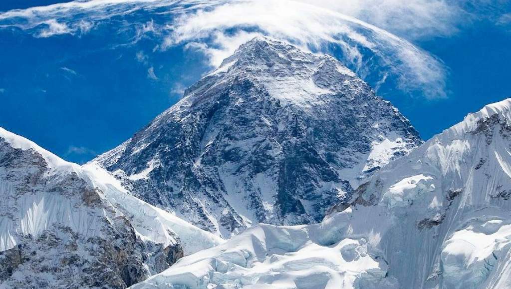
Панорама Эвереста
Как вычислялась высота Эвереста
Эверест (Джомолунгма) издалека
Примечательно, что до 1852 года самой высокой точкой планеты считался многовершинный горный массив Дхаулагири, тоже расположенный в Гималаях. Первые топографические исследования, проводившиеся с 1823 по 1843 годы, отнюдь не опровергли это утверждение.
Через некоторое время все же начали возникать сомнения, и первым их носителем стал индийский математик Радханат Сикдар. В 1852 году, находясь на расстоянии 240 км от горы, он с помощью тригонометрических расчетов сделал предположение, что Джомолунгма или, как ее тогда называли, Пик XV – высочайшая вершина мира. Только спустя четыре года более точные практические вычисления это подтвердили.
Данные о высоте Джомолунгмы часто менялись: по распространенным предположениям того времени она составляла примерно 8872 метра. Однако английский аристократ и ученый-геодезист Джордж Эверест, который возглавлял с 1830 по 1843 годы геодезическую службу Британской Индии, был первым, кто сумел определить не только точное расположение гималайской вершины, но и ее высоту. В 1856 году Джомолунгме дали новое название, в честь сэра Эвереста. Но Китай и Непал не согласились с этим переименованием, хотя заслуги выдающегося геодезиста были вне сомнений.
Сегодня, согласно официально подтвержденным данным, Эверест находится на высоте 8 км 848 м над уровнем моря, из которых последние четыре метра – сплошные ледники.
Путь на вершину Кала-Паттар (5 545 м). Эверест виден слеваВид на вершину Ама-Даблам
Кто они, мужественные первопроходцы?
Восхождение на Эверест
Организация восхождений на «крышу мира» и проведение там научных исследований были затруднены не только из-за высокой стоимости подобных мероприятий. Непал и тогда еще независимый Тибет долгое время оставались закрытыми для иностранцев. Только в 1921 году тибетские власти дали добро и первая экспедиция начала разведку возможных маршрутов восхождения на Эверест по северному склону. В 1922 году муссоны и снегопады помешали исследователям добраться до вершины, альпинисты впервые применяли кислородные баллоны, и дошли до отметки 8320 метров.
По дороге к вершине то и дело встречаются буддийские святилища и мемориалы
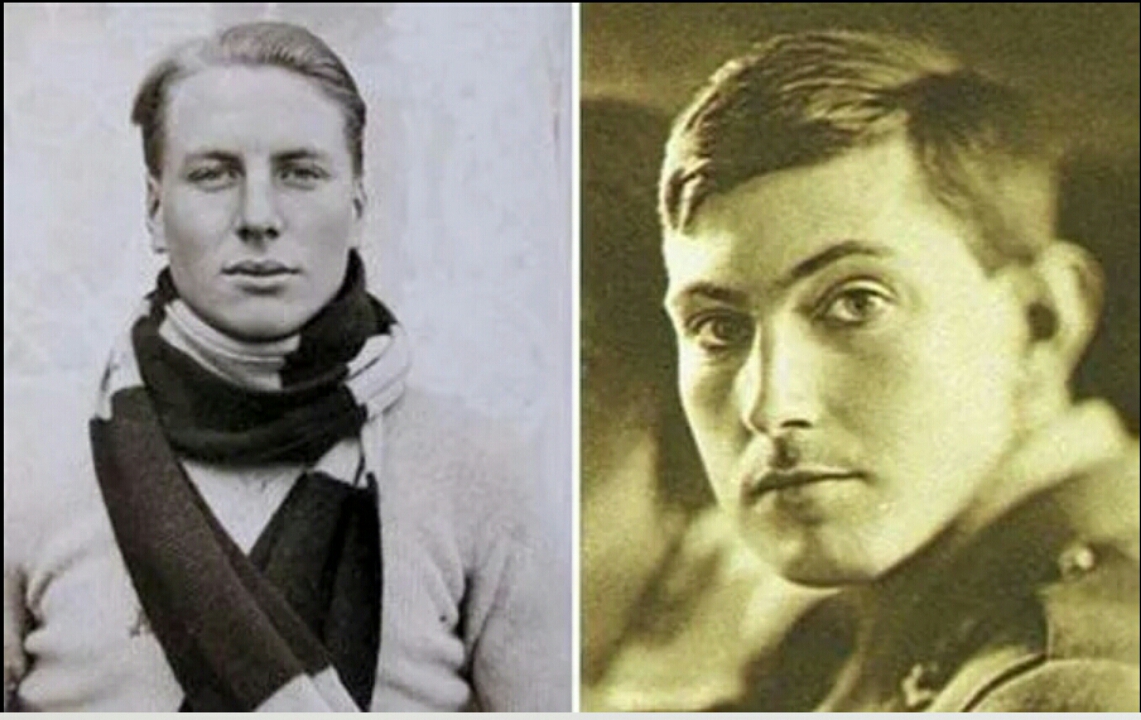
Англичанин Джордж Герберт Ли Мэллори, 38-летний доцент из Кэмбриджа и знаменитый альпинист с большим опытом, был одержим идеей покорения Эвереста. В 1921 году группа под его руководством добралась до высоты 8170 метров и разбила лагерь, а он сам вошел в историю как человек, впервые вознамерившийся покорить эту гордую и неприступную высоту. Впоследствии им предприняты еще две попытки восхождения, в 1922 и 1924 году. Третья из них оказалась последней и… фатальной. 8 июня они вместе с напарником по связке, 22-летним студентом Эндрю Ирвином пропали без вести. С земли их в последний раз видели в бинокль на высоте примерно 8500 метров. И потом – всё: бесстрашные исследователи внезапно исчезли из виду…
Судьба Мэллори прояснилась только спустя 75 лет. 1 мая 1999 года американская поисковая экспедиция обнаружила останки отважного альпиниста на высоте 8230 метров. В том, что это именно он, сомнений не возникло: его опознали по нашивке на одежде «Дж. Мэллори», а также по письму жены, обнаруженному в нагрудном кармане. Сам труп лежал лицом вниз с распростертыми руками, будто силившимися обнять гору. Когда его перевернули, глаза были закрыты, что означало только одно: смерть наступила не внезапно. Дальнейшее обследование останков первой жертвы Джомолунгмы показало, что легендарный исследователь получил переломы большой и малой берцовой кости.
Ледник недалеко от базового лагеря со стороны НепалаТропа к вершине на высоте около 5000 метров
Таким образом, были опровергнуты сразу две версии: о гибели от падения с большой высоты, и о гибели во время спуска. Что же касается Ирвина, то его тело до сих пор не найдено, хотя для всех очевидно, что он тоже тогда погиб. И, скорее всего, потом его сдуло сильным ветром в ближайшую пропасть, глубина которой не меньше 2 км.
Еще одним известным покорителем Джомолунгмы стал британский офицер и альпинист Эдвард Феликс Нортон, в 1924 году достигший отметки 8565 метров, что стало абсолютным рекордом, который держался на протяжении следующих тридцати лет.
В период с 1921 года по 1952 было предпринято около 11 безуспешных попыток восхождения. В 1952 году экспедиция из Швейцарии дважды пыталась покорить вершину. Но вернулись высотники ни с чем.
Эдмунд Хиллари в 1953 году
В 1953 году к английской экспедиции присоединились новозеландские альпинисты. 29 мая 1953 года 34-летний новозеландец Эдмунд Хиллари и 39-летний представитель непальской народности шерпа Тенцинг Норгей стали первыми людьми на Земле, взошедшими на «крышу мира». Они провели там всего 15 минут: из-за недостаточного количества кислорода больше просто не смогли. Норгей символически зарыл в снег печенье и конфеты – в качестве подношения богам. Забавно, что он не смог сфотографировать новозеландца, на вершине получилось запечатлеть только непальца.
Гора Эверест (Джомолунгма)
Тенцинг Норгей семь раз пытался вместе с другими экспедициями подняться на вершину Джомолунгмы. Каждый раз он делал это с особой философией представителя горного народа. Как вспоминал позднее шерпа в своей книге «Тигр снегов», в нем не было ожесточения. Он ощущал себя ребенком, взбирающимся на колени матери.
Что чувствовали они, гражданин далекого островного государства в Тихом океане и уроженец горного гималайского королевства, ставшие первыми покорителями вершины мира? Они обнялись, с чувством хлопали друг друга по спине. Наверное, всю гамму этих эмоций передать словами невозможно.
Эверест на закате
О покорении Эвереста мир узнал только через три дня. Трудно переоценить значение этого события. Неугомонный Хиллари вместе с экспедицией пересек спустя несколько лет Антарктиду. Британская королева Елизавета II, являющаяся также монархом Новой Зеландии, произвела его в рыцари. Также новозеландский альпинист стал почетным гражданином Непала. В 1990 году на вершину поднялся сын Хиллари Питер.
После 1953 года на «крышу мира» отправлялись экспедиции из Соединенных Штатов, Индии, Италии, Японии. Первым американцем, ступившим на вершину Джомолунгмы, стал Джим Уиттакер. Это произошло 1 мая 1963 года. Спустя каких-то три недели мир ждала сенсация сродни первому ее покорению – американские альпинисты перешли через Западное ребро, где ранее еще не ступала нога человека.
С 1975 года на штурм высочайшего пика планеты двинулись представительницы слабого пола. Первой женщиной – покорительницей Эвереста стала альпинистка из Страны восходящего солнца Дзюнко Табэй, а гражданка Польши Ванда Руткевич – первой европейкой в этом качестве. В 1990 году вершины достигла первая россиянка, это была Екатерина Иванова.
Отчаянные покорители вершин
На вершине Джомолунгмы побывало уже более 4 тысяч человек. Многие не единожды. Например, непальский альпинист Апа Шерпа покорял ее 21 раз. Ученые утверждают, что жителям гор легче дается пребывание на такой высоте. И все-таки удивляет рекорд, поставленный местной жительницей Чхурим, которая дважды за неделю поднялась на вершину.
Исследования Эвереста – это в первую очередь испытание предела человеческих возможностей. Итальянец Р. Месснер и немец П. Хабелер в мае 1978 года поднялись на гору без кислородных масок. Месснер впоследствии не раз поднимался в одиночку и установил серию рекордов. Он первый одолел вершину в период муссонов, проходил без помощи носильщиков, в рекордные сроки осилил новый маршрут. Когда изучаешь биографии таких отчаянных смельчаков, понимаешь, что стремление покорять вершины подобно страсти или болезни.
Восхождение на Джомолунгму
В 1982 году советская экспедиция впервые поднялась на Джомолунгму по сложному маршруту со стороны юго-западной стены. Выбор спортсменов был аналогичен отбору космонавтов. 11 человек совершили восхождение, один альпинист был без кислородной маски, один покорил вершину ночью. На фотографиях видно, что красота с такой природной смотровой площадки открывается необычайная. Не передать словами, какое это прекрасное зрелище ночью, при свете звезд.
Как до вершины смогли добраться слепой американец Эрих Вейхенмайер (2001 год) и Марк Инглис с ампутированными ногами (2006 год) – известно только им. Целью смельчаков было показать людям всего мира, что достижение поставленной цели – это реальность. И они это сделали!
Экстремальные случаи
Вид на Эверест с самолета
В истории покорения Эвереста людская отвага зачастую граничит с сумасшествием. Человек неутомим в стремлении устанавливать новые рекорды и достижения, особенно такого рода, с перспективой войти в историю.
Первая попытка спуститься с него на горных лыжах предпринята японцем Миура, который лишь чудом не свалился в пропасть. Меньше повезло французскому сноубордисту Марко Сиффреди. В первый раз спуск с вершины по кулуару Нортона закончился благополучно. В 2001 году отважный спортсмен пожелал съехать по другому маршруту, по кулуару Хорнбейна – и пропал без вести.
О скорости движения лыжников можно судить по спуску француза Пьера Тардевеля. С высоты 8571 метр он проехал 3 км за 3 часа. В 1998 году первым с вершины на сноуборде спустился француз Кирил Десремо.
В далеком 1933 году на биплане (самолете с двумя расположенными друг над другом крыльями) пролетели над вершиной горы маркиз Клайдсдейл и Дэвид Макинтайр.
Пилот Дидье Дельсаль впервые посадил вертолет на вершину горы в 2005 году. Над Эверестом летали на дельтапланах и парапланах, спрыгивали с самолета на парашютах.
Восхождения в наши дни
На покорение Эвереста (Джомолунгмы) решается около 500 человек в год. Это очень дорогое удовольствие. Возможен подъем как со стороны Непала, так и Китая. Отправление из первого обойдется дороже, в то время как с китайской территории – дешевле, но сложнее в техническом плане. Коммерческие фирмы, которые специализируются на сопровождении к вершине высочайшей горы планеты, запрашивают от 40 до 80 тысяч долларов. В сумму входит стоимость современного снаряжения, оплата услуг носильщиков. Только разрешение правительства Непала может стоить от 10 до 25 тысяч долларов. Сам подъем длится до двух месяцев.
Намче-Базар — поселок на пути к Эвересту, который обладает расширенной туристской инфраструктурой, где путешественники могут набраться сил и подготовиться к восхождению
Пример 16-ти дневного маршрута с восхождением на гору Кала-Патхар
Наивно думать, что без богатырского здоровья и надлежащей физической подготовки можно замахнуться на такое трудное и серьезное мероприятие. Альпинистов ожидают сложнейшее восхождение, нечеловеческие нагрузки, вырубка ступеней во льду, прокладывание мостов через трещины в самых суровых природных условиях. Около 10 000 килокалорий в сутки человек тратит при восхождении на Эверест (вместо обычных 3 тысяч). За время подъема альпинисты теряют до 15 кг веса. И далеко не все зависит от них самих, от уровня их подготовки. Внезапный ураган или обвал могут сбить с ног и унести в пропасть, а снежная лавина придавит как мелкую букашку. Тем не менее, все новые и новые смельчаки решаются на восхождение.
До столицы Непала Катманду добираются на самолете. Дорога к базовому лагерю занимает около двух недель. Он расположен на высоте 5364 метра. Путь сюда не очень труден, сложности начинаются дальше. Во время адаптации к экстремальным условиям Эвереста подъемы чередуются со спусками к лагерю. Организм привыкает к разряженному воздуху, холоду. При подготовке к восхождению каждая деталь тщательно проверяется. Когда человек находится над пропастью, его жизнь зачастую зависит от крепости троса и стального карабина, забитого в скальную породу.
Выше 7500 метров начинается так называемая «зона смерти». Кислорода в воздухе на 30% меньше, чем при обычных условиях. Слепящее солнце, сбивающий с ног ветер (до 200 км в час). Не всякий выдержит такие реалии, которые кто-то из исследователей сравнил с марсианскими.
Последние метрыВид с вершины Эвереста
Легкая простуда может закончиться отеком легких или мозга. На пределе работает сердечно-сосудистая система. Обморожения, переломы и вывихи при восхождениях не редкость. А необходимо ведь еще и спуститься обратно, что не менее сложно.
«Самая длинная миля на Земле», – так называют альпинисты последние 300 метров, самый сложный участок. Он представляет собой крутой, очень гладкий склон, припорошенный снегом. И вот она – «крыша мира»…
Покорители Эвереста
Климатические условия, флора и фауна
Величественный Эверест
Летом температура на Эвересте днем не поднимается выше -19 градусов, а ночью – падает до отметки минус 50. Самый холодный месяц – январь. Нередко температура опускается до 60 градусов ниже нуля.
Конечно, в таких экстремальных условиях животный и растительный мир не может быть богатым и разнообразным. Наоборот, он очень скудный. Однако именно здесь обитает самый высокоживущий представитель земной фауны – гималайский прыгающий паук. Его особей обнаруживали на высоте 6700 метров, кажущейся просто немыслимой для существования жизни.
Несколько ниже, на уровне 5500 метров, произрастает многолетнее травянистое растение – горечавка желтая. Еще выше, на высоте 8100 метров, исследователи наблюдали за горной галкой или клушицей, представительницей семейства врановых, близкой родственницей альпийской галки.
Экологическая обстановка
Другой вид на Эверест
В последнее время ученые бьют тревогу и призывают закрыть доступ к самой высокой вершине мира. Причина – катастрофический уровень загрязнения Эвереста и его окрестностей.
Каждый, кто здесь бывает, оставляет после себя около 3 кг мусора. На горе скопилось, согласно предварительным подсчетам, более 50 тонн отходов. Организованы команды волонтеров, очищающих склоны от следов жизнедеятельности человека.
Однако современное снаряжение и проложенные маршруты лишь увеличивают сюда количество приезжих, на трассах даже случаются заторы. И поток туристов к подножию Джомолунгмы растет с каждым годом…
Природа есть самый великий творец, и одним из величайших её произведений является гора Эверест. Большинство людей наслышаны об этой вершине, но видел лично её отнюдь не каждый. Захватывающие виды, белоснежные склоны притягивают к себе словно магнит. И истинные любители искусства, превозмогая все трудности, поднимаются наверх, чтобы насладиться необычайным чувством свободы, которым их одаряют горы за смелость.
Гора Эверест — высочайшая вершина Земли
Гора Эверест или Джомолунгма возвышается над уровнем моря на 8848 метров.

Таким образом по абсолютной высоте эта вершина является высочайшей на планете, обгоняя такие, как Аконкагуа и Мак-Кинли.
Однако стоит учесть тот интересный факт, что по относительной высоте её опережает вулкан Мауна-Кеа, высота которого над уровнем океана составляет 10203 метров. Но всё может измениться, ведь согласно расчетам ученых, Эверест поднимается ежегодно примерно на 4 мм.
Где находится самая высокая гора мира
Эверест входит в состав хребта Махалангур-Химал Гималайских гор, располагающихся на материке Евразия. Одна из его вершин, северная, локализуется на территории страны Китай. Южная же размещается на границе, разделяющей Тибетский автономный район и Непал, национальному парку которого отчасти принадлежит вершина.

Географические координаты для точного определения местонахождения на карте мира — 27°59′17″ северной широты и 86°55′31″ восточной долготы.
Этимология названия
Как известно, Эверест имеет несколько названий. Местное население Непала величает его «Сагоматхой», что означает «властитель неба». В Тибете же вершине дали имя «Джомолунгма» или «Чомолангма» в честь богини, являющейся символом материнской энергии.

Англичане же присвоили горе название «Эверест», которое на настоящий момент считается самым популярным среди прочих. Оно появилось благодаря Эндрю Во, руководителю геодезической службы, и Радхата Сикдара, математика, впервые оценившего высоту горы. Именно по их инициативе фамилия предшественника сыра Джорджа Эвереста стала обозначать во всём мире эту величайшую вершину.
История восхождений на Эверест
Попытки покорить вершину начались с первой половины XIX в. Сделать огромный шаг к достижению цели альпинистам помог кислород. Благодаря его использованию англичанами была пройдена точка 8320 м уже в 1922 году. Затем Джордж Мэллори и Эндрю Ирвин в 1924 г. отправились в этот сложнейший и, к сожалению, трагический путь. Дойти до конца им не удалось — они были замечены неживыми на расстоянии 150 метров от вершины. Однако существует мнение, что альпинисты в этот момент уже спускались вниз.

Помимо хорошо подготовленных спортсменов, забраться на Эверест пытались и люди, достаточно далекие от таких трудных восхождений. Так, в 1934 г. Морис Уилсон, будучи эксцентриком и полагая, что он сможет достичь пика Джомолунгмы лишь за счёт сверхъестественных сил, все же поднялся на уровень 7 км, погибнув в Гималаях.
Первое же официально подтвержденное восхождение состоялось 29 мая 1953 г. Эдмундом Хиллари и сопровождавшим его шерпом Тенцингом Норгеем. Далее подняться на Эверест отважились и женщины. В 1976 вершину покорила Дзюнко Табэй, а в 1990 советская альпинистка Екатерина Иванова.
Вскоре спортсмены стали усложнять себе и так непростую задачу. Например, Райнхольд Месснер и Питер Хабелер напрочь отказываются от использования кислорода, а группа Анджея Завады из Польши решают стартовать зимой, когда температура опускается ниже – 50 градусов по Цельсию.
Экспедиция на Эверест — как покорить Джомолунгму
На протяжении длительного времени Эверест был закрыт для посещения иностранцами правительством Непала и Тибета. Причина тому — вера в священность вершины. Однако позже путь все же открыли для альпинистов, и на настоящий момент ежегодно сотни человек устремляются к ней. Интернет пестрит предложениями посетить Эверест. Кажется, стоит только захотеть человеку, и он уже там. Но так ли это?

Туристу необходимо рассмотреть как минимум 3 фактора, которые могут стать препятствием на пути к покорению Джомолунгмы:
-
Конечно, основной проблемой будет являться стоимость восхождения. Подняться на Эверест – удовольствие не из дешевых. В среднем затраты составят от 35000 долларов до 130000. Такой ценовой разброс объясняется просто — цена зависит от того, какой вариант подъема выберет альпинист: соло, в составе самостоятельной группы или же коммерческой экспедиции. В цену входит перелёт, разрешение властей, а также использование услуг носильщиков, профессиональных проводников и пр.
-
Второй проблемой может стать время. Стоит учесть, что экспедиции для туристов, не являющихся профессиональными спортсменами, стартуют в мае, а длятся они не менее двух месяцев.
-
Третий пункт – здоровье. Необходимо адекватно оценить своё физическое состояние перед тем, как решиться на восхождение. Только турист отвечает за то, как его организм поведет себя в необычных, экстремальных условиях.
Экологическая катастрофа на Эвересте
В связи с ростом популярности такого опасного маршрута как подъем на Эверест, возникла серьезная угроза экологии вершины. К сожалению, большая часть альпинистов не считает нужным спускать отходы жизнедеятельности вниз или хотя бы до базового лагеря, откуда мусор организованно вывозят.

Вершина постепенно превращается в свалку, что сильно портит открывающуюся на высоте панораму. Кроме того, такое пренебрежительное отношение может привести к возникновению на самой высокой точке планеты вирусных заболеваний. В качестве меры борьбы против загрязнения в 2014 году было введено постановление, согласно которому каждый турист обязан вынести с собой как минимум 8 кг мусора.
В заключение хочется сказать, что Эверест – это не просто горная вершина. Одни видят в ней цель всей жизни, другие источник острых ощущений или даже способ доказать себе свою состоятельность. Для всех людей, решающихся подняться наверх, есть своя мотивация. Но никакое описание не сможет передать чувства тех, кто всё же достиг пика.
Что же может испытывать человек, который забрался на самый верх планеты? Может быть Вам повезёт узнать это?
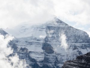
Высочайшая вершина Земли
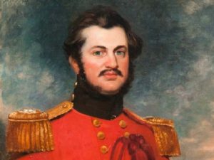
Andrew Scott Waugh
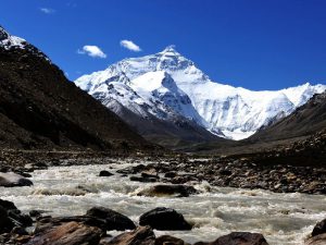
По пути к Эвересту
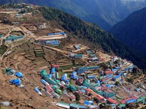
Намче-Базар
Эверест — самая высокая гора в мире, выше Эвереста гор на Земле нет. Именно поэтому восхождение на эту вершину на протяжении многих десятилетий является заветной целью практически всех альпинистов.
Что такое Эверест?
Эверест расположен на юго-востоке Евразии, немного севернее Бенгальского залива и южнее российского Алтая, в горном массив, который называется Гималаями. В этом горном массиве, где находится Эверест, находятся десять из четырнадцати самых высоких гор на планете, за что он получил название «Крыши мира». Гималаи располагаются на территории четырех разных стран: Индии, Непала, Бутана и Китая, хотя географически все горы восьмитысячники расположены в Тибете, страны которой сейчас не существует, она входит в состав современного Китая.
Эверест находится на границе между Непалом и Китаем и представляет собой трехгранную пирамиду более крутую с южной стороны и относительно пологую с севера. Сама гора принадлежит одновременно и Непалу, и Китаю, правда, разные её склоны, но вершина всё-таки находится на территории Китая.
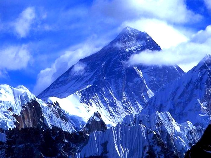
Горный хребет Гималаев — Махалангур-Химал, в центре которого расположен Эверест, образован стыком Индо-Австралийской платформы и Евразийской плиты, в результате смещения которых и образовались эти горы вздыбившиеся на высоту более чем восемь тысяч метров над уровнем моря. Перемещения земной коры продолжаются и поныне, и Гималаи, в том числе и Эверест, продолжают расти на несколько сантиметров в год. Скорее всего этим и объясняется тот факт, что измерения высоты вершины Эвереста в разные годы отличаются друг от друга. Но официально высота Эвереста зарегистрирована как 8848 метров.
История открытия Эвереста
О существовании Джомолунгмы европейцам было известно ещё в начале XVIII века, подтверждением этому является карта Тибета 1717 года, составленная французскими миссионерами-иезуитами. Правда карта была схематичной и без указания высот, но место нахождения самых высоких гор было нанесено верно, и название «Джомолунгма» конкретный факт. То что Джомолунгма является самой высокой стало известно более чем через сто лет.
В начале ХIХ века Лондонское королевское географическое общество решило создать карты Индии, бывшей тогда британской колонии, и прилегающих к ней территорий. Для этого в Британской Ост-Индской компании была организована геодезическая служба, руководителем которой стал Джордж Эверест. Он создал индийскую геодезию и картографию, которая производила съемки местности и нанесение их на карты.

Под руководством Джорджа Эвереста, бывшего главным геодезистом Индии, в течение 37 лет с 1806 по 1843 год геодезической службой были составлены карты практически всей Индии, в том числе и большей части Гималаев. Большинству горных пиков сразу не давались названия, а просто присваивался порядковый номер. Джомолунгма на этих картах была отмечена как Пик XV.
Джордж Эверест посвятил топографии Индии большую часть своей жизни. Эта работа была начата в 1806 году, продолжалась полвека, и была окончена только в 1856 году. За свои заслуги Джордж Эверест в 1827 году был принят в члены Королевского географического общества, ему был присвоен чин полковника. По возвращении на родину в Англию в 1861 году Джорджу Эвересту был пожалован титул рыцаря, а с 1862 по 1865 год он являлся вице-президентом Королевского географического общества.
Самая высокая гора в мире
О том, что Эверест самая высокая гора в мире стало известно значительно позже. Приемник Эвереста Эндрю Во продолжил работу Джорджа Эвереста. Особую работу представляло определение высот горных пиков. К тому времени уже был изобретен теодолит, позволяющий производить замеры на расстоянии, а затем математически вычислять высоту горных вершин. Эта работа была очень сложная, тем более что северная часть Гималаев была на непальской территории, власти которой не допускали на свою территорию иностранцев. Измерения приходилось производить с расстояний за десятки километров от измеряемого объекта.
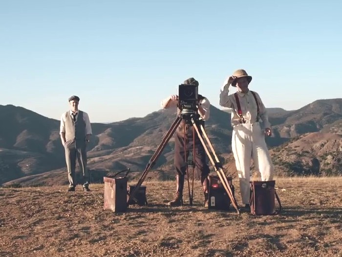
В работе по измерению высот принимал участие Радханат Сикдар, бенгальский математик, которого, после окончания колледжа в Калькутте, в возрасте 19 лет принял на работу в геодезическую службу вычислителем ещё Джон Эверест. Получая всего 30 рупий в месяц, Радханат Сикдар, самостоятельно разработал способ определения высот на расстоянии. Не смотря на несовершенство теодолита, его вычисления были удивительной точносты, разница определенных им высот в сравнении с сделанными в настоящее время составляет всего несколько сантиметров.
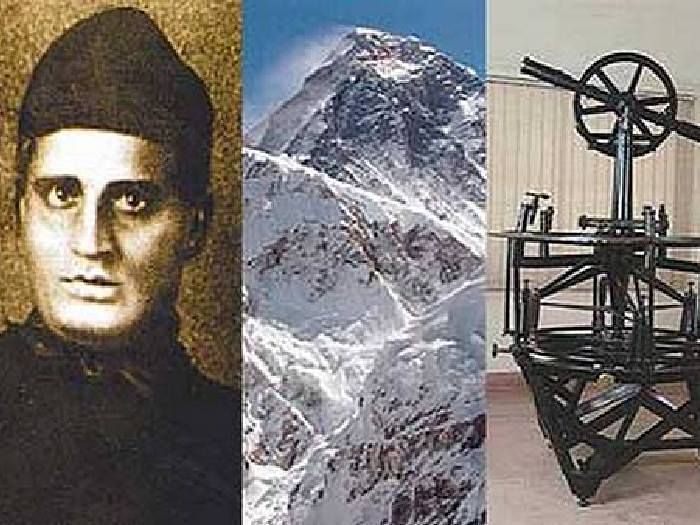
В 1852 году производя замер и вычисление высот самых высоких горных вершин находящихся за пределами Индии в Непале, удаленных более чем на 100 км, Радханат Сикдар установил что высота Джомолунгмы составляет 8848 метров. Из этого следовало что Джомолунгма на 250 метров выше вершины Канченджанга, которая тогда считалась самой высокой горой в мире. О своем открытии Сикдар сразу доложил Эндрю Во, который только после личной проверки проверки сообщил это в Лондон.
Однако Лондонское королевское общество не торопилось с выводами и только после неоднократно проведенных измерений признало что Пик XV самая высокая гора в мире. Мировое сообщество узнало об этом только 1865 году, после того как Джомолунгме — Пику XV было присвоено название Эверест и он был нанесен на карты с указанием высоты 8848 метров. С тех пор Эверест официально стал считаться самой высокой горой в мире.
Эверест или Джомолунгма, как правильно?
Вопрос с названием Эвереста решался довольно долго. Это связано с тем что народы населяющие местность, где находится самая высокая гора, её называли по разному. Так племена тибетцев называли эту, считающуюся священной, гору Чомолунгма или Чжумуланма, что значит «Божественная», для европейцев это воспринималось как Джомолунгма. Непальцы называли эту гору Сагарматха, что в переводе означает «Мать Богов». В Индии вообще существовало несколько имен этой горы: «Jomokangar», «Chamokankar», «Deodangar», «Bhirab Langur» и другие. Но в большинстве стран, в том числе и в СССР её признавали как Джомолунгма.
Но когда англичане в середине XVIII основательно начали топографию этих районов то составляя карты Джомолунгму обозначили её порядковым номером XV. И только через несколько лет, уже после того как было выяснено что Джомолунгма — Пик XV является самой большой горой в мире, по предложению Эндрю Во, в 1865 году Лондонское королевское географическое общество утвердило название Mount Everest. С тех пор на всех картах самая высокая гора в мире называется Эверест.
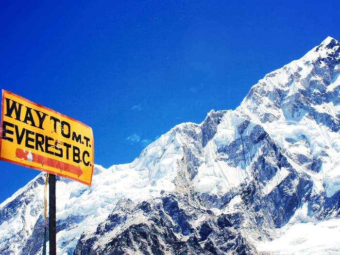
Однако, власти Непала, не признают английское название и официально называют эту, священную для них гору, Сагарматха, как и прилегающую к ней территорию которую сделали национальным парком. Китай официально принял международное название Эверест, но для жителей Тибета это по прежнему Джомолунгма.
Кто первым поднялся на Эверест?
Первыми подняться на Эверест попытались англичане в 1921 г. Экспедицию из восьми человек возглавил полковник Говард Бюри. В составе экспедиции были лучшие английские альпинисты: Уолластон, Херон, Келлас, Реборн, Мэллори, Уилер, Буллок, Морсхед. Поскольку Непал для англичан был закрыт, до подножья Эвереста с тибетской стороны экспедиция добиралась пешим ходом из Бенгальского Дарджилинга, пройдя более 400 км. Выйдя 18 мая, экспедиция более двух месяцев провела в пути, а потом ещё месяц разведывала маршруты восхождения. Только 31 августа были предприняты первые попытки восхождения. После нескольких попыток по разным маршрутам им удалось подняться только до северного седла, то есть до высоты в 7000 метров. Однако из-за непогоды 26 сентября было решено всё это закончить, и через месяц экспедиция вернулась в Дарджилинг. Однако усилия первой экспедиции на Эверест не прошли впустую. Были созданы подробные карты, взяты геологические пробы, сделаны фото растений, птиц и животных, а главное намечены маршруты восхождения на вершину Эвереста.
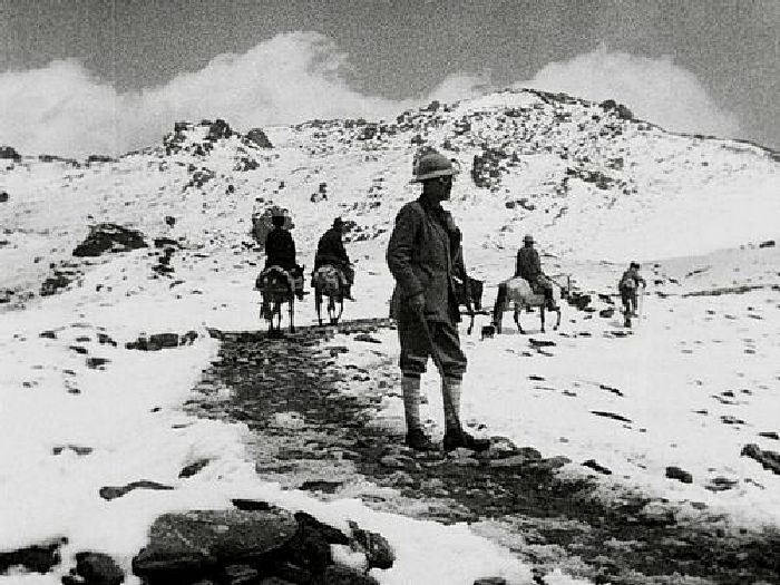
Вторая Британская экспедиция на Джомолунгму состоялась в следующем 1922 году. К этой экспедиции подготовились более тщательно. Экспедицию возглавил бригадный генерал Чарльз Гранвиль Брюс. Экспедиция состояла из двенадцати человек, в том числе в её составе был Джордж Мэллори, решивший во что бы то ни стало покорить Эверест. Для этой экспедиции было подготовлены специальные кислородные аппараты. Восхождение проводилось опять с северной стороны. Со второй попытки была достигнута высота 8225 метров. Но после того как во время третьей попытки погибло семь носильщиков и восхождение пришлось прекратить. Кислородными аппаратами в этот раз не воспользовались.

В 1924 году британцы организовали третью экспедицию на Эверест. Восхождение проходило так же с севера, по пробитым ранее маршрутам. Было совершено три попытки. Во время второй Эдвард Нортон сумел подняться до высоты 8570 метров. В третьей попытке на восхождение пошли Джордж Мэллори и Эндрю Ирвин. Чем кончилось их восхождение неизвестно, потому как они оба в лагерь не вернулись.
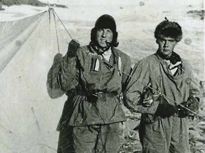
После многих неудач покорить вершину Эвереста долгое время ни кто не пытался. И только в 1933 году британские альпинисты снова пошли на штурм Эвереста. На этот раз П.Вин-Харрис, Л.Уэйгер и Ф.Смит смогли подняться уже до высоты 8565 метров. В 1936 и 1938 годах британцы снова организовывали экспедиции на Эверест, но так же безрезультатно. В 1949 году Великобритания получила разрешение властей Непала осуществить восхождение на Эверест с их территории, однако и в этот раз их экспедиция потерпела неудачу.
В 1953 году, уже в двенадцатый раз, была организована британская экспедиция, в которой участвовали почти 400 человек, из них пятнадцать альпинистов, специально отобранных для восхождения на вершину.
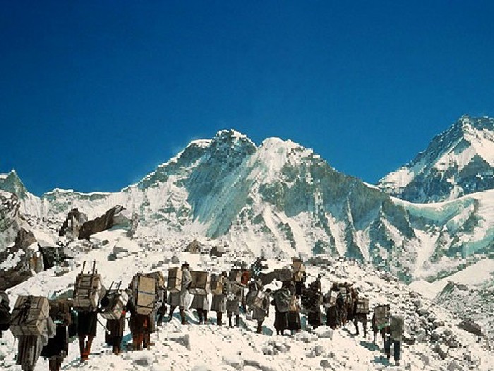
Однако в результате этой многочисленной экспедиции на вершину Эвереста смогли подняться только два человека, новозеландец Эдмунд Хиллари и шерп Тенцинг Норгей. Они шли по маршруту через Южное седло и не смотря на ухудшение погоды достигли вершины Эвереста.
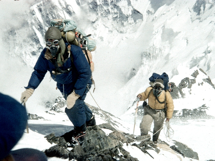
На вершине они пробыли всего несколько минут во время которых Эдмунд Хиллари сделал фото Тенцинга Норгея на вершине самой высокой горы в мире. Произошло это 29 мая 1953 года.
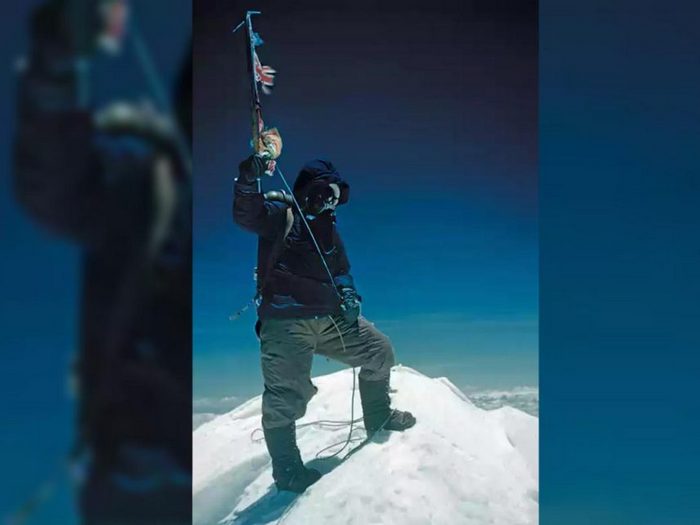
За свой подвиг они были удостоены различных наград и признание мирового общества. Эдмунд Хиллари и Тенцинг Норгей навсегда вошли в историю как люди сумевшие первыми подняться на вершину самой высокой горы в мире.
Климат Эвереста
Не смотря на то что Эверест географически находится в субтропической зоне, климат Эвереста очень даже суровый. При чем он отличается в зависимости от высоты. По градации земного климата, до 1900 метров на склонах Эвереста горные субтропики. Высота от 1900 до 2800 метров соответствует горному умеренному поясу. Выше, от 3000 до 4000 м. имет признаки умеренного холодного пояса. С 4000 до 5200 метров альпийские луга. Выше 5200 метров начинается ледяная зона. С высоты 7500 метров начинается так называемая «зона смерти» где атмосферное давление и содержание кислорода падают с каждой сотней метров.
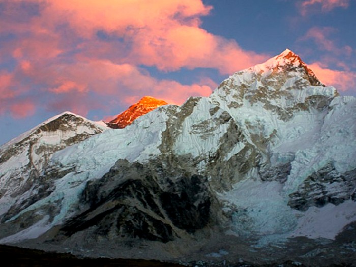
Количество солнечных дней в году, температура и количество осадков зависит от времени года. Средняя годовая температура на вершине Эвереста -19 °C, январе в среднем -36 °C, но иногда падает до -60 °C. Самое неприятное это сильные ветра, скорость которых может доходить до 200 км/час.
Рекорды Эвереста
После покорения 1953 года, на вершину Эвереста почти каждый год стали подниматься альпинисты разных стран. Сначала это были единицы, в основном именитые альпинисты с большим опытом. Потом это были достаточно большие команды. Некоторые восходители установили своеобразные рекорды Эвереста.
- -В 2004 году непальский альпинист шерпа Пемба Дордже поднялся из базового лагеря на высоте на высоте 5364 метра до вершины за 8 часов 10 минут.
- Непальский шерп Ками Рита поднялся на Эверест 24 раза.
- Непалец Анг Рита десять раз поднимался на вершину Эвереста не используя кислород.
- Японец Юичиро Миура в 1970 году первым спустился с Южного седла Эвереста на лыжах, в 2013 году в возрасте 80 лет он стал самым пожилым участником восхождения.
- В 2010 году американский мальчик Джордан Ромеро в возрасте 13 лет и 10 месяцев стал самым молодым альпинистом который поднялся на вершину Эвереста.
- Непальский монах Бхакта Кумар Рай в 2011 году поднялся на вершину Эвереста и там медитировал более суток.
- Голландец Вим Хоф в 2007 году поднялся до высоты 6 700 метров в одних ботинках и шорах.
- Австриец Стефан Гатт в 2001 году без кислорода поднялся на Эверест и спустился с его вершины на сноуборде.
- Россиянин Валерий Розов в 2013 году в костюме-крыле из ткани совершил полет с Чангзе — Северного Пика Джомолунгмы.
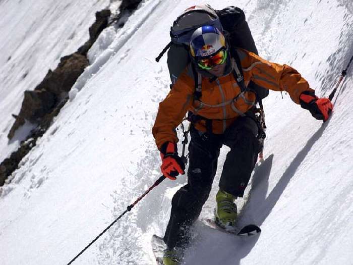
И таких рекордов на сегодняшний день насчитывается более сотни.
Русские на Эвересте
Русские альпинисты тоже не оставили без внимания самый высокий горный пик планеты. В 1982 году советская команда альпинистов в составе 11 человек поднялись на вершину Эвереста. При чем, восхождение походило по долее сложному маршруту с юго-западной стороны, откуда раньше ни кто даже не пытался подняться. Подъем проводили пятью группами в разное время, но все благополучно достигли вершины и спустились вниз.
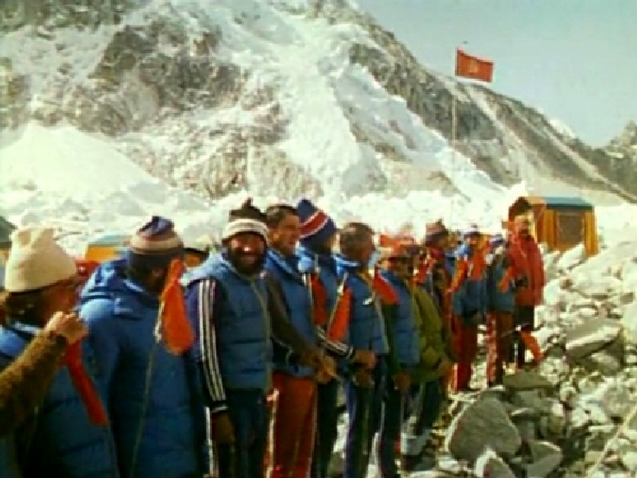
В последующие годы на вершине Эверста побывало более 200 Советских и Российских альпинистов, в том числе и несколько женщин. Дважды на Эверест поднимался известный российский экстримал Федор Конюхов. Двадцать восемь россиян совершали восхождение без кислорода.
Оставшиеся на Эвересте навечно
Как бы не были опытны и умелы люди решившие подняться на вершину самой высокой горы в мире, практически не один год не обходился без того что что бы кто то при этом не погибал. Считают что пытавшихся подняться на Эверест было около миллиона человек и более чем 4000 тысячам это удалось. Но при этом почти 280 человек остались лежать на склонах этой горы. Эвакуировать погибших с такой высоты практически невозможно или стоит огромных денег. И до настоящего времени эти неудачники лежат в неестественных позах запорошенные снегом, как напоминание о возможности такого исхода.
Это может показаться кощунством, но многие их погибших стали своеобразным ориентиром для идущих по маршруту. Так яркие зеленые ботинки, погибшего в 1996-м году индийца Цеванга Палджора, видели все кто поднимался по этому маршруту.
Использовать лежащих на маршруте неудачников в качестве указательных знаков по земным понятиям невероятный цинизм и бессердечие, но ни кто не пытался как то изменить эту ситуацию. Русские альпинисты ни когда не бросали попавших в беду товарищей, за исключением нескольких абсолютно безысходных случаев. Среди оставшихся навечно на Эвересте россияне Николай Шевченко, Иван Плотников и Александр Торощин, Сергей Арсентьев, Алексей Никифоров, Алексей Болотов. В Екатеринбурге есть целый мемориал погибшим российским альпинистам.
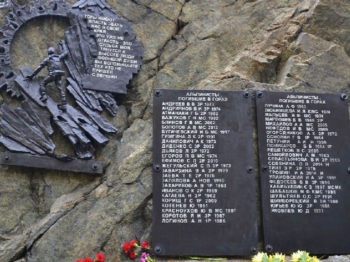
Особо примечательна история Сергея Арсентьева и его жены американки Френсис Дистефано, которые в 1998 году хотели подняться на вершину со стороны северного склона. До этого ни одной женщина не поднималась по этому маршруту, а каждый шестой из альпинистов мужчин не возвращался оттуда живым. Сергей и Френсис будучи опытными альпинистами шли без дыхательных аппаратов. Но что то пошло не так и Френсис осталась одна. В результате кислородного голодания у неё началась горная болезнь и психоз, она сбросила верхнюю одежду и замерзла. Попытки её спасти не увенчались успехом. Через девять лет знакомые Френсис альпинисты Йен Вудхолл и Кэти О’Доуд отдали ей почести, завернув в американский флаг. Сергея Арсентьева так и не нашли.
Русские стали первыми кто решился по-человечески похоронить погибшего альпиниста. В 2017 году группа их 3-х человек во главе с Олегом Савченко капсулировали тело Марко Литенекера из Словении, а так же укрыли знаменитые зеленые ботинки.
Как взойти на Эверест?
Не смотря на все страсти восхождения, желающих попасть на вершину Эвереста с каждым годом становится всё больше. Существует довольно много туристических фирм организующих восхождения. И хотя сегодня, восхождение на вершину Эвереста стало технически оснащенным, благодаря постоянному сканированию трассы радиолучами и расположению спасательных постов буквально в сотне метров друг от друга, оно не стало менее опасным.
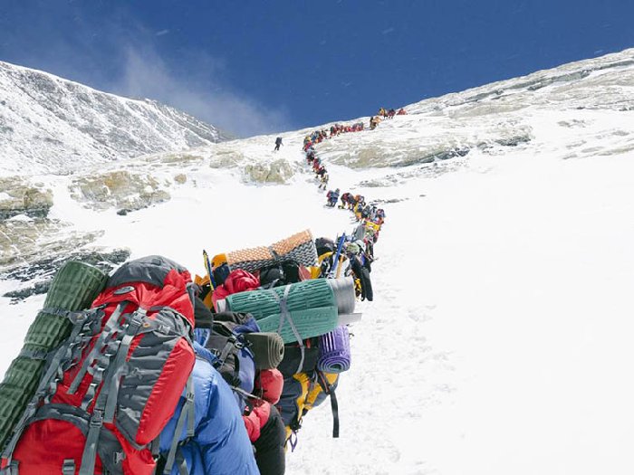
Последние десять лет восхождение на Эверест стало достаточно обыденным делом. Практически любой здоровый человек пройдя не сложную подготовку и заплатив определенную сумму в компанию организующую эти туры может оказаться на вершине Эвереста.
Сколько стоит восхождение?
Сегодня стоимость разрешения совершить восхождение на гору Эверест от правительства Непала может быть от $ 10 000 до $ 25 000 на человека, в зависимости от числа альпинистов. К этому нужно добавить стоимость оборудования, оплату услуг шерпов-носильщиков и проводников, дополнительные разрешения, предметы первой необходимости. В итоге сумма, на одного альпиниста может составить до $ 75 000.
Экология Эвереста
Экологическое состояние Джомолунгмы сегодня оставляет желать лучшего. Панорама Эвереста уже не так привлекательна. К тому же вершина начинает довольно быстро «худеть» в результате глобального потепления, вызванного человеком. Гора очень интенсивно теряет лёд со своих склонов, и по прогнозам некоторых учёных буквально через каких то 100 лет или даже раньше в Гималаях растают все ледники, а высочайшие горы в мире лишатся своего снежного покрова. Таким образом, покорителям в весьма недалёком будущем придется запасаться совсем другим оборудованием — вместо давно привычных ледорубов они будут вооружаться скалорезами.
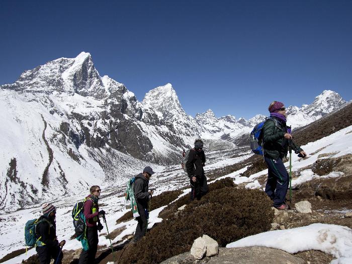
Последние несколько лет непальские власти и Комитет Эвереста предпринимают меры по очистке склонов от скопившегося там мусора. Десятки тонн пластиковых бутылок, использованных кислородных баллонов, остатков пищи, снаряжения, одежды и прочего собирают и спускают вниз и утилизируют. Но это только до высоты в пять с половиной тысяч метров, выше это очень дорогостоящая операция. Но к этому привлекают всех возвращающихся вниз после восхождения. Возможно что это даст определенные результаты, хоть как то привести в порядок это знаменитое и популярное место нашей планеты.
| Mount Everest | |
|---|---|

North Face as seen from the path to North Base Camp |
|
| Highest point | |
| Elevation | 8,848.86 m (29,031.7 ft) Ranked 1st |
| Prominence | 8,848.86 m (29,031.7 ft) Ranked 1st (Special definition for Everest) |
| Isolation | n/a |
| Listing |
|
| Coordinates | 27°59′17″N 86°55′31″E / 27.98806°N 86.92528°ECoordinates: 27°59′17″N 86°55′31″E / 27.98806°N 86.92528°E[note 2] |
| Naming | |
| Etymology | Sir George Everest |
| Native name |
|
| English translation | Holy Mother |
| Geography | |
|
Mount Everest Location on the border between Province No. 1, Nepal and Tibet Autonomous Region, China
Mount Everest Mount Everest (Province No. 1)
Mount Everest Mount Everest (China)
Mount Everest Mount Everest (Tibet)
Mount Everest Mount Everest (Asia) |
|
| Location | Solukhumbu District, Province No. 1, Nepal;[1] Tingri County, Xigazê, Tibet Autonomous Region, China[note 3] |
| Countries | China and Nepal |
| Parent range | Mahalangur Himal, Himalayas |
| Climbing | |
| First ascent | 29 May 1953 Edmund Hillary and Tenzing Norgay |
| Normal route | Southeast ridge (Nepal) |


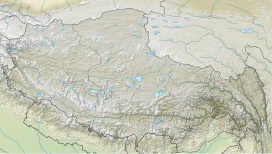


Aerial photo from the south, with Mount Everest rising above the ridge connecting Nuptse and Lhotse
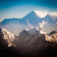
Mount Everest (Nepali: सगरमाथा, romanized: Sagarmāthā; Tibetan: Chomolungma ཇོ་མོ་གླང་མ; Chinese: 珠穆朗玛峰; pinyin: Zhūmùlǎngmǎ Fēng) is Earth’s highest mountain above sea level, located in the Mahalangur Himal sub-range of the Himalayas. The China–Nepal border runs across its summit point.[2] Its elevation (snow height) of 8,848.86 m (29,031.7 ft) was most recently established in 2020 by the Chinese and Nepali authorities.[3]
Mount Everest attracts many climbers, including highly experienced mountaineers. There are two main climbing routes, one approaching the summit from the southeast in Nepal (known as the «standard route») and the other from the north in Tibet. While not posing substantial technical climbing challenges on the standard route, Everest presents dangers such as altitude sickness, weather, and wind, as well as hazards from avalanches and the Khumbu Icefall. As of 2019, over 300 people have died on Everest,[4] many of whose bodies remain on the mountain.[5]
The first recorded efforts to reach Everest’s summit were made by British mountaineers. As Nepal did not allow foreigners to enter the country at the time, the British made several attempts on the north ridge route from the Tibetan side. After the first reconnaissance expedition by the British in 1921 reached 7,000 m (22,970 ft) on the North Col, the 1922 expedition pushed the north ridge route up to 8,320 m (27,300 ft), marking the first time a human had climbed above 8,000 m (26,247 ft). The 1924 expedition resulted in one of the greatest mysteries on Everest to this day: George Mallory and Andrew Irvine made a final summit attempt on 8 June but never returned, sparking debate as to whether they were the first to reach the top. Tenzing Norgay and Edmund Hillary made the first documented ascent of Everest in 1953, using the southeast ridge route. Norgay had reached 8,595 m (28,199 ft) the previous year as a member of the 1952 Swiss expedition. The Chinese mountaineering team of Wang Fuzhou, Gonpo, and Qu Yinhua made the first reported ascent of the peak from the north ridge on 25 May 1960.[6]
Name
The name «Mount Everest» was first proposed in this 1856 speech, later published in 1857, in which the mountain was first confirmed as the world’s highest
The Tibetan name for Everest is Qomolangma (ཇོ་མོ་གླང་མ, lit. «Holy Mother»). The name was first recorded with a Chinese transcription on the 1721 Kangxi Atlas during the reign of Emperor Kangxi of Qing China, and then appeared as Tchoumour Lancma on a 1733 map published in Paris by the French geographer D’Anville based on the former map.[7] It is also popularly romanised as Chomolungma and (in Wylie) as Jo-mo-glang-ma.[12] The official Chinese transcription is 珠穆朗玛峰 (t 珠穆朗瑪峰), whose pinyin form is Zhūmùlǎngmǎ Fēng. While other Chinese names exist, including Shèngmǔ Fēng (t 聖母峰, s 圣母峰, lit. «Holy Mother Peak»), these names largely phased out from May 1952 as the Ministry of Internal Affairs of China issued a decree to adopt 珠穆朗玛峰 as the sole name[13] (romanised: Mount Qomolangma[14]). Documented local names include «Deodungha» («Holy Mountain»), but it is unclear whether it is commonly used.[15]
In 1849, the British survey wanted to preserve local names if possible (e.g., Kangchenjunga and Dhaulagiri), and Andrew Waugh, the British Surveyor General of India argued that he could not find any commonly used local name, as his search for a local name was hampered by Nepal and Tibet’s exclusion of foreigners. Waugh argued that because there were many local names, it would be difficult to favour one name over all others; he decided that Peak XV should be named after British surveyor Sir George Everest, his predecessor as Surveyor General of India.[16][17][18] Everest himself opposed the name suggested by Waugh and told the Royal Geographical Society in 1857 that «Everest» could not be written in Hindi nor pronounced by «the native of India». Waugh’s proposed name prevailed despite the objections, and in 1865, the Royal Geographical Society officially adopted Mount Everest as the name for the highest mountain in the world.[16][19] The modern pronunciation of Everest ()[20] is different from Sir George’s pronunciation of his surname ( EEV-rist).[21][verification needed] In the late 19th century, many European cartographers incorrectly believed that a native name for the mountain was Gaurishankar, a mountain between Kathmandu and Everest.[22]
In the early 1960s, the Nepali government coined the Nepali name Sagarmāthā (IAST transcription) or Sagar-Matha[23] (सगर-माथा, [sʌɡʌrmatʰa], lit. «goddess of the sky»[24]),[25] which means «the Head in the Great Blue Sky», being derived from सगर (sagar), meaning «sky», and माथा (māthā), meaning «head».
Other names
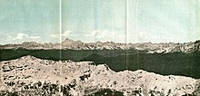
1890 graphic with the Himalayas, including Gaurisankar (Mount Everest) in the distance
- Peak XV (British Empire’s Survey)[16][17][18]
- Old Darjeeling name: «Deodungha»[26]
- «Gauri Shankar» or «Gaurisankar»; in modern times the name is used for a different peak about 30 miles (48 kilometres) away, but it was used occasionally until about 1900.[27]
Surveys
19th-century surveys

In 1802, the British began the Great Trigonometrical Survey of India to fix the locations, heights, and names of the world’s highest mountains. Starting in southern India, the survey teams moved northward using giant theodolites, each weighing 500 kg (1,100 lb) and requiring 12 men to carry, to measure heights as accurately as possible. They reached the Himalayan foothills by the 1830s, but Nepal was unwilling to allow the British to enter the country due to suspicions of their intentions. Several requests by the surveyors to enter Nepal were denied.[16]
The British were forced to continue their observations from Terai, a region south of Nepal which is parallel to the Himalayas. Conditions in Terai were difficult because of torrential rains and malaria. Three survey officers died from malaria while two others had to retire because of failing health.[16]
Nonetheless, in 1847, the British continued the survey and began detailed observations of the Himalayan peaks from observation stations up to 240 km (150 mi) distant. Weather restricted work to the last three months of the year. In November 1847, Andrew Waugh, the British Surveyor General of India, made several observations from the Sawajpore station at the east end of the Himalayas. Kangchenjunga was then considered the highest peak in the world, and with interest, he noted a peak beyond it, about 230 km (140 mi) away. John Armstrong, one of Waugh’s subordinates, also saw the peak from a site farther west and called it peak «b». Waugh would later write that the observations indicated that peak «b» was higher than Kangchenjunga, but given the great distance of the observations, closer observations were required for verification. The following year, Waugh sent a survey official back to Terai to make closer observations of peak «b», but clouds thwarted his attempts.[16]
In 1849, Waugh dispatched James Nicolson to the area, who made two observations from Jirol, 190 km (120 mi) away. Nicolson then took the largest theodolite and headed east, obtaining over 30 observations from five different locations, with the closest being 174 km (108 mi) from the peak.[16]
Nicolson retreated to Patna on the Ganges to perform the necessary calculations based on his observations. His raw data gave an average height of 9,200 m (30,200 ft) for peak «b», but this did not consider light refraction, which distorts heights. However, the number clearly indicated that peak «b» was higher than Kangchenjunga. Nicolson contracted malaria and was forced to return home without finishing his calculations. Michael Hennessy, one of Waugh’s assistants, had begun designating peaks based on Roman numerals, with Kangchenjunga named Peak IX. Peak «b» now became known as Peak XV.[16]
In 1852, stationed at the survey headquarters in Dehradun, Radhanath Sikdar, an Indian mathematician and surveyor from Bengal was the first to identify Everest as the world’s highest peak, using trigonometric calculations based on Nicolson’s measurements.[28] An official announcement that Peak XV was the highest was delayed for several years as the calculations were repeatedly verified. Waugh began work on Nicolson’s data in 1854, and along with his staff spent almost two years working on the numbers, having to deal with the problems of light refraction, barometric pressure, and temperature over the vast distances of the observations. Finally, in March 1856 he announced his findings in a letter to his deputy in Calcutta. Kangchenjunga was declared to be 8,582 m (28,156 ft), while Peak XV was given the height of 8,840 m (29,002 ft). Waugh concluded that Peak XV was «most probably the highest in the world».[16] Peak XV (measured in feet) was calculated to be exactly 29,000 ft (8,839.2 m) high, but was publicly declared to be 29,002 ft (8,839.8 m) in order to avoid the impression that an exact height of 29,000 feet (8,839.2 m) was nothing more than a rounded estimate.[29] Waugh is sometimes playfully credited with being «the first person to put two feet on top of Mount Everest».[30]
20th-century surveys
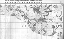
Published by the Survey of Nepal, this is Map 50 of the 57 map set at 1:50,000 scale «attached to the main text on the First Joint Inspection Survey, 1979–80, Nepal-China border.» At the top centre, a boundary line, identified as separating «China» and «Nepal», passes through the summit contour. The boundary here and for much of the China–Nepal border follows the main Himalayan watershed divide.

Kangshung Face (the east face) as seen from orbit
In 1856, Andrew Waugh announced Everest (then known as Peak XV) as 8,840 m (29,002 ft) high, after several years of calculations based on observations made by the Great Trigonometrical Survey.[31]
In 1955, the elevation of 8,848 m (29,029 ft) was first determined by an Indian survey, made closer to the mountain, also using theodolites.[citation needed] In 1975 it was subsequently reaffirmed by a Chinese measurement of 8,848.13 m (29,029.30 ft).[32] In both cases the snow cap, not the rock head, was measured.
The 8,848 m (29,029 ft) height given was officially recognised by Nepal and China.[33] Nepal planned a new survey in 2019 to determine if the April 2015 Nepal earthquake affected the height of the mountain.[34]
In May 1999, an American Everest expedition directed by Bradford Washburn anchored a GPS unit into the highest bedrock. A rock head elevation of 8,850 m (29,035 ft), and a snow/ice elevation 1 m (3 ft) higher, were obtained via this device.[35] Although as of 2001, it has not been officially recognised by Nepal,[36] this figure is widely quoted. Geoid uncertainty casts doubt upon the accuracy claimed by both the 1999 and 2005 (see § 21st-century surveys) surveys.[37]
In 1955, a detailed photogrammetric map (at a scale of 1:50,000) of the Khumbu region, including the south side of Mount Everest, was made by Erwin Schneider as part of the 1955 International Himalayan Expedition, which also attempted Lhotse.
In the late 1980s, an even more detailed topographic map of the Everest area was made under the direction of Bradford Washburn, using extensive aerial photography.[38]
21st-century surveys
On 9 October 2005, after several months of measurement and calculation, the Chinese Academy of Sciences and State Bureau of Surveying and Mapping announced the height of Everest as 8,844.43 m (29,017.16 ft) with accuracy of ±0.21 m (8.3 in), claiming it was the most accurate and precise measurement to date.[39][40] This height is based on the highest point of rock and not the snow and ice covering it. The Chinese team measured a snow-ice depth of 3.5 m (11 ft),[32] which is in agreement with a net elevation of 8,848 m (29,029 ft). An argument arose between China and Nepal as to whether the official height should be the rock height (8,844 m, China) or the snow height (8,848 m, Nepal). In 2010, both sides agreed that the height of Everest is 8,848 m, and Nepal recognises China’s claim that the rock height of Everest is 8,844 m.[41] On 8 December 2020, it was jointly announced by the two countries that the new official height is 8,848.86 metres (29,031.7 ft).[42][43]
It is thought that the plate tectonics of the area are adding to the height and moving the summit northeastwards. Two accounts suggest the rates of change are 4 mm (0.16 in) per year vertically and 3 to 6 mm (0.12 to 0.24 in) per year horizontally,[35][44] but another account mentions more lateral movement (27 mm or 1.1 in),[45] and even shrinkage has been suggested.[46]
Comparisons
The summit of Everest is the point at which Earth’s surface reaches the greatest distance above sea level. Several other mountains are sometimes claimed to be the «tallest mountains on Earth». Mauna Kea in Hawaii is tallest when measured from its base;[note 4] it rises over 10,200 m (33,464.6 ft) when measured from its base on the mid-ocean floor, but only attains 4,205 m (13,796 ft) above sea level.
By the same measure of base to summit, Denali, in Alaska, also known as Mount McKinley, is taller than Everest as well.[note 4] Despite its height above sea level of only 6,190 m (20,308 ft), Denali sits atop a sloping plain with elevations from 300 to 900 m (980 to 2,950 ft), yielding a height above base in the range of 5,300 to 5,900 m (17,400 to 19,400 ft); a commonly quoted figure is 5,600 m (18,400 ft).[47][48] By comparison, reasonable base elevations for Everest range from 4,200 m (13,800 ft) on the south side to 5,200 m (17,100 ft) on the Tibetan Plateau, yielding a height above base in the range of 3,650 to 4,650 m (11,980 to 15,260 ft).[38]
The summit of Chimborazo in Ecuador is 2,168 m (7,113 ft) farther from Earth’s centre (6,384.4 km, 3,967.1 mi) than that of Everest (6,382.3 km, 3,965.8 mi), because the Earth bulges at the equator.[49] This is despite Chimborazo having a peak 6,268 m (20,564.3 ft) above sea level versus Mount Everest’s 8,848 m (29,028.9 ft).
Geology
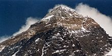
Mount Everest with snow melted, showing upper geologic layers in bands.
Geologists have subdivided the rocks comprising Mount Everest into three units called formations.[50][51] Each formation is separated from the other by low-angle faults, called detachments, along which they have been thrust southward over each other. From the summit of Mount Everest to its base these rock units are the Qomolangma Formation, the North Col Formation, and the Rongbuk Formation.
The Qomolangma Formation, also known as the Jolmo Lungama Formation,[52] runs from the summit to the top of the Yellow Band, about 8,600 m (28,200 ft) above sea level. It consists of greyish to dark grey or white, parallel laminated and bedded, Ordovician limestone interlayered with subordinate beds of recrystallised dolomite with argillaceous laminae and siltstone. Gansser first reported finding microscopic fragments of crinoids in this limestone.[53][54] Later petrographic analysis of samples of the limestone from near the summit revealed them to be composed of carbonate pellets and finely fragmented remains of trilobites, crinoids, and ostracods. Other samples were so badly sheared and recrystallised that their original constituents could not be determined. A thick, white-weathering thrombolite bed that is 60 m (200 ft) thick comprises the foot of the «Third Step», and base of the summit pyramid of Everest. This bed, which crops out starting about 70 m (230 ft) below the summit of Mount Everest, consists of sediments trapped, bound, and cemented by the biofilms of micro-organisms, especially cyanobacteria, in shallow marine waters. The Qomolangma Formation is broken up by several high-angle faults that terminate at the low angle normal fault, the Qomolangma Detachment. This detachment separates it from the underlying Yellow Band. The lower five metres of the Qomolangma Formation overlying this detachment are very highly deformed.[50][51][55]
The bulk of Mount Everest, between 7,000 and 8,600 m (23,000 and 28,200 ft), consists of the North Col Formation, of which the Yellow Band forms the upper part between 8,200 to 8,600 m (26,900 to 28,200 ft). The Yellow Band consists of intercalated beds of Middle Cambrian diopside-epidote-bearing marble, which weathers a distinctive yellowish brown, and muscovite-biotite phyllite and semischist. Petrographic analysis of marble collected from about 8,300 m (27,200 ft) found it to consist as much as five per cent of the ghosts of recrystallised crinoid ossicles. The upper five metres of the Yellow Band lying adjacent to the Qomolangma Detachment is badly deformed. A 5–40 cm (2.0–15.7 in) thick fault breccia separates it from the overlying Qomolangma Formation.[50][51][55]
The remainder of the North Col Formation, exposed between 7,000 to 8,200 m (23,000 to 26,900 ft) on Mount Everest, consists of interlayered and deformed schist, phyllite, and minor marble. Between 7,600 and 8,200 m (24,900 and 26,900 ft), the North Col Formation consists chiefly of biotite-quartz phyllite and chlorite-biotite phyllite intercalated with minor amounts of biotite-sericite-quartz schist. Between 7,000 and 7,600 m (23,000 and 24,900 ft), the lower part of the North Col Formation consists of biotite-quartz schist intercalated with epidote-quartz schist, biotite-calcite-quartz schist, and thin layers of quartzose marble. These metamorphic rocks appear to be the result of the metamorphism of Middle to Early Cambrian deep sea flysch composed of interbedded, mudstone, shale, clayey sandstone, calcareous sandstone, graywacke, and sandy limestone. The base of the North Col Formation is a regional low-angle normal fault called the «Lhotse detachment».[50][51][55]
Below 7,000 m (23,000 ft), the Rongbuk Formation underlies the North Col Formation and forms the base of Mount Everest. It consists of sillimanite-K-feldspar grade schist and gneiss intruded by numerous sills and dikes of leucogranite ranging in thickness from 1 cm to 1,500 m (0.4 in to 4,900 ft).[51][56] These leucogranites are part of a belt of Late Oligocene–Miocene intrusive rocks known as the Higher Himalayan leucogranite. They formed as the result of partial melting of Paleoproterozoic to Ordovician high-grade metasedimentary rocks of the Higher Himalayan Sequence about 20 to 24 million years ago during the subduction of the Indian Plate.[57]
Mount Everest consists of sedimentary and metamorphic rocks that have been faulted southward over continental crust composed of Archean granulites of the Indian Plate during the Cenozoic collision of India with Asia.[58][59][60] Current interpretations argue that the Qomolangma and North Col formations consist of marine sediments that accumulated within the continental shelf of the northern passive continental margin of India before it collided with Asia. The Cenozoic collision of India with Asia subsequently deformed and metamorphosed these strata as it thrust them southward and upward.[61][62] The Rongbuk Formation consists of a sequence of high-grade metamorphic and granitic rocks that were derived from the alteration of high-grade metasedimentary rocks. During the collision of India with Asia, these rocks were thrust downward and to the north as they were overridden by other strata; heated, metamorphosed, and partially melted at depths of over 15 to 20 kilometres (9.3 to 12.4 mi) below sea level; and then forced upward to surface by thrusting towards the south between two major detachments.[63] The Himalayas are rising by about 5 mm per year.
IUGS geological heritage site
In respect of the recognition of the ‘highest rocks on the planet’ as fossiliferous, marine limestone, the ‘Ordovician Rocks of Mount Everest’ were included by the International Union of Geological Sciences (IUGS) in its assemblage of 100 ‘geological heritage sites’ around the world in a listing published in October 2022. The organisation defines an ‘IUGS Geological Heritage Site’ as ‘a key place with geological elements and/or processes of international scientific relevance, used as a reference, and/or with a substantial contribution to the development of geological sciences through history.’[64]
Flora and fauna
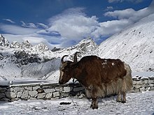
A yak at around 4,790 m (15,715 ft)
There is very little native flora or fauna on Everest. A moss grows at 6,480 metres (21,260 ft) on Mount Everest.[65] It may be the highest altitude plant species.[65] An alpine cushion plant called Arenaria is known to grow below 5,500 metres (18,000 ft) in the region.[66] According to the study based on satellite data from 1993 to 2018, vegetation is expanding in the Everest region. Researchers have found plants in areas that were previously deemed bare.[67]
Euophrys omnisuperstes, a minute black jumping spider, has been found at elevations as high as 6,700 metres (22,000 ft), possibly making it the highest confirmed non-microscopic permanent resident on Earth. In the base camp of Everest the jumping spider Euophrys everestensis occurs.[68] It lurks in crevices and may feed on frozen insects that have been blown there by the wind. There is a high likelihood of microscopic life at even higher altitudes.[69]
Birds, such as the bar-headed goose, have been seen flying at the higher altitudes of the mountain, while others, such as the chough, have been spotted as high as the South Col at 7,920 metres (25,980 ft).[70] Yellow-billed choughs have been seen as high as 7,900 metres (26,000 ft) and bar-headed geese migrate over the Himalayas.[71] In 1953, George Lowe (part of the expedition of Tenzing and Hillary) said that he saw bar-headed geese flying over Everest’s summit.[72]
Yaks are often used to haul gear for Mount Everest climbs. They can haul 100 kg (220 pounds), have thick fur and large lungs.[66] Other animals in the region include the Himalayan tahr which is sometimes eaten by the snow leopard.[73] The Himalayan black bear can be found up to about 4,300 metres (14,000 ft) and the red panda is also present in the region.[74] One expedition found a surprising range of species in the region including a pika and ten new species of ants.[75]
Climate
Mount Everest has an ice cap climate (Köppen EF) with all months averaging well below freezing.[note 5]
| Climate data for Mount Everest | |||||||||||||
|---|---|---|---|---|---|---|---|---|---|---|---|---|---|
| Month | Jan | Feb | Mar | Apr | May | Jun | Jul | Aug | Sep | Oct | Nov | Dec | Year |
| Mean minimum °C (°F) | −36 (−33) |
−35 (−31) |
−32 (−26) |
−31 (−24) |
−25 (−13) |
−20 (−4) |
−18 (0) |
−18 (0) |
−21 (−6) |
−27 (−17) |
−30 (−22) |
−34 (−29) |
−36 (−33) |
| Source: [76] |
Climate change
The base camp for Everest expeditions based out of Nepal is located by Khumbu Glacier, which is rapidly thinning and destabilizing due to climate change, making it unsafe for climbers. As recommended by the committee formed by Nepal’s government to facilitate and monitor mountaineering in the Everest region, Taranath Adhikari—the director general of Nepal’s tourism department—said they have plans to move the base camp to a lower altitude. This would mean a longer distance for climbers between the base camp and Camp 1. However, the present base camp is still useful and could still serve its purpose for three to four years. The move may happen by 2024, per officials.[77]
Meteorology
| Atmospheric pressure comparison | Pressure | Reference | |
|---|---|---|---|
| kilopascal | psi | ||
| Olympus Mons summit | 0.03 | 0.0044 | – |
| Mars average | 0.6 | 0.087 | – |
| Hellas Planitia bottom | 1.16 | 0.168 | – |
| Armstrong limit | 6.25 | 0.906 | – |
| Mount Everest summit | 33.7 | 4.89 | [78] |
| Earth sea level | 101.3 | 14.69 | – |
| Dead Sea level | 106.7 | 15.48 | [79] |
| Surface of Venus | 9,200 | 1,330 | [80] |
In 2008, a new weather station at about 8,000 m (26,000 ft) elevation went online.[81] The station’s first data in May 2008 were air temperature −17 °C (1 °F), relative humidity 41.3 per cent, atmospheric pressure 382.1 hPa (38.21 kPa), wind direction 262.8°, wind speed 12.8 m/s (28.6 mph, 46.1 km/h), global solar radiation 711.9 watts/m2, solar UVA radiation 30.4 W/m2.[81] The project was orchestrated by Stations at High Altitude for Research on the Environment (SHARE), which also placed the Mount Everest webcam in 2011.[81][82] The solar-powered weather station is on the South Col.[83]
Mount Everest extends into the upper troposphere and penetrates the stratosphere.[84] The air pressure at the summit is generally about one-third what it is at sea level. The altitude can expose the summit to the fast and freezing winds of the jet stream.[85] Winds commonly attain 160 km/h (100 mph);[86] in February 2004, a wind speed of 280 km/h (175 mph) was recorded at the summit.
These winds can hamper or endanger climbers, by blowing them into chasms[86] or (by Bernoulli’s principle) by lowering the air pressure further, reducing available oxygen by up to 14 per cent.[85][87] To avoid the harshest winds, climbers typically aim for a 7- to 10-day window in the spring and fall when the Asian monsoon season is starting up or ending.
Expeditions
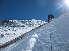
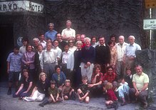
Reunion of the 1953 British team
Because Mount Everest is the highest mountain in the world, it has attracted considerable attention and climbing attempts. Whether the mountain was climbed in ancient times is unknown. It may have been climbed in 1924, although this has never been confirmed, as neither of the men making the attempt returned. Several climbing routes have been established over several decades of climbing expeditions to the mountain.[88][89][better source needed]
Overview
Everest’s first known summiting occurred by 1953, and interest by climbers increased.[90] Despite the effort and attention poured into expeditions, only about 200 people had summitted by 1987.[90] Everest remained a difficult climb for decades, even for serious attempts by professional climbers and large national expeditions, which were the norm until the commercial era began in the 1990s.[91]
By March 2012, Everest had been climbed 5,656 times with 223 deaths.[92] Although lower mountains have longer or steeper climbs, Everest is so high the jet stream can hit it. Climbers can be faced with winds beyond 320 km/h (200 mph) when the weather shifts.[93] At certain times of the year the jet stream shifts north, providing periods of relative calm at the mountain.[94] Other dangers include blizzards and avalanches.[94]
By 2013, The Himalayan Database recorded 6,871 summits by 4,042 different people.[95]
Early attempts
In 1885, Clinton Thomas Dent, president of the Alpine Club, suggested that climbing Mount Everest was possible in his book Above the Snow Line.[96]
The northern approach to the mountain was discovered by George Mallory and Guy Bullock on the initial 1921 British Reconnaissance Expedition. It was an exploratory expedition not equipped for a serious attempt to climb the mountain. With Mallory leading (and thus becoming the first European to set foot on Everest’s flanks) they climbed the North Col to an altitude of 7,005 metres (22,982 ft). From there, Mallory espied a route to the top, but the party was unprepared for the great task of climbing any further and descended.
The British returned for a 1922 expedition. George Finch climbed using oxygen for the first time. He ascended at a remarkable speed—290 metres (951 ft) per hour, and reached an altitude of 8,320 m (27,300 ft), the first time a human reported to climb higher than 8,000 m. Mallory and Col. Felix Norton made a second unsuccessful attempt.
The next expedition was in 1924. The initial attempt by Mallory and Geoffrey Bruce was aborted when weather conditions prevented the establishment of Camp VI. The next attempt was that of Norton and Somervell, who climbed without oxygen and in perfect weather, traversing the North Face into the Great Couloir. Norton managed to reach 8,550 m (28,050 ft), though he ascended only 30 m (98 ft) or so in the last hour. Mallory rustled up oxygen equipment for a last-ditch effort. He chose young Andrew Irvine as his partner[97]
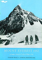
On 8 June 1924, George Mallory and Andrew Irvine made an attempt on the summit via the North Col-North Ridge-Northeast Ridge route from which they never returned. On 1 May 1999, the Mallory and Irvine Research Expedition found Mallory’s body on the North Face in a snow basin below and to the west of the traditional site of Camp VI. Controversy has raged in the mountaineering community whether one or both of them reached the summit 29 years before the confirmed ascent and safe descent of Everest by Sir Edmund Hillary and Tenzing Norgay in 1953.
In 1933, Lady Houston, a British millionairess, funded the Houston Everest Flight of 1933, which saw a formation of two aeroplanes led by the Marquess of Clydesdale fly over the Everest summit.[98][99][100][101]
Early expeditions—such as Charles Bruce’s in the 1920s and Hugh Ruttledge’s two unsuccessful attempts in 1933 and 1936—tried to ascend the mountain from Tibet, via the North Face. Access was closed from the north to Western expeditions in 1950 after China took control of Tibet. In 1950, Bill Tilman and a small party which included Charles Houston, Oscar Houston, and Betsy Cowles undertook an exploratory expedition to Everest through Nepal along the route which has now become the standard approach to Everest from the south.[102]
The 1952 Swiss Mount Everest Expedition, led by Edouard Wyss-Dunant, was granted permission to attempt a climb from Nepal. It established a route through the Khumbu icefall and ascended to the South Col at an elevation of 7,986 m (26,201 ft). Raymond Lambert and Sherpa Tenzing Norgay were able to reach an elevation of about 8,595 m (28,199 ft) on the southeast ridge, setting a new climbing altitude record. Tenzing’s experience was useful when he was hired to be part of the British expedition in 1953.[103] One reference says that no attempt at an ascent of Everest was ever under consideration in this case,[104]
although John Hunt (who met the team in Zurich on their return) wrote that when the Swiss Expedition «just failed» in the spring they decided to make another post-monsoon (summit ascent) attempt in the autumn; although as it was only decided in June the second party arrived too late, when winter winds were buffeting the mountain.[105]
First successful ascent by Tenzing and Hillary, 1953
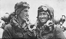
In 1953, a ninth British expedition, led by John Hunt, returned to Nepal. Hunt selected two climbing pairs to attempt to reach the summit. The first pair, Tom Bourdillon and Charles Evans, came within 100 m (330 ft) of the summit on 26 May 1953, but turned back after running into oxygen problems. As planned, their work in route finding and breaking trail and their oxygen caches were of great aid to the following pair. Two days later, the expedition made its second assault on the summit with the second climbing pair: the New Zealander Edmund Hillary and Tenzing Norgay, a Nepali Sherpa climber. They reached the summit at 11:30 local time on 29 May 1953 via the South Col route. At the time, both acknowledged it as a team effort by the whole expedition, but Tenzing revealed a few years later that Hillary had put his foot on the summit first.[106] They paused at the summit to take photographs and buried a few sweets and a small cross in the snow before descending.[citation needed]
News of the expedition’s success reached London on the morning of Queen Elizabeth II’s coronation, 2 June. A few days later, the Queen gave orders that Hunt (a Briton) and Hillary (a New Zealander) were to be knighted in the Order of the British Empire for the ascent.[107] Tenzing, a Nepali Sherpa who was a citizen of India, was granted the George Medal by the UK. Hunt was ultimately made a life peer in Britain, while Hillary became a founding member of the Order of New Zealand.[108] Hillary and Tenzing have also been recognised in Nepal. In 2009, statues were raised in their honour, and in 2014, Hillary Peak and Tenzing Peak were named for them.[109][110]
1950s–1960s
On 23 May 1956, Ernst Schmied and Juerg Marmet ascended.[111] This was followed by Dölf Reist and Hans-Rudolf von Gunten on 24 May 1957.[111] Wang Fuzhou, Gonpo and Qu Yinhua of China made the first reported ascent of the peak from the North Ridge on 25 May 1960.[6] The first American to climb Everest, Jim Whittaker, joined by Nawang Gombu, reached the summit on 1 May 1963.[112][113]
1970s
In 1970, Japanese mountaineers conducted a major expedition. The centrepiece was a large «siege»-style expedition led by Saburo Matsukata, working on finding a new route up the southwest face.[114] Another element of the expedition was an attempt to ski Mount Everest.[91] Despite a staff of over one hundred people and a decade of planning work, the expedition suffered eight deaths and failed to summit via the planned routes.[91] However, Japanese expeditions did enjoy some successes. For example, Yuichiro Miura became the first man to ski down Everest from the South Col – he descended nearly 1,300 vertical metres (4,200 ft) from the South Col before falling with extreme injuries. Another success was an expedition that put four on the summit via the South Col route.[91][115][116] Miura’s exploits became the subject of film, and he went on to become the oldest person to summit Mount Everest in 2003 at age 70 and again in 2013 at the age of 80.[117]
In 1975, Junko Tabei, a Japanese woman, became the first woman to summit Mount Everest.[91]
The 1975 British Mount Everest Southwest Face expedition led and organised by Chris Bonington made the first ascent of the south west face of Everest from the western cwm.
The 1976 British and Nepalese Army Expedition to Everest led by Tony Streather put Bronco Lane and Brummy Stokes on the summit by the normal route.
In 1978, Reinhold Messner and Peter Habeler made the first ascent of Everest without supplemental oxygen.
1979/1980: Winter Himalaism
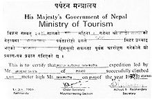
The Polish climber Andrzej Zawada headed the first winter ascent of Mount Everest, the first winter ascent of an eight-thousander. The team of 20 Polish climbers and 4 Sherpas established a base camp on Khumbu Glacier in early January 1980. On 15 January, the team managed to set up Camp III at 7150 metres above sea level, but further action was stopped by hurricane-force winds. The weather improved after 11 February, when Leszek Cichy, Walenty Fiut and Krzysztof Wielicki set up camp IV on South Col (7906 m). Cichy and Wielicki started the final ascent at 6:50 am on 17 February. At 2:40 pm Andrzej Zawada at base camp heard the climbers’ voices over the radio – «We are on the summit! The strong wind blows all the time. It is unimaginably cold.»[118][119][120][121] The successful winter ascent of Mount Everest started a new decade of Winter Himalaism, which became a Polish specialisation. After 1980 Poles did ten first winter ascents on 8000 metre peaks, which earned Polish climbers a reputation of «Ice Warriors».[122][119][123][124]
Lho La tragedy, 1989
In May 1989, Polish climbers under the leadership of Eugeniusz Chrobak organised an international expedition to Mount Everest on a difficult western ridge. Ten Poles and nine foreigners participated, but ultimately only the Poles remained in the attempt for the summit. On 24 May, Chrobak and Andrzej Marciniak, starting from camp V at 8,200 m, overcame the ridge and reached the summit. But on 27 May, during an avalanche from the side of Khumbutse near the Lho La pass, four Polish climbers were killed: Mirosław Dąsal, Mirosław Gardzielewski, Zygmunt Andrzej Heinrich and Wacław Otręba. The following day, due to his injuries, Chrobak also died. Marciniak, who was also injured, was saved by a rescue expedition in which Artur Hajzer and New Zealanders Gary Ball and Rob Hall took part. In the organisation of the rescue expedition they took part, inter alia Reinhold Messner, Elizabeth Hawley, Carlos Carsolio and the US consul.[125]
1996 disaster
On 10 and 11 May 1996, eight climbers died after several guided expeditions were caught in a blizzard high up on the mountain during a summit attempt on 10 May. During the 1996 season, 15 people died while climbing on Mount Everest. These were the highest death tolls for a single weather event, and for a single season, until the sixteen deaths in the 2014 Mount Everest avalanche. The guiding disaster gained wide publicity and raised questions about the commercialisation of climbing and the safety of guiding clients on Mount Everest.
Journalist Jon Krakauer, on assignment from Outside magazine, was in one of the affected guided parties, and afterward published the bestseller Into Thin Air, which related his experience. Krakauer was critical of guide Anatoli Boukreev in his recollection of the expedition.[126][127] A year later, Boukreev co-authored The Climb, in part as a rebuttal of Krakauer’s portrayal.[128] The dispute sparked a debate within the climbing community. Boukreev was later awarded The American Alpine Club’s David Sowles Award for his rescue efforts on the expedition.[127]
In May 2004, physicist Kent Moore and surgeon John L. Semple, both researchers from the University of Toronto, told New Scientist magazine that an analysis of weather conditions on 11 May suggested that weather caused oxygen levels to plunge about 14 per cent.[129][130]
One of the survivors was Beck Weathers, an American client of New Zealand–based guide service Adventure Consultants. Weathers was left for dead about 275 metres (900 feet) from Camp 4 at 7,950 metres (26,085 feet). After spending a night on the mountain, Weathers managed to make it back to Camp 4 with massive frostbite and vision impaired due to snow blindness.[131] When he arrived at Camp 4, fellow climbers considered his condition terminal and left him in a tent to die overnight.[132]
Weathers’ condition had not improved and an immediate descent to a lower elevation was deemed essential.[132] A helicopter rescue was out of the question: Camp 4 was higher than the rated ceiling of any available helicopter. Weathers was lowered to Camp 2. Eventually, a helicopter rescue was organised thanks to the Nepali Army.[131][132]
The storm’s impact on climbers on the North Ridge of Everest, where several climbers also died, was detailed in a first-hand account by British filmmaker and writer Matt Dickinson in his book The Other Side of Everest. Sixteen-year-old Mark Pfetzer was on the climb and wrote about it in his account, Within Reach: My Everest Story.
The 2015 feature film Everest, directed by Baltasar Kormákur, is based on the events of this guiding disaster.[133]
2006 mountaineering season
| 2006 fatalities | |
|---|---|
| Deaths[134] | Nation[135] |
| Tuk Bahadur Thapa Masa | |
| Igor Plyushkin | |
| Vitor Negrete | |
| David Sharp | |
| Thomas Weber | |
| Tomas Olsson | |
| Jacques-Hugues Letrange | |
| Ang Phinjo | |
| *Pavel Kalny | |
| Lhakpa Tseri[136] | |
| Dawa Temba[136] | |
| Sri Kishan[135] | |
| *Lhotse face fatality |

Small avalanche on Everest, 2006
In 2006, 12 people died. One death in particular (see below) triggered an international debate and years of discussion about climbing ethics.[137] The season was also remembered for the rescue of Lincoln Hall who had been left by his climbing team and declared dead, but was later discovered alive and survived being helped off the mountain.
David Sharp ethics controversy, 2006
There was an international controversy about the death of a solo British climber David Sharp, who attempted to climb Mount Everest in 2006 but died in his attempt. The story broke out of the mountaineering community into popular media, with a series of interviews, allegations, and critiques. The question was whether climbers that season had left a man to die and whether he could have been saved. He was said to have attempted to summit Mount Everest by himself with no Sherpa or guide and fewer oxygen bottles than considered normal.[138] He went with a low-budget Nepali guide firm that only provides support up to Base Camp, after which climbers go as a «loose group», offering a high degree of independence. The manager at Sharp’s guide support said Sharp did not take enough oxygen for his summit attempt and did not have a Sherpa guide.[139] It is less clear who knew Sharp was in trouble, and if they did know, whether they were qualified or capable of helping him.[138]
Double-amputee climber Mark Inglis said in an interview with the press on 23 May 2006, that his climbing party, and many others, had passed Sharp, on 15 May, sheltering under a rock overhang 450 metres (1,480 ft) below the summit, without attempting a rescue.[140] Inglis said 40 people had passed by Sharp, but he might have been overlooked as climbers assumed Sharp was the corpse nicknamed «Green Boots»,[141] but Inglis was not aware that Turkish climbers had tried to help Sharp despite being in the process of helping an injured woman down (a Turkish woman, Burçak Poçan). There has also been some discussion about Himex in the commentary on Inglis and Sharp. In regards to Inglis’s initial comments, he later revised certain details because he had been interviewed while he was «…physically and mentally exhausted, and in a lot of pain. He had suffered severe frostbite – he later had five fingertips amputated.» When they went through Sharp’s possessions they found a receipt for US$7,490, believed to be the whole financial cost.[142] Comparatively, most expeditions are between $35,000 to US$100,000 plus an additional $20,000 in other expenses that range from gear to bonuses.[143] It was estimated on 14 May that Sharp summitted Mount Everest and began his descent down, but 15 May he was in trouble but being passed by climbers on their way up and down.[144] On 15 May 2006 it is believed he was suffering from hypoxia and was about 300 m (1,000 ft) from the summit on the North Side route.[144]
Dawa from Arun Treks also gave oxygen to David and tried to help him move, repeatedly, for perhaps an hour. But he could not get David to stand alone or even stand to rest on his shoulders, and crying, Dawa had to leave him too. Even with two Sherpas, it was not going to be possible to get David down the tricky sections below.
— Jamie McGuiness[145]
Beck Weathers of the 1996 Mount Everest disaster said that those who are dying are often left behind and that he himself had been left for dead twice but was able to keep walking.[146] The Tribune of Chandigarh, India quoted someone who described what happened to Sharp as «the most shameful act in the history of mountaineering».[147] In addition to Sharp’s death, at least nine other climbers perished that year, including multiple Sherpas working for various guiding companies.[148]
You are never on your own. There are climbers everywhere.
— David Sharp[149]
Much of this controversy was captured by the Discovery Channel while filming the television program Everest: Beyond the Limit. A crucial decision affecting the fate of Sharp is shown in the program, where an early returning climber Lebanese adventurer Maxim Chaya is descending from the summit and radios to his base camp manager (Russell Brice) that he has found a frostbitten and unconscious climber in distress. Chaya is unable to identify Sharp, who had chosen to climb solo without any support and so did not identify himself to other climbers. The base camp manager assumes that Sharp is part of a group that has already calculated that they must abandon him, and informs his lone climber that there is no chance of him being able to help Sharp by himself. As Sharp’s condition deteriorates through the day and other descending climbers pass him, his opportunities for rescue diminish: his legs and feet curl from frostbite, preventing him from walking; the later descending climbers are lower on oxygen and lack the strength to offer aid; time runs out for any Sherpas to return and rescue him.
David Sharp’s body remained just below the summit on the Chinese side next to «Green Boots»; they shared a space in a small rock cave that was an ad hoc tomb for them.[144] Sharp’s body was removed from the cave in 2007, according to the BBC,[150] and since 2014, Green Boots has been missing, presumably removed or buried.[151]
Lincoln Hall rescue, 2006
As the Sharp debate kicked off on 26 May 2006, Australian climber Lincoln Hall was found alive after being left for dead the day before.[152] He was found by a party of four climbers (Dan Mazur, Andrew Brash, Myles Osborne and Jangbu Sherpa) who, giving up their own summit attempt, stayed with Hall and descended with him and a party of 11 Sherpas sent up to carry him down. Hall later fully recovered. His team assumed he had died from cerebral edema, and they were instructed to cover him with rocks.[152] There were no rocks around to do this and he was abandoned.[153] The erroneous information of his death was passed on to his family. The next day he was discovered alive by another party.[153]
I was shocked to see a guy without gloves, hat, oxygen bottles or sleeping bag at sunrise at 28,200 feet [8,600 m] height, just sitting up there.
— Dan Mazur[153]
Lincoln greeted his fellow mountaineers with this:[153]
I imagine you are surprised to see me here.
— Lincoln Hall[153]
Lincoln Hall went on to live for several more years, often giving talks about his near-death experience and rescue, before dying from unrelated medical issues in 2012 at the age of 56 (born in 1955).[153]
2007
On 21 May 2007, Canadian climber Meagan McGrath initiated the successful high-altitude rescue of Nepali Usha Bista. Recognising this rescue, Major McGrath was selected as a 2011 recipient of the Sir Edmund Hillary Foundation of Canada Humanitarian Award, which recognises a Canadian who has personally or administratively contributed a significant service or act in the Himalayan Region of Nepal.[154]
Ascent statistics up to 2010 season
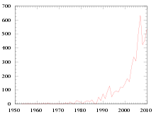
Ascents of Mount Everest by year through 2010
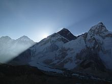
The sun rising on Everest in 2011
By the end of the 2010 climbing season, there had been 5,104 ascents to the summit by about 3,142 individuals, with 77 per cent of these ascents being accomplished since 2000.[155] The summit was achieved in 7 of the 22 years from 1953 to 1974 and was not missed between 1975 and 2014.[155] In 2007, the record number of 633 ascents was recorded, by 350 climbers and 253 sherpas.[155]
An illustration of the explosion of popularity of Everest is provided by the numbers of daily ascents. Analysis of the 1996 Mount Everest disaster shows that part of the blame was on the bottleneck caused by a large number of climbers (33 to 36) attempting to summit on the same day; this was considered unusually high at the time. By comparison, on 23 May 2010, the summit of Mount Everest was reached by 169 climbers – more summits in a single day than in the cumulative 31 years from the first successful summit in 1953 through 1983.[155]
There have been 219 fatalities recorded on Mount Everest from the 1922 British Mount Everest Expedition through the end of 2010, a rate of 4.3 fatalities for every 100 summits (this is a general rate, and includes fatalities amongst support climbers, those who turned back before the peak, those who died en route to the peak and those who died while descending from the peak). Of the 219 fatalities, 58 (26.5 per cent) were climbers who had summited but did not complete their descent.[155] Though the rate of fatalities has decreased since the year 2000 (1.4 fatalities for every 100 summits, with 3938 summits since 2000), the significant increase in the total number of climbers still means 54 fatalities since 2000: 33 on the northeast ridge, 17 on the southeast ridge, 2 on the southwest face, and 2 on the north face.[155]
Nearly all attempts at the summit are done using one of the two main routes. The traffic seen by each route varies from year to year. In 2005–07, more than half of all climbers elected to use the more challenging, but cheaper northeast route. In 2008, the northeast route was closed by the Chinese government for the entire climbing season, and the only people able to reach the summit from the north that year were athletes responsible for carrying the Olympic torch for the 2008 Summer Olympics.[156] The route was closed to foreigners once again in 2009 in the run-up to the 50th anniversary of the Dalai Lama’s exile.[157] These closures led to declining interest in the north route, and, in 2010, two-thirds of the climbers reached the summit from the south.[155]
2010s
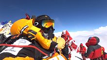
Selfie on the summit, 2012
The 2010s were a time of new highs and lows for the mountain, with back-to-back disasters in 2013 and 2014 causing record deaths. In 2015 there were no summits for the first time in decades. However, other years set records for numbers of summits – 2013’s record number of summiters, around 667, was surpassed in 2018 with around 800 summiting the peak,[158] and a subsequent record was set in 2019 with over 890 summiters.[159]
| Year | Summiters | References |
|---|---|---|
| 2010 | 543 | [159] |
| 2011 | 538 | [159] |
| 2012 | 547 | [160] |
| 2013 | 658–670 | [161][159] |
| 2014 | 106 | [162] |
| 2015 | 0 | [163][159] |
| 2016 | 641 | [164] |
| 2017 | 648 | [165] |
| 2018 | 807 | [158][166] |
| 2019 | approx. 891 | [159] |
2014 avalanche and season
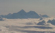
On 18 April 2014, an avalanche hit the area just below the Base Camp 2 at around 01:00 UTC (06:30 local time) and at an elevation of about 5,900 metres (19,400 ft).[167] Sixteen people were killed in the avalanche (all Nepali guides) and nine more were injured.[168]
During the season, a 13-year-old girl, Malavath Purna, reached the summit, becoming the youngest female climber to do so.[169] Additionally, one team used a helicopter to fly from South base camp to Camp 2 to avoid the Khumbu Icefall, then reached the Everest summit. This team had to use the south side because the Chinese had denied them a permit to climb. A team member (Jing Wang) donated US$30,000 to a local hospital.[170] She was named the Nepali «International Mountaineer of the Year».[170]

The location of the fatal ice avalanche on the 2014 route, and the revised 2015 route through the Khumbu.
Over 100 people summited Everest from China (Tibet region), and six from Nepal in the 2014 season.[171] This included 72-year-old Bill Burke, the Indian teenage girl, and a Chinese woman Jing Wang.[172] Another teen girl summiter was Ming Kipa Sherpa who summited with her elder sister Lhakpa Sherpa in 2003, and who had achieved the most times for woman to the summit of Mount Everest at that time.[173] (see also Santosh Yadav)
2015 avalanche, earthquake, season
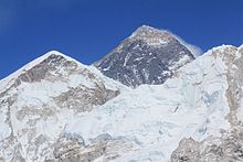
2015 was set to be a record-breaking season of climbs, with hundreds of permits issued in Nepal and many additional permits in Tibet (China). However, on 25 April 2015, an earthquake measuring 7.8 Mw triggered an avalanche that hit Everest Base Camp,[174] effectively shutting down the Everest climbing season.[175] 18 bodies were recovered from Mount Everest by the Indian Army mountaineering team.[176] The avalanche began on Pumori,[177] moved through the Khumbu Icefall on the southwest side of Mount Everest, and slammed into the South Base Camp.[178] 2015 was the first time since 1974 with no spring summits, as all climbing teams pulled out after the quakes and avalanche.[179][180] One of the reasons for this was the high probability of aftershocks (over 50 per cent according to the United States Geological Survey).[181] Just weeks after the first quake, the region was rattled again by a 7.3 magnitude quake and there were also many considerable aftershocks.[182]
The quakes trapped hundreds of climbers above the Khumbu icefall, and they had to be evacuated by helicopter as they ran low on supplies.[183] The quake shifted the route through the ice fall, making it essentially impassable to climbers.[183] Bad weather also made helicopter evacuation difficult.[183] The Everest tragedy was small compared to the impact overall on Nepal, with almost nine thousand dead[184][185] and about 22,000 injured.[184] In Tibet, by 28 April at least 25 had died, and 117 were injured.[186] By 29 April 2015, the Tibet Mountaineering Association (North/Chinese side) closed Everest and other peaks to climbing, stranding 25 teams and about 300 people on the north side of Everest.[187] On the south side, helicopters evacuated 180 people trapped at Camps 1 and 2.[188]
Mountain re-opens in August 2015
On 24 August 2015, Nepal re-opened Everest to tourism including mountain climbers.[189] The only climber permit for the autumn season was awarded to Japanese climber Nobukazu Kuriki, who had tried four times previously to summit Everest without success. He made his fifth attempt in October, but had to give up just 700 m (2,300 ft) from the summit due to «strong winds and deep snow».[190][191] Kuriki noted the dangers of climbing Everest, having himself survived being stuck in a freezing snow hole for two days near the top, which came at the cost of all his fingertips and his thumb, lost to frostbite, which added further difficulty to his climb.[192]
Some sections of the trail from Lukla to Everest Base Camp (Nepal) were damaged in the earthquakes earlier in the year and needed repairs to handle trekkers.[193]
2016 season
Hawley’s database records 641 made it to the summit in early 2016.[194]
2017 season
2017 was the biggest season yet, permit-wise, yielding hundreds of summiters and a handful of deaths.[195] On 27 May 2017, Kami Rita Sherpa made his 21st climb to the summit with the Alpine Ascents Everest Expedition, one of three people in the World along with Apa Sherpa and Phurba Tashi Sherpa to make it to the summit of Mount Everest 21 times.[196][197] The season had a tragic start with the death of Ueli Steck of Switzerland, who died from a fall during a warm-up climb.[198] There was a continued discussion about the nature of possible changes to the Hillary Step.[199] Total summiters for 2017 was tallied up to be 648.[165] 449 summited via Nepal (from the South) and 120 from Chinese Tibet (North side).[200]
2018
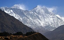
Mount Everest in the upper left (March 2018)
807 climbers summited Mount Everest in 2018,[201] including 563 on the Nepal side and 240 from the Chinese Tibet side.[158] This broke the previous record for total summits in year from which was 667 in 2013, and one factor that aided in this was an especially long and clear weather window of 11 days during the critical spring climbing season.[158][202][166] Various records were broken, including a summit by double-amputee Hari Budha Magar, who undertook his climb after winning a court case in the Nepali Supreme Court.[158] There were no major disasters, but seven climbers died in various situations including several sherpas as well as international climbers.[158] Although record numbers of climbers reached the summit, old-time summiters that made expeditions in the 1980s lamented the crowding, feces, and cost.[202]
Himalayan record keeper Elizabeth Hawley died in late January 2018.[203]
Figures for the number of permits issued by Nepal range from 347[204] to 375.[205]
2019
| 2019 fatalities[206] | |
|---|---|
| Fatalities | Nationality |
| Chris Daly | |
| Donald Cash | |
| Robin Fisher | |
| Druba Bista | |
| Kevin Hynes | |
| Kalpana Dash | |
| Anjali S. Kulkarni | |
| Ernst Landgraf | |
| Nihal Bagwan | |
| Ravi Thakar | |
| Chris Kulish | |
| Séamus Lawless*[207] | |
| *Declared dead after missing |
The spring or pre-monsoon window for 2019 witnessed the deaths of a number of climbers and worldwide publication of images of hundreds of mountaineers queuing to reach the summit and sensational media reports of climbers stepping over dead bodies dismayed people around the world.[208][209][210]
There were reports of various winter expeditions in the Himalayas, including K2, Nanga Parbat, and Meru with the buzz for the Everest 2019 beginning just 14 weeks to the weather window.[211] Noted climber Cory Richards announced on Twitter that he was hoping to establish a new climbing route to the summit in 2019.[211] Also announced was an expedition to re-measure the height of Everest, particularly in light of the 2015 earthquakes.[212][213] China closed the base-camp to those without climbing permits in February 2019 on the northern side of Mount Everest.[214] By early April, climbing teams from around the world were arriving for the 2019 spring climbing season.[166] Among the teams was a scientific expedition with a planned study of pollution, and how things like snow and vegetation influence the availability of food and water in the region.[215] In the 2019 spring mountaineering season, there were roughly 40 teams with almost 400 climbers and several hundred guides attempting to summit on the Nepali side.[216][217][218] Nepal issued 381 climbing permits for 2019.[201] For the northern routes in Chinese Tibet, several hundred more permits were issued for climbing by authorities there.[219]
In May 2019, Nepali mountaineering guide Kami Rita summited Mount Everest twice within a week, his 23rd and 24th ascents, making international news headlines.[220][216][217] He first summited Everest in 1994, and has summited several other extremely high mountains, such as K2 and Lhotse.[216][217][218][220]
By 23 May 2019, about seven people had died, possibly due to crowding leading to delays high on the mountain, and shorter weather windows.[201] One 19-year-old who summited previously noted that when the weather window opens (the high winds calm down), long lines form as everyone rushes to get the top and back down.[221] In Chinese Tibet, one Austrian climber died from a fall,[201] and by 26 May 2019 the overall number of deaths for the spring climbing season rose to 10.[222][223][224] By 28 May, the death toll increased to 11 when a climber died at about 7,900 m (26,000 ft) during the descent,[206] and a 12th climber missing and presumed dead.[207] Despite the number of deaths, reports indicated that a record 891 climbers summited in the spring 2019 climbing season.[225][159]
Although China has had various permit restrictions, and Nepal requires a doctor to sign off on climbing permits,[225] the natural dangers of climbing such as falls and avalanches combined with medical issues aggravated by Everest’s extreme altitude led to 2019 being a year with a comparatively high death toll.[225]
2020s
Both Nepal and China prohibited foreign climbing groups during the 2020 season, due to the COVID-19 pandemic. 2020 was the third year in this decade after 2014 and 2015 which saw no summits from the Nepal (South) Side.[226]
A team of Chinese surveyors climbed Mt. Everest from the North side during April–May 2020, becoming the only climbers to summit the world’s highest peak during the pandemic, at least through May. The team was there to re-measure the height of Mount Everest.[227]
On 12 May 2022, the first all-Black team summited Mt. Everest. Seven men and two women climbers from the U.S. and Kenya, guided by eight sherpas, comprised the expedition.[228]
Climbing
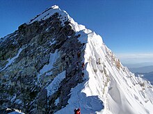
Looking up along the southern ridgeline, the face of the Hillary Step is visible. The top of the South-West face is on the left in shadow, and in the light to the right is the top of the East/Kangshung face. In 2016 and 2017 there were serious reports that the Hillary Step was changed, which triggered a big discussion in the climbing community. (2010 photo)
| Location | Altitude (km) | |
|---|---|---|
| Base camp 5400 m / 17700 ft. | 5.4 | |
| Camp 1 6100 m / 20000 ft. | 6.1 | |
| Camp 2 6400 m / 21000 ft. | 6.4 | |
| Camp 3 6800m / 22300 ft. | 6.8 | |
| Camp 4 8000 m / 26000 ft. | 8 | |
| Summit 8848 m / 29035 ft. | 8.8 |
Permits
In 2014, Nepal issued 334 climbing permits, which were extended until 2019 due to the closure.[230] In 2015, Nepal issued 357 permits, but the mountain was closed again because of the avalanche and earthquake, and these permits were given a two-year extension to 2017.[231][230][clarification needed]
In 2017, a person who tried to climb Everest without the $11,000 permit was caught after he made it past the Khumbu icefall. He faced, among other penalties, a $22,000 fine and a possible four years in jail. In the end, he was allowed to return home but banned from mountaineering in Nepal for 10 years.[232]
The number of permits issued each year by Nepal is:[231][233]
- 2008: 160
- 2009: 220
- 2010: 209
- 2011: 225
- 2012: 208
- 2013: 316
- 2014: 326 (extended for use through 2019)
- 2015: 356 (extended for use through 2017)
- 2016: 289
- 2017: 366 to 373
- 2018: 346
- 2019: 381
- 2020: 0 (no permits issued during the pandemic)
- 2021: 408 (current record)[234][235]
The Chinese side in Tibet is also managed with permits for summiting Everest.[236] They did not issue permits in 2008, due to the Olympic torch relay being taken to the summit of Mount Everest.[237]
In March 2020, the governments of China and Nepal cancelled all climbing permits for Mount Everest due to the COVID-19 pandemic.[238][239] In April 2020, a group of Chinese mountaineers began an expedition from the Chinese side. The mountain remained closed on the Chinese side to all foreign climbers.[240] On 10 May 2021, a separation line was announced by Chinese authorities to prevent the spread of coronavirus from climbers ascending Nepal’s side of the mountain.[241]
Routes

Overview South Col route and North Col/Ridge route
Mount Everest has two main climbing routes, the southeast ridge from Nepal and the north ridge from Tibet, as well as many other less frequently climbed routes.[242] Of the two main routes, the southeast ridge is technically easier and more frequently used. It was the route used by Edmund Hillary and Tenzing Norgay in 1953 and the first recognised of 15 routes to the top by 1996.[242] This was, however, a route decision dictated more by politics than by design, as the Chinese border was closed to the western world in the 1950s, after the People’s Republic of China invaded Tibet.[243]
Most attempts are made during May, before the summer monsoon season. As the monsoon season approaches, the jet stream shifts northward, thereby reducing the average wind speeds high on the mountain.[244][245] While attempts are sometimes made in September and October, after the monsoons, when the jet stream is again temporarily pushed northward, the additional snow deposited by the monsoons and the less stable weather patterns at the monsoons’ tail end makes climbing extremely difficult.
Southeast ridge
The ascent via the southeast ridge begins with a trek to Base Camp at 5,380 m (17,700 ft) on the south side of Everest, in Nepal. Expeditions usually fly into Lukla (2,860 m) from Kathmandu and pass through Namche Bazaar. Climbers then hike to Base Camp, which usually takes six to eight days, allowing for proper altitude acclimatisation in order to prevent altitude sickness.[246] Climbing equipment and supplies are carried by yaks, dzopkyos (yak-cow hybrids), and human porters to Base Camp on the Khumbu Glacier. When Hillary and Tenzing climbed Everest in 1953, the British expedition they were part of (comprising over 400 climbers, porters, and Sherpas at that point) started from the Kathmandu Valley, as there were no roads further east at that time.
Climbers spend a couple of weeks in Base Camp, acclimatising to the altitude. During that time, Sherpas and some expedition climbers set up ropes and ladders in the treacherous Khumbu Icefall.
Seracs, crevasses, and shifting blocks of ice make the icefall one of the most dangerous sections of the route. Many climbers and Sherpas have been killed in this section. To reduce the hazard, climbers usually begin their ascent well before dawn, when the freezing temperatures glue ice blocks in place.
Above the icefall is Camp I at 6,065 metres (19,900 ft).
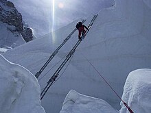
Climber traversing Khumbu Icefall
From Camp I, climbers make their way up the Western Cwm to the base of the Lhotse face, where Camp II or Advanced Base Camp (ABC) is established at 6,500 m (21,300 ft). The Western Cwm is a flat, gently rising glacial valley, marked by huge lateral crevasses in the centre, which prevent direct access to the upper reaches of the Cwm. Climbers are forced to cross on the far right, near the base of Nuptse, to a small passageway known as the «Nuptse corner». The Western Cwm is also called the «Valley of Silence» as the topography of the area generally cuts off wind from the climbing route. The high altitude and a clear, windless day can make the Western Cwm unbearably hot for climbers.[247]
From Advanced Base Camp, climbers ascend the Lhotse face on fixed ropes, up to Camp III, located on a small ledge at 7,470 m (24,500 ft). From there, it is another 500 metres to Camp IV on the South Col at 7,920 m (26,000 ft).
From Camp III to Camp IV, climbers are faced with two additional challenges: the Geneva Spur and the Yellow Band. The Geneva Spur is an anvil-shaped rib of black rock named by the 1952 Swiss expedition. Fixed ropes assist climbers in scrambling over this snow-covered rock band. The Yellow Band is a section of interlayered marble, phyllite, and semischist, which also requires about 100 metres of rope for traversing it.[247]
On the South Col, climbers enter the death zone. Climbers making summit bids typically can endure no more than two or three days at this altitude. If the weather is not clear with low winds during these short few days, climbers are forced to descend, many all the way back down to Base Camp.
From Camp IV, climbers begin their summit push around midnight, with hopes of reaching the summit (still another 1,000 metres above) within 10 to 12 hours. Climbers first reach «The Balcony» at 8,400 m (27,600 ft), a small platform where they can rest and gaze at peaks to the south and east in the early light of dawn. Continuing up the ridge, climbers are then faced with a series of imposing rock steps which usually forces them to the east into the waist-deep snow, a serious avalanche hazard. At 8,750 m (28,700 ft), a small table-sized dome of ice and snow marks the South Summit.[247]
From the South Summit, climbers follow the knife-edge southeast ridge along what is known as the «Cornice traverse», where snow clings to intermittent rock. This is the most exposed section of the climb, and a misstep to the left would send one 2,400 m (7,900 ft) down the southwest face, while to the immediate right is the 3,050 m (10,010 ft) Kangshung Face. At the end of this traverse is an imposing 12 m (39 ft) rock wall, the Hillary Step, at 8,790 m (28,840 ft).[248]
Hillary and Tenzing were the first climbers to ascend this step, and they did so using primitive ice climbing equipment and ropes. Nowadays, climbers ascend this step using fixed ropes previously set up by Sherpas. Once above the step, it is a comparatively easy climb to the top on moderately angled snow slopes—though the exposure on the ridge is extreme, especially while traversing large cornices of snow. With increasing numbers of people climbing the mountain in recent[when?] years, the Step has frequently become a bottleneck, with climbers forced to wait significant amounts of time for their turn on the ropes, leading to problems in getting climbers efficiently up and down the mountain.[citation needed]
After the Hillary Step, climbers also must traverse a loose and rocky section that has a large entanglement of fixed ropes that can be troublesome in bad weather. Climbers typically spend less than half an hour at the summit to allow time to descend to Camp IV before darkness sets in, to avoid serious problems with afternoon weather, or because supplemental oxygen tanks run out.
North ridge route
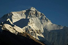
Mount Everest north face from Rongbuk in Tibet
The north ridge route begins from the north side of Everest, in Tibet. Expeditions trek to the Rongbuk Glacier, setting up base camp at 5,180 m (16,990 ft) on a gravel plain just below the glacier. To reach Camp II, climbers ascend the medial moraine of the east Rongbuk Glacier up to the base of Changtse, at around 6,100 m (20,000 ft). Camp III (ABC—Advanced Base Camp) is situated below the North Col at 6,500 m (21,300 ft). To reach Camp IV on the North Col, climbers ascend the glacier to the foot of the col where fixed ropes are used to reach the North Col at 7,010 m (23,000 ft). From the North Col, climbers ascend the rocky north ridge to set up Camp V at around 7,775 m (25,500 ft). The route crosses the North Face in a diagonal climb to the base of the Yellow Band, reaching the site of Camp VI at 8,230 m (27,000 ft). From Camp VI, climbers make their final summit push.
Climbers face a treacherous traverse from the base of the First Step: ascending from 8,501 to 8,534 m (27,890 to 28,000 ft), to the crux of the climb, the Second Step, ascending from 8,577 to 8,626 m (28,140 to 28,300 ft). (The Second Step includes a climbing aid called the «Chinese ladder», a metal ladder placed semi-permanently in 1975 by a party of Chinese climbers.[249] It has been almost continuously in place since, and ladders have been used by virtually all climbers on the route.) Once above the Second Step the inconsequential Third Step is clambered over, ascending from 8,690 to 8,800 m (28,510 to 28,870 ft). Once above these steps, the summit pyramid is climbed by a snow slope of 50 degrees, to the final summit ridge along which the top is reached.[250]
Summit
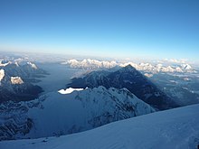
A view from the summit of Mount Everest in May 2013
The summit of Everest has been described as «the size of a dining room table».[251] The summit is capped with snow over ice over rock, and the layer of snow varies from year to year.[252] The rock summit is made of Ordovician limestone and is a low-grade metamorphic rock.[253] (see the ‘Surveys’ section for more on its height and about the Everest rock summit)
Below the summit, there is an area known as «rainbow valley», filled with dead bodies still wearing brightly coloured winter gear. Down to about 8,000 m (26,000 ft) is an area commonly called the «death zone», due to the high danger and low oxygen because of the low pressure.[84]
Below the summit the mountain slopes downward to the three main sides, or faces, of Mount Everest: the North Face, the South-West Face, and the East/Kangshung Face.[254][better source needed]
Death zone
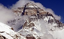
The summit of Mount Everest from the North side
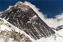
At the higher regions of Mount Everest, climbers seeking the summit typically spend substantial time within the death zone (altitudes higher than 8,000 metres (26,000 ft)), and face significant challenges to survival. Temperatures can dip to very low levels, resulting in frostbite of any body part exposed to the air. Since temperatures are so low, snow is well-frozen in certain areas and death or injury by slipping and falling can occur. High winds at these altitudes on Everest are also a potential threat to climbers.
Another significant threat to climbers is low atmospheric pressure. The atmospheric pressure at the top of Everest is about a third of sea level pressure or 0.333 standard atmospheres (337 mbar), resulting in the availability of only about a third as much oxygen to breathe.[255]
Debilitating effects of the death zone are so great that it takes most climbers up to 12 hours to walk the distance of 1.72 kilometres (1.07 mi) from South Col to the summit.[256] Achieving even this level of performance requires prolonged altitude acclimatisation, which takes 40–60 days for a typical expedition. A sea-level dweller exposed to the atmospheric conditions at the altitude above 8,500 m (27,900 ft) without acclimatisation would likely lose consciousness within 2 to 3 minutes.[257]
In May 2007, the Caudwell Xtreme Everest undertook a medical study of oxygen levels in human blood at extreme altitude. Over 200 volunteers climbed to Everest Base Camp where various medical tests were performed to examine blood oxygen levels. A small team also performed tests on the way to the summit.[258] Even at base camp, the low partial pressure of oxygen had direct effect on blood oxygen saturation levels. At sea level, blood oxygen saturation is generally 98 to 99 per cent. At base camp, blood saturation fell to between 85 and 87 per cent. Blood samples taken at the summit indicated very low oxygen levels in the blood. A side effect of low blood oxygen is a greatly increased breathing rate, often 80–90 breaths per minute as opposed to a more typical 20–30. Exhaustion can occur merely by attempting to breathe.[259]
Lack of oxygen, exhaustion, extreme cold, and climbing hazards all contribute to the death toll. An injured person who cannot walk is in serious trouble, since rescue by helicopter is generally impractical and carrying the person off the mountain is very risky. People who die during the climb are typically left behind. As of 2006, about 150 bodies had never been recovered. It is not uncommon to find corpses near the standard climbing routes.[260]
Debilitating symptoms consistent with high altitude cerebral oedema commonly present during descent from the summit of Mount Everest. Profound fatigue and late times in reaching the summit are early features associated with subsequent death.
— Mortality on Mount Everest, 1921–2006: descriptive study[261]
A 2008 study noted that the «death zone» is indeed where most Everest deaths occur, but also noted that most deaths occur during descent from the summit.[262] A 2014 article in The Atlantic about deaths on Everest noted that while falling is one of the greatest dangers the death zone presents for all 8000ers, avalanches are a more common cause of death at lower altitudes.[263] However, Everest climbing is more deadly than BASE jumping, although some have combined extreme sports and Everest including a Russian who base-jumped off Everest in a wingsuit (he did survive, though).[264]
Despite this, Everest is safer for climbers than a number of peaks by some measurements, but it depends on the period.[265] Some examples are Kangchenjunga, K2, Annapurna, Nanga Parbat, and the Eiger (especially the nordwand).[265] Some factors that affect total mountain lethality include the level of popularity of the mountain, the skill of those climbing, and the difficulty of the climb.[266]
Another health hazard is retinal haemorrhages, which can damage eyesight and cause blindness.[267] Up to a quarter of Everest climbers can experience retinal haemorrhages, and although they usually heal within weeks of returning to lower altitudes, in 2010 a climber went blind and ended up dying in the death zone.[267]
At one o’clock in the afternoon, the British climber Peter Kinloch was on the roof of the world, in bright sunlight, taking photographs of the Himalayas below, «elated, cheery and bubbly». But Mount Everest is now his grave, because only minutes later, he suddenly went blind and had to be abandoned to die from the cold.
— A. McSmith[267]
The team made a huge effort for the next 12 hours to try to get him down the mountain, but to no avail, as they were unsuccessful in getting him through the difficult sections.[268] Even for the able, the Everest North-East ridge is recognised as a challenge. It is hard to rescue someone who has become incapacitated and it can be beyond the ability of rescuers to save anyone in such a difficult spot.[268] One way around this situation was pioneered by two Nepali men in 2011, who had intended to paraglide off the summit. They had no choice and were forced to go through with their plan anyway, because they had run out of bottled oxygen and supplies.[269] They successfully launched off the summit and para-glided down to Namche Bazaar in just 42 minutes, without having to climb down the mountain.[269]
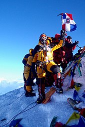
Climber at the summit wearing an oxygen mask
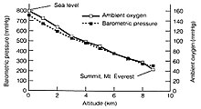
Available oxygen at Everest
Most expeditions use oxygen masks and tanks above 8,000 m (26,000 ft).[270] Everest can be climbed without supplementary oxygen, but only by the most accomplished mountaineers and at increased risk. Humans’ ability to think clearly is hindered with low oxygen, and the combination of extreme weather, low temperatures, and steep slopes often requires quick, accurate decisions. While about 95 per cent of climbers who reach the summit use bottled oxygen in order to reach the top, about five per cent of climbers have summited Everest without supplemental oxygen. The death rate is double for those who attempt to reach the summit without supplemental oxygen.[271] Travelling above 2,400 m (8,000 ft) altitude is a factor in cerebral hypoxia.[272] This decrease of oxygen to the brain can cause dementia and brain damage, as well as other symptoms.[273] One study found that Mount Everest may be the highest an acclimatised human could go, but also found that climbers may suffer permanent neurological damage despite returning to lower altitudes.[274]
Brain cells are extremely sensitive to a lack of oxygen. Some brain cells start dying less than 5 minutes after their oxygen supply disappears. As a result, brain hypoxia can rapidly cause severe brain damage or death.
— Healthline Website[272]
The use of bottled oxygen to ascend Mount Everest has been controversial. It was first used on the 1922 British Mount Everest Expedition by George Finch and Geoffrey Bruce who climbed up to 7,800 m (25,600 ft) at a spectacular speed of 300 vertical metres (1,000 ft) per hour. Pinned down by a fierce storm, they escaped death by breathing oxygen from a jury-rigged set-up during the night. The next day they climbed to 8,100 m (26,600 ft) at 270 m/h (900 ft/h) – nearly three times as fast as non-oxygen users. Yet the use of oxygen was considered so unsportsmanlike that none of the rest of the Alpine world recognised this high ascent rate.[citation needed]
George Mallory described the use of such oxygen as unsportsmanlike, but he later concluded that it would be impossible for him to summit without it and consequently used it on his final attempt in 1924.[275] When Tenzing and Hillary made the first successful summit in 1953, they also used open-circuit bottled oxygen sets, with the expedition’s physiologist Griffith Pugh referring to the oxygen debate as a «futile controversy», noting that oxygen «greatly increases subjective appreciation of the surroundings, which after all is one of the chief reasons for climbing.»[276] For the next twenty-five years, bottled oxygen was considered standard for any successful summit.
…although an acclimatised lowlander can survive for a time on the summit of Everest without supplemental oxygen, one is so close to the limit that even a modicum of excess exertion may impair brain function.
— Thomas F. Hornbein in The high-altitude brain[274]
Reinhold Messner was the first climber to break the bottled oxygen tradition and in 1978, with Peter Habeler, made the first successful climb without it. In 1980, Messner summited the mountain solo, without supplemental oxygen or any porters or climbing partners, on the more difficult northwest route. Once the climbing community was satisfied that the mountain could be climbed without supplemental oxygen, many purists then took the next logical step of insisting that is how it should be climbed.[24]: 154
The aftermath of the 1996 disaster further intensified the debate. Jon Krakauer’s Into Thin Air (1997) expressed the author’s personal criticisms of the use of bottled oxygen. Krakauer wrote that the use of bottled oxygen allowed otherwise unqualified climbers to attempt to summit, leading to dangerous situations and more deaths. The disaster was partially caused by the sheer number of climbers (34 on that day) attempting to ascend, causing bottlenecks at the Hillary Step and delaying many climbers, most of whom summitted after the usual 14:00 turnaround time. He proposed banning bottled oxygen except for emergency cases, arguing that this would both decrease the growing pollution on Everest—many bottles have accumulated on its slopes—and keep marginally qualified climbers off the mountain.
The 1996 disaster also introduced the issue of the guide’s role in using bottled oxygen.[277]
Guide Anatoli Boukreev’s decision not to use bottled oxygen was sharply criticised by Jon Krakauer. Boukreev’s supporters (who include G. Weston DeWalt, who co-wrote The Climb) state that using bottled oxygen gives a false sense of security.[278] Krakauer and his supporters point out that, without bottled oxygen, Boukreev could not directly help his clients descend.[279] They state that Boukreev said that he was going down with client Martin Adams,[279] but just below the south summit, Boukreev determined that Adams was doing fine on the descent and so descended at a faster pace, leaving Adams behind. Adams states in The Climb, «For me, it was business as usual, Anatoli’s going by, and I had no problems with that.»[280]
The low oxygen can cause a mental fog-like impairment of cognitive abilities described as «delayed and lethargic thought process, clinically defined as bradypsychia» even after returning to lower altitudes.[281] In severe cases, climbers can experience hallucinations. Some studies have found that high-altitude climbers, including Everest climbers, experience altered brain structure.[281] The effects of high altitude on the brain, particularly if it can cause permanent brain damage, continue to be studied.[281]
Autumn climbing
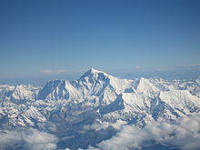
Everest in September 2006
Although generally less popular than spring, Mount Everest has also been climbed in the autumn (also called the «post-monsoon season»).[66][282] For example, in 2010 Eric Larsen and five Nepali guides summited Everest in the autumn for the first time in ten years.[282] The autumn season, when the monsoon ends, is regarded as more dangerous because there is typically a lot of new snow which can be unstable.[283] However, this increased snow can make it more popular with certain winter sports like skiing and snowboarding.[66] Two Japanese climbers also summited in October 1973.[284]
Chris Chandler and Bob Cormack summited Everest in October 1976 as part of the American Bicentennial Everest Expedition that year, the first Americans to make an autumn ascent of Mount Everest according to the Los Angeles Times.[285] By the 21st century, summer and autumn can be more popular with skiing and snowboard attempts on Mount Everest.[286] During the 1980s, climbing in autumn was actually more popular than in spring.[287] U.S. astronaut Karl Gordon Henize died in October 1993 on an autumn expedition, conducting an experiment on radiation. The amount of background radiation increases with higher altitudes.[288]
The mountain has also been climbed in the winter, but that is not popular because of the combination of cold high winds and shorter days.[289] By January the peak is typically battered by 170 mph (270 km/h) winds and the average temperature of the summit is around −33 °F (−36 °C).[66]
Selected climbing records
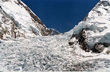
The Khumbu Icefall in 2005

The Western Cwm («Coom»), with Everest on the left and Lhotse to the right
By the end of the 2010 climbing season, there had been 5,104 ascents to the summit by about 3,142 individuals.[155] Some notable «firsts» by climbers include:
- 1922: First climb to 8,000 metres (26,247 ft), by George Finch and Captain Geoffrey Bruce
- 1952: First climb to South Col by 1952 Swiss Mount Everest expedition
- 1953: First ascent, by Tenzing Norgay and Edmund Hillary on 1953 British Mount Everest expedition
- 1960: First reported ascent from the North Ridge by Wang Fuzhou, Gonpo and Qu Yinhua of China.[6]
- 1975: First female ascent, by Junko Tabei (16 May).[155][290]
- 1975: First female ascent from the North Ridge, by Phanthog, deputy head of the second Chinese Everest expedition that sent nine climbers to the summit (27 May).[291][292][293]
- 1978: First ascent without supplemental oxygen by Reinhold Messner and Peter Habeler[294]
- 1978: First solo ascent, by Franz Oppurg[295]
- 1980: First winter ascent, by Polish National Expedition Winter 1979/1980 (Leszek Cichy and Krzysztof Wielicki[296][297])
- 1980: Second solo ascent, and the first without supplemental oxygen, by Reinhold Messner[294]
- 1981: Third solo ascent, by Peter Hackett[298]
- 1988: First «cross-over» climb by Chinese, Japanese and Nepali teams which ascended the peak simultaneously from both the North and South sides of the mountain and descended down the other side.[290] The cross-over climb was also the first to be recorded on live broadcast television.
- 1988: First descent by paraglider, by Jean-Marc Boivin[299]
- 1988: First female ascent without supplemental oxygen by Lydia Bradey[300]
- 1998: Fastest to reach the summit via the southeast ridge (South Col), without supplemental oxygen, by Kazi Sherpa, in 20 hours and 24 minutes.[301][302][303]
- 2000: First descent by ski by Davo Karničar[304]
- 2001: First ascent by a blind climber, Erik Weihenmayer[305]
- 2001: Lhakpa Sherpa becomes first Nepali woman to summit Everest and survive.[306]
- 2004: Fastest to reach the summit via the southeast ridge (South Col), with supplemental oxygen, by Pemba Dorje, in 8 hours and 10 minutes.[307]
- 2006: Lhakpa Sherpa summits for the 6th time, breaking her own record for most successful female Everest climber.[308]
- 2007: Fastest to reach the summit via the northeast ridge, without supplemental oxygen, by Christian Stangl, in 16 hours, 42 minutes.[309][310]
- 2010: Youngest male to reach the summit, by Jordan Romero (13 years and 10 months old)[311]
- 2011: Most times to reach the summit, Apa Sherpa (21 times; 10 May 1990 – 11 May 2011)[312]
- 2013: Apa Sherpa tied for most times to reach the summit by Phurba Tashi (21 times; 1999–2013)
- 2013: Melissa Arnot, American, summits for the fifth time, breaking her own record for most successful summits by any non-Sherpa woman.[313]
- 2014: Youngest female to reach the summit, by Malavath Purna (13 years and 11 months old)
- 2017: Kami Rita Sherpa of Alpine Ascents reaches 21 ascents to the summit.[314][315]
- 2019: Kami Rita Sherpa reaches 24 ascents to the summit.[316]
- 2021: Kami Rita Sherpa reaches 25 ascents to the summit.[317][318]
- 2022: Kami Rita Sherpa reaches 26 ascents to the summit,[319] and Pasang Dawa Sherpa reaches 25 ascents to the summit.[320][321]
Summiting with disabilities
Summiting Everest with disabilities such as amputations and diseases has become popular in the 21st century, with stories like that of Sudarshan Gautam, a man with no arms who made it to the top in 2013.[322] A teenager with Down’s syndrome made it to Base camp, which has become a substitute for more extreme record-breaking because it carries many of the same thrills including the trip to the Himalayas and rustic scenery.[323] Danger lurks even at base camp though, which was the site where dozens were killed in the 2015 Mount Everest avalanches. Others that have climbed Everest with amputations include Mark Inglis (no legs), Paul Hockey (one arm only), and Arunima Sinha (one leg only).
In 2001, Erik Weihenmayer became the first person to reach the summit of Mount Everest while blind.[305]
Fake ascents
In 2021, Nepal banned three Indians for faking an ascent of Mount Everest in 2016.[324][325] In 2017, two Indian police officers, supposedly the first couple to ascend Mount Everest, were sacked once it was found they had faked their ascent.[324]
Aviation
1933: Flight over Everest
Lucy, Lady Houston, a British millionaire former showgirl, funded the Houston Everest Flight of 1933. A formation of airplanes led by the Marquess of Clydesdale flew over the summit in an effort to photograph the unknown terrain.[326]
1988: First climb and glide
On 26 September 1988, having climbed the mountain via the south-east ridge, Jean-Marc Boivin made the first paraglider descent of Everest,[299] in the process creating the record for the fastest descent of the mountain and the highest paraglider flight. Boivin said: «I was tired when I reached the top because I had broken much of the trail, and to run at this altitude was quite hard.»[327] Boivin ran 18 m (60 ft) from below the summit on 40-degree slopes to launch his paraglider, reaching Camp II at 5,900 m (19,400 ft) in 12 minutes (some sources say 11 minutes).[327][328] Boivin would not repeat this feat, as he was killed two years later in 1990, BASE-jumping off Venezuela’s Angel Falls.[329]
1991: Hot air balloon flyover
In 1991 four men in two balloons achieved the first hot-air balloon flight over Mount Everest.[330] In one balloon was Andy Elson and Eric Jones (cameraman), and in the other balloon Chris Dewhirst and Leo Dickinson (cameraman).[331] Dickinson went on to write a book about the adventure called Ballooning Over Everest.[331] The hot-air balloons were modified to function at up to 12,000 m (40,000 ft) altitude.[331] Reinhold Messner called one of Dickinson’s panoramic views of Everest, captured on the now discontinued Kodak Kodachrome film, the «best snap on Earth», according to UK newspaper The Telegraph.[332] Dewhirst has offered to take passengers on a repeat of this feat for US$2.6 million per passenger.[330]
2005: Pilot summits with helicopter

Photo of a Eurocopter AS350 B3 «Squirrel»
In May 2005, pilot Didier Delsalle of France landed a Eurocopter AS350 B3 helicopter on the summit of Mount Everest.[333] He needed to land for two minutes to set the Fédération Aéronautique Internationale (FAI) official record, but he stayed for about four minutes, twice.[333] In this type of landing the rotors stay engaged, which avoids relying on the snow to fully support the aircraft. The flight set rotorcraft world records, for highest of both landing and take-off.[334]
Some press reports suggested that the report of the summit landing was a misunderstanding of a South Col landing, but he had also landed on South Col two days earlier,[335] with this landing and the Everest records confirmed by the FAI.[334] Delsalle also rescued two Japanese climbers at 4,880 m (16,000 ft) while he was there. One climber noted that the new record meant a better chance of rescue.[333]
2011: Paraglide off summit
On 21 May 2011, Nepalis Lakpa Tsheri Sherpa and Sano Bapu Sunuwar paraglided from Everest’s summit to Namche Bazaar in 42 minutes.[269][336] After the flight they hiked, biked, and kayaked to the Indian Ocean, reaching the Bay of Bengal by 27 June 2011, thereby becoming the first persons to complete a continuous summit-to-sea descent from Everest.[337] They accomplished the ground-breaking feat despite Bapu having never previously climbed, and Lakpa having never kayaked and not even knowing how to swim.[337] The duo subsequently won National Geographic Adventurers of the Year for 2012 for their exploits.[337] In 2013 footage of the flight was shown on the television news program Nightline.[338]
2014: Helicopter-assisted ascent
In 2014, a team financed and led by mountaineer Wang Jing used a helicopter to fly from South base camp to Camp 2 to avoid the Khumbu Icefall, and thence climbed to the Everest summit.[339] This climb immediately sparked outrage and controversy in much of the mountaineering world over the legitimacy and propriety of her climb.[170][340] Nepal ended up investigating Wang, who initially denied the claim that she had flown to Camp 2, admitting only that some support crew were flown to that higher camp, over the Khumbu Icefall.[341] In August 2014, however, she stated that she had flown to Camp 2 because the icefall was impassable. «If you don’t fly to Camp II, you just go home,» she said in an interview. In that same interview, she also insisted that she had never tried to hide this fact.[170]
Her team had had to use the south side because the Chinese had denied them a permit to climb. Ultimately, the Chinese refusal may have been beneficial to Nepal’s interests, allowing the government to showcase improved local hospitals and provided the opportunity for a new hybrid aviation/mountaineering style, triggering discussions about helicopter use in the mountaineering world.[170] National Geographic noted that a village festooned Wang with honours after she donated US$30,000 to the town’s hospital. Wang won the International Mountaineer of the Year Award from the Nepal government in June 2014.[339]
2016: Helicopter business increases
In 2016 the increased use of helicopters was noted for increased efficiency and for hauling material over the deadly Khumbu icefall.[342] In particular it was noted that flights saved icefall porters 80 trips but still increased commercial activity at Everest.[342] After many Nepalis died in the icefall in 2014, the government had wanted helicopters to handle more transportation to Camp 1 but this was not possible because of the 2015 deaths and earthquake closing the mountain, so this was then implemented in 2016 (helicopters did prove instrumental in rescuing many people in 2015 though).[342] That summer Bell tested the 412EPI, which conducted a series of tests including hovering at 5,500 m (18,000 ft) and flying as high as 6,100 m (20,000 ft) altitude near Mount Everest.[343]
Commercial climbing
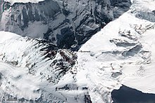
Top down view showing the location of the summit, and its three main faces/sides
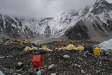
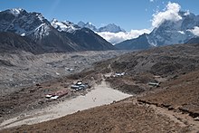
Gorak Shep is about a three-hour walk to South EBC (Everest Base Camp).[344]
According to Jon Krakauer, the era of commercialisation of Everest started in 1985, when the summit was reached by a guided expedition led by David Breashears that included Richard Bass, a wealthy 55-year-old businessman and an amateur mountain climber with only four years of climbing experience.[345] By the early-1990s, several companies were offering guided tours to the mountain. Rob Hall, one of the mountaineers who died in the 1996 disaster, had successfully guided 39 clients to the summit before that incident.[24]: 24, 42
By 2016, most guiding services cost between US$35,000 and US$200,000.[346] Going with a «celebrity guide», usually a well-known mountaineer typically with decades of climbing experience and perhaps several Everest summits, can cost over £100,000 as of 2015.[347] However, the services offered vary widely and it is «buyer beware» when doing deals in Nepal, one of the poorest and least developed countries in the world.[346][348] Tourism contributed 7.9 per cent of the gross domestic product (GDP) in 2019[349] in a country with high unemployment,[350] but Everest is special in that an Everest porter can make nearly double the nation’s average wage in a region in which other sources of income are lacking.[351]
Costs beyond the guiding service can vary widely. It is technically possible to reach the summit with minimal additional expenses, and there are «budget» travel agencies that offer logistical support for such trips. A limited support service, offering only some meals at base camp and bureaucratic overhead like a permit, can cost as little as US$7,000 as of 2007.[142] However, this is considered difficult and dangerous (as illustrated by the case of David Sharp).
Climbing gear required to reach the summit may cost in excess of US$8,000, and most climbers also use bottled oxygen, which adds around US$3,000.[352] The permit to enter the Everest area from the south via Nepal costs US$10,000 to US$30,000 per person, depending on the size of the team.[352] The ascent typically starts at one of the two base camps near the mountain, both of which are approximately 100 kilometres (60 mi) from Kathmandu and 300 kilometres (190 mi) from Lhasa (the two nearest cities with major airports). Transferring one’s equipment from the airport to the base camp may add as much as US$2,000.[352]
Many climbers hire «full service» guide companies, which provide a wide spectrum of services, including the acquisition of permits, transportation to/from base camp, food, tents, fixed ropes,[353] medical assistance while on the mountain, an experienced mountaineer guide, and even personal porters to carry one’s backpack and cook one’s meals. The cost of such a guide service may range from US$40,000 to $80,000 per person.[354] Since most equipment is moved by Sherpas, clients of full-service guide companies can often keep their backpack weights under 10 kilograms (22 lb), or hire a Sherpa to carry their backpack for them. By contrast, climbers attempting less commercialised peaks, like Denali, are often expected to carry backpacks over 30 kilograms (66 lb) and, occasionally, to tow a sled with 35 kilograms (77 lb) of gear and food.[355]
The degree of commercialisation of Mount Everest is a frequent subject of criticism.[356] Jamling Tenzing Norgay, the son of Tenzing Norgay, said in a 2003 interview that his late father would have been shocked to discover that rich thrill-seekers with no climbing experience were now routinely reaching the summit, «You still have to climb this mountain yourself with your feet. But the spirit of adventure is not there any more. It is lost. There are people going up there who have no idea how to put on crampons. They are climbing because they have paid someone $65,000. It is very selfish. It endangers the lives of others.»[357]
One example of this is Shriya Shah-Klorfine, who had to be taught how to put on crampons during her summit attempt in 2012.[358] She paid at least US$40,000 to a new guiding company for the trip, and died when she ran out of oxygen during the descent after climbing for 27 hours straight.[359]
Reinhold Messner concurred in 2004, «You could die in each climb and that meant you were responsible for yourself. We were real mountaineers: careful, aware and even afraid. By climbing mountains we were not learning how big we were. We were finding out how breakable, how weak and how full of fear we are. You can only get this if you expose yourself to high danger. I have always said that a mountain without danger is not a mountain….High altitude alpinism has become tourism and show. These commercial trips to Everest, they are still dangerous. But the guides and organisers tell clients, ‘Don’t worry, it’s all organised.’ The route is prepared by hundreds of Sherpas. Extra oxygen is available in all camps, right up to the summit. People will cook for you and lay out your beds. Clients feel safe and don’t care about the risks.»[360]
By 2015, Nepal was considering to require that climbers have some experience and wanted to make the mountain safer, and especially increase revenue.[361] One barrier to this is that low-budget firms make money not taking inexperienced climbers to the summit.[346] Those turned away by Western firms can often find another firm willing to take them for a price — that they return home soon after arriving after base camp, or part way up the mountain.[346] Whereas a Western firm will convince those they deem incapable to turn back, other firms simply give people the freedom to choose.[346]
However, not all opinions on the subject among prominent mountaineers have been strictly negative. For example, Edmund Hillary stated in 2003 that while «Having people pay $65,000 and then be led up the mountain by a couple of experienced guides…isn’t really mountaineering at all»,[362] he was pleased by the changes brought to Everest area by Westerners, «I don’t have any regrets because I worked very hard indeed to improve the condition for the local people. When we first went in there they didn’t have any schools, they didn’t have any medical facilities, all over the years we have established 27 schools, we have two hospitals and a dozen medical clinics and then we’ve built bridges over wild mountain rivers and put in fresh water pipelines so in cooperation with the Sherpas we’ve done a lot to benefit them.»[363]
One of the early guided summiters, Richard Bass (of Seven Summits fame) stated in 2003 that «Climbers should have high altitude experience before they attempt the really big mountains. People don’t realise the difference between a 20,000-foot [6,100 m] mountain and 29,000-foot [8,800 m]. It’s not just arithmetic. The reduction of oxygen in the air is proportionate to the altitude alright, but the effect on the human body is disproportionate—an exponential curve. People climb Denali [6,190 m or 20,320 ft] or Aconcagua [6,960 m or 22,834 ft] and think, ‘Heck, I feel great up here, I’m going to try Everest.’ But it’s not like that.»[364]
Thefts and crime
Some climbers have reported life-threatening thefts from supply caches. In May 2006, Vitor Negrete, the first Brazilian to climb Everest without oxygen and part of David Sharp’s party, died during his descent, and theft of gear and food from his high-altitude camp may have contributed.[365][366]
«Several members were bullied, gear was stolen, and threats were made against me and my climbing partner, Michael Kodas, making an already stressful situation even more dire», said one climber.[367]
In addition to theft, Michael Kodas describes in his book, High Crimes: The Fate of Everest in an Age of Greed (2008):[368] unethical guides and Sherpas, prostitution and gambling at the Tibet Base Camp, fraud related to the sale of oxygen bottles, and climbers collecting donations under the pretense of removing trash from the mountain.[369][370]
The Chinese side of Everest in Tibet was described as «out of control» in 2007 after one Canadian had all his gear stolen and was abandoned by his Sherpa.[371] Another Sherpa helped the victim get off the mountain safely and gave him some spare gear. Other climbers have also reported missing oxygen bottles, which can be worth hundreds of dollars each. Hundreds of climbers pass by people’s tents, making it hard to safeguard against theft.[371] In the late 2010s, the reports of theft of oxygen bottles from camps became more common.[372]
2014 Sherpa strike
On 18 April 2014, in one of the worst disasters to ever hit the Everest climbing community up to that time, 16 Sherpas died in Nepal due to the avalanche that swept them off Mount Everest. In response to the tragedy, numerous Sherpa climbing guides walked off the job and most climbing companies pulled out in respect for the Sherpa people mourning the loss.[373][374] Some still wanted to climb but there was too much controversy to continue that year.[373] One of the issues that triggered the work action by Sherpas was unreasonable client demands during climbs.[373]
Extreme sports at Mount Everest
Mount Everest has been host to other winter sports and adventuring besides mountaineering, including snowboarding, skiing, paragliding, and BASE jumping.
Yuichiro Miura became the first man to ski down Everest in the 1970s. He descended nearly 1,300 vertical metres (4,200 ft) from the South Col before falling with extreme injuries.[91] Stefan Gatt and Marco Siffredi snowboarded Mount Everest in 2001.[375] Other Everest skiers include Davo Karničar of Slovenia, who completed a top to south base camp descent in 2000, Hans Kammerlander of Italy in 1996 on the north side,[376] and Kit DesLauriers of the United States in 2006.[377] In 2006 Swede Tomas Olsson and Norwegian Tormod Granheim skied together down the north face. Olsson’s anchor broke while they were rappelling down a cliff in the Norton couloir at about 8,500 metres, resulting in his death from a two and a half-kilometre fall. Granheim skied down to camp III.[378] Also, Marco Siffredi died in 2002 on his second snow-boarding expedition.[375]
Various types of gliding descents have slowly become more popular, and are noted for their rapid descents to lower camps. In 1986 Steve McKinney led an expedition to Mount Everest,[379] during which he became the first person to fly a hang-glider off the mountain.[328] Frenchman Jean-Marc Boivin made the first paraglider descent of Everest in September 1988, descending in minutes from the south-east ridge to a lower camp.[299] In 2011, two Nepalis made a gliding descent from the Everest summit down 5,000 metres (16,400 ft) in 45 minutes.[380] On 5 May 2013, the beverage company Red Bull sponsored Valery Rozov, who successfully BASE jumped off of the mountain while wearing a wingsuit, setting a record for world’s highest BASE jump in the process.[264][381]
Everest and religion
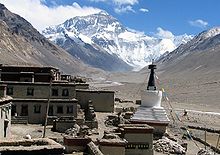
The southern part of Mount Everest is regarded as one of several «hidden valleys» of refuge designated by Padmasambhava, a ninth-century «lotus-born» Buddhist saint.[382]
Near the base of the north side of Everest lies Rongbuk Monastery, which has been called the «sacred threshold to Mount Everest, with the most dramatic views of the world.»[383] For Sherpas living on the slopes of Everest in the Khumbu region of Nepal, Rongbuk Monastery is an important pilgrimage site, accessed in a few days of travel across the Himalayas through Nangpa La.[106]
Miyolangsangma, a Tibetan Buddhist «Goddess of Inexhaustible Giving«, is believed to have lived at the top of Mount Everest. According to Sherpa Buddhist monks, Mount Everest is Miyolangsangma’s palace and playground, and all climbers are only partially welcome guests, having arrived without invitation.[382]
The Sherpa people also believe that Mount Everest and its flanks are blessed with spiritual energy, and one should show reverence when passing through this sacred landscape. Here, the karmic effects of one’s actions are magnified, and impure thoughts are best avoided.[382]
Waste management
In 2015, the president of the Nepal Mountaineering Association warned that pollution, especially human waste, has reached critical levels. As much as 12,000 kg (26,500 lb) of human excrement each season is left behind on the mountain.[384] Human waste is strewn across the verges of the route to the summit, making the four sleeping areas on the route up Everest’s south side minefields of human excrement. Climbers above Base Camp—for the 62-year history of climbing on the mountain—have most commonly either buried their excrement in holes they dug by hand in the snow, or slung it into crevasses, or simply defecated wherever convenient, often within metres of their tents. The only place where climbers can defecate without worrying about contaminating the mountain is Base Camp. At approximately 5,500 m (18,000 ft), Base Camp sees the most activity of all camps on Everest because climbers acclimate and rest there. In the late-1990s, expeditions began using toilets that they fashioned from blue plastic 190-litre (50-US-gallon) barrels fitted with a toilet seat and enclosed.[385]
The problem of human waste is compounded by the presence of more anodyne waste: spent oxygen tanks, abandoned tents, empty cans and bottles. The Nepali government now requires each climber to pack out eight kilograms of waste when descending the mountain.[386]
In February 2019, due to the mounting waste problem, China closed the base camp on its side of Everest to visitors without climbing permits. Tourists are allowed to go as far as the Rongbuk Monastery.[387]
In April 2019, the Solukhumbu district’s Khumbu Pasanglhamu Rural Municipality launched a campaign to collect nearly 10,000 kg of garbage from Everest.[388]
Context and maps
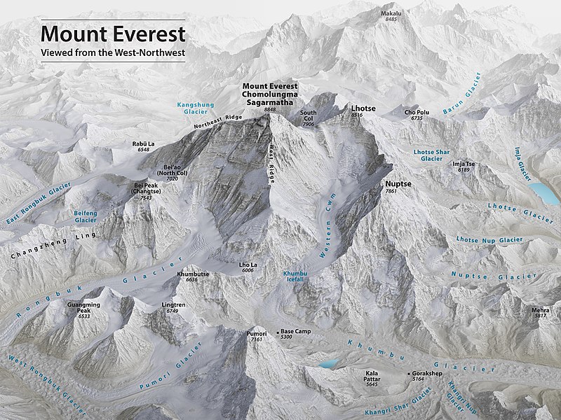
3D rendering of Mount Everest and surrounding terrain
Nearby peaks include Lhotse, 8,516 m (27,940 ft); Nuptse, 7,855 m (25,771 ft), and Changtse, 7,580 m (24,870 ft) among others. Another nearby peak is Khumbutse, and many of the highest mountains in the world are near Mount Everest. On the southwest side, a major feature in the lower areas is the Khumbu icefall and glacier, an obstacle to climbers on those routes but also to the base camps.


Southern and northern climbing routes as seen from the International Space Station. (The names on the photo are links to corresponding pages.)
See also
- Chinese plan for a rail tunnel under Mount Everest
- Everesting
- The Himalayan Database
- List of deaths on eight-thousanders
- List of elevation extremes by country
- List of Mount Everest death statistics
- List of Mount Everest summiters by number of times to the summit
- List of Mount Everest records
- List of people who died climbing Mount Everest
- List of ski descents of Eight-Thousanders
- List of tallest mountains in the Solar System
- Mount Everest in popular culture
- Mount Hood climbing accidents
- Mukhiyapatti Musharniya, the lowest point of Nepal
- Qomolangma National Park
- Rongbuk Glacier
- Sagarmatha National Park
- Timeline of climbing Mount Everest
- Timeline of Mount Everest expeditions
Notes
- ^ Based on the 2020 surveys of elevation of snow cap, not rock head. For more details, see Surveys.
- ^ The WGS84 coordinates given here were calculated using detailed topographic mapping and are in agreement with adventurestats. They are unlikely to be in error by more than 2″. Coordinates showing Everest to be more than a minute further east that appeared on this page until recently, and still appear in Wikipedia in several other languages, are incorrect.
- ^ The position of the summit of Everest on the international border is clearly shown on detailed topographic mapping, including official Nepali mapping.
- ^ a b The «base» of a mountain is a problematic notion in general with no universally accepted definition. However, for a peak rising out of relatively flat terrain, such as Mauna Kea or Denali, an «approximate» height above «base» can be calculated. Everest is more complicated since it only rises above relatively flat terrain on its north (Tibetan Plateau) side. Hence the concept of «base» has even less meaning for Everest than for Mauna Kea or Denali, and the range of numbers for «height above base» is wider. In general, comparisons based on «height above base» are somewhat suspect.
- ^ In the table below, the temperature given is the average lowest temperature recorded in that month. So, in an average year, the lowest recorded July temperature will be −18 degrees Celsius, and the lowest recorded January temperature will be -36 degrees Celsius.
References
- ^ Geography of Nepal: Physical, Economic, Cultural and Regional by Netra Bahadur Thapa, D.P. Thapa Orient Longmans, 1969.
- ^ Bishart, Andrew (4 May 2016). «China’s New Road May Clear a Path for More Everest Climbers». National Geographic.
- ^ «Mount Everest is two feet taller, China and Nepal announce». National Geographic. Retrieved 8 December 2020.
- ^ Meritt, Chris (25 July 2019). «Mount Everest Deaths Statistics by Year (1922-2019)». climbinggearlab.com.
- ^ Nuwer, Rachel. «Death in the clouds: The problem with Everest’s 200+ bodies». BBC Future.
- ^ a b c Lewis, Jon E. (2012). «Appendix 1». The Mammoth Book of How it Happened – Everest. Little, Brown Book Group. p. 212. ISBN 978-1-78033-727-2.
- ^ Storti, Craig (5 October 2021). The Hunt for Mount Everest. Quercus. ISBN 978-1-5293-6629-7.
- ^ «Chomo-lungma: Nepal». Geographical Names. Retrieved 18 April 2014.
- ^ «Djomo-lungma: Nepal». Geographical Names. Retrieved 18 April 2014.
- ^ «Chomolongma: Nepal». Geographical Names. Retrieved 18 April 2014.
- ^ «Mount Jolmo Lungma: Nepal». Geographical Names. Retrieved 18 April 2014.
- ^ Other variants include «Jomo Langma», «Chomo-lungma», «Djomo-lungma», «Jolmo Lungma», and «Chomolongma».[8][9][10][11]
- ^ «TIBET: Call It Chomolungma». TIME magazine. 16 June 1952.
- ^ «Qomolangma Feng: Nepal». Geographical Names. Retrieved 18 April 2014.
- ^ «Mt. Everest 1857». harappa.com. Archived from the original on 26 December 2007. Retrieved 23 January 2008.
- ^ a b c d e f g h i Peter Gillman, ed. (1993). Everest – The Best Writing and Pictures from Seventy Years of Human Endeavour. Little, Brown and Company. pp. 10–13. ISBN 978-0-316-90489-6.
- ^ a b «India and China». The Times. No. 22490. 4 October 1856. p. 8.
- ^ a b «Papers relating to the Himalaya and Mount Everest». Proceedings of the Royal Geographical Society of London. IX: 345–351. April–May 1857.
- ^ «Papers relating to the Himalaya and Mount Everest». Proceedings of the London Royal Geographical Society of London. IX: 345–351. April–May 1857.
- ^ «Mount Everest». Dictionary.com Unabridged (v 1.1). Random House, Inc. Retrieved 22 July 2009.
- ^ Claypole, Jonty (Director); Kunzru, Hari (Presenter) (2003). Mapping Everest (TV Documentary). London: BBC Television.
- ^ Waddell, LA (December 1898). «The Environs and Native Names of Mount Everest». The Geographical Journal. 12 (6): 564–569. doi:10.2307/1774275. JSTOR 1774275.
- ^ «Sagar-Matha: Nepal». Geographical Names. Retrieved 18 April 2014.
- ^ a b c Krakauer, Jon (1997). Into Thin Air: A Personal Account of the Mt. Everest Disaster. New York: Villard. ISBN 978-0-679-45752-7.
- ^ Unsworth, Walt (2000). Everest – The Mountaineering History (3rd ed.). Bâton Wicks. p. 584. ISBN 978-1-898573-40-1.
- ^ «5 Everest facts». historyextra.com. Archived from the original on 6 April 2016. Retrieved 1 June 2016.
- ^ H.P.S. Ahluwalia (1978). Faces of Everest. Vikas Publishing House. ISBN 978-0-7069-0563-2.
- ^ Biswas, Soutik (20 October 2003). «The man who «discovered» Everest». BBC News. Retrieved 11 April 2008.
- ^ Stegman, Charles E; Bellhouse, David; Ehrenberg, A.S. C; Mantel, Nathan; Proschan, Frank; Gianola, Daniel; Searle, S.R; Speed, F.M; Milliken, G.A (February 1982). «Letters to the Editor». The American Statistician. 36 (1): 64–67. doi:10.1080/00031305.1982.10482782. JSTOR 2684102.
- ^ Beech, Martin (2014). The Pendulum Paradigm: Variations on a Theme and the Measure of Heaven and Earth. Universal-Publishers. p. 267.
- ^ Krakauer, Jon (1997). Into Thin Air: A Personal Account of the Mount Everest Disaster (First ed.). New York: Anchor Books. pp. 15–16. ISBN 978-0-385-49478-6. OCLC 36130642.
- ^ a b «Everest not as tall as thought». News in Science. Australian Broadcasting Corporation. 5 October 2005. Retrieved 1 April 2007.
- ^ «Nepal and China agree on Mount Everest’s height». BBC News. 8 April 2010. Retrieved 22 August 2010.
- ^ Daley, Jason (15 April 2019). «Nepalese Expedition Seeks to Find Out if an Earthquake Shrunk Mount Everest Read». Smithsonian.com. Smithsonian Magazine.
- ^ a b «Elevation of Mount Everest newly defined». Swiss Foundation for Alpine Research. 12 November 1999. Archived from the original on 3 January 2007. Retrieved 1 April 2007.
- ^ «Country Profile». Government of Nepal. 2001. Archived from the original on 14 March 2007. Retrieved 1 April 2007.
- ^ US Department of Commerce, NOAA. «GEOID18 Technical Details | GEOID18 | National Geodetic Survey». geodesy.noaa.gov. Retrieved 9 March 2021.
- ^ a b Mount Everest (1:50,000 scale map), prepared under the direction of Bradford Washburn for the Boston Museum of Science, the Swiss Foundation for Alpine Research, and the National Geographic Society, 1991, ISBN 3-85515-105-9.
- ^ «China says Mount Qomolangma stands at 8844.43». Xinhua online. Xinhua News Agency. 9 October 2005. Archived from the original on 13 February 2006. Retrieved 17 June 2016.
- ^ Junyong, Chen; Yanping, Zhang; Janli, Yuan; Chunxi, Guo; Peng, Zhang (2010). «Height Determination of Qomolangma Feng (MT. Everest) in 2005». Survey Review. Informa UK Limited. 42 (316): 122–131. doi:10.1179/003962610×12572516251565. ISSN 0039-6265. S2CID 129376174.
- ^ «Official height for Everest set». BBC. 8 April 2010. Retrieved 16 August 2016.
- ^ «Mount Everest, the world’s highest mountain, officially just got a little bit higher». CBS. 8 December 2020. Retrieved 8 December 2020.
- ^ Navin Singh Khadka (8 December 2020). «Mt Everest grows by nearly a metre to new height». BBC. Retrieved 8 December 2020.
- ^ «Roof of the World». National Geographic Society. 1999. Archived from the original on 12 July 2007. Retrieved 1 April 2007.
- ^ «Everest: Plate Tectonics». Museum of Science. 1998. Archived from the original on 8 November 2006.
- ^ Lim, Louisa (25 January 2005). «China fears Everest is shrinking». BBC News. Retrieved 1 April 2007.
- ^ «Surviving Denali, The Mission». PBS.org. Public Broadcasting Service. 2000. Retrieved 7 June 2007.
- ^ «Mount McKinley 83 feet shorter than thought, new data show». United Press International.
- ^ Krulwich, Robert (7 April 2007). «The ‘Highest’ Spot on Earth?». NPR.org. National Public Radio.
- ^ a b c d Yin, C.-H., and S.-T. Kuo. 1978. «Stratigraphy of the Mount Jolmo Langma and its north slope.» Scientia Sinica. v. 5, pp. 630–644
- ^ a b c d e Sakai, H., M. Sawada, Y. Takigami, Y. Orihashi, T. Danhara, H. Iwano, Y. Kuwahara, Q. Dong, H. Cai, and J. Li. 2005. «Geology of the summit limestone of Mount Qomolangma (Everest) and cooling history of the Yellow Band under the Qomolangma detachment.» Island Arc. v. 14 no. 4 pp. 297–310.
- ^ «Geology of Mount Everest». everest1953.co.uk. Archived from the original on 24 June 2016. Retrieved 13 November 2018.
- ^ Gansser, A. 1964. Geology of the Himalayas, John Wiley Interscience, London, 1964 289 pp.
- ^ Rosenberg, Matt. «A site which uses this dramatic fact first used in illustration of «deep time» in John McPhee’s book Basin and Range«. Geology.about.com. Retrieved 17 June 2016.
- ^ a b c Myrow, P.M., N.C. Hughes, M.P. Searle, C.M. Fanning, S.-C. Peng, and S.K. Parcha, 2009, «Stratigraphic correlation of Cambrian Ordovician deposits along the Himalaya: Implications for the age and nature of rocks in the Mount Everest region». Geological Society of America Bulletin. v. 121, no. 3–4, pp. 323–332.
- ^ Searle, M.P. (1999) Emplacement of Himalayan leucogranites by magma injection along giant sill complexes: examples from the Cho Oyu, Gyachung Kang and Everest leucogranites (Nepal Himalaya). Journal of Asian Earth Sciences. v. 17, no. 5–6, pp. 773–783.
- ^ Guo, Z., and M. Wilson (2012) The Himalayan leucogranites: Constraints on the nature of their crustal source region and geodynamic setting. Gondwana Research. v. 22, no. 2, pp. 360–376.
- ^
«Tectonic Motion: Making the Himalayas». Nature on PBS. 11 February 2011. Retrieved 6 February 2016. - ^
«The Himalayas: Two continents collide». USGS. 5 May 1999. Retrieved 6 February 2016. - ^ «Press Release: An Earth Plate Is Breaking in Two». www.columbia.edu.
- ^ Myrow, P.M., N.C. Hughes, T.S. Paulsen, I.S. Williams, S.K. Parcha, K.R. Thompson, S.A. Bowring, S.-C. Peng, and A.D. Ahluwalia. 2003. Integrated tectonostratigraphic reconstruction of the Himalaya and implications for its tectonic reconstruction. Earth and Planetary Science Letters. vol. 212, pp. 433–441.
- ^ Myrow, P.M., N.C. Hughes, J.W. Goodge, C.M. Fanning, I.S. Williams, S.-C. Peng, O.N. Bhargava, S.K. Tangri, S.K. Parcha, and K.R. Pogue. 2010. Extraordinary transport and mixing of sediment across Himalayan central Gondwanaland during the Cambrian-Ordovician. Geological Society of America Bulletin. vol. 122, pp. 1660–1670.
- ^ Searle, M. 2012. Colliding Continents: A geological exploration of the Himalaya, Karakoram, & Tibet. Oxford University Press, Oxford. 464 pp. ISBN 978-0-19-965300-3
- ^ «The First 100 IUGS Geological Heritage Sites» (PDF). IUGS International Commission on Geoheritage. IUGS. Archived (PDF) from the original on 27 October 2022. Retrieved 10 November 2022.
- ^ a b «High altitude plants». Adventure Scientists. Archived from the original on 25 April 2012. Retrieved 15 May 2012.
- ^ a b c d e Ann Heinrichs (2009). Mount Everest. Marshall Cavendish. p. 25. ISBN 978-0-7614-4649-1.
- ^ Anderson, Karen; Fawcett, Dominic; Cugulliere, Anthony; Benford, Sophie; Jones, Darren; Leng, Ruolin (9 January 2020). «Vegetation expansion in the subnival Hindu Kush Himalaya». Global Change Biology. 26 (3): 1608–1625. Bibcode:2020GCBio..26.1608A. doi:10.1111/gcb.14919. PMC 7078945. PMID 31918454.
- ^ «Wanless, F. R. (1975). Spiders of the family Salticidae from the upper slopes of Everest and Makalu. Bulletin of the British Arachnological Society 3(5): 132-136». World Spider Catalog. Retrieved 11 April 2021.
- ^ Wanless, F.R. (1975). «Spiders of the family Salticidae from the upper slopes of Everest and Makalu». British Arachnological Society.
- ^ The Ascent of Everest by John Hunt (Hodder & Stoughton, 1953) In chapter 14, Hunt describes seeing a chough on the South Col; meanwhile Charles Evans saw some unidentified birds fly over the col
- ^ Jesse Greenspan. «7 Things You Should Know About Mount Everest». History.com. Retrieved 20 September 2015.
- ^ «Bar-headed geese: Highest bird migration tracked». BBC News. Retrieved 20 September 2015.
- ^ «Ale, Som B. «Ecology of the Snow Leopard and the Himalayan Tahr in Sagarmatha (Mt. Everest) National Park, Nepal.» University of Illinois, 2007″ (PDF). Archived (PDF) from the original on 9 October 2022.
- ^ «List of Animals on Mount Everest». Pets on mom.me. Retrieved 20 September 2015.
- ^ «Everest Expedition Uncovers Exotic Species». LiveScience.com. 7 April 2006. Retrieved 20 September 2015.
- ^ «Monthly Average Coldest temperature on Everest Summit». topchinatravel.com. Retrieved 16 August 2015.
- ^ «Nepal to move Everest base camp from melting glacier». BBC News. 17 June 2022. Retrieved 17 June 2022.
- ^ West, John B. (1 March 1999). «Barometric pressures on Mt. Everest: new data and physiological significance». Journal of Applied Physiology. 86 (3): 1062–1066. doi:10.1152/jappl.1999.86.3.1062. PMID 10066724. S2CID 27875962.
- ^ «The Dead Sea Region as a Health Resort». The CF Center. Archived from the original on 15 July 2012. Retrieved 15 May 2012.
- ^ Basilevsky, Alexandr T.; Head, James W. (2003). «The surface of Venus». Rep. Prog. Phys. 66 (10): 1699–1734. Bibcode:2003RPPh…66.1699B. doi:10.1088/0034-4885/66/10/R04. S2CID 13338382.
- ^ a b c «Everest weather station goes online». UIAA. 16 June 2008. Archived from the original on 5 January 2009. Retrieved 15 May 2012.
- ^ Connelly, Claire (30 September 2011). «Mount Everest webcam gives new meaning to high-def». Herald Sun. Archived from the original on 4 November 2021. Retrieved 30 September 2011.
- ^ da Polenza, Agostino; Vuillermoz, Elisa; Verza, Gian Pietro; Cortinovis, Alberto. «SHARE Everest Automatic Weather Station: South Col, Mt. Everest, Nepal» (PDF). Italy: Ev-K2-CNR Committee. Archived from the original (PDF) on 19 November 2011.
- ^ a b godhead/v (10 February 2011). «The Open Graveyard of Mt. Everest’s «Death Zone»«. Gizmodo. Gawker Media. Retrieved 20 September 2015.
- ^ a b Peplow, Mark (25 May 2004). «High winds suck oxygen from Everest». Nature. doi:10.1038/news040524-2.
- ^ a b «The deadly odds of climbing Mount Everest: By the numbers». The Week.
- ^ «The Physiological Effects of Altitude». TheTech. Archived from the original on 13 July 2015. Retrieved 20 September 2015.
- ^ «The route — climbers guide to Everest». www.mounteverest.net. Retrieved 23 February 2020.
- ^ «Mount Everest: The Routes». Alpenglow. 4 May 2017. Retrieved 23 February 2020.
- ^ a b «Mt. Everest’s Popularity Is Still Climbing». Los Angeles Times. Retrieved 20 September 2015.
- ^ a b c d e f James, Victoria (27 May 2012). «Japan’s Everest timeline». The Japan Times Online. Retrieved 20 February 2016.
- ^ «The World’s Tallest Mountain». Earth Observatory. NASA. 2 January 2014.
- ^ «Everest Facts for Kids». www.alanarnette.com.
- ^ a b «Window of Opportunity: Everest Climbing Season Underway». Accuweather. Archived from the original on 1 September 2016. Retrieved 23 January 2014.
- ^ «Everest by the Numbers: The Latest Summit Stats» (Blog). alanarnette.com. Retrieved 20 September 2015.
- ^ William Buxton (5 October 2015). From First Sight to Summit: A Guide to the Literature on Everest up to the 1953 Ascent (PDF). Archived (PDF) from the original on 9 October 2022. Retrieved 31 January 2017.
- ^ Norton, E.F. (1924). «The Climb with Mr. Sommerville to 28,000 feet». The Geographical Journal. 64 (6): 451–455. doi:10.2307/1781918. JSTOR 1781918.
- ^ Crompton, Teresa (2020). Adventuress: The Life and Loves of Lucy, Lady Houston. The History Press.
- ^ «Aeroplane expeditions to Everest». flymicro.com.
- ^ «Wings Over Everest 2003». Everestnews.com. 2002.
- ^ «Flying Over World’s Highest Peak». Popular Science. Bonnier Corporation. 122 (5): 20. May 1933.
- ^ «Everest History Time Line». Everest History. 2003. Archived from the original on 26 May 2010. Retrieved 17 June 2016.
- ^ «Tenzing Norgay GM». Imagining Everest. The Royal Geographical Society. Archived from the original on 14 April 2007. Retrieved 21 June 2007.
- ^ «Excerpt from: Swiss Foundation for Alpine Research, 1939 to 1970». Zurich. 1972. Archived from the original on 8 March 2011.
- ^ Hunt, John (1953). The Ascent of Everest. London: Hodder & Stoughton. pp. 51, 52.
- ^ a b Norgay, Tenzing; Ramsey Ullman, James (1955). Man of Everest: The Autobiography of Tenzing. also published as Tiger of the Snows. G.G. Harrap. p. 320.
- ^ «The London Gazette». 6 June 1953. Retrieved 27 December 2015.
- ^ «The Order of New Zealand(Instituted 1987)». Department of the Prime Minister and Cabinet. Archived from the original on 6 January 2016. Retrieved 27 December 2015.
- ^ «Nepal honours Tenzing and Hillary». The Hindu. PTI. 12 October 2009. ISSN 0971-751X. Retrieved 20 February 2020.
{{cite news}}: CS1 maint: others (link) - ^ Pagnamenta, Robin. «Mt Tenzing and Mt Hillary: Nepal honours Everest pioneers». The Times. ISSN 0140-0460. Retrieved 20 February 2020.
- ^ a b «Ernst Schmied». EverestHistory.com. Retrieved 10 April 2010.
- ^ «Jim Whittaker». EverestHistory.com. Retrieved 13 February 2010.
- ^ Isserman, Maurice (February–March 2007). «Highest Adventure». American Heritage. Archived from the original on 3 December 2008.
- ^ Unsworth (2000), p. 594.
- ^ «The HJ/31/8 THE JAPANESE MOUNT EVEREST EXPEDITION, 1969-1970». The HJ/31/8 THE JAPANESE MOUNT EVEREST EXPEDITION, 1969-1970.
- ^ «Everest Summits in the 1970s». EverestHistory.com. Archived from the original on 14 October 2009. Retrieved 25 May 2016.
- ^ «Yuichiro Miura, 80, scales Everest». ESPN. Associated Press. 23 May 2013.
- ^ Mount Everest the first winter ascent Andrzej Zawada www.alpinejournal.org.uk, accessed 12 December 2020
- ^ a b «The Ice Warriors: Poland’s Golden Alpine Generation». 30 March 2016.
- ^ Granowski, Damian. «The first winter ascent of Mount Everest -«.
- ^ «Krzysztof Wielicki – Polish Winter Expedition 1980 – part 1». 13 November 2007.
- ^ «Adventurestats.com». www.adventurestats.com. Archived from the original on 23 October 2019. Retrieved 26 March 2018.
- ^ «Golden Decade: The Birth of 8000m Winter Climbing». www.alpinist.com.
- ^ «Poland’s ‘ice warriors’ risk life and limb to be first to summit K2 in winter». 13 July 2017.
- ^ ««Zginęli, bo byli najlepsi»«. www.tygodnikpowszechny.pl. 9 June 2009.
- ^ Baechtel, Mark. «Review: Above the Clouds: The Diaries of a High-Altitude Mountaineer». Washington Post.
- ^ a b Zubacheva, Ksenia (21 February 2018). «How a Russian rescued U.S. alpinists on top of Mt. Everest». Russia Beyond. Retrieved 21 February 2018.
- ^ Parfit, Michael (7 December 1997). «Breathless». New York Times.
- ^ «The day the sky fell on Everest». New Scientist (2449): 15. 29 May 2004. Archived from the original on 3 July 2007. Retrieved 11 December 2006.
- ^ Peplow, Mark (25 May 2004). «High winds suck oxygen from Everest. Predicting pressure lows could protect climbers». BioEd Online. Retrieved 11 December 2006.
Moore explains that these jet streaks can drag a huge draught of air up the side of the mountain, lowering the air pressure. He calculates that this typically reduces the partial pressure of oxygen in the air by about 6%, which translates to a 14% reduction in oxygen uptake for the climbers. Air at that altitude already contains only one third as much oxygen as sea-level air.
- ^ a b «Beck Weathers». Badass of the Week.
- ^ a b c Weathers, Beck (May 2000). «My Journey Home From Everest». D Magazine. Retrieved 31 January 2017.
They left me alone in Scott Fischer’s tent that night, expecting me to die. On a couple of occasions, I heard the others referring to ‘a dead guy’ in the tent. Who could that be? I wondered as I slipped in and out of wakefulness.
- ^ Hopewell, John (6 August 2013). «‘2 Guns’ Helmer Kormakur Set to Climb ‘Everest’«. Variety. Retrieved 17 January 2014.
- ^ «Cold mountain: Death on Everest». The Independent. Retrieved 20 September 2015.
- ^ a b «Himalayan Database Expedition Archives of Elizabeth Hawley». himalayandatabase.com. Retrieved 20 September 2015.
- ^ a b «Dispatch 19: Massive Collapse in Khumbu Icefall Claims the Lives of Three Sherpa Climbers». greatoutdoors.com. Archived from the original on 24 September 2015. Retrieved 20 September 2015.
- ^ Ashley Strickland, CNN (25 May 2013). «Striving for Everest: World’s highest battle». CNN. Retrieved 20 September 2015.
- ^ a b «Over the Top». Outside Online. 15 August 2006. Retrieved 20 September 2015.
- ^ «Everest climber left to die alone». The Washington Times. Retrieved 20 September 2015.
- ^ «Everest climber defends leaving dying Briton». Australian Broadcasting Corporation. 23 May 2006. Archived from the original on 23 August 2006.
- ^ Breed, Allen G.; Gurubacharya, Binaj (18 July 2006). «Part II: Near top of Everest, he waves off fellow climbers: ‘I just want to sleep’«. Oh My News. Archived from the original on 24 April 2014. Retrieved 7 December 2016.
- ^ a b Ed Douglas (13 January 2007). «Summit fever». Telegraph.co.uk. Archived from the original on 10 January 2022. Retrieved 20 September 2015.
- ^ Tarbox, Katherine (23 January 2012). «How Much it Costs to Climb Mount Everest». Time. Retrieved 20 September 2015.
- ^ a b c D. Savage; B. Torgler (2015). The Times They Are A Changin’: The Effect of Institutional Change on Cooperative Behaviour at 26,000 ft over Sixty Years. Springer. pp. 5–. ISBN 978-1-137-52515-4.
- ^ «Everest K2 News ExplorersWeb – Jamie McGuiness about David Sharp: «Crying, Dawa had to leave him»«. explorersweb.com. Retrieved 20 September 2015.
- ^ «Did Everest Climber Sharp Have to Die?». washingtonpost.com. Retrieved 20 September 2015.
- ^ «The High and Low of Everest». Spectrum. The Sunday Tribune. Chandigarh, India. Retrieved 24 November 2021.
- ^ «Everest K2 News ExplorersWeb – Un-named Everest Sherpa gets a name – and fatality details». explorersweb.com. Archived from the original on 4 July 2022. Retrieved 20 September 2015.
- ^ «Outdoors: David Sharp’s vow on Everest: ‘If I don’t do it this time, I’m not coming back.’«. The Seattle Times. Retrieved 20 September 2015.
- ^ «Death in the Clouds: The problem with Everest’s 200+ bodies». Retrieved 10 October 2015.
- ^ Nuwer, Rachel (9 October 2015). «Death in the clouds: The problem with Everest’s 200+ bodies». BBC Future.
- ^ a b Squires, Nick. «Climber declared dead on Everest is brought down alive». Daily Telegraph. United Kingdom. Archived from the original on 10 January 2022. Retrieved 16 May 2017.
- ^ a b c d e f Weber, Bruce (24 March 2012). «Lincoln Hall, Australian Mountaineer, Dies at 56». The New York Times. ISSN 0362-4331. Retrieved 16 May 2017.
- ^ «Sir Edmund Hillary Foundation of Canada». Thesiredmundhillaryfoundation.ca. Retrieved 15 May 2012.
- ^ a b c d e f g h i «Full list of all ascents of Everest up to and including 2010». 8000ers.com. 24 September 2011. Retrieved 28 September 2011.
- ^ Sengupta, Somini (15 March 2008). «Nepal Puts Everest Off Limits During China’s Olympic Torch Relay in May». The New York Times.
- ^ Moore, Malcolm (25 February 2009). «China closes Tibetan side of Everest to climbers ahead of anniversary of Dalai Lama’s exile». The Daily Telegraph. London. Archived from the original on 10 January 2022.
- ^ a b c d e f «Everest 2018: Season Summary – Record Weather, Record Summits». The Blog on alanarnette.com. 25 May 2018. Retrieved 22 January 2019.
- ^ a b c d e f g Emily Barone and Lon Tweeten. «Greed, Weather and Inexperience: See How Mount Everest’s Deadly Season Compares to Past Years». Time. Retrieved 12 June 2019.
{{cite magazine}}: CS1 maint: uses authors parameter (link) - ^ «Everest Maxed Out». ngm.nationalgeographic.com. Retrieved 29 May 2016.
- ^ «Everest 2013: Season Recap: Summits, Records and Fights». alanarnette.com. Retrieved 29 May 2016.
- ^ «Everest 2014: Season Summary – A Nepal Tragedy». alanarnette.com. Retrieved 29 May 2016.
- ^ Peter Holley (12 January 2016). «For the first time in four decades, nobody made it to the top of Mount Everest last year». The Washington Post. Retrieved 29 May 2016.
- ^ «Everest by the Numbers: 2017 Edition». alanarnette.com. 30 December 2016. Retrieved 24 May 2017.
- ^ a b Parker, Simon (4 April 2018). «Is it time to ban Western travellers – and their egos – from Mount Everest?». The Telegraph. Archived from the original on 10 January 2022.
- ^ a b c Arnette, Alan (4 April 2019). «What to Watch for on Everest This Year». Outside Online. Retrieved 10 April 2019.
- ^ «Everest avalanche kills at least 12 Sherpa guides». BBC News. 18 April 2014. Retrieved 18 April 2014.
- ^ Krakauer, Jon (21 April 2014). «Death and Anger on Everest». The New Yorker. Retrieved 22 April 2014.
Of the twenty-five men hit by the falling ice, sixteen were killed, all of them Nepalis working for guided climbing teams.
- ^ «13-year-old Andhra teen becomes the youngest woman to scale Everest». Times of India. Retrieved 25 May 2014.
- ^ a b c d e «Woman Whose Post-Avalanche Everest Ascent Sparked Outrage Defends Her Feat». National Geographic. Retrieved 20 September 2015.
- ^ «Everest 2014: Season Summary – A Nepal Tragedy» (Blog). alanarnette.com. Retrieved 20 September 2015.
- ^ «Everest 2014: Summits – Update 6» (Blog). alanarnette.com.
- ^ Luke Harding (25 May 2003). «Teenage girl conquers Everest, 50 years on». The Guardian.
- ^ Gardiner Harris (25 April 2015). «Everest Climbers Are Killed as Nepal Quake Sets Off Avalanche». The New York Times. Retrieved 23 December 2015.
- ^ «Everest 2015: Season Summary – Summits Don’t Matter» (Blog). alanarnette.com. Retrieved 20 September 2015.
- ^ «Avalanche triggered by quake kills 18 on Mount Everest». The Times of India. Retrieved 26 April 2015.
- ^ «Everest Base Camp a ‘War Zone’ After Earthquake Triggers Avalanches». National Geographic. Retrieved 26 April 2015.
- ^ «10 confirmed dead in Mount Everest avalanche, but toll expected to rise». The Washington Post. 25 April 2015. Retrieved 25 April 2015.
- ^ «Mt. Everest Will Not Be Climbed for First Time Since 1974». snowbrains.com. 5 May 2015. Retrieved 20 September 2015.
- ^ Parker, Laura (13 May 2015). «Will Everest’s Climbing Circus Slow Down After Disasters?». news.nationalgeographic.com. National Geographic. Retrieved 6 July 2015.
- ^ «No One Will Climb Everest This Year – The Last Team Pulls Out» (Blog). snowbrains.com. 2 May 2015. Retrieved 20 September 2015.
- ^ Nick Rawlinson (15 May 2015). «Nepal earthquake: such huge aftershocks are rare». The Conversation. Retrieved 20 September 2015.
- ^ a b c «Trapped at 20,000 feet: Hundreds of Everest climbers await choppers as supplies run low». Fox News.
- ^ a b «Incident Report of Earthquake 2015». Nepal Disaster Risk Reduction Portal, drrportal.gov.np. Retrieved 28 May 2015.
- ^ «Nepal earthquake death toll rises to 8,413». The Times of India. 7 May 2015. Archived from the original on 10 May 2015. Retrieved 9 May 2015.
- ^ «Nepal quake: Death toll rises to 25 in Tibet; 117 injured». Business Standard. Press Trust of India. 28 April 2015. Retrieved 17 June 2016.
- ^ «North Side of Everest Closing». Outside. 29 April 2015. Retrieved 20 September 2015.
- ^ «Nepal earthquake: Hopes fade for survivors; 180 rescued on Mount Everest». The Sydney Morning Herald. 27 April 2015. Retrieved 20 September 2015.
- ^ «Mount Everest opens for business». Deutsche Welle. Retrieved 20 September 2015.
- ^ «Japanese climber with no fingertips abandons bid to scale Everest». The Guardian. 8 October 2015.
- ^ Tanya Basu. «Everest Reopened to Climbers». Time. Retrieved 20 September 2015.
- ^ «Japan finger frostbite victim exposes Nepali desperation to revive Everest climbs». Reuters. Retrieved 20 September 2015.
- ^ «4 sections of trekking route to Mount Everest were damaged by earthquake, assessment finds». Fox News. Archived from the original on 24 September 2015. Retrieved 20 September 2015.
- ^ «Himalayan Database Expedition Archives of Elizabeth Hawley». www.himalayandatabase.com. Retrieved 16 April 2019.
- ^ «Everest 2017: South Col Dead Body Report was Wrong». Alanarnette. 25 May 2017. Retrieved 23 October 2017.
- ^ Pokhrel, Rajan (27 May 2017). «Kami Rita Sherpa scales Mt Everest 21 times». The Himalayan Times. Retrieved 27 May 2017.
- ^ PTI (27 May 2017). «Nepalese Sherpa scales Everest for record 21 times». The Hindu. Retrieved 27 May 2017.
- ^ Mettler, Katie (1 May 2017). «Ueli Steck, famed Swiss mountain climber, dead after plunging 3,280 feet near Mount Everest». Washington Post. Retrieved 23 October 2017.
- ^ «Mount Everest’s famed Hillary Step collapses». ABC Online. ABC News. 22 May 2017. Retrieved 23 October 2017.
- ^ AFP (13 May 2018). «First climbers of 2018 reach Mount Everest summit». Times of India. Bennett, Coleman & Co. Ltd. Archived from the original on 14 May 2018. Retrieved 25 August 2018.
- ^ a b c d «Three more die on Everest amid overcrowding». BBC News. 24 May 2019. Retrieved 24 May 2019.
- ^ a b Douglas, Ed (4 June 2018). «Is climbing Everest today as ‘awful’ as Chris Bonington says?». The Guardian. ISSN 0261-3077. Retrieved 22 January 2019.
- ^ «Elizabeth Hawley dies at 94». 27 January 2018.
- ^ Wilkinson, Freddie (22 January 2019). «Want to climb Mount Everest? Here’s what you need to know». National Geographic.
- ^ Prasain, Sangam (11 April 2018). «2018 Everest season starts with fresh hopes, dreams». Kathmandu Post.
- ^ a b «Mount Everest death toll increases to 11 after American dies». UPI. Retrieved 28 May 2019.
- ^ a b Slater, Sarah. «Memorial service to be held for Everest climber Shay Lawless». The Irish Times. Retrieved 29 May 2019.
- ^ Wengel, Yana. «Death on Everest: the boom in climbing tourism is dangerous and unsustainable». The Conversation.
- ^ «Colorado climber stepped over newly dead bodies to summit Everest. He’s still wrestling with what it all means». The Colorado Sun. 6 June 2019.
- ^ «Climber describes scene in Everest’s «death zone»: Traffic jams and corpses». www.cbsnews.com.
- ^ a b «2018/19 Winter Climbs: K2 Climbers en route, Nanga Climbers Climbing, New Everest Route?». The Blog on alanarnette.com. 7 January 2019. Retrieved 23 January 2019.
- ^ Wallen, Joe (9 April 2019). «Nepalese team to measure Mount Everest amid concerns it has shrunk following earthquake». The Telegraph. ISSN 0307-1235. Archived from the original on 10 January 2022. Retrieved 10 April 2019.
- ^ «Nepalese Climbers to Remeasure Mount Everest». Time. Retrieved 10 April 2019.
- ^ «China closes Everest base camp to tourists». 15 February 2019. Retrieved 24 May 2019.
- ^ «American scientists to climb Mount Everest to study pollution». Washington Post. Retrieved 10 April 2019.
- ^ a b c «Mountaineer extends record by climbing Everest for 24th time». NBC News. Retrieved 22 May 2019.
- ^ a b c Emily Dixon and Sugam Pokharel (21 May 2019). «Sherpa summits Everest a record 24th time». CNN. Retrieved 22 May 2019.
- ^ a b «Sherpa sets record with 24th Everest summit». BBC News. 21 May 2019. Retrieved 22 May 2019.
- ^ «Chinese Everest Permits Slashed By 33%». Rock and Ice. 28 January 2019. Retrieved 26 May 2019.
- ^ a b «Sherpa climbs Everest twice in a week, breaks his record with his 24th ascent». Washington Post. Retrieved 22 May 2019.
- ^ «Aussie climber says Nepal needs to act after horror season on Everest». 29 May 2019.
- ^ Aaro, David (25 May 2019). «British climber dies on Mount Everest; death toll reaches 10». Fox News. Retrieved 26 May 2019.
- ^ Sharma, Bhadra; Mashal, Mujib (25 May 2019). «British Climber Dies on Everest as Traffic Jam’s Toll Rises to 10». The New York Times. ISSN 0362-4331. Retrieved 26 May 2019.
- ^ Everest mountaineer warned of overcrowding before dying on climb www.cnn.com, accessed 12 December 2020
- ^ a b c «What’s causing Mount Everest’s deadly season? Overcrowding, inexperience and a long line to the top». USA TODAY. Retrieved 29 May 2019.
- ^ «COVID-19 shuts down Everest». Adventure. 13 March 2020. Retrieved 19 September 2020.
- ^ Khadka, Navin Singh (27 May 2020). «Chinese team scale Everest during pandemic». BBC News. Retrieved 31 January 2021.
- ^ Cluff, Jilli (12 May 2022). «Mt. Everest History: First All-Black Expedition Team Summits World’s Highest Peak». GearJunkie. Retrieved 13 May 2022.
- ^ «The route – climbers guide to Everest». www.mounteverest.net. Retrieved 24 May 2017.
- ^ a b Sangam Prasain. «Kathmandu Post- Everest permits to be extended». Kathmandupost.ekantipur.com. Retrieved 17 June 2016.
- ^ a b «Everest expeditions likely to be delayed by bad weather». ekantipur.com. Retrieved 23 October 2017.
- ^ Mt. Everest Beckoned, So He Climbed Without a Permit. Now He’s Under Arrest www.nytimes.com accessed 12 December 2020
- ^ «Climbers Did Not Die Due To Congestion on Mount Everest, Says Nepal». NDTV. Retrieved 13 June 2019.
- ^ «Everest Climbing Season Was Like No Other». VOA. Retrieved 30 October 2021.
- ^ Ledur, Júlia; Galocha, Artur. «Covid reached Everest base camp. Now climbers are trying to prevent its spread amid a record season». Washington Post. Retrieved 30 October 2021.
- ^ O’Neil, Devon (3 April 2017). «Everest Will Be More Crowded Than Ever This Year». outsideonline.com. Retrieved 23 October 2017.
- ^ Sengupta, Somini (15 March 2008). «Nepal Puts Everest Off Limits During China’s Olympic Torch Relay in May». The New York Times. Retrieved 23 October 2017.
- ^ «China shuts down Everest over coronavirus». CNA. Agence France-Presse. 12 March 2020. Archived from the original on 13 March 2020. Retrieved 13 March 2020.
- ^ «Mount Everest: Nepal’s government shuts off mountain amid virus outbreak». BBC News. 13 March 2020. Archived from the original on 13 March 2020. Retrieved 13 March 2020.
- ^ Khadka, Navin (3 April 2020). «Coronavirus: Chinese explorers start Everest climb amid pandemic». BBC. Retrieved 3 April 2020.
- ^ «China to draw ‘separation line’ on peak of Mount Everest». Retrieved 10 May 2021.
- ^ a b «Ascent Routes on Everest». EverestHistory.com. Archived from the original on 15 January 2008. Retrieved 21 January 2008.
- ^ Thompson, Kalee (2 April 2003). «Everest Time Line: 80 Years of Triumph and Tragedy». National Geographic Society. Retrieved 28 March 2008.
- ^ «Climbing Mount Everest». The New York Times. 19 May 1997. Retrieved 24 October 2008.
- ^ Team Everest 03. «Mt. Everest Information». Archived from the original on 11 February 2010. Retrieved 24 October 2008.
- ^ Muza, SR; Fulco, CS; Cymerman, A (2004). «Altitude Acclimatization Guide». US Army Research Inst. Of Environmental Medicine Thermal and Mountain Medicine Division Technical Report (USARIEM–TN–04–05). Archived from the original on 23 April 2009. Retrieved 5 March 2009.
{{cite journal}}: CS1 maint: unfit URL (link) - ^ a b c «The Way to the Summit». NOVA Online. Public Broadcasting Corporation. 2000. Retrieved 28 March 2008.
- ^ Vajpai, Arjun (10 November 2010). On Top of World: My Everest Adventure. Penguin UK. ISBN 978-81-8475-304-2.
- ^ «Chinese ladder». AFFIMER. Archived from the original on 16 January 2016. Retrieved 16 January 2014.
- ^ «The Way to the Summit (North)». NOVA Online. Public Broadcasting Corporation. 2000. Retrieved 28 March 2008.
- ^ «Swindon explorer on top of the world». Swindon Advertiser. Retrieved 20 September 2015.
- ^ «Highest Mountain – Everest». extremescience.com. Retrieved 20 September 2015.
- ^ «Montana State University – Everest Education Expedition – Everest Facts». Montana.edu. Archived from the original on 5 March 2016. Retrieved 17 June 2016.
- ^ «Everest Facts». Archived from the original on 9 May 2015.
- ^ «Online high altitude oxygen calculator». altitude.org. Archived from the original on 29 July 2012. Retrieved 15 August 2007.
- ^ «Mount Everest South Col Route Maps». alanarnette.com. Retrieved 15 August 2013.
- ^ Grocott, Michael P.W.; et al. (2009). «Arterial Blood Gases and Oxygen Content in Climbers on Mount Everest» (PDF). The New England Journal of Medicine. 360 (2): 140–9. doi:10.1056/NEJMoa0801581. PMID 19129527. Archived from the original (PDF) on 4 March 2016. Retrieved 29 October 2011.
- ^ «Everest 2007». Caudwell Xtreme Everest 2007. Archived from the original on 6 June 2008.
- ^ «Altitude physiology». altitude.org. Archived from the original on 16 June 2018. Retrieved 6 July 2010.
- ^ Levett, Connie (3 June 2006). «The deadly business of climbing Everest». The Age. Melbourne.
- ^ Firth, P.G; Zheng, H; Windsor, J. S; Sutherland, A.I; Imray, C.H; Moore, G W K; Semple, J.L; Roach, R.C; Salisbury, R.A (2008). «Mortality on Mount Everest, 1921-2006: Descriptive study». BMJ. 337 (dec11 1): a2654. doi:10.1136/bmj.a2654. PMC 2602730. PMID 19074222.
- ^ «Climbing Everest: Who Makes It to the Top?». Climbing. 23 November 2009. Retrieved 20 September 2015.
- ^ Svati Kirsten Narula (21 April 2014). «Charting Deaths on Mount Everest». The Atlantic. Retrieved 20 September 2015.
- ^ a b «Everest Base Jumper». Red Bull.
- ^ a b «5 Mountains Deadlier Than Everest». Mental Floss. Archived from the original on 23 September 2015. Retrieved 20 September 2015.
- ^ «Everest anniversary: World’s five deadliest mountains». Yahoo News UK. 28 May 2013. Retrieved 20 September 2015.
- ^ a b c «Everest team forced to leave sick British climber to die». The Independent. Retrieved 20 September 2015.
- ^ a b Peter Gillman (2 June 2010). «What killed Peter Kinloch, ‘left to die’ on Everest». The Week UK. Archived from the original on 2 April 2017. Retrieved 17 June 2016.
- ^ a b c «Paragliding From Everest’s Peak, Then Kayaking to Indian Ocean». ABC News. 5 December 2013. Retrieved 17 June 2016.
- ^ «Chamber of Horrors: The Oxygen Mask». MountainZone.com. 21 May 1998. Archived from the original on 22 August 2000. Retrieved 1 April 2007.
- ^ «Field Test on Everest: To Os or not to Os». National Geographic. 18 May 2012. Retrieved 11 May 2015.
- ^ a b «Brain Hypoxia». Healthline. 25 July 2012. Retrieved 20 September 2015.
- ^ «Dementia From Oxygen Deprivation». Dementia.org. Retrieved 20 September 2015.
- ^ a b Hornbein, Thomas F. (15 September 2001). «The high-altitude brain». Journal of Experimental Biology. 204 (18): 3129–3132. doi:10.1242/jeb.204.18.3129. PMID 11581326. Retrieved 20 September 2015.
- ^ Tom Holzel; Audrey Salkeld (1986). The Mystery of Mallory & Irvine.
- ^ Hunt, John (1953). «Appendix VII». The Ascent of Everest. Hodder & Stoughton.
- ^ DeWalt, Weston (7 August 1998). «Everest controversy continues». Salon. Archived from the original on 14 May 2011. Retrieved 17 June 2016.
- ^ «The Oxygen Illusion». The Anatoli Boukreev Memorial Fund. Retrieved 24 June 2010.
- ^ a b Garner, Dwight (August 1998). «Coming Down». Salon. p. 3. Archived from the original on 3 March 2000.
- ^ Boukreev, Anatoli; DeWalt, Weston (1998). The Climb. St. Martins Paperbacks. p. 182. ISBN 978-0-312-96533-4.
- ^ a b c «This is your brain. This is your brain at altitude». Boulder Weekly. 14 June 2012. Retrieved 20 September 2015.
- ^ a b «The Kathmandu Post :: Read the Post. Get Posted». ekantipur.com. Archived from the original on 21 July 2015. Retrieved 20 September 2015.
- ^ «Window of Opportunity: Everest Climbing Season Underway». AccuWeather. Archived from the original on 1 September 2016. Retrieved 20 September 2015.
- ^ «Japanese summits». Everest History.com.
- ^ «U.S. Climber Chris Chandler Dies on Nepal Peak». Los Angeles Times. 27 January 1985. Retrieved 20 September 2015.
- ^ «Asia, Nepal, Malahangur Asia, Nepal (Khumbu), Everest, Summer and Autumn Attempts with Ski and Snowboard». americanalpineclub.org. Retrieved 20 September 2015.
- ^ Huey, RB; Salisbury, R (2003). «Success & death on Everest» (PDF). American Alpine Journal. Archived (PDF) from the original on 9 October 2022.
- ^ Townsend, Lawrence W (2001). «Invited Editorial: Radiation exposures of aircrew in high altitude flight». Journal of Radiological Protection. 21 (1): 5–8. Bibcode:2001JRP….21….5T. doi:10.1088/0952-4746/21/1/003. PMID 11281530. S2CID 250794441.
- ^ «Nepal to cut fees for off-season Everest climbers». Reuters. 22 August 2007. Retrieved 20 September 2015.
- ^ a b Victoria, James (27 May 2012). «Japan’s Everest timeline». Japan Times.
- ^ Reinhold Messner (2014). Everest: Expedition to the Ultimate. Vertebrate Graphics Limited. p. 283. ISBN 978-1-910240-21-2.
- ^ John B West (2013). High Life: A History of High-Altitude Physiology and Medicine. Springer. p. 487. ISBN 978-1-4614-7573-6.
- ^ «Pāndēng zhū fēng chuánqí» 攀登珠峰传奇 [Everest Legend]. People’s Daily (in Chinese). Archived from the original on 4 March 2016. Retrieved 16 October 2015.
- ^ a b «Everest – First without oxygen». NOVA Online. PBS. 2000. Retrieved 28 March 2008.
- ^ Fröhlich, Helena (14 September 2018). «Der vergessene Everest-Solist» (in German). ORF. Retrieved 25 December 2021.
- ^ Starr, Daniel (18 March 2011). «Golden Decade: The Birth of 8000m Winter Climbing». Alpinist.com. Retrieved 28 May 2013.
- ^ «Mt Everest History and facts». Mnteverest.net. Archived from the original on 8 May 1999. Retrieved 17 June 2016.
- ^ West, John B. (1985). Everest: The Testing Place. New York: McGraw-Hill. ISBN 0070695024.
- ^ a b c «A view from the top of the world». BBC News. 15 February 2007. Retrieved 6 October 2010.
- ^ «Firsts». Everest History.com. Retrieved 8 February 2014.
- ^ «Sherpa Attempts Everest Speed Climbing Record». Classic.mountainzone.com. Archived from the original on 16 November 2012. Retrieved 24 October 2012.
- ^ «New/Old Records Record». everestsummiteersassociation.org. Retrieved 30 April 2013.
- ^ 1999 American Alpine Journal. American Alpine Club Press. p. 374. ISBN 978-1-933056-46-3. Retrieved 25 April 2015.
- ^ Stuart, Julia (10 October 2000). «The man who skied down Everest». The Independent. London. Archived from the original on 22 June 2013.
- ^ a b Greenfeld, Karl (18 June 2001). «Adventure: Blind To Failure». Time Magazine. Archived from the original on 5 May 2007. Retrieved 7 May 2013.
- ^ «SAWNET: Who’s Who: Lhakpa Sherpa». Archived from the original on 20 February 2005.
- ^ «Sherpa sets record Everest time». BBC News. 21 May 2004.
- ^ Grayson Schaffer (10 May 2016). «The Most Successful Female Everest Climber of All Time Is a Housekeeper in Hartford, Connecticut». Outside Online.
- ^ «58 Stunden, 45 Minuten». Süddeutsche Zeitung (in German). 10 December 2007.
- ^ «In 16 Stunden auf den Mount Everest» [In 16 hours to Mount Everest] (in German). bergsteigen.com. 30 May 2006. Retrieved 16 June 2016.
- ^ «Everest K2 News Explorersweb – the pioneers checkpoint». Explorersweb.com. 21 May 2010. Retrieved 22 August 2010.
- ^ «Weekend Warm-Up: Loved by All – The Story of Apa Sherpa». Explorersweb. 27 October 2018. Retrieved 27 May 2021.
- ^ O’Neil, Devon (14 November 2013). «espnW – Melissa Arnot has conquered Mount Everest five times, but American is hailed as hero for playing peacemaker on mountain’s slopes». Espn.go.com. Retrieved 17 June 2016.
- ^ Feeds, IANS (27 May 2017). «Nepal’s Kami Rita becomes third person to scale Mt. Everest 21 times». india.com. Retrieved 23 October 2017.
- ^ «Nepalese creates record by scaling Mount Everest 21 times». deccanchronicle.com. 27 May 2017. Retrieved 23 October 2017.
- ^ «Nepalese climber scales Everest record 24 times – with one more to go». The Guardian. 21 May 2019. Retrieved 24 May 2019.
- ^ Alan Arnette (12 May 2021). «Kami Rita Sherpa Just Broke His Own Everest Record». Outside Online.
- ^ «Sherpa guide scales Mount Everest for record 25th time». AP News. 7 May 2021. Retrieved 4 July 2022.
- ^ «Nepal’s Kami Rita Sherpa climbs Mount Everest for 26th time to set new world record». newsonair.gov.in. 8 May 2022. Retrieved 4 July 2022.
- ^ Raju Silwal (22 May 2022). «Nepali climber who climbed Everest 25 times». nepalnews.com. Retrieved 4 July 2022.
- ^ Isaac Fernández (27 May 2022). «Pasang Dawa Sherpa y Ngima Nuru Sherpa acechan el récord de cimas en el Everest». desnivel.com (in Spanish). Retrieved 4 July 2022.
- ^ «Canadian double-amputee summits Mount Everest». CBC News. CBC/Radio-Canada. 30 May 2013. Retrieved 31 May 2013 – via CBC.ca.
- ^ «Teen with Down syndrome becomes first ever to reach Mt. Everest base camp». Fox News. FOX. 1 April 2013. Retrieved 20 September 2015.
- ^ a b «Nepal bans India climbers for faking Everest summit». BBC News. 11 February 2021. Retrieved 13 February 2021.
- ^ Beaumont, Peter (11 February 2021). «Nepal bans three Indian climbers accused of faking Everest summit». The Guardian. Retrieved 13 February 2021.
- ^ «Aeroplane expeditions to Everest». FlyMicro.com. Retrieved 13 February 2010.
- ^ a b Harlin, John (May 1989). «Get Down». Backpacker Magazine: 11.
- ^ a b «Hang glider and Paraglider expeditions to Everest». flymicro.com. Retrieved 2 October 2010.
- ^ «BASE Fatality List – Jean-Marc Boivin». blincmagazine.com. 23 January 2016. Retrieved 17 June 2016.
- ^ a b «A Hot-Air Balloon Ride Over Mt. Everest Will Cost You $2.6 Million». Bloomberg News.
- ^ a b c «Andy Elson goes over the top». andyelson.com. Archived from the original on 4 March 2016. Retrieved 20 September 2015.
- ^ «Spectacular panorama captured of the Himalayas from hot air balloon». Telegraph.co.uk. 22 July 2009. Archived from the original on 10 January 2022. Retrieved 20 September 2015.
- ^ a b c «Landing on Air». National Geographic Adventure. 1 September 2005. Archived from the original on 6 July 2016. Retrieved 24 June 2009.
- ^ a b «Rotorcraft World Records». FAI. Archived from the original on 2 December 2008.
- ^ «French Everest Mystery Chopper’s Utopia summit». MountEverest.net. 27 May 2005. Archived from the original on 13 January 2015. Retrieved 20 September 2014.
- ^ Ed Ewing (29 May 2013). «60 Years of Everest: Paragliding and Hang Gliding on the World’s Highest Peak». Cross Country Magazine.
- ^ a b c «Ultimate Descent: Lakpa Tsheri Sherpa and Sano Babu Sunuwar». nationalgeographic.com. 9 November 2011. Retrieved 19 March 2021.
- ^ «Ultimate Descent: Paragliding off Everest Video – ABC News». Abcnews.go.com. Retrieved 17 June 2016.
- ^ a b Brown, Chip (25 May 2014). «Chinese Woman Becomes First to Summit Everest After Avalanche». National Geographic. National Geographic Society. Retrieved 16 December 2017.
Next year I think maybe I will relax.
- ^ Yelkov, Alexander (20 April 2015). «Ван Цзин – миллионерша, красавица, мама и скандальная рекордсменка мира (Wang Jing – millionaire, beauty, mother and scandalous world record holder)». ГорнЯшкА.рф (in Russian). Gornyack.com. Retrieved 18 December 2017.
- ^ Sharma, Gopal (27 May 2014). «Nepal probes if Chinese woman used helicopter on Everest climb». Reuters. Reuters. Retrieved 17 June 2016.
- ^ a b c «Helicopter transport flights to Everest high camps – Mount Everest». Blogs.dw.com – Adventure Sports. 25 April 2015. Archived from the original on 2 September 2016. Retrieved 17 June 2016.
- ^ Bergqvist, Pia (16 June 2016). «Bell Helicopter Tests 412EPI Near Mount Everest | Flying Magazine». Flyingmag.com. Retrieved 17 June 2016.
- ^ «Gorak Shep to Everest Base Camp and return». www.himalayas-trekking-pictures.com.
- ^ Stall, Bill (2 May 1985). «Conquers Mt. Everest to Fulfill Dream: Millionaire First to Climb Summits of All Continents». Los Angeles Times.
- ^ a b c d e «Mt Everest ‘summit fever’: Why climbers make poor decisions near peak». Herald Sun. Melbourne, Australia. 28 May 2016. Retrieved 17 June 2016.
- ^ Stadlen, Matthew (11 August 2015). «Kenton Cool: my journey from a wheelchair to the peak of Mount Everest». The Telegraph. Archived from the original on 10 January 2022. Retrieved 20 September 2015.
- ^ «Nepal». Developing World Connections. 25 April 2015. Retrieved 17 June 2016.
- ^ «Nepal tourism generated Rs240b and supported 1m jobs last year: Report». kathmandupost.com. Retrieved 22 November 2021.
- ^ «Nepal’s unemployment rate estimated at 11.4 percent». kathmandupost.com. Retrieved 22 November 2021.
- ^ Conger, Cristen (1 April 2008). «How has Mount Everest tourism affected Nepal? | HowStuffWorks». Adventure.howstuffworks.com. Retrieved 17 June 2016.
- ^ a b c Arnette, Alan (20 April 2021). «How Much Does It Cost to Climb Everest? 2021 Edition». Climbing. Retrieved 9 May 2021.
- ^ «Fixed ropes — climbers guide to Everest». www.mounteverest.net.
- ^ «What It Costs To Climb Mount Everest». 2 May 2016.
- ^ «How Hard is Denali? | American Alpine Institute». www.alpineinstitute.com.
- ^ Jenkins, Mark (June 2013). «Maxed Out on Everest». National Geographic. Retrieved 31 January 2017.
- ^ «Everest’s decline blamed on trail of rich tourists». The Guardian. London.
- ^ «Canadian Everest victim used inexperienced company, lacked oxygen». CBC. 13 September 2012. Retrieved 24 January 2021.
- ^ «Mount Everest : Into the Death Zone — the fifth estate — YouTube». www.youtube.com. Archived from the original on 11 December 2021. Retrieved 24 January 2021.
- ^ «Home on the range». The Guardian. London.
- ^ Jason Burke (28 September 2015). «Mount Everest to be declared off-limits to inexperienced climbers, says Nepal». The Guardian. Retrieved 17 June 2016.
- ^ «Hillary laments Everest changes». BBC News. 26 May 2003.
- ^ Bradford, Gillian (29 April 2003). «Interview with Sir Edmund Hillary». Foreign Correspondent. ABC. Archived from the original on 14 November 2013. Retrieved 26 April 2014.
- ^ James Clash (12 November 2003). «The Adventurer: Dick Bass’ Many Summits». Forbes. Retrieved 20 September 2015.
- ^ «Everest fatality silence mystery solved: British David Sharp left to die by 40 climbers». Explorersweb.com.
- ^ «Brazilian Vitor Negrete lost on Everest after a no O2 summit». Explorersweb.com.
- ^ Parmenter, Anne. «Guest Insights: A leadership nightmare turned Everest triumph». The Washington Post. Retrieved 20 September 2015.
- ^ Kodas, Michael (2008). High Crimes: The Fate of Everest in an Age of Greed. Hyperion. ISBN 978-1-4013-0273-3.
- ^ «Go Sell It on the Mountain». Mother Jones. 1 February 2008.
- ^ Bristow, Michael (13 July 2007). «Everest base camp a ‘wild-west town’«. BBC News. Retrieved 31 March 2010.
- ^ a b Chessell, Duncan. «Manny Pizarro robbed and abandoned by Sherpa after summiting Everest – being helped down by DCXP’s sirdar». Explorersweb.com.
- ^ «Two Climbers Return to Everest to Snapchat the Summit». nationalgeographic.com. 14 April 2017. Retrieved 23 October 2017.
- ^ a b c McCarthy, Julie (24 April 2014). «Sherpas Walk Off The Job After Deadly Avalanche». NPR. Retrieved 26 April 2014.
- ^ «Sherpas Consider Boycott After Everest Disaster». NPR. Associated Press. 21 April 2014. Archived from the original on 21 April 2014. Retrieved 26 April 2014.
- ^ a b «Mount Everest Snowboard Controversy Solved». TransWorld SNOWboarding. 27 June 2001. Retrieved 20 September 2015.
- ^ «Skiing Down Mount Everest and the World’s Highest Peaks». igluski.com. Retrieved 17 June 2016.
- ^ Salisbury, Richard (2004). The Himalayan database the expedition archives of Elizabeth Hawley. Golden, CO: American Alpine Club Press. ISBN 978-0-930410-99-5.
- ^ «Tomas Olsson found dead – Skiing down from the North side of Mount Everest ended in tragedy!». travelexplorations.com. Retrieved 20 September 2015.
- ^ Walt Unsworth (2000). Everest: The Mountaineering History. London: Mountaineers. p. 626. ISBN 978-0-89886-670-4.
- ^ Sano Babu Sunuwar & Lakpa Tsheri Sherpa. «Ultimate Adventure Bucket List – Dream Trip: Make the Ultimate Descent». National Geographic. Archived from the original on 18 September 2015. Retrieved 20 September 2015.
- ^ Cooper, Tarquin (28 May 2013). «Valery Rozov BASE Jumps From Mt Everest». Red Bull.
- ^ a b c Coburn, Broughton (1 May 2013). «Mount Everest Fight Raises Questions About Sherpas». National Geographic News. National Geographic Society. National Geographic Partners, LLC. Retrieved 14 September 2013.
- ^ Gilbert, Jeanne-Marie (November 2000). «Rongbuk Monastery». PBS. Retrieved 14 September 2013.
- ^ Holley, Peter (3 March 2015). «Morning Mix Decades of human waste have made Mount Everest a ‘fecal time bomb’«. Washington Post. Retrieved 31 January 2017.
- ^ Bishop, Brent (7 April 2015). «Peak Poop: The Feces Problem on Everest Needs a Solution». Outside Online. Mariah Media Network LLC. Retrieved 18 June 2021.
- ^ Saul, Heather (3 March 2015). «Human waste left by climbers on Mount Everest is causing pollution and could spread diseases». The Independent. Archived from the original on 22 December 2017. Retrieved 31 January 2017.
- ^ «China closes Everest base camp to tourists». 15 February 2019. Retrieved 15 February 2019.
- ^ «Major cleanup of Everest aims to bring back 10,000 kg of garbage, bodies of dead climbers». The Straits Times. 29 April 2019. Retrieved 1 May 2019.
Further reading
- Astill, Tony (2005). Mount Everest: The Reconnaissance 1935.
- Boukreev, Anatoli; DeWalt, G. Weston (1997). The Climb: Tragic Ambitions on Everest. Saint Martin’s Press. ISBN 978-0-312-16814-8.
- Hillary, Edmund (1953). High Adventure. London: Hodder & Stoughton.
- Messner, Reinhold (1989). The Crystal Horizon: Everest – the first solo ascent. Seattle: The Mountaineers. ISBN 978-0-89886-207-2.
- Murray, W.H. (1953). The Story of Everest, 1921–1952. London: J.M. Dent & Sons.
- Norgay, Tenzing; Ullman, Ramsey James (1955). Tiger of the Snows. New York: Putnam.
- Tilman, H.W. (1952). Nepal Himalaya. Cambridge University Press.
- Washburn, Bradford (November 1988). «Mount Everest: Surveying the Third Pole». National Geographic. Vol. 174, no. 5. pp. 652–659. ISSN 0027-9358. OCLC 643483454.
- Fleetwood, Lachlan (May 2022). Science on the Roof of the World: Empire and the Remaking of the Himalaya. Science in History. Cambridge: Cambridge University Press. ISBN 978-1-009-12311-2.
External links
| External image |
|---|
- Mount Everest on Himalaya-Info.org (German)
- 360 panorama view from top of Mount Everest – large dimension drawing
- National Geographic site on Mount Everest
- NOVA site on Mount Everest
- Imaging Everest, a collection of photographs Archived 14 November 2016 at the Wayback Machine
- Panoramas:
- North
- South
- Interactive climb of Everest from Discovery Channel
- Mount Everest on Summitpost
- Full list of all ascents of Everest up to and including 2008 (in pdf format)
- Summits and deaths per year
- Mount Everest panorama, Mount Everest interactive panorama (QuickTime format), Virtual panoramas
- National Geographic, 2015 article with info-graphic on climbing routes
- Data Visualization of Mount Everest Summit, Attempt, and Death
| Mount Everest | |
|---|---|
|
North Face as seen from the path to North Base Camp |
|
| Highest point | |
| Elevation | 8,848.86 m (29,031.7 ft) Ranked 1st |
| Prominence | 8,848.86 m (29,031.7 ft) Ranked 1st (Special definition for Everest) |
| Isolation | n/a |
| Listing |
|
| Coordinates | 27°59′17″N 86°55′31″E / 27.98806°N 86.92528°ECoordinates: 27°59′17″N 86°55′31″E / 27.98806°N 86.92528°E[note 2] |
| Naming | |
| Etymology | Sir George Everest |
| Native name |
|
| English translation | Holy Mother |
| Geography | |
|
Mount Everest Location on the border between Province No. 1, Nepal and Tibet Autonomous Region, China
Mount Everest Mount Everest (Province No. 1)
Mount Everest Mount Everest (China)
Mount Everest Mount Everest (Tibet)
Mount Everest Mount Everest (Asia) |
|
| Location | Solukhumbu District, Province No. 1, Nepal;[1] Tingri County, Xigazê, Tibet Autonomous Region, China[note 3] |
| Countries | China and Nepal |
| Parent range | Mahalangur Himal, Himalayas |
| Climbing | |
| First ascent | 29 May 1953 Edmund Hillary and Tenzing Norgay |
| Normal route | Southeast ridge (Nepal) |
Aerial photo from the south, with Mount Everest rising above the ridge connecting Nuptse and Lhotse
Mount Everest (Nepali: सगरमाथा, romanized: Sagarmāthā; Tibetan: Chomolungma ཇོ་མོ་གླང་མ; Chinese: 珠穆朗玛峰; pinyin: Zhūmùlǎngmǎ Fēng) is Earth’s highest mountain above sea level, located in the Mahalangur Himal sub-range of the Himalayas. The China–Nepal border runs across its summit point.[2] Its elevation (snow height) of 8,848.86 m (29,031.7 ft) was most recently established in 2020 by the Chinese and Nepali authorities.[3]
Mount Everest attracts many climbers, including highly experienced mountaineers. There are two main climbing routes, one approaching the summit from the southeast in Nepal (known as the «standard route») and the other from the north in Tibet. While not posing substantial technical climbing challenges on the standard route, Everest presents dangers such as altitude sickness, weather, and wind, as well as hazards from avalanches and the Khumbu Icefall. As of 2019, over 300 people have died on Everest,[4] many of whose bodies remain on the mountain.[5]
The first recorded efforts to reach Everest’s summit were made by British mountaineers. As Nepal did not allow foreigners to enter the country at the time, the British made several attempts on the north ridge route from the Tibetan side. After the first reconnaissance expedition by the British in 1921 reached 7,000 m (22,970 ft) on the North Col, the 1922 expedition pushed the north ridge route up to 8,320 m (27,300 ft), marking the first time a human had climbed above 8,000 m (26,247 ft). The 1924 expedition resulted in one of the greatest mysteries on Everest to this day: George Mallory and Andrew Irvine made a final summit attempt on 8 June but never returned, sparking debate as to whether they were the first to reach the top. Tenzing Norgay and Edmund Hillary made the first documented ascent of Everest in 1953, using the southeast ridge route. Norgay had reached 8,595 m (28,199 ft) the previous year as a member of the 1952 Swiss expedition. The Chinese mountaineering team of Wang Fuzhou, Gonpo, and Qu Yinhua made the first reported ascent of the peak from the north ridge on 25 May 1960.[6]
Name
The name «Mount Everest» was first proposed in this 1856 speech, later published in 1857, in which the mountain was first confirmed as the world’s highest
The Tibetan name for Everest is Qomolangma (ཇོ་མོ་གླང་མ, lit. «Holy Mother»). The name was first recorded with a Chinese transcription on the 1721 Kangxi Atlas during the reign of Emperor Kangxi of Qing China, and then appeared as Tchoumour Lancma on a 1733 map published in Paris by the French geographer D’Anville based on the former map.[7] It is also popularly romanised as Chomolungma and (in Wylie) as Jo-mo-glang-ma.[12] The official Chinese transcription is 珠穆朗玛峰 (t 珠穆朗瑪峰), whose pinyin form is Zhūmùlǎngmǎ Fēng. While other Chinese names exist, including Shèngmǔ Fēng (t 聖母峰, s 圣母峰, lit. «Holy Mother Peak»), these names largely phased out from May 1952 as the Ministry of Internal Affairs of China issued a decree to adopt 珠穆朗玛峰 as the sole name[13] (romanised: Mount Qomolangma[14]). Documented local names include «Deodungha» («Holy Mountain»), but it is unclear whether it is commonly used.[15]
In 1849, the British survey wanted to preserve local names if possible (e.g., Kangchenjunga and Dhaulagiri), and Andrew Waugh, the British Surveyor General of India argued that he could not find any commonly used local name, as his search for a local name was hampered by Nepal and Tibet’s exclusion of foreigners. Waugh argued that because there were many local names, it would be difficult to favour one name over all others; he decided that Peak XV should be named after British surveyor Sir George Everest, his predecessor as Surveyor General of India.[16][17][18] Everest himself opposed the name suggested by Waugh and told the Royal Geographical Society in 1857 that «Everest» could not be written in Hindi nor pronounced by «the native of India». Waugh’s proposed name prevailed despite the objections, and in 1865, the Royal Geographical Society officially adopted Mount Everest as the name for the highest mountain in the world.[16][19] The modern pronunciation of Everest ()[20] is different from Sir George’s pronunciation of his surname ( EEV-rist).[21][verification needed] In the late 19th century, many European cartographers incorrectly believed that a native name for the mountain was Gaurishankar, a mountain between Kathmandu and Everest.[22]
In the early 1960s, the Nepali government coined the Nepali name Sagarmāthā (IAST transcription) or Sagar-Matha[23] (सगर-माथा, [sʌɡʌrmatʰa], lit. «goddess of the sky»[24]),[25] which means «the Head in the Great Blue Sky», being derived from सगर (sagar), meaning «sky», and माथा (māthā), meaning «head».
Other names
1890 graphic with the Himalayas, including Gaurisankar (Mount Everest) in the distance
- Peak XV (British Empire’s Survey)[16][17][18]
- Old Darjeeling name: «Deodungha»[26]
- «Gauri Shankar» or «Gaurisankar»; in modern times the name is used for a different peak about 30 miles (48 kilometres) away, but it was used occasionally until about 1900.[27]
Surveys
19th-century surveys
In 1802, the British began the Great Trigonometrical Survey of India to fix the locations, heights, and names of the world’s highest mountains. Starting in southern India, the survey teams moved northward using giant theodolites, each weighing 500 kg (1,100 lb) and requiring 12 men to carry, to measure heights as accurately as possible. They reached the Himalayan foothills by the 1830s, but Nepal was unwilling to allow the British to enter the country due to suspicions of their intentions. Several requests by the surveyors to enter Nepal were denied.[16]
The British were forced to continue their observations from Terai, a region south of Nepal which is parallel to the Himalayas. Conditions in Terai were difficult because of torrential rains and malaria. Three survey officers died from malaria while two others had to retire because of failing health.[16]
Nonetheless, in 1847, the British continued the survey and began detailed observations of the Himalayan peaks from observation stations up to 240 km (150 mi) distant. Weather restricted work to the last three months of the year. In November 1847, Andrew Waugh, the British Surveyor General of India, made several observations from the Sawajpore station at the east end of the Himalayas. Kangchenjunga was then considered the highest peak in the world, and with interest, he noted a peak beyond it, about 230 km (140 mi) away. John Armstrong, one of Waugh’s subordinates, also saw the peak from a site farther west and called it peak «b». Waugh would later write that the observations indicated that peak «b» was higher than Kangchenjunga, but given the great distance of the observations, closer observations were required for verification. The following year, Waugh sent a survey official back to Terai to make closer observations of peak «b», but clouds thwarted his attempts.[16]
In 1849, Waugh dispatched James Nicolson to the area, who made two observations from Jirol, 190 km (120 mi) away. Nicolson then took the largest theodolite and headed east, obtaining over 30 observations from five different locations, with the closest being 174 km (108 mi) from the peak.[16]
Nicolson retreated to Patna on the Ganges to perform the necessary calculations based on his observations. His raw data gave an average height of 9,200 m (30,200 ft) for peak «b», but this did not consider light refraction, which distorts heights. However, the number clearly indicated that peak «b» was higher than Kangchenjunga. Nicolson contracted malaria and was forced to return home without finishing his calculations. Michael Hennessy, one of Waugh’s assistants, had begun designating peaks based on Roman numerals, with Kangchenjunga named Peak IX. Peak «b» now became known as Peak XV.[16]
In 1852, stationed at the survey headquarters in Dehradun, Radhanath Sikdar, an Indian mathematician and surveyor from Bengal was the first to identify Everest as the world’s highest peak, using trigonometric calculations based on Nicolson’s measurements.[28] An official announcement that Peak XV was the highest was delayed for several years as the calculations were repeatedly verified. Waugh began work on Nicolson’s data in 1854, and along with his staff spent almost two years working on the numbers, having to deal with the problems of light refraction, barometric pressure, and temperature over the vast distances of the observations. Finally, in March 1856 he announced his findings in a letter to his deputy in Calcutta. Kangchenjunga was declared to be 8,582 m (28,156 ft), while Peak XV was given the height of 8,840 m (29,002 ft). Waugh concluded that Peak XV was «most probably the highest in the world».[16] Peak XV (measured in feet) was calculated to be exactly 29,000 ft (8,839.2 m) high, but was publicly declared to be 29,002 ft (8,839.8 m) in order to avoid the impression that an exact height of 29,000 feet (8,839.2 m) was nothing more than a rounded estimate.[29] Waugh is sometimes playfully credited with being «the first person to put two feet on top of Mount Everest».[30]
20th-century surveys
Published by the Survey of Nepal, this is Map 50 of the 57 map set at 1:50,000 scale «attached to the main text on the First Joint Inspection Survey, 1979–80, Nepal-China border.» At the top centre, a boundary line, identified as separating «China» and «Nepal», passes through the summit contour. The boundary here and for much of the China–Nepal border follows the main Himalayan watershed divide.
Kangshung Face (the east face) as seen from orbit
In 1856, Andrew Waugh announced Everest (then known as Peak XV) as 8,840 m (29,002 ft) high, after several years of calculations based on observations made by the Great Trigonometrical Survey.[31]
In 1955, the elevation of 8,848 m (29,029 ft) was first determined by an Indian survey, made closer to the mountain, also using theodolites.[citation needed] In 1975 it was subsequently reaffirmed by a Chinese measurement of 8,848.13 m (29,029.30 ft).[32] In both cases the snow cap, not the rock head, was measured.
The 8,848 m (29,029 ft) height given was officially recognised by Nepal and China.[33] Nepal planned a new survey in 2019 to determine if the April 2015 Nepal earthquake affected the height of the mountain.[34]
In May 1999, an American Everest expedition directed by Bradford Washburn anchored a GPS unit into the highest bedrock. A rock head elevation of 8,850 m (29,035 ft), and a snow/ice elevation 1 m (3 ft) higher, were obtained via this device.[35] Although as of 2001, it has not been officially recognised by Nepal,[36] this figure is widely quoted. Geoid uncertainty casts doubt upon the accuracy claimed by both the 1999 and 2005 (see § 21st-century surveys) surveys.[37]
In 1955, a detailed photogrammetric map (at a scale of 1:50,000) of the Khumbu region, including the south side of Mount Everest, was made by Erwin Schneider as part of the 1955 International Himalayan Expedition, which also attempted Lhotse.
In the late 1980s, an even more detailed topographic map of the Everest area was made under the direction of Bradford Washburn, using extensive aerial photography.[38]
21st-century surveys
On 9 October 2005, after several months of measurement and calculation, the Chinese Academy of Sciences and State Bureau of Surveying and Mapping announced the height of Everest as 8,844.43 m (29,017.16 ft) with accuracy of ±0.21 m (8.3 in), claiming it was the most accurate and precise measurement to date.[39][40] This height is based on the highest point of rock and not the snow and ice covering it. The Chinese team measured a snow-ice depth of 3.5 m (11 ft),[32] which is in agreement with a net elevation of 8,848 m (29,029 ft). An argument arose between China and Nepal as to whether the official height should be the rock height (8,844 m, China) or the snow height (8,848 m, Nepal). In 2010, both sides agreed that the height of Everest is 8,848 m, and Nepal recognises China’s claim that the rock height of Everest is 8,844 m.[41] On 8 December 2020, it was jointly announced by the two countries that the new official height is 8,848.86 metres (29,031.7 ft).[42][43]
It is thought that the plate tectonics of the area are adding to the height and moving the summit northeastwards. Two accounts suggest the rates of change are 4 mm (0.16 in) per year vertically and 3 to 6 mm (0.12 to 0.24 in) per year horizontally,[35][44] but another account mentions more lateral movement (27 mm or 1.1 in),[45] and even shrinkage has been suggested.[46]
Comparisons
The summit of Everest is the point at which Earth’s surface reaches the greatest distance above sea level. Several other mountains are sometimes claimed to be the «tallest mountains on Earth». Mauna Kea in Hawaii is tallest when measured from its base;[note 4] it rises over 10,200 m (33,464.6 ft) when measured from its base on the mid-ocean floor, but only attains 4,205 m (13,796 ft) above sea level.
By the same measure of base to summit, Denali, in Alaska, also known as Mount McKinley, is taller than Everest as well.[note 4] Despite its height above sea level of only 6,190 m (20,308 ft), Denali sits atop a sloping plain with elevations from 300 to 900 m (980 to 2,950 ft), yielding a height above base in the range of 5,300 to 5,900 m (17,400 to 19,400 ft); a commonly quoted figure is 5,600 m (18,400 ft).[47][48] By comparison, reasonable base elevations for Everest range from 4,200 m (13,800 ft) on the south side to 5,200 m (17,100 ft) on the Tibetan Plateau, yielding a height above base in the range of 3,650 to 4,650 m (11,980 to 15,260 ft).[38]
The summit of Chimborazo in Ecuador is 2,168 m (7,113 ft) farther from Earth’s centre (6,384.4 km, 3,967.1 mi) than that of Everest (6,382.3 km, 3,965.8 mi), because the Earth bulges at the equator.[49] This is despite Chimborazo having a peak 6,268 m (20,564.3 ft) above sea level versus Mount Everest’s 8,848 m (29,028.9 ft).
Geology
Mount Everest with snow melted, showing upper geologic layers in bands.
Geologists have subdivided the rocks comprising Mount Everest into three units called formations.[50][51] Each formation is separated from the other by low-angle faults, called detachments, along which they have been thrust southward over each other. From the summit of Mount Everest to its base these rock units are the Qomolangma Formation, the North Col Formation, and the Rongbuk Formation.
The Qomolangma Formation, also known as the Jolmo Lungama Formation,[52] runs from the summit to the top of the Yellow Band, about 8,600 m (28,200 ft) above sea level. It consists of greyish to dark grey or white, parallel laminated and bedded, Ordovician limestone interlayered with subordinate beds of recrystallised dolomite with argillaceous laminae and siltstone. Gansser first reported finding microscopic fragments of crinoids in this limestone.[53][54] Later petrographic analysis of samples of the limestone from near the summit revealed them to be composed of carbonate pellets and finely fragmented remains of trilobites, crinoids, and ostracods. Other samples were so badly sheared and recrystallised that their original constituents could not be determined. A thick, white-weathering thrombolite bed that is 60 m (200 ft) thick comprises the foot of the «Third Step», and base of the summit pyramid of Everest. This bed, which crops out starting about 70 m (230 ft) below the summit of Mount Everest, consists of sediments trapped, bound, and cemented by the biofilms of micro-organisms, especially cyanobacteria, in shallow marine waters. The Qomolangma Formation is broken up by several high-angle faults that terminate at the low angle normal fault, the Qomolangma Detachment. This detachment separates it from the underlying Yellow Band. The lower five metres of the Qomolangma Formation overlying this detachment are very highly deformed.[50][51][55]
The bulk of Mount Everest, between 7,000 and 8,600 m (23,000 and 28,200 ft), consists of the North Col Formation, of which the Yellow Band forms the upper part between 8,200 to 8,600 m (26,900 to 28,200 ft). The Yellow Band consists of intercalated beds of Middle Cambrian diopside-epidote-bearing marble, which weathers a distinctive yellowish brown, and muscovite-biotite phyllite and semischist. Petrographic analysis of marble collected from about 8,300 m (27,200 ft) found it to consist as much as five per cent of the ghosts of recrystallised crinoid ossicles. The upper five metres of the Yellow Band lying adjacent to the Qomolangma Detachment is badly deformed. A 5–40 cm (2.0–15.7 in) thick fault breccia separates it from the overlying Qomolangma Formation.[50][51][55]
The remainder of the North Col Formation, exposed between 7,000 to 8,200 m (23,000 to 26,900 ft) on Mount Everest, consists of interlayered and deformed schist, phyllite, and minor marble. Between 7,600 and 8,200 m (24,900 and 26,900 ft), the North Col Formation consists chiefly of biotite-quartz phyllite and chlorite-biotite phyllite intercalated with minor amounts of biotite-sericite-quartz schist. Between 7,000 and 7,600 m (23,000 and 24,900 ft), the lower part of the North Col Formation consists of biotite-quartz schist intercalated with epidote-quartz schist, biotite-calcite-quartz schist, and thin layers of quartzose marble. These metamorphic rocks appear to be the result of the metamorphism of Middle to Early Cambrian deep sea flysch composed of interbedded, mudstone, shale, clayey sandstone, calcareous sandstone, graywacke, and sandy limestone. The base of the North Col Formation is a regional low-angle normal fault called the «Lhotse detachment».[50][51][55]
Below 7,000 m (23,000 ft), the Rongbuk Formation underlies the North Col Formation and forms the base of Mount Everest. It consists of sillimanite-K-feldspar grade schist and gneiss intruded by numerous sills and dikes of leucogranite ranging in thickness from 1 cm to 1,500 m (0.4 in to 4,900 ft).[51][56] These leucogranites are part of a belt of Late Oligocene–Miocene intrusive rocks known as the Higher Himalayan leucogranite. They formed as the result of partial melting of Paleoproterozoic to Ordovician high-grade metasedimentary rocks of the Higher Himalayan Sequence about 20 to 24 million years ago during the subduction of the Indian Plate.[57]
Mount Everest consists of sedimentary and metamorphic rocks that have been faulted southward over continental crust composed of Archean granulites of the Indian Plate during the Cenozoic collision of India with Asia.[58][59][60] Current interpretations argue that the Qomolangma and North Col formations consist of marine sediments that accumulated within the continental shelf of the northern passive continental margin of India before it collided with Asia. The Cenozoic collision of India with Asia subsequently deformed and metamorphosed these strata as it thrust them southward and upward.[61][62] The Rongbuk Formation consists of a sequence of high-grade metamorphic and granitic rocks that were derived from the alteration of high-grade metasedimentary rocks. During the collision of India with Asia, these rocks were thrust downward and to the north as they were overridden by other strata; heated, metamorphosed, and partially melted at depths of over 15 to 20 kilometres (9.3 to 12.4 mi) below sea level; and then forced upward to surface by thrusting towards the south between two major detachments.[63] The Himalayas are rising by about 5 mm per year.
IUGS geological heritage site
In respect of the recognition of the ‘highest rocks on the planet’ as fossiliferous, marine limestone, the ‘Ordovician Rocks of Mount Everest’ were included by the International Union of Geological Sciences (IUGS) in its assemblage of 100 ‘geological heritage sites’ around the world in a listing published in October 2022. The organisation defines an ‘IUGS Geological Heritage Site’ as ‘a key place with geological elements and/or processes of international scientific relevance, used as a reference, and/or with a substantial contribution to the development of geological sciences through history.’[64]
Flora and fauna
A yak at around 4,790 m (15,715 ft)
There is very little native flora or fauna on Everest. A moss grows at 6,480 metres (21,260 ft) on Mount Everest.[65] It may be the highest altitude plant species.[65] An alpine cushion plant called Arenaria is known to grow below 5,500 metres (18,000 ft) in the region.[66] According to the study based on satellite data from 1993 to 2018, vegetation is expanding in the Everest region. Researchers have found plants in areas that were previously deemed bare.[67]
Euophrys omnisuperstes, a minute black jumping spider, has been found at elevations as high as 6,700 metres (22,000 ft), possibly making it the highest confirmed non-microscopic permanent resident on Earth. In the base camp of Everest the jumping spider Euophrys everestensis occurs.[68] It lurks in crevices and may feed on frozen insects that have been blown there by the wind. There is a high likelihood of microscopic life at even higher altitudes.[69]
Birds, such as the bar-headed goose, have been seen flying at the higher altitudes of the mountain, while others, such as the chough, have been spotted as high as the South Col at 7,920 metres (25,980 ft).[70] Yellow-billed choughs have been seen as high as 7,900 metres (26,000 ft) and bar-headed geese migrate over the Himalayas.[71] In 1953, George Lowe (part of the expedition of Tenzing and Hillary) said that he saw bar-headed geese flying over Everest’s summit.[72]
Yaks are often used to haul gear for Mount Everest climbs. They can haul 100 kg (220 pounds), have thick fur and large lungs.[66] Other animals in the region include the Himalayan tahr which is sometimes eaten by the snow leopard.[73] The Himalayan black bear can be found up to about 4,300 metres (14,000 ft) and the red panda is also present in the region.[74] One expedition found a surprising range of species in the region including a pika and ten new species of ants.[75]
Climate
Mount Everest has an ice cap climate (Köppen EF) with all months averaging well below freezing.[note 5]
| Climate data for Mount Everest | |||||||||||||
|---|---|---|---|---|---|---|---|---|---|---|---|---|---|
| Month | Jan | Feb | Mar | Apr | May | Jun | Jul | Aug | Sep | Oct | Nov | Dec | Year |
| Mean minimum °C (°F) | −36 (−33) |
−35 (−31) |
−32 (−26) |
−31 (−24) |
−25 (−13) |
−20 (−4) |
−18 (0) |
−18 (0) |
−21 (−6) |
−27 (−17) |
−30 (−22) |
−34 (−29) |
−36 (−33) |
| Source: [76] |
Climate change
The base camp for Everest expeditions based out of Nepal is located by Khumbu Glacier, which is rapidly thinning and destabilizing due to climate change, making it unsafe for climbers. As recommended by the committee formed by Nepal’s government to facilitate and monitor mountaineering in the Everest region, Taranath Adhikari—the director general of Nepal’s tourism department—said they have plans to move the base camp to a lower altitude. This would mean a longer distance for climbers between the base camp and Camp 1. However, the present base camp is still useful and could still serve its purpose for three to four years. The move may happen by 2024, per officials.[77]
Meteorology
| Atmospheric pressure comparison | Pressure | Reference | |
|---|---|---|---|
| kilopascal | psi | ||
| Olympus Mons summit | 0.03 | 0.0044 | – |
| Mars average | 0.6 | 0.087 | – |
| Hellas Planitia bottom | 1.16 | 0.168 | – |
| Armstrong limit | 6.25 | 0.906 | – |
| Mount Everest summit | 33.7 | 4.89 | [78] |
| Earth sea level | 101.3 | 14.69 | – |
| Dead Sea level | 106.7 | 15.48 | [79] |
| Surface of Venus | 9,200 | 1,330 | [80] |
In 2008, a new weather station at about 8,000 m (26,000 ft) elevation went online.[81] The station’s first data in May 2008 were air temperature −17 °C (1 °F), relative humidity 41.3 per cent, atmospheric pressure 382.1 hPa (38.21 kPa), wind direction 262.8°, wind speed 12.8 m/s (28.6 mph, 46.1 km/h), global solar radiation 711.9 watts/m2, solar UVA radiation 30.4 W/m2.[81] The project was orchestrated by Stations at High Altitude for Research on the Environment (SHARE), which also placed the Mount Everest webcam in 2011.[81][82] The solar-powered weather station is on the South Col.[83]
Mount Everest extends into the upper troposphere and penetrates the stratosphere.[84] The air pressure at the summit is generally about one-third what it is at sea level. The altitude can expose the summit to the fast and freezing winds of the jet stream.[85] Winds commonly attain 160 km/h (100 mph);[86] in February 2004, a wind speed of 280 km/h (175 mph) was recorded at the summit.
These winds can hamper or endanger climbers, by blowing them into chasms[86] or (by Bernoulli’s principle) by lowering the air pressure further, reducing available oxygen by up to 14 per cent.[85][87] To avoid the harshest winds, climbers typically aim for a 7- to 10-day window in the spring and fall when the Asian monsoon season is starting up or ending.
Expeditions
Reunion of the 1953 British team
Because Mount Everest is the highest mountain in the world, it has attracted considerable attention and climbing attempts. Whether the mountain was climbed in ancient times is unknown. It may have been climbed in 1924, although this has never been confirmed, as neither of the men making the attempt returned. Several climbing routes have been established over several decades of climbing expeditions to the mountain.[88][89][better source needed]
Overview
Everest’s first known summiting occurred by 1953, and interest by climbers increased.[90] Despite the effort and attention poured into expeditions, only about 200 people had summitted by 1987.[90] Everest remained a difficult climb for decades, even for serious attempts by professional climbers and large national expeditions, which were the norm until the commercial era began in the 1990s.[91]
By March 2012, Everest had been climbed 5,656 times with 223 deaths.[92] Although lower mountains have longer or steeper climbs, Everest is so high the jet stream can hit it. Climbers can be faced with winds beyond 320 km/h (200 mph) when the weather shifts.[93] At certain times of the year the jet stream shifts north, providing periods of relative calm at the mountain.[94] Other dangers include blizzards and avalanches.[94]
By 2013, The Himalayan Database recorded 6,871 summits by 4,042 different people.[95]
Early attempts
In 1885, Clinton Thomas Dent, president of the Alpine Club, suggested that climbing Mount Everest was possible in his book Above the Snow Line.[96]
The northern approach to the mountain was discovered by George Mallory and Guy Bullock on the initial 1921 British Reconnaissance Expedition. It was an exploratory expedition not equipped for a serious attempt to climb the mountain. With Mallory leading (and thus becoming the first European to set foot on Everest’s flanks) they climbed the North Col to an altitude of 7,005 metres (22,982 ft). From there, Mallory espied a route to the top, but the party was unprepared for the great task of climbing any further and descended.
The British returned for a 1922 expedition. George Finch climbed using oxygen for the first time. He ascended at a remarkable speed—290 metres (951 ft) per hour, and reached an altitude of 8,320 m (27,300 ft), the first time a human reported to climb higher than 8,000 m. Mallory and Col. Felix Norton made a second unsuccessful attempt.
The next expedition was in 1924. The initial attempt by Mallory and Geoffrey Bruce was aborted when weather conditions prevented the establishment of Camp VI. The next attempt was that of Norton and Somervell, who climbed without oxygen and in perfect weather, traversing the North Face into the Great Couloir. Norton managed to reach 8,550 m (28,050 ft), though he ascended only 30 m (98 ft) or so in the last hour. Mallory rustled up oxygen equipment for a last-ditch effort. He chose young Andrew Irvine as his partner[97]
On 8 June 1924, George Mallory and Andrew Irvine made an attempt on the summit via the North Col-North Ridge-Northeast Ridge route from which they never returned. On 1 May 1999, the Mallory and Irvine Research Expedition found Mallory’s body on the North Face in a snow basin below and to the west of the traditional site of Camp VI. Controversy has raged in the mountaineering community whether one or both of them reached the summit 29 years before the confirmed ascent and safe descent of Everest by Sir Edmund Hillary and Tenzing Norgay in 1953.
In 1933, Lady Houston, a British millionairess, funded the Houston Everest Flight of 1933, which saw a formation of two aeroplanes led by the Marquess of Clydesdale fly over the Everest summit.[98][99][100][101]
Early expeditions—such as Charles Bruce’s in the 1920s and Hugh Ruttledge’s two unsuccessful attempts in 1933 and 1936—tried to ascend the mountain from Tibet, via the North Face. Access was closed from the north to Western expeditions in 1950 after China took control of Tibet. In 1950, Bill Tilman and a small party which included Charles Houston, Oscar Houston, and Betsy Cowles undertook an exploratory expedition to Everest through Nepal along the route which has now become the standard approach to Everest from the south.[102]
The 1952 Swiss Mount Everest Expedition, led by Edouard Wyss-Dunant, was granted permission to attempt a climb from Nepal. It established a route through the Khumbu icefall and ascended to the South Col at an elevation of 7,986 m (26,201 ft). Raymond Lambert and Sherpa Tenzing Norgay were able to reach an elevation of about 8,595 m (28,199 ft) on the southeast ridge, setting a new climbing altitude record. Tenzing’s experience was useful when he was hired to be part of the British expedition in 1953.[103] One reference says that no attempt at an ascent of Everest was ever under consideration in this case,[104]
although John Hunt (who met the team in Zurich on their return) wrote that when the Swiss Expedition «just failed» in the spring they decided to make another post-monsoon (summit ascent) attempt in the autumn; although as it was only decided in June the second party arrived too late, when winter winds were buffeting the mountain.[105]
First successful ascent by Tenzing and Hillary, 1953
In 1953, a ninth British expedition, led by John Hunt, returned to Nepal. Hunt selected two climbing pairs to attempt to reach the summit. The first pair, Tom Bourdillon and Charles Evans, came within 100 m (330 ft) of the summit on 26 May 1953, but turned back after running into oxygen problems. As planned, their work in route finding and breaking trail and their oxygen caches were of great aid to the following pair. Two days later, the expedition made its second assault on the summit with the second climbing pair: the New Zealander Edmund Hillary and Tenzing Norgay, a Nepali Sherpa climber. They reached the summit at 11:30 local time on 29 May 1953 via the South Col route. At the time, both acknowledged it as a team effort by the whole expedition, but Tenzing revealed a few years later that Hillary had put his foot on the summit first.[106] They paused at the summit to take photographs and buried a few sweets and a small cross in the snow before descending.[citation needed]
News of the expedition’s success reached London on the morning of Queen Elizabeth II’s coronation, 2 June. A few days later, the Queen gave orders that Hunt (a Briton) and Hillary (a New Zealander) were to be knighted in the Order of the British Empire for the ascent.[107] Tenzing, a Nepali Sherpa who was a citizen of India, was granted the George Medal by the UK. Hunt was ultimately made a life peer in Britain, while Hillary became a founding member of the Order of New Zealand.[108] Hillary and Tenzing have also been recognised in Nepal. In 2009, statues were raised in their honour, and in 2014, Hillary Peak and Tenzing Peak were named for them.[109][110]
1950s–1960s
On 23 May 1956, Ernst Schmied and Juerg Marmet ascended.[111] This was followed by Dölf Reist and Hans-Rudolf von Gunten on 24 May 1957.[111] Wang Fuzhou, Gonpo and Qu Yinhua of China made the first reported ascent of the peak from the North Ridge on 25 May 1960.[6] The first American to climb Everest, Jim Whittaker, joined by Nawang Gombu, reached the summit on 1 May 1963.[112][113]
1970s
In 1970, Japanese mountaineers conducted a major expedition. The centrepiece was a large «siege»-style expedition led by Saburo Matsukata, working on finding a new route up the southwest face.[114] Another element of the expedition was an attempt to ski Mount Everest.[91] Despite a staff of over one hundred people and a decade of planning work, the expedition suffered eight deaths and failed to summit via the planned routes.[91] However, Japanese expeditions did enjoy some successes. For example, Yuichiro Miura became the first man to ski down Everest from the South Col – he descended nearly 1,300 vertical metres (4,200 ft) from the South Col before falling with extreme injuries. Another success was an expedition that put four on the summit via the South Col route.[91][115][116] Miura’s exploits became the subject of film, and he went on to become the oldest person to summit Mount Everest in 2003 at age 70 and again in 2013 at the age of 80.[117]
In 1975, Junko Tabei, a Japanese woman, became the first woman to summit Mount Everest.[91]
The 1975 British Mount Everest Southwest Face expedition led and organised by Chris Bonington made the first ascent of the south west face of Everest from the western cwm.
The 1976 British and Nepalese Army Expedition to Everest led by Tony Streather put Bronco Lane and Brummy Stokes on the summit by the normal route.
In 1978, Reinhold Messner and Peter Habeler made the first ascent of Everest without supplemental oxygen.
1979/1980: Winter Himalaism
The Polish climber Andrzej Zawada headed the first winter ascent of Mount Everest, the first winter ascent of an eight-thousander. The team of 20 Polish climbers and 4 Sherpas established a base camp on Khumbu Glacier in early January 1980. On 15 January, the team managed to set up Camp III at 7150 metres above sea level, but further action was stopped by hurricane-force winds. The weather improved after 11 February, when Leszek Cichy, Walenty Fiut and Krzysztof Wielicki set up camp IV on South Col (7906 m). Cichy and Wielicki started the final ascent at 6:50 am on 17 February. At 2:40 pm Andrzej Zawada at base camp heard the climbers’ voices over the radio – «We are on the summit! The strong wind blows all the time. It is unimaginably cold.»[118][119][120][121] The successful winter ascent of Mount Everest started a new decade of Winter Himalaism, which became a Polish specialisation. After 1980 Poles did ten first winter ascents on 8000 metre peaks, which earned Polish climbers a reputation of «Ice Warriors».[122][119][123][124]
Lho La tragedy, 1989
In May 1989, Polish climbers under the leadership of Eugeniusz Chrobak organised an international expedition to Mount Everest on a difficult western ridge. Ten Poles and nine foreigners participated, but ultimately only the Poles remained in the attempt for the summit. On 24 May, Chrobak and Andrzej Marciniak, starting from camp V at 8,200 m, overcame the ridge and reached the summit. But on 27 May, during an avalanche from the side of Khumbutse near the Lho La pass, four Polish climbers were killed: Mirosław Dąsal, Mirosław Gardzielewski, Zygmunt Andrzej Heinrich and Wacław Otręba. The following day, due to his injuries, Chrobak also died. Marciniak, who was also injured, was saved by a rescue expedition in which Artur Hajzer and New Zealanders Gary Ball and Rob Hall took part. In the organisation of the rescue expedition they took part, inter alia Reinhold Messner, Elizabeth Hawley, Carlos Carsolio and the US consul.[125]
1996 disaster
On 10 and 11 May 1996, eight climbers died after several guided expeditions were caught in a blizzard high up on the mountain during a summit attempt on 10 May. During the 1996 season, 15 people died while climbing on Mount Everest. These were the highest death tolls for a single weather event, and for a single season, until the sixteen deaths in the 2014 Mount Everest avalanche. The guiding disaster gained wide publicity and raised questions about the commercialisation of climbing and the safety of guiding clients on Mount Everest.
Journalist Jon Krakauer, on assignment from Outside magazine, was in one of the affected guided parties, and afterward published the bestseller Into Thin Air, which related his experience. Krakauer was critical of guide Anatoli Boukreev in his recollection of the expedition.[126][127] A year later, Boukreev co-authored The Climb, in part as a rebuttal of Krakauer’s portrayal.[128] The dispute sparked a debate within the climbing community. Boukreev was later awarded The American Alpine Club’s David Sowles Award for his rescue efforts on the expedition.[127]
In May 2004, physicist Kent Moore and surgeon John L. Semple, both researchers from the University of Toronto, told New Scientist magazine that an analysis of weather conditions on 11 May suggested that weather caused oxygen levels to plunge about 14 per cent.[129][130]
One of the survivors was Beck Weathers, an American client of New Zealand–based guide service Adventure Consultants. Weathers was left for dead about 275 metres (900 feet) from Camp 4 at 7,950 metres (26,085 feet). After spending a night on the mountain, Weathers managed to make it back to Camp 4 with massive frostbite and vision impaired due to snow blindness.[131] When he arrived at Camp 4, fellow climbers considered his condition terminal and left him in a tent to die overnight.[132]
Weathers’ condition had not improved and an immediate descent to a lower elevation was deemed essential.[132] A helicopter rescue was out of the question: Camp 4 was higher than the rated ceiling of any available helicopter. Weathers was lowered to Camp 2. Eventually, a helicopter rescue was organised thanks to the Nepali Army.[131][132]
The storm’s impact on climbers on the North Ridge of Everest, where several climbers also died, was detailed in a first-hand account by British filmmaker and writer Matt Dickinson in his book The Other Side of Everest. Sixteen-year-old Mark Pfetzer was on the climb and wrote about it in his account, Within Reach: My Everest Story.
The 2015 feature film Everest, directed by Baltasar Kormákur, is based on the events of this guiding disaster.[133]
2006 mountaineering season
| 2006 fatalities | |
|---|---|
| Deaths[134] | Nation[135] |
| Tuk Bahadur Thapa Masa | |
| Igor Plyushkin | |
| Vitor Negrete | |
| David Sharp | |
| Thomas Weber | |
| Tomas Olsson | |
| Jacques-Hugues Letrange | |
| Ang Phinjo | |
| *Pavel Kalny | |
| Lhakpa Tseri[136] | |
| Dawa Temba[136] | |
| Sri Kishan[135] | |
| *Lhotse face fatality |
Small avalanche on Everest, 2006
In 2006, 12 people died. One death in particular (see below) triggered an international debate and years of discussion about climbing ethics.[137] The season was also remembered for the rescue of Lincoln Hall who had been left by his climbing team and declared dead, but was later discovered alive and survived being helped off the mountain.
David Sharp ethics controversy, 2006
There was an international controversy about the death of a solo British climber David Sharp, who attempted to climb Mount Everest in 2006 but died in his attempt. The story broke out of the mountaineering community into popular media, with a series of interviews, allegations, and critiques. The question was whether climbers that season had left a man to die and whether he could have been saved. He was said to have attempted to summit Mount Everest by himself with no Sherpa or guide and fewer oxygen bottles than considered normal.[138] He went with a low-budget Nepali guide firm that only provides support up to Base Camp, after which climbers go as a «loose group», offering a high degree of independence. The manager at Sharp’s guide support said Sharp did not take enough oxygen for his summit attempt and did not have a Sherpa guide.[139] It is less clear who knew Sharp was in trouble, and if they did know, whether they were qualified or capable of helping him.[138]
Double-amputee climber Mark Inglis said in an interview with the press on 23 May 2006, that his climbing party, and many others, had passed Sharp, on 15 May, sheltering under a rock overhang 450 metres (1,480 ft) below the summit, without attempting a rescue.[140] Inglis said 40 people had passed by Sharp, but he might have been overlooked as climbers assumed Sharp was the corpse nicknamed «Green Boots»,[141] but Inglis was not aware that Turkish climbers had tried to help Sharp despite being in the process of helping an injured woman down (a Turkish woman, Burçak Poçan). There has also been some discussion about Himex in the commentary on Inglis and Sharp. In regards to Inglis’s initial comments, he later revised certain details because he had been interviewed while he was «…physically and mentally exhausted, and in a lot of pain. He had suffered severe frostbite – he later had five fingertips amputated.» When they went through Sharp’s possessions they found a receipt for US$7,490, believed to be the whole financial cost.[142] Comparatively, most expeditions are between $35,000 to US$100,000 plus an additional $20,000 in other expenses that range from gear to bonuses.[143] It was estimated on 14 May that Sharp summitted Mount Everest and began his descent down, but 15 May he was in trouble but being passed by climbers on their way up and down.[144] On 15 May 2006 it is believed he was suffering from hypoxia and was about 300 m (1,000 ft) from the summit on the North Side route.[144]
Dawa from Arun Treks also gave oxygen to David and tried to help him move, repeatedly, for perhaps an hour. But he could not get David to stand alone or even stand to rest on his shoulders, and crying, Dawa had to leave him too. Even with two Sherpas, it was not going to be possible to get David down the tricky sections below.
— Jamie McGuiness[145]
Beck Weathers of the 1996 Mount Everest disaster said that those who are dying are often left behind and that he himself had been left for dead twice but was able to keep walking.[146] The Tribune of Chandigarh, India quoted someone who described what happened to Sharp as «the most shameful act in the history of mountaineering».[147] In addition to Sharp’s death, at least nine other climbers perished that year, including multiple Sherpas working for various guiding companies.[148]
You are never on your own. There are climbers everywhere.
— David Sharp[149]
Much of this controversy was captured by the Discovery Channel while filming the television program Everest: Beyond the Limit. A crucial decision affecting the fate of Sharp is shown in the program, where an early returning climber Lebanese adventurer Maxim Chaya is descending from the summit and radios to his base camp manager (Russell Brice) that he has found a frostbitten and unconscious climber in distress. Chaya is unable to identify Sharp, who had chosen to climb solo without any support and so did not identify himself to other climbers. The base camp manager assumes that Sharp is part of a group that has already calculated that they must abandon him, and informs his lone climber that there is no chance of him being able to help Sharp by himself. As Sharp’s condition deteriorates through the day and other descending climbers pass him, his opportunities for rescue diminish: his legs and feet curl from frostbite, preventing him from walking; the later descending climbers are lower on oxygen and lack the strength to offer aid; time runs out for any Sherpas to return and rescue him.
David Sharp’s body remained just below the summit on the Chinese side next to «Green Boots»; they shared a space in a small rock cave that was an ad hoc tomb for them.[144] Sharp’s body was removed from the cave in 2007, according to the BBC,[150] and since 2014, Green Boots has been missing, presumably removed or buried.[151]
Lincoln Hall rescue, 2006
As the Sharp debate kicked off on 26 May 2006, Australian climber Lincoln Hall was found alive after being left for dead the day before.[152] He was found by a party of four climbers (Dan Mazur, Andrew Brash, Myles Osborne and Jangbu Sherpa) who, giving up their own summit attempt, stayed with Hall and descended with him and a party of 11 Sherpas sent up to carry him down. Hall later fully recovered. His team assumed he had died from cerebral edema, and they were instructed to cover him with rocks.[152] There were no rocks around to do this and he was abandoned.[153] The erroneous information of his death was passed on to his family. The next day he was discovered alive by another party.[153]
I was shocked to see a guy without gloves, hat, oxygen bottles or sleeping bag at sunrise at 28,200 feet [8,600 m] height, just sitting up there.
— Dan Mazur[153]
Lincoln greeted his fellow mountaineers with this:[153]
I imagine you are surprised to see me here.
— Lincoln Hall[153]
Lincoln Hall went on to live for several more years, often giving talks about his near-death experience and rescue, before dying from unrelated medical issues in 2012 at the age of 56 (born in 1955).[153]
2007
On 21 May 2007, Canadian climber Meagan McGrath initiated the successful high-altitude rescue of Nepali Usha Bista. Recognising this rescue, Major McGrath was selected as a 2011 recipient of the Sir Edmund Hillary Foundation of Canada Humanitarian Award, which recognises a Canadian who has personally or administratively contributed a significant service or act in the Himalayan Region of Nepal.[154]
Ascent statistics up to 2010 season
Ascents of Mount Everest by year through 2010
The sun rising on Everest in 2011
By the end of the 2010 climbing season, there had been 5,104 ascents to the summit by about 3,142 individuals, with 77 per cent of these ascents being accomplished since 2000.[155] The summit was achieved in 7 of the 22 years from 1953 to 1974 and was not missed between 1975 and 2014.[155] In 2007, the record number of 633 ascents was recorded, by 350 climbers and 253 sherpas.[155]
An illustration of the explosion of popularity of Everest is provided by the numbers of daily ascents. Analysis of the 1996 Mount Everest disaster shows that part of the blame was on the bottleneck caused by a large number of climbers (33 to 36) attempting to summit on the same day; this was considered unusually high at the time. By comparison, on 23 May 2010, the summit of Mount Everest was reached by 169 climbers – more summits in a single day than in the cumulative 31 years from the first successful summit in 1953 through 1983.[155]
There have been 219 fatalities recorded on Mount Everest from the 1922 British Mount Everest Expedition through the end of 2010, a rate of 4.3 fatalities for every 100 summits (this is a general rate, and includes fatalities amongst support climbers, those who turned back before the peak, those who died en route to the peak and those who died while descending from the peak). Of the 219 fatalities, 58 (26.5 per cent) were climbers who had summited but did not complete their descent.[155] Though the rate of fatalities has decreased since the year 2000 (1.4 fatalities for every 100 summits, with 3938 summits since 2000), the significant increase in the total number of climbers still means 54 fatalities since 2000: 33 on the northeast ridge, 17 on the southeast ridge, 2 on the southwest face, and 2 on the north face.[155]
Nearly all attempts at the summit are done using one of the two main routes. The traffic seen by each route varies from year to year. In 2005–07, more than half of all climbers elected to use the more challenging, but cheaper northeast route. In 2008, the northeast route was closed by the Chinese government for the entire climbing season, and the only people able to reach the summit from the north that year were athletes responsible for carrying the Olympic torch for the 2008 Summer Olympics.[156] The route was closed to foreigners once again in 2009 in the run-up to the 50th anniversary of the Dalai Lama’s exile.[157] These closures led to declining interest in the north route, and, in 2010, two-thirds of the climbers reached the summit from the south.[155]
2010s
Selfie on the summit, 2012
The 2010s were a time of new highs and lows for the mountain, with back-to-back disasters in 2013 and 2014 causing record deaths. In 2015 there were no summits for the first time in decades. However, other years set records for numbers of summits – 2013’s record number of summiters, around 667, was surpassed in 2018 with around 800 summiting the peak,[158] and a subsequent record was set in 2019 with over 890 summiters.[159]
| Year | Summiters | References |
|---|---|---|
| 2010 | 543 | [159] |
| 2011 | 538 | [159] |
| 2012 | 547 | [160] |
| 2013 | 658–670 | [161][159] |
| 2014 | 106 | [162] |
| 2015 | 0 | [163][159] |
| 2016 | 641 | [164] |
| 2017 | 648 | [165] |
| 2018 | 807 | [158][166] |
| 2019 | approx. 891 | [159] |
2014 avalanche and season
On 18 April 2014, an avalanche hit the area just below the Base Camp 2 at around 01:00 UTC (06:30 local time) and at an elevation of about 5,900 metres (19,400 ft).[167] Sixteen people were killed in the avalanche (all Nepali guides) and nine more were injured.[168]
During the season, a 13-year-old girl, Malavath Purna, reached the summit, becoming the youngest female climber to do so.[169] Additionally, one team used a helicopter to fly from South base camp to Camp 2 to avoid the Khumbu Icefall, then reached the Everest summit. This team had to use the south side because the Chinese had denied them a permit to climb. A team member (Jing Wang) donated US$30,000 to a local hospital.[170] She was named the Nepali «International Mountaineer of the Year».[170]
The location of the fatal ice avalanche on the 2014 route, and the revised 2015 route through the Khumbu.
Over 100 people summited Everest from China (Tibet region), and six from Nepal in the 2014 season.[171] This included 72-year-old Bill Burke, the Indian teenage girl, and a Chinese woman Jing Wang.[172] Another teen girl summiter was Ming Kipa Sherpa who summited with her elder sister Lhakpa Sherpa in 2003, and who had achieved the most times for woman to the summit of Mount Everest at that time.[173] (see also Santosh Yadav)
2015 avalanche, earthquake, season
2015 was set to be a record-breaking season of climbs, with hundreds of permits issued in Nepal and many additional permits in Tibet (China). However, on 25 April 2015, an earthquake measuring 7.8 Mw triggered an avalanche that hit Everest Base Camp,[174] effectively shutting down the Everest climbing season.[175] 18 bodies were recovered from Mount Everest by the Indian Army mountaineering team.[176] The avalanche began on Pumori,[177] moved through the Khumbu Icefall on the southwest side of Mount Everest, and slammed into the South Base Camp.[178] 2015 was the first time since 1974 with no spring summits, as all climbing teams pulled out after the quakes and avalanche.[179][180] One of the reasons for this was the high probability of aftershocks (over 50 per cent according to the United States Geological Survey).[181] Just weeks after the first quake, the region was rattled again by a 7.3 magnitude quake and there were also many considerable aftershocks.[182]
The quakes trapped hundreds of climbers above the Khumbu icefall, and they had to be evacuated by helicopter as they ran low on supplies.[183] The quake shifted the route through the ice fall, making it essentially impassable to climbers.[183] Bad weather also made helicopter evacuation difficult.[183] The Everest tragedy was small compared to the impact overall on Nepal, with almost nine thousand dead[184][185] and about 22,000 injured.[184] In Tibet, by 28 April at least 25 had died, and 117 were injured.[186] By 29 April 2015, the Tibet Mountaineering Association (North/Chinese side) closed Everest and other peaks to climbing, stranding 25 teams and about 300 people on the north side of Everest.[187] On the south side, helicopters evacuated 180 people trapped at Camps 1 and 2.[188]
Mountain re-opens in August 2015
On 24 August 2015, Nepal re-opened Everest to tourism including mountain climbers.[189] The only climber permit for the autumn season was awarded to Japanese climber Nobukazu Kuriki, who had tried four times previously to summit Everest without success. He made his fifth attempt in October, but had to give up just 700 m (2,300 ft) from the summit due to «strong winds and deep snow».[190][191] Kuriki noted the dangers of climbing Everest, having himself survived being stuck in a freezing snow hole for two days near the top, which came at the cost of all his fingertips and his thumb, lost to frostbite, which added further difficulty to his climb.[192]
Some sections of the trail from Lukla to Everest Base Camp (Nepal) were damaged in the earthquakes earlier in the year and needed repairs to handle trekkers.[193]
2016 season
Hawley’s database records 641 made it to the summit in early 2016.[194]
2017 season
2017 was the biggest season yet, permit-wise, yielding hundreds of summiters and a handful of deaths.[195] On 27 May 2017, Kami Rita Sherpa made his 21st climb to the summit with the Alpine Ascents Everest Expedition, one of three people in the World along with Apa Sherpa and Phurba Tashi Sherpa to make it to the summit of Mount Everest 21 times.[196][197] The season had a tragic start with the death of Ueli Steck of Switzerland, who died from a fall during a warm-up climb.[198] There was a continued discussion about the nature of possible changes to the Hillary Step.[199] Total summiters for 2017 was tallied up to be 648.[165] 449 summited via Nepal (from the South) and 120 from Chinese Tibet (North side).[200]
2018
Mount Everest in the upper left (March 2018)
807 climbers summited Mount Everest in 2018,[201] including 563 on the Nepal side and 240 from the Chinese Tibet side.[158] This broke the previous record for total summits in year from which was 667 in 2013, and one factor that aided in this was an especially long and clear weather window of 11 days during the critical spring climbing season.[158][202][166] Various records were broken, including a summit by double-amputee Hari Budha Magar, who undertook his climb after winning a court case in the Nepali Supreme Court.[158] There were no major disasters, but seven climbers died in various situations including several sherpas as well as international climbers.[158] Although record numbers of climbers reached the summit, old-time summiters that made expeditions in the 1980s lamented the crowding, feces, and cost.[202]
Himalayan record keeper Elizabeth Hawley died in late January 2018.[203]
Figures for the number of permits issued by Nepal range from 347[204] to 375.[205]
2019
| 2019 fatalities[206] | |
|---|---|
| Fatalities | Nationality |
| Chris Daly | |
| Donald Cash | |
| Robin Fisher | |
| Druba Bista | |
| Kevin Hynes | |
| Kalpana Dash | |
| Anjali S. Kulkarni | |
| Ernst Landgraf | |
| Nihal Bagwan | |
| Ravi Thakar | |
| Chris Kulish | |
| Séamus Lawless*[207] | |
| *Declared dead after missing |
The spring or pre-monsoon window for 2019 witnessed the deaths of a number of climbers and worldwide publication of images of hundreds of mountaineers queuing to reach the summit and sensational media reports of climbers stepping over dead bodies dismayed people around the world.[208][209][210]
There were reports of various winter expeditions in the Himalayas, including K2, Nanga Parbat, and Meru with the buzz for the Everest 2019 beginning just 14 weeks to the weather window.[211] Noted climber Cory Richards announced on Twitter that he was hoping to establish a new climbing route to the summit in 2019.[211] Also announced was an expedition to re-measure the height of Everest, particularly in light of the 2015 earthquakes.[212][213] China closed the base-camp to those without climbing permits in February 2019 on the northern side of Mount Everest.[214] By early April, climbing teams from around the world were arriving for the 2019 spring climbing season.[166] Among the teams was a scientific expedition with a planned study of pollution, and how things like snow and vegetation influence the availability of food and water in the region.[215] In the 2019 spring mountaineering season, there were roughly 40 teams with almost 400 climbers and several hundred guides attempting to summit on the Nepali side.[216][217][218] Nepal issued 381 climbing permits for 2019.[201] For the northern routes in Chinese Tibet, several hundred more permits were issued for climbing by authorities there.[219]
In May 2019, Nepali mountaineering guide Kami Rita summited Mount Everest twice within a week, his 23rd and 24th ascents, making international news headlines.[220][216][217] He first summited Everest in 1994, and has summited several other extremely high mountains, such as K2 and Lhotse.[216][217][218][220]
By 23 May 2019, about seven people had died, possibly due to crowding leading to delays high on the mountain, and shorter weather windows.[201] One 19-year-old who summited previously noted that when the weather window opens (the high winds calm down), long lines form as everyone rushes to get the top and back down.[221] In Chinese Tibet, one Austrian climber died from a fall,[201] and by 26 May 2019 the overall number of deaths for the spring climbing season rose to 10.[222][223][224] By 28 May, the death toll increased to 11 when a climber died at about 7,900 m (26,000 ft) during the descent,[206] and a 12th climber missing and presumed dead.[207] Despite the number of deaths, reports indicated that a record 891 climbers summited in the spring 2019 climbing season.[225][159]
Although China has had various permit restrictions, and Nepal requires a doctor to sign off on climbing permits,[225] the natural dangers of climbing such as falls and avalanches combined with medical issues aggravated by Everest’s extreme altitude led to 2019 being a year with a comparatively high death toll.[225]
2020s
Both Nepal and China prohibited foreign climbing groups during the 2020 season, due to the COVID-19 pandemic. 2020 was the third year in this decade after 2014 and 2015 which saw no summits from the Nepal (South) Side.[226]
A team of Chinese surveyors climbed Mt. Everest from the North side during April–May 2020, becoming the only climbers to summit the world’s highest peak during the pandemic, at least through May. The team was there to re-measure the height of Mount Everest.[227]
On 12 May 2022, the first all-Black team summited Mt. Everest. Seven men and two women climbers from the U.S. and Kenya, guided by eight sherpas, comprised the expedition.[228]
Climbing
Looking up along the southern ridgeline, the face of the Hillary Step is visible. The top of the South-West face is on the left in shadow, and in the light to the right is the top of the East/Kangshung face. In 2016 and 2017 there were serious reports that the Hillary Step was changed, which triggered a big discussion in the climbing community. (2010 photo)
| Location | Altitude (km) | |
|---|---|---|
| Base camp 5400 m / 17700 ft. | 5.4 | |
| Camp 1 6100 m / 20000 ft. | 6.1 | |
| Camp 2 6400 m / 21000 ft. | 6.4 | |
| Camp 3 6800m / 22300 ft. | 6.8 | |
| Camp 4 8000 m / 26000 ft. | 8 | |
| Summit 8848 m / 29035 ft. | 8.8 |
Permits
In 2014, Nepal issued 334 climbing permits, which were extended until 2019 due to the closure.[230] In 2015, Nepal issued 357 permits, but the mountain was closed again because of the avalanche and earthquake, and these permits were given a two-year extension to 2017.[231][230][clarification needed]
In 2017, a person who tried to climb Everest without the $11,000 permit was caught after he made it past the Khumbu icefall. He faced, among other penalties, a $22,000 fine and a possible four years in jail. In the end, he was allowed to return home but banned from mountaineering in Nepal for 10 years.[232]
The number of permits issued each year by Nepal is:[231][233]
- 2008: 160
- 2009: 220
- 2010: 209
- 2011: 225
- 2012: 208
- 2013: 316
- 2014: 326 (extended for use through 2019)
- 2015: 356 (extended for use through 2017)
- 2016: 289
- 2017: 366 to 373
- 2018: 346
- 2019: 381
- 2020: 0 (no permits issued during the pandemic)
- 2021: 408 (current record)[234][235]
The Chinese side in Tibet is also managed with permits for summiting Everest.[236] They did not issue permits in 2008, due to the Olympic torch relay being taken to the summit of Mount Everest.[237]
In March 2020, the governments of China and Nepal cancelled all climbing permits for Mount Everest due to the COVID-19 pandemic.[238][239] In April 2020, a group of Chinese mountaineers began an expedition from the Chinese side. The mountain remained closed on the Chinese side to all foreign climbers.[240] On 10 May 2021, a separation line was announced by Chinese authorities to prevent the spread of coronavirus from climbers ascending Nepal’s side of the mountain.[241]
Routes
Overview South Col route and North Col/Ridge route
Mount Everest has two main climbing routes, the southeast ridge from Nepal and the north ridge from Tibet, as well as many other less frequently climbed routes.[242] Of the two main routes, the southeast ridge is technically easier and more frequently used. It was the route used by Edmund Hillary and Tenzing Norgay in 1953 and the first recognised of 15 routes to the top by 1996.[242] This was, however, a route decision dictated more by politics than by design, as the Chinese border was closed to the western world in the 1950s, after the People’s Republic of China invaded Tibet.[243]
Most attempts are made during May, before the summer monsoon season. As the monsoon season approaches, the jet stream shifts northward, thereby reducing the average wind speeds high on the mountain.[244][245] While attempts are sometimes made in September and October, after the monsoons, when the jet stream is again temporarily pushed northward, the additional snow deposited by the monsoons and the less stable weather patterns at the monsoons’ tail end makes climbing extremely difficult.
Southeast ridge
The ascent via the southeast ridge begins with a trek to Base Camp at 5,380 m (17,700 ft) on the south side of Everest, in Nepal. Expeditions usually fly into Lukla (2,860 m) from Kathmandu and pass through Namche Bazaar. Climbers then hike to Base Camp, which usually takes six to eight days, allowing for proper altitude acclimatisation in order to prevent altitude sickness.[246] Climbing equipment and supplies are carried by yaks, dzopkyos (yak-cow hybrids), and human porters to Base Camp on the Khumbu Glacier. When Hillary and Tenzing climbed Everest in 1953, the British expedition they were part of (comprising over 400 climbers, porters, and Sherpas at that point) started from the Kathmandu Valley, as there were no roads further east at that time.
Climbers spend a couple of weeks in Base Camp, acclimatising to the altitude. During that time, Sherpas and some expedition climbers set up ropes and ladders in the treacherous Khumbu Icefall.
Seracs, crevasses, and shifting blocks of ice make the icefall one of the most dangerous sections of the route. Many climbers and Sherpas have been killed in this section. To reduce the hazard, climbers usually begin their ascent well before dawn, when the freezing temperatures glue ice blocks in place.
Above the icefall is Camp I at 6,065 metres (19,900 ft).
Climber traversing Khumbu Icefall
From Camp I, climbers make their way up the Western Cwm to the base of the Lhotse face, where Camp II or Advanced Base Camp (ABC) is established at 6,500 m (21,300 ft). The Western Cwm is a flat, gently rising glacial valley, marked by huge lateral crevasses in the centre, which prevent direct access to the upper reaches of the Cwm. Climbers are forced to cross on the far right, near the base of Nuptse, to a small passageway known as the «Nuptse corner». The Western Cwm is also called the «Valley of Silence» as the topography of the area generally cuts off wind from the climbing route. The high altitude and a clear, windless day can make the Western Cwm unbearably hot for climbers.[247]
From Advanced Base Camp, climbers ascend the Lhotse face on fixed ropes, up to Camp III, located on a small ledge at 7,470 m (24,500 ft). From there, it is another 500 metres to Camp IV on the South Col at 7,920 m (26,000 ft).
From Camp III to Camp IV, climbers are faced with two additional challenges: the Geneva Spur and the Yellow Band. The Geneva Spur is an anvil-shaped rib of black rock named by the 1952 Swiss expedition. Fixed ropes assist climbers in scrambling over this snow-covered rock band. The Yellow Band is a section of interlayered marble, phyllite, and semischist, which also requires about 100 metres of rope for traversing it.[247]
On the South Col, climbers enter the death zone. Climbers making summit bids typically can endure no more than two or three days at this altitude. If the weather is not clear with low winds during these short few days, climbers are forced to descend, many all the way back down to Base Camp.
From Camp IV, climbers begin their summit push around midnight, with hopes of reaching the summit (still another 1,000 metres above) within 10 to 12 hours. Climbers first reach «The Balcony» at 8,400 m (27,600 ft), a small platform where they can rest and gaze at peaks to the south and east in the early light of dawn. Continuing up the ridge, climbers are then faced with a series of imposing rock steps which usually forces them to the east into the waist-deep snow, a serious avalanche hazard. At 8,750 m (28,700 ft), a small table-sized dome of ice and snow marks the South Summit.[247]
From the South Summit, climbers follow the knife-edge southeast ridge along what is known as the «Cornice traverse», where snow clings to intermittent rock. This is the most exposed section of the climb, and a misstep to the left would send one 2,400 m (7,900 ft) down the southwest face, while to the immediate right is the 3,050 m (10,010 ft) Kangshung Face. At the end of this traverse is an imposing 12 m (39 ft) rock wall, the Hillary Step, at 8,790 m (28,840 ft).[248]
Hillary and Tenzing were the first climbers to ascend this step, and they did so using primitive ice climbing equipment and ropes. Nowadays, climbers ascend this step using fixed ropes previously set up by Sherpas. Once above the step, it is a comparatively easy climb to the top on moderately angled snow slopes—though the exposure on the ridge is extreme, especially while traversing large cornices of snow. With increasing numbers of people climbing the mountain in recent[when?] years, the Step has frequently become a bottleneck, with climbers forced to wait significant amounts of time for their turn on the ropes, leading to problems in getting climbers efficiently up and down the mountain.[citation needed]
After the Hillary Step, climbers also must traverse a loose and rocky section that has a large entanglement of fixed ropes that can be troublesome in bad weather. Climbers typically spend less than half an hour at the summit to allow time to descend to Camp IV before darkness sets in, to avoid serious problems with afternoon weather, or because supplemental oxygen tanks run out.
North ridge route
Mount Everest north face from Rongbuk in Tibet
The north ridge route begins from the north side of Everest, in Tibet. Expeditions trek to the Rongbuk Glacier, setting up base camp at 5,180 m (16,990 ft) on a gravel plain just below the glacier. To reach Camp II, climbers ascend the medial moraine of the east Rongbuk Glacier up to the base of Changtse, at around 6,100 m (20,000 ft). Camp III (ABC—Advanced Base Camp) is situated below the North Col at 6,500 m (21,300 ft). To reach Camp IV on the North Col, climbers ascend the glacier to the foot of the col where fixed ropes are used to reach the North Col at 7,010 m (23,000 ft). From the North Col, climbers ascend the rocky north ridge to set up Camp V at around 7,775 m (25,500 ft). The route crosses the North Face in a diagonal climb to the base of the Yellow Band, reaching the site of Camp VI at 8,230 m (27,000 ft). From Camp VI, climbers make their final summit push.
Climbers face a treacherous traverse from the base of the First Step: ascending from 8,501 to 8,534 m (27,890 to 28,000 ft), to the crux of the climb, the Second Step, ascending from 8,577 to 8,626 m (28,140 to 28,300 ft). (The Second Step includes a climbing aid called the «Chinese ladder», a metal ladder placed semi-permanently in 1975 by a party of Chinese climbers.[249] It has been almost continuously in place since, and ladders have been used by virtually all climbers on the route.) Once above the Second Step the inconsequential Third Step is clambered over, ascending from 8,690 to 8,800 m (28,510 to 28,870 ft). Once above these steps, the summit pyramid is climbed by a snow slope of 50 degrees, to the final summit ridge along which the top is reached.[250]
Summit
A view from the summit of Mount Everest in May 2013
The summit of Everest has been described as «the size of a dining room table».[251] The summit is capped with snow over ice over rock, and the layer of snow varies from year to year.[252] The rock summit is made of Ordovician limestone and is a low-grade metamorphic rock.[253] (see the ‘Surveys’ section for more on its height and about the Everest rock summit)
Below the summit, there is an area known as «rainbow valley», filled with dead bodies still wearing brightly coloured winter gear. Down to about 8,000 m (26,000 ft) is an area commonly called the «death zone», due to the high danger and low oxygen because of the low pressure.[84]
Below the summit the mountain slopes downward to the three main sides, or faces, of Mount Everest: the North Face, the South-West Face, and the East/Kangshung Face.[254][better source needed]
Death zone
The summit of Mount Everest from the North side
At the higher regions of Mount Everest, climbers seeking the summit typically spend substantial time within the death zone (altitudes higher than 8,000 metres (26,000 ft)), and face significant challenges to survival. Temperatures can dip to very low levels, resulting in frostbite of any body part exposed to the air. Since temperatures are so low, snow is well-frozen in certain areas and death or injury by slipping and falling can occur. High winds at these altitudes on Everest are also a potential threat to climbers.
Another significant threat to climbers is low atmospheric pressure. The atmospheric pressure at the top of Everest is about a third of sea level pressure or 0.333 standard atmospheres (337 mbar), resulting in the availability of only about a third as much oxygen to breathe.[255]
Debilitating effects of the death zone are so great that it takes most climbers up to 12 hours to walk the distance of 1.72 kilometres (1.07 mi) from South Col to the summit.[256] Achieving even this level of performance requires prolonged altitude acclimatisation, which takes 40–60 days for a typical expedition. A sea-level dweller exposed to the atmospheric conditions at the altitude above 8,500 m (27,900 ft) without acclimatisation would likely lose consciousness within 2 to 3 minutes.[257]
In May 2007, the Caudwell Xtreme Everest undertook a medical study of oxygen levels in human blood at extreme altitude. Over 200 volunteers climbed to Everest Base Camp where various medical tests were performed to examine blood oxygen levels. A small team also performed tests on the way to the summit.[258] Even at base camp, the low partial pressure of oxygen had direct effect on blood oxygen saturation levels. At sea level, blood oxygen saturation is generally 98 to 99 per cent. At base camp, blood saturation fell to between 85 and 87 per cent. Blood samples taken at the summit indicated very low oxygen levels in the blood. A side effect of low blood oxygen is a greatly increased breathing rate, often 80–90 breaths per minute as opposed to a more typical 20–30. Exhaustion can occur merely by attempting to breathe.[259]
Lack of oxygen, exhaustion, extreme cold, and climbing hazards all contribute to the death toll. An injured person who cannot walk is in serious trouble, since rescue by helicopter is generally impractical and carrying the person off the mountain is very risky. People who die during the climb are typically left behind. As of 2006, about 150 bodies had never been recovered. It is not uncommon to find corpses near the standard climbing routes.[260]
Debilitating symptoms consistent with high altitude cerebral oedema commonly present during descent from the summit of Mount Everest. Profound fatigue and late times in reaching the summit are early features associated with subsequent death.
— Mortality on Mount Everest, 1921–2006: descriptive study[261]
A 2008 study noted that the «death zone» is indeed where most Everest deaths occur, but also noted that most deaths occur during descent from the summit.[262] A 2014 article in The Atlantic about deaths on Everest noted that while falling is one of the greatest dangers the death zone presents for all 8000ers, avalanches are a more common cause of death at lower altitudes.[263] However, Everest climbing is more deadly than BASE jumping, although some have combined extreme sports and Everest including a Russian who base-jumped off Everest in a wingsuit (he did survive, though).[264]
Despite this, Everest is safer for climbers than a number of peaks by some measurements, but it depends on the period.[265] Some examples are Kangchenjunga, K2, Annapurna, Nanga Parbat, and the Eiger (especially the nordwand).[265] Some factors that affect total mountain lethality include the level of popularity of the mountain, the skill of those climbing, and the difficulty of the climb.[266]
Another health hazard is retinal haemorrhages, which can damage eyesight and cause blindness.[267] Up to a quarter of Everest climbers can experience retinal haemorrhages, and although they usually heal within weeks of returning to lower altitudes, in 2010 a climber went blind and ended up dying in the death zone.[267]
At one o’clock in the afternoon, the British climber Peter Kinloch was on the roof of the world, in bright sunlight, taking photographs of the Himalayas below, «elated, cheery and bubbly». But Mount Everest is now his grave, because only minutes later, he suddenly went blind and had to be abandoned to die from the cold.
— A. McSmith[267]
The team made a huge effort for the next 12 hours to try to get him down the mountain, but to no avail, as they were unsuccessful in getting him through the difficult sections.[268] Even for the able, the Everest North-East ridge is recognised as a challenge. It is hard to rescue someone who has become incapacitated and it can be beyond the ability of rescuers to save anyone in such a difficult spot.[268] One way around this situation was pioneered by two Nepali men in 2011, who had intended to paraglide off the summit. They had no choice and were forced to go through with their plan anyway, because they had run out of bottled oxygen and supplies.[269] They successfully launched off the summit and para-glided down to Namche Bazaar in just 42 minutes, without having to climb down the mountain.[269]
Climber at the summit wearing an oxygen mask
Available oxygen at Everest
Most expeditions use oxygen masks and tanks above 8,000 m (26,000 ft).[270] Everest can be climbed without supplementary oxygen, but only by the most accomplished mountaineers and at increased risk. Humans’ ability to think clearly is hindered with low oxygen, and the combination of extreme weather, low temperatures, and steep slopes often requires quick, accurate decisions. While about 95 per cent of climbers who reach the summit use bottled oxygen in order to reach the top, about five per cent of climbers have summited Everest without supplemental oxygen. The death rate is double for those who attempt to reach the summit without supplemental oxygen.[271] Travelling above 2,400 m (8,000 ft) altitude is a factor in cerebral hypoxia.[272] This decrease of oxygen to the brain can cause dementia and brain damage, as well as other symptoms.[273] One study found that Mount Everest may be the highest an acclimatised human could go, but also found that climbers may suffer permanent neurological damage despite returning to lower altitudes.[274]
Brain cells are extremely sensitive to a lack of oxygen. Some brain cells start dying less than 5 minutes after their oxygen supply disappears. As a result, brain hypoxia can rapidly cause severe brain damage or death.
— Healthline Website[272]
The use of bottled oxygen to ascend Mount Everest has been controversial. It was first used on the 1922 British Mount Everest Expedition by George Finch and Geoffrey Bruce who climbed up to 7,800 m (25,600 ft) at a spectacular speed of 300 vertical metres (1,000 ft) per hour. Pinned down by a fierce storm, they escaped death by breathing oxygen from a jury-rigged set-up during the night. The next day they climbed to 8,100 m (26,600 ft) at 270 m/h (900 ft/h) – nearly three times as fast as non-oxygen users. Yet the use of oxygen was considered so unsportsmanlike that none of the rest of the Alpine world recognised this high ascent rate.[citation needed]
George Mallory described the use of such oxygen as unsportsmanlike, but he later concluded that it would be impossible for him to summit without it and consequently used it on his final attempt in 1924.[275] When Tenzing and Hillary made the first successful summit in 1953, they also used open-circuit bottled oxygen sets, with the expedition’s physiologist Griffith Pugh referring to the oxygen debate as a «futile controversy», noting that oxygen «greatly increases subjective appreciation of the surroundings, which after all is one of the chief reasons for climbing.»[276] For the next twenty-five years, bottled oxygen was considered standard for any successful summit.
…although an acclimatised lowlander can survive for a time on the summit of Everest without supplemental oxygen, one is so close to the limit that even a modicum of excess exertion may impair brain function.
— Thomas F. Hornbein in The high-altitude brain[274]
Reinhold Messner was the first climber to break the bottled oxygen tradition and in 1978, with Peter Habeler, made the first successful climb without it. In 1980, Messner summited the mountain solo, without supplemental oxygen or any porters or climbing partners, on the more difficult northwest route. Once the climbing community was satisfied that the mountain could be climbed without supplemental oxygen, many purists then took the next logical step of insisting that is how it should be climbed.[24]: 154
The aftermath of the 1996 disaster further intensified the debate. Jon Krakauer’s Into Thin Air (1997) expressed the author’s personal criticisms of the use of bottled oxygen. Krakauer wrote that the use of bottled oxygen allowed otherwise unqualified climbers to attempt to summit, leading to dangerous situations and more deaths. The disaster was partially caused by the sheer number of climbers (34 on that day) attempting to ascend, causing bottlenecks at the Hillary Step and delaying many climbers, most of whom summitted after the usual 14:00 turnaround time. He proposed banning bottled oxygen except for emergency cases, arguing that this would both decrease the growing pollution on Everest—many bottles have accumulated on its slopes—and keep marginally qualified climbers off the mountain.
The 1996 disaster also introduced the issue of the guide’s role in using bottled oxygen.[277]
Guide Anatoli Boukreev’s decision not to use bottled oxygen was sharply criticised by Jon Krakauer. Boukreev’s supporters (who include G. Weston DeWalt, who co-wrote The Climb) state that using bottled oxygen gives a false sense of security.[278] Krakauer and his supporters point out that, without bottled oxygen, Boukreev could not directly help his clients descend.[279] They state that Boukreev said that he was going down with client Martin Adams,[279] but just below the south summit, Boukreev determined that Adams was doing fine on the descent and so descended at a faster pace, leaving Adams behind. Adams states in The Climb, «For me, it was business as usual, Anatoli’s going by, and I had no problems with that.»[280]
The low oxygen can cause a mental fog-like impairment of cognitive abilities described as «delayed and lethargic thought process, clinically defined as bradypsychia» even after returning to lower altitudes.[281] In severe cases, climbers can experience hallucinations. Some studies have found that high-altitude climbers, including Everest climbers, experience altered brain structure.[281] The effects of high altitude on the brain, particularly if it can cause permanent brain damage, continue to be studied.[281]
Autumn climbing
Everest in September 2006
Although generally less popular than spring, Mount Everest has also been climbed in the autumn (also called the «post-monsoon season»).[66][282] For example, in 2010 Eric Larsen and five Nepali guides summited Everest in the autumn for the first time in ten years.[282] The autumn season, when the monsoon ends, is regarded as more dangerous because there is typically a lot of new snow which can be unstable.[283] However, this increased snow can make it more popular with certain winter sports like skiing and snowboarding.[66] Two Japanese climbers also summited in October 1973.[284]
Chris Chandler and Bob Cormack summited Everest in October 1976 as part of the American Bicentennial Everest Expedition that year, the first Americans to make an autumn ascent of Mount Everest according to the Los Angeles Times.[285] By the 21st century, summer and autumn can be more popular with skiing and snowboard attempts on Mount Everest.[286] During the 1980s, climbing in autumn was actually more popular than in spring.[287] U.S. astronaut Karl Gordon Henize died in October 1993 on an autumn expedition, conducting an experiment on radiation. The amount of background radiation increases with higher altitudes.[288]
The mountain has also been climbed in the winter, but that is not popular because of the combination of cold high winds and shorter days.[289] By January the peak is typically battered by 170 mph (270 km/h) winds and the average temperature of the summit is around −33 °F (−36 °C).[66]
Selected climbing records
The Khumbu Icefall in 2005
The Western Cwm («Coom»), with Everest on the left and Lhotse to the right
By the end of the 2010 climbing season, there had been 5,104 ascents to the summit by about 3,142 individuals.[155] Some notable «firsts» by climbers include:
- 1922: First climb to 8,000 metres (26,247 ft), by George Finch and Captain Geoffrey Bruce
- 1952: First climb to South Col by 1952 Swiss Mount Everest expedition
- 1953: First ascent, by Tenzing Norgay and Edmund Hillary on 1953 British Mount Everest expedition
- 1960: First reported ascent from the North Ridge by Wang Fuzhou, Gonpo and Qu Yinhua of China.[6]
- 1975: First female ascent, by Junko Tabei (16 May).[155][290]
- 1975: First female ascent from the North Ridge, by Phanthog, deputy head of the second Chinese Everest expedition that sent nine climbers to the summit (27 May).[291][292][293]
- 1978: First ascent without supplemental oxygen by Reinhold Messner and Peter Habeler[294]
- 1978: First solo ascent, by Franz Oppurg[295]
- 1980: First winter ascent, by Polish National Expedition Winter 1979/1980 (Leszek Cichy and Krzysztof Wielicki[296][297])
- 1980: Second solo ascent, and the first without supplemental oxygen, by Reinhold Messner[294]
- 1981: Third solo ascent, by Peter Hackett[298]
- 1988: First «cross-over» climb by Chinese, Japanese and Nepali teams which ascended the peak simultaneously from both the North and South sides of the mountain and descended down the other side.[290] The cross-over climb was also the first to be recorded on live broadcast television.
- 1988: First descent by paraglider, by Jean-Marc Boivin[299]
- 1988: First female ascent without supplemental oxygen by Lydia Bradey[300]
- 1998: Fastest to reach the summit via the southeast ridge (South Col), without supplemental oxygen, by Kazi Sherpa, in 20 hours and 24 minutes.[301][302][303]
- 2000: First descent by ski by Davo Karničar[304]
- 2001: First ascent by a blind climber, Erik Weihenmayer[305]
- 2001: Lhakpa Sherpa becomes first Nepali woman to summit Everest and survive.[306]
- 2004: Fastest to reach the summit via the southeast ridge (South Col), with supplemental oxygen, by Pemba Dorje, in 8 hours and 10 minutes.[307]
- 2006: Lhakpa Sherpa summits for the 6th time, breaking her own record for most successful female Everest climber.[308]
- 2007: Fastest to reach the summit via the northeast ridge, without supplemental oxygen, by Christian Stangl, in 16 hours, 42 minutes.[309][310]
- 2010: Youngest male to reach the summit, by Jordan Romero (13 years and 10 months old)[311]
- 2011: Most times to reach the summit, Apa Sherpa (21 times; 10 May 1990 – 11 May 2011)[312]
- 2013: Apa Sherpa tied for most times to reach the summit by Phurba Tashi (21 times; 1999–2013)
- 2013: Melissa Arnot, American, summits for the fifth time, breaking her own record for most successful summits by any non-Sherpa woman.[313]
- 2014: Youngest female to reach the summit, by Malavath Purna (13 years and 11 months old)
- 2017: Kami Rita Sherpa of Alpine Ascents reaches 21 ascents to the summit.[314][315]
- 2019: Kami Rita Sherpa reaches 24 ascents to the summit.[316]
- 2021: Kami Rita Sherpa reaches 25 ascents to the summit.[317][318]
- 2022: Kami Rita Sherpa reaches 26 ascents to the summit,[319] and Pasang Dawa Sherpa reaches 25 ascents to the summit.[320][321]
Summiting with disabilities
Summiting Everest with disabilities such as amputations and diseases has become popular in the 21st century, with stories like that of Sudarshan Gautam, a man with no arms who made it to the top in 2013.[322] A teenager with Down’s syndrome made it to Base camp, which has become a substitute for more extreme record-breaking because it carries many of the same thrills including the trip to the Himalayas and rustic scenery.[323] Danger lurks even at base camp though, which was the site where dozens were killed in the 2015 Mount Everest avalanches. Others that have climbed Everest with amputations include Mark Inglis (no legs), Paul Hockey (one arm only), and Arunima Sinha (one leg only).
In 2001, Erik Weihenmayer became the first person to reach the summit of Mount Everest while blind.[305]
Fake ascents
In 2021, Nepal banned three Indians for faking an ascent of Mount Everest in 2016.[324][325] In 2017, two Indian police officers, supposedly the first couple to ascend Mount Everest, were sacked once it was found they had faked their ascent.[324]
Aviation
1933: Flight over Everest
Lucy, Lady Houston, a British millionaire former showgirl, funded the Houston Everest Flight of 1933. A formation of airplanes led by the Marquess of Clydesdale flew over the summit in an effort to photograph the unknown terrain.[326]
1988: First climb and glide
On 26 September 1988, having climbed the mountain via the south-east ridge, Jean-Marc Boivin made the first paraglider descent of Everest,[299] in the process creating the record for the fastest descent of the mountain and the highest paraglider flight. Boivin said: «I was tired when I reached the top because I had broken much of the trail, and to run at this altitude was quite hard.»[327] Boivin ran 18 m (60 ft) from below the summit on 40-degree slopes to launch his paraglider, reaching Camp II at 5,900 m (19,400 ft) in 12 minutes (some sources say 11 minutes).[327][328] Boivin would not repeat this feat, as he was killed two years later in 1990, BASE-jumping off Venezuela’s Angel Falls.[329]
1991: Hot air balloon flyover
In 1991 four men in two balloons achieved the first hot-air balloon flight over Mount Everest.[330] In one balloon was Andy Elson and Eric Jones (cameraman), and in the other balloon Chris Dewhirst and Leo Dickinson (cameraman).[331] Dickinson went on to write a book about the adventure called Ballooning Over Everest.[331] The hot-air balloons were modified to function at up to 12,000 m (40,000 ft) altitude.[331] Reinhold Messner called one of Dickinson’s panoramic views of Everest, captured on the now discontinued Kodak Kodachrome film, the «best snap on Earth», according to UK newspaper The Telegraph.[332] Dewhirst has offered to take passengers on a repeat of this feat for US$2.6 million per passenger.[330]
2005: Pilot summits with helicopter
Photo of a Eurocopter AS350 B3 «Squirrel»
In May 2005, pilot Didier Delsalle of France landed a Eurocopter AS350 B3 helicopter on the summit of Mount Everest.[333] He needed to land for two minutes to set the Fédération Aéronautique Internationale (FAI) official record, but he stayed for about four minutes, twice.[333] In this type of landing the rotors stay engaged, which avoids relying on the snow to fully support the aircraft. The flight set rotorcraft world records, for highest of both landing and take-off.[334]
Some press reports suggested that the report of the summit landing was a misunderstanding of a South Col landing, but he had also landed on South Col two days earlier,[335] with this landing and the Everest records confirmed by the FAI.[334] Delsalle also rescued two Japanese climbers at 4,880 m (16,000 ft) while he was there. One climber noted that the new record meant a better chance of rescue.[333]
2011: Paraglide off summit
On 21 May 2011, Nepalis Lakpa Tsheri Sherpa and Sano Bapu Sunuwar paraglided from Everest’s summit to Namche Bazaar in 42 minutes.[269][336] After the flight they hiked, biked, and kayaked to the Indian Ocean, reaching the Bay of Bengal by 27 June 2011, thereby becoming the first persons to complete a continuous summit-to-sea descent from Everest.[337] They accomplished the ground-breaking feat despite Bapu having never previously climbed, and Lakpa having never kayaked and not even knowing how to swim.[337] The duo subsequently won National Geographic Adventurers of the Year for 2012 for their exploits.[337] In 2013 footage of the flight was shown on the television news program Nightline.[338]
2014: Helicopter-assisted ascent
In 2014, a team financed and led by mountaineer Wang Jing used a helicopter to fly from South base camp to Camp 2 to avoid the Khumbu Icefall, and thence climbed to the Everest summit.[339] This climb immediately sparked outrage and controversy in much of the mountaineering world over the legitimacy and propriety of her climb.[170][340] Nepal ended up investigating Wang, who initially denied the claim that she had flown to Camp 2, admitting only that some support crew were flown to that higher camp, over the Khumbu Icefall.[341] In August 2014, however, she stated that she had flown to Camp 2 because the icefall was impassable. «If you don’t fly to Camp II, you just go home,» she said in an interview. In that same interview, she also insisted that she had never tried to hide this fact.[170]
Her team had had to use the south side because the Chinese had denied them a permit to climb. Ultimately, the Chinese refusal may have been beneficial to Nepal’s interests, allowing the government to showcase improved local hospitals and provided the opportunity for a new hybrid aviation/mountaineering style, triggering discussions about helicopter use in the mountaineering world.[170] National Geographic noted that a village festooned Wang with honours after she donated US$30,000 to the town’s hospital. Wang won the International Mountaineer of the Year Award from the Nepal government in June 2014.[339]
2016: Helicopter business increases
In 2016 the increased use of helicopters was noted for increased efficiency and for hauling material over the deadly Khumbu icefall.[342] In particular it was noted that flights saved icefall porters 80 trips but still increased commercial activity at Everest.[342] After many Nepalis died in the icefall in 2014, the government had wanted helicopters to handle more transportation to Camp 1 but this was not possible because of the 2015 deaths and earthquake closing the mountain, so this was then implemented in 2016 (helicopters did prove instrumental in rescuing many people in 2015 though).[342] That summer Bell tested the 412EPI, which conducted a series of tests including hovering at 5,500 m (18,000 ft) and flying as high as 6,100 m (20,000 ft) altitude near Mount Everest.[343]
Commercial climbing
Top down view showing the location of the summit, and its three main faces/sides
Gorak Shep is about a three-hour walk to South EBC (Everest Base Camp).[344]
According to Jon Krakauer, the era of commercialisation of Everest started in 1985, when the summit was reached by a guided expedition led by David Breashears that included Richard Bass, a wealthy 55-year-old businessman and an amateur mountain climber with only four years of climbing experience.[345] By the early-1990s, several companies were offering guided tours to the mountain. Rob Hall, one of the mountaineers who died in the 1996 disaster, had successfully guided 39 clients to the summit before that incident.[24]: 24, 42
By 2016, most guiding services cost between US$35,000 and US$200,000.[346] Going with a «celebrity guide», usually a well-known mountaineer typically with decades of climbing experience and perhaps several Everest summits, can cost over £100,000 as of 2015.[347] However, the services offered vary widely and it is «buyer beware» when doing deals in Nepal, one of the poorest and least developed countries in the world.[346][348] Tourism contributed 7.9 per cent of the gross domestic product (GDP) in 2019[349] in a country with high unemployment,[350] but Everest is special in that an Everest porter can make nearly double the nation’s average wage in a region in which other sources of income are lacking.[351]
Costs beyond the guiding service can vary widely. It is technically possible to reach the summit with minimal additional expenses, and there are «budget» travel agencies that offer logistical support for such trips. A limited support service, offering only some meals at base camp and bureaucratic overhead like a permit, can cost as little as US$7,000 as of 2007.[142] However, this is considered difficult and dangerous (as illustrated by the case of David Sharp).
Climbing gear required to reach the summit may cost in excess of US$8,000, and most climbers also use bottled oxygen, which adds around US$3,000.[352] The permit to enter the Everest area from the south via Nepal costs US$10,000 to US$30,000 per person, depending on the size of the team.[352] The ascent typically starts at one of the two base camps near the mountain, both of which are approximately 100 kilometres (60 mi) from Kathmandu and 300 kilometres (190 mi) from Lhasa (the two nearest cities with major airports). Transferring one’s equipment from the airport to the base camp may add as much as US$2,000.[352]
Many climbers hire «full service» guide companies, which provide a wide spectrum of services, including the acquisition of permits, transportation to/from base camp, food, tents, fixed ropes,[353] medical assistance while on the mountain, an experienced mountaineer guide, and even personal porters to carry one’s backpack and cook one’s meals. The cost of such a guide service may range from US$40,000 to $80,000 per person.[354] Since most equipment is moved by Sherpas, clients of full-service guide companies can often keep their backpack weights under 10 kilograms (22 lb), or hire a Sherpa to carry their backpack for them. By contrast, climbers attempting less commercialised peaks, like Denali, are often expected to carry backpacks over 30 kilograms (66 lb) and, occasionally, to tow a sled with 35 kilograms (77 lb) of gear and food.[355]
The degree of commercialisation of Mount Everest is a frequent subject of criticism.[356] Jamling Tenzing Norgay, the son of Tenzing Norgay, said in a 2003 interview that his late father would have been shocked to discover that rich thrill-seekers with no climbing experience were now routinely reaching the summit, «You still have to climb this mountain yourself with your feet. But the spirit of adventure is not there any more. It is lost. There are people going up there who have no idea how to put on crampons. They are climbing because they have paid someone $65,000. It is very selfish. It endangers the lives of others.»[357]
One example of this is Shriya Shah-Klorfine, who had to be taught how to put on crampons during her summit attempt in 2012.[358] She paid at least US$40,000 to a new guiding company for the trip, and died when she ran out of oxygen during the descent after climbing for 27 hours straight.[359]
Reinhold Messner concurred in 2004, «You could die in each climb and that meant you were responsible for yourself. We were real mountaineers: careful, aware and even afraid. By climbing mountains we were not learning how big we were. We were finding out how breakable, how weak and how full of fear we are. You can only get this if you expose yourself to high danger. I have always said that a mountain without danger is not a mountain….High altitude alpinism has become tourism and show. These commercial trips to Everest, they are still dangerous. But the guides and organisers tell clients, ‘Don’t worry, it’s all organised.’ The route is prepared by hundreds of Sherpas. Extra oxygen is available in all camps, right up to the summit. People will cook for you and lay out your beds. Clients feel safe and don’t care about the risks.»[360]
By 2015, Nepal was considering to require that climbers have some experience and wanted to make the mountain safer, and especially increase revenue.[361] One barrier to this is that low-budget firms make money not taking inexperienced climbers to the summit.[346] Those turned away by Western firms can often find another firm willing to take them for a price — that they return home soon after arriving after base camp, or part way up the mountain.[346] Whereas a Western firm will convince those they deem incapable to turn back, other firms simply give people the freedom to choose.[346]
However, not all opinions on the subject among prominent mountaineers have been strictly negative. For example, Edmund Hillary stated in 2003 that while «Having people pay $65,000 and then be led up the mountain by a couple of experienced guides…isn’t really mountaineering at all»,[362] he was pleased by the changes brought to Everest area by Westerners, «I don’t have any regrets because I worked very hard indeed to improve the condition for the local people. When we first went in there they didn’t have any schools, they didn’t have any medical facilities, all over the years we have established 27 schools, we have two hospitals and a dozen medical clinics and then we’ve built bridges over wild mountain rivers and put in fresh water pipelines so in cooperation with the Sherpas we’ve done a lot to benefit them.»[363]
One of the early guided summiters, Richard Bass (of Seven Summits fame) stated in 2003 that «Climbers should have high altitude experience before they attempt the really big mountains. People don’t realise the difference between a 20,000-foot [6,100 m] mountain and 29,000-foot [8,800 m]. It’s not just arithmetic. The reduction of oxygen in the air is proportionate to the altitude alright, but the effect on the human body is disproportionate—an exponential curve. People climb Denali [6,190 m or 20,320 ft] or Aconcagua [6,960 m or 22,834 ft] and think, ‘Heck, I feel great up here, I’m going to try Everest.’ But it’s not like that.»[364]
Thefts and crime
Some climbers have reported life-threatening thefts from supply caches. In May 2006, Vitor Negrete, the first Brazilian to climb Everest without oxygen and part of David Sharp’s party, died during his descent, and theft of gear and food from his high-altitude camp may have contributed.[365][366]
«Several members were bullied, gear was stolen, and threats were made against me and my climbing partner, Michael Kodas, making an already stressful situation even more dire», said one climber.[367]
In addition to theft, Michael Kodas describes in his book, High Crimes: The Fate of Everest in an Age of Greed (2008):[368] unethical guides and Sherpas, prostitution and gambling at the Tibet Base Camp, fraud related to the sale of oxygen bottles, and climbers collecting donations under the pretense of removing trash from the mountain.[369][370]
The Chinese side of Everest in Tibet was described as «out of control» in 2007 after one Canadian had all his gear stolen and was abandoned by his Sherpa.[371] Another Sherpa helped the victim get off the mountain safely and gave him some spare gear. Other climbers have also reported missing oxygen bottles, which can be worth hundreds of dollars each. Hundreds of climbers pass by people’s tents, making it hard to safeguard against theft.[371] In the late 2010s, the reports of theft of oxygen bottles from camps became more common.[372]
2014 Sherpa strike
On 18 April 2014, in one of the worst disasters to ever hit the Everest climbing community up to that time, 16 Sherpas died in Nepal due to the avalanche that swept them off Mount Everest. In response to the tragedy, numerous Sherpa climbing guides walked off the job and most climbing companies pulled out in respect for the Sherpa people mourning the loss.[373][374] Some still wanted to climb but there was too much controversy to continue that year.[373] One of the issues that triggered the work action by Sherpas was unreasonable client demands during climbs.[373]
Extreme sports at Mount Everest
Mount Everest has been host to other winter sports and adventuring besides mountaineering, including snowboarding, skiing, paragliding, and BASE jumping.
Yuichiro Miura became the first man to ski down Everest in the 1970s. He descended nearly 1,300 vertical metres (4,200 ft) from the South Col before falling with extreme injuries.[91] Stefan Gatt and Marco Siffredi snowboarded Mount Everest in 2001.[375] Other Everest skiers include Davo Karničar of Slovenia, who completed a top to south base camp descent in 2000, Hans Kammerlander of Italy in 1996 on the north side,[376] and Kit DesLauriers of the United States in 2006.[377] In 2006 Swede Tomas Olsson and Norwegian Tormod Granheim skied together down the north face. Olsson’s anchor broke while they were rappelling down a cliff in the Norton couloir at about 8,500 metres, resulting in his death from a two and a half-kilometre fall. Granheim skied down to camp III.[378] Also, Marco Siffredi died in 2002 on his second snow-boarding expedition.[375]
Various types of gliding descents have slowly become more popular, and are noted for their rapid descents to lower camps. In 1986 Steve McKinney led an expedition to Mount Everest,[379] during which he became the first person to fly a hang-glider off the mountain.[328] Frenchman Jean-Marc Boivin made the first paraglider descent of Everest in September 1988, descending in minutes from the south-east ridge to a lower camp.[299] In 2011, two Nepalis made a gliding descent from the Everest summit down 5,000 metres (16,400 ft) in 45 minutes.[380] On 5 May 2013, the beverage company Red Bull sponsored Valery Rozov, who successfully BASE jumped off of the mountain while wearing a wingsuit, setting a record for world’s highest BASE jump in the process.[264][381]
Everest and religion
The southern part of Mount Everest is regarded as one of several «hidden valleys» of refuge designated by Padmasambhava, a ninth-century «lotus-born» Buddhist saint.[382]
Near the base of the north side of Everest lies Rongbuk Monastery, which has been called the «sacred threshold to Mount Everest, with the most dramatic views of the world.»[383] For Sherpas living on the slopes of Everest in the Khumbu region of Nepal, Rongbuk Monastery is an important pilgrimage site, accessed in a few days of travel across the Himalayas through Nangpa La.[106]
Miyolangsangma, a Tibetan Buddhist «Goddess of Inexhaustible Giving«, is believed to have lived at the top of Mount Everest. According to Sherpa Buddhist monks, Mount Everest is Miyolangsangma’s palace and playground, and all climbers are only partially welcome guests, having arrived without invitation.[382]
The Sherpa people also believe that Mount Everest and its flanks are blessed with spiritual energy, and one should show reverence when passing through this sacred landscape. Here, the karmic effects of one’s actions are magnified, and impure thoughts are best avoided.[382]
Waste management
In 2015, the president of the Nepal Mountaineering Association warned that pollution, especially human waste, has reached critical levels. As much as 12,000 kg (26,500 lb) of human excrement each season is left behind on the mountain.[384] Human waste is strewn across the verges of the route to the summit, making the four sleeping areas on the route up Everest’s south side minefields of human excrement. Climbers above Base Camp—for the 62-year history of climbing on the mountain—have most commonly either buried their excrement in holes they dug by hand in the snow, or slung it into crevasses, or simply defecated wherever convenient, often within metres of their tents. The only place where climbers can defecate without worrying about contaminating the mountain is Base Camp. At approximately 5,500 m (18,000 ft), Base Camp sees the most activity of all camps on Everest because climbers acclimate and rest there. In the late-1990s, expeditions began using toilets that they fashioned from blue plastic 190-litre (50-US-gallon) barrels fitted with a toilet seat and enclosed.[385]
The problem of human waste is compounded by the presence of more anodyne waste: spent oxygen tanks, abandoned tents, empty cans and bottles. The Nepali government now requires each climber to pack out eight kilograms of waste when descending the mountain.[386]
In February 2019, due to the mounting waste problem, China closed the base camp on its side of Everest to visitors without climbing permits. Tourists are allowed to go as far as the Rongbuk Monastery.[387]
In April 2019, the Solukhumbu district’s Khumbu Pasanglhamu Rural Municipality launched a campaign to collect nearly 10,000 kg of garbage from Everest.[388]
Context and maps
3D rendering of Mount Everest and surrounding terrain
Nearby peaks include Lhotse, 8,516 m (27,940 ft); Nuptse, 7,855 m (25,771 ft), and Changtse, 7,580 m (24,870 ft) among others. Another nearby peak is Khumbutse, and many of the highest mountains in the world are near Mount Everest. On the southwest side, a major feature in the lower areas is the Khumbu icefall and glacier, an obstacle to climbers on those routes but also to the base camps.
Southern and northern climbing routes as seen from the International Space Station. (The names on the photo are links to corresponding pages.)
See also
- Chinese plan for a rail tunnel under Mount Everest
- Everesting
- The Himalayan Database
- List of deaths on eight-thousanders
- List of elevation extremes by country
- List of Mount Everest death statistics
- List of Mount Everest summiters by number of times to the summit
- List of Mount Everest records
- List of people who died climbing Mount Everest
- List of ski descents of Eight-Thousanders
- List of tallest mountains in the Solar System
- Mount Everest in popular culture
- Mount Hood climbing accidents
- Mukhiyapatti Musharniya, the lowest point of Nepal
- Qomolangma National Park
- Rongbuk Glacier
- Sagarmatha National Park
- Timeline of climbing Mount Everest
- Timeline of Mount Everest expeditions
Notes
- ^ Based on the 2020 surveys of elevation of snow cap, not rock head. For more details, see Surveys.
- ^ The WGS84 coordinates given here were calculated using detailed topographic mapping and are in agreement with adventurestats. They are unlikely to be in error by more than 2″. Coordinates showing Everest to be more than a minute further east that appeared on this page until recently, and still appear in Wikipedia in several other languages, are incorrect.
- ^ The position of the summit of Everest on the international border is clearly shown on detailed topographic mapping, including official Nepali mapping.
- ^ a b The «base» of a mountain is a problematic notion in general with no universally accepted definition. However, for a peak rising out of relatively flat terrain, such as Mauna Kea or Denali, an «approximate» height above «base» can be calculated. Everest is more complicated since it only rises above relatively flat terrain on its north (Tibetan Plateau) side. Hence the concept of «base» has even less meaning for Everest than for Mauna Kea or Denali, and the range of numbers for «height above base» is wider. In general, comparisons based on «height above base» are somewhat suspect.
- ^ In the table below, the temperature given is the average lowest temperature recorded in that month. So, in an average year, the lowest recorded July temperature will be −18 degrees Celsius, and the lowest recorded January temperature will be -36 degrees Celsius.
References
- ^ Geography of Nepal: Physical, Economic, Cultural and Regional by Netra Bahadur Thapa, D.P. Thapa Orient Longmans, 1969.
- ^ Bishart, Andrew (4 May 2016). «China’s New Road May Clear a Path for More Everest Climbers». National Geographic.
- ^ «Mount Everest is two feet taller, China and Nepal announce». National Geographic. Retrieved 8 December 2020.
- ^ Meritt, Chris (25 July 2019). «Mount Everest Deaths Statistics by Year (1922-2019)». climbinggearlab.com.
- ^ Nuwer, Rachel. «Death in the clouds: The problem with Everest’s 200+ bodies». BBC Future.
- ^ a b c Lewis, Jon E. (2012). «Appendix 1». The Mammoth Book of How it Happened – Everest. Little, Brown Book Group. p. 212. ISBN 978-1-78033-727-2.
- ^ Storti, Craig (5 October 2021). The Hunt for Mount Everest. Quercus. ISBN 978-1-5293-6629-7.
- ^ «Chomo-lungma: Nepal». Geographical Names. Retrieved 18 April 2014.
- ^ «Djomo-lungma: Nepal». Geographical Names. Retrieved 18 April 2014.
- ^ «Chomolongma: Nepal». Geographical Names. Retrieved 18 April 2014.
- ^ «Mount Jolmo Lungma: Nepal». Geographical Names. Retrieved 18 April 2014.
- ^ Other variants include «Jomo Langma», «Chomo-lungma», «Djomo-lungma», «Jolmo Lungma», and «Chomolongma».[8][9][10][11]
- ^ «TIBET: Call It Chomolungma». TIME magazine. 16 June 1952.
- ^ «Qomolangma Feng: Nepal». Geographical Names. Retrieved 18 April 2014.
- ^ «Mt. Everest 1857». harappa.com. Archived from the original on 26 December 2007. Retrieved 23 January 2008.
- ^ a b c d e f g h i Peter Gillman, ed. (1993). Everest – The Best Writing and Pictures from Seventy Years of Human Endeavour. Little, Brown and Company. pp. 10–13. ISBN 978-0-316-90489-6.
- ^ a b «India and China». The Times. No. 22490. 4 October 1856. p. 8.
- ^ a b «Papers relating to the Himalaya and Mount Everest». Proceedings of the Royal Geographical Society of London. IX: 345–351. April–May 1857.
- ^ «Papers relating to the Himalaya and Mount Everest». Proceedings of the London Royal Geographical Society of London. IX: 345–351. April–May 1857.
- ^ «Mount Everest». Dictionary.com Unabridged (v 1.1). Random House, Inc. Retrieved 22 July 2009.
- ^ Claypole, Jonty (Director); Kunzru, Hari (Presenter) (2003). Mapping Everest (TV Documentary). London: BBC Television.
- ^ Waddell, LA (December 1898). «The Environs and Native Names of Mount Everest». The Geographical Journal. 12 (6): 564–569. doi:10.2307/1774275. JSTOR 1774275.
- ^ «Sagar-Matha: Nepal». Geographical Names. Retrieved 18 April 2014.
- ^ a b c Krakauer, Jon (1997). Into Thin Air: A Personal Account of the Mt. Everest Disaster. New York: Villard. ISBN 978-0-679-45752-7.
- ^ Unsworth, Walt (2000). Everest – The Mountaineering History (3rd ed.). Bâton Wicks. p. 584. ISBN 978-1-898573-40-1.
- ^ «5 Everest facts». historyextra.com. Archived from the original on 6 April 2016. Retrieved 1 June 2016.
- ^ H.P.S. Ahluwalia (1978). Faces of Everest. Vikas Publishing House. ISBN 978-0-7069-0563-2.
- ^ Biswas, Soutik (20 October 2003). «The man who «discovered» Everest». BBC News. Retrieved 11 April 2008.
- ^ Stegman, Charles E; Bellhouse, David; Ehrenberg, A.S. C; Mantel, Nathan; Proschan, Frank; Gianola, Daniel; Searle, S.R; Speed, F.M; Milliken, G.A (February 1982). «Letters to the Editor». The American Statistician. 36 (1): 64–67. doi:10.1080/00031305.1982.10482782. JSTOR 2684102.
- ^ Beech, Martin (2014). The Pendulum Paradigm: Variations on a Theme and the Measure of Heaven and Earth. Universal-Publishers. p. 267.
- ^ Krakauer, Jon (1997). Into Thin Air: A Personal Account of the Mount Everest Disaster (First ed.). New York: Anchor Books. pp. 15–16. ISBN 978-0-385-49478-6. OCLC 36130642.
- ^ a b «Everest not as tall as thought». News in Science. Australian Broadcasting Corporation. 5 October 2005. Retrieved 1 April 2007.
- ^ «Nepal and China agree on Mount Everest’s height». BBC News. 8 April 2010. Retrieved 22 August 2010.
- ^ Daley, Jason (15 April 2019). «Nepalese Expedition Seeks to Find Out if an Earthquake Shrunk Mount Everest Read». Smithsonian.com. Smithsonian Magazine.
- ^ a b «Elevation of Mount Everest newly defined». Swiss Foundation for Alpine Research. 12 November 1999. Archived from the original on 3 January 2007. Retrieved 1 April 2007.
- ^ «Country Profile». Government of Nepal. 2001. Archived from the original on 14 March 2007. Retrieved 1 April 2007.
- ^ US Department of Commerce, NOAA. «GEOID18 Technical Details | GEOID18 | National Geodetic Survey». geodesy.noaa.gov. Retrieved 9 March 2021.
- ^ a b Mount Everest (1:50,000 scale map), prepared under the direction of Bradford Washburn for the Boston Museum of Science, the Swiss Foundation for Alpine Research, and the National Geographic Society, 1991, ISBN 3-85515-105-9.
- ^ «China says Mount Qomolangma stands at 8844.43». Xinhua online. Xinhua News Agency. 9 October 2005. Archived from the original on 13 February 2006. Retrieved 17 June 2016.
- ^ Junyong, Chen; Yanping, Zhang; Janli, Yuan; Chunxi, Guo; Peng, Zhang (2010). «Height Determination of Qomolangma Feng (MT. Everest) in 2005». Survey Review. Informa UK Limited. 42 (316): 122–131. doi:10.1179/003962610×12572516251565. ISSN 0039-6265. S2CID 129376174.
- ^ «Official height for Everest set». BBC. 8 April 2010. Retrieved 16 August 2016.
- ^ «Mount Everest, the world’s highest mountain, officially just got a little bit higher». CBS. 8 December 2020. Retrieved 8 December 2020.
- ^ Navin Singh Khadka (8 December 2020). «Mt Everest grows by nearly a metre to new height». BBC. Retrieved 8 December 2020.
- ^ «Roof of the World». National Geographic Society. 1999. Archived from the original on 12 July 2007. Retrieved 1 April 2007.
- ^ «Everest: Plate Tectonics». Museum of Science. 1998. Archived from the original on 8 November 2006.
- ^ Lim, Louisa (25 January 2005). «China fears Everest is shrinking». BBC News. Retrieved 1 April 2007.
- ^ «Surviving Denali, The Mission». PBS.org. Public Broadcasting Service. 2000. Retrieved 7 June 2007.
- ^ «Mount McKinley 83 feet shorter than thought, new data show». United Press International.
- ^ Krulwich, Robert (7 April 2007). «The ‘Highest’ Spot on Earth?». NPR.org. National Public Radio.
- ^ a b c d Yin, C.-H., and S.-T. Kuo. 1978. «Stratigraphy of the Mount Jolmo Langma and its north slope.» Scientia Sinica. v. 5, pp. 630–644
- ^ a b c d e Sakai, H., M. Sawada, Y. Takigami, Y. Orihashi, T. Danhara, H. Iwano, Y. Kuwahara, Q. Dong, H. Cai, and J. Li. 2005. «Geology of the summit limestone of Mount Qomolangma (Everest) and cooling history of the Yellow Band under the Qomolangma detachment.» Island Arc. v. 14 no. 4 pp. 297–310.
- ^ «Geology of Mount Everest». everest1953.co.uk. Archived from the original on 24 June 2016. Retrieved 13 November 2018.
- ^ Gansser, A. 1964. Geology of the Himalayas, John Wiley Interscience, London, 1964 289 pp.
- ^ Rosenberg, Matt. «A site which uses this dramatic fact first used in illustration of «deep time» in John McPhee’s book Basin and Range«. Geology.about.com. Retrieved 17 June 2016.
- ^ a b c Myrow, P.M., N.C. Hughes, M.P. Searle, C.M. Fanning, S.-C. Peng, and S.K. Parcha, 2009, «Stratigraphic correlation of Cambrian Ordovician deposits along the Himalaya: Implications for the age and nature of rocks in the Mount Everest region». Geological Society of America Bulletin. v. 121, no. 3–4, pp. 323–332.
- ^ Searle, M.P. (1999) Emplacement of Himalayan leucogranites by magma injection along giant sill complexes: examples from the Cho Oyu, Gyachung Kang and Everest leucogranites (Nepal Himalaya). Journal of Asian Earth Sciences. v. 17, no. 5–6, pp. 773–783.
- ^ Guo, Z., and M. Wilson (2012) The Himalayan leucogranites: Constraints on the nature of their crustal source region and geodynamic setting. Gondwana Research. v. 22, no. 2, pp. 360–376.
- ^
«Tectonic Motion: Making the Himalayas». Nature on PBS. 11 February 2011. Retrieved 6 February 2016. - ^
«The Himalayas: Two continents collide». USGS. 5 May 1999. Retrieved 6 February 2016. - ^ «Press Release: An Earth Plate Is Breaking in Two». www.columbia.edu.
- ^ Myrow, P.M., N.C. Hughes, T.S. Paulsen, I.S. Williams, S.K. Parcha, K.R. Thompson, S.A. Bowring, S.-C. Peng, and A.D. Ahluwalia. 2003. Integrated tectonostratigraphic reconstruction of the Himalaya and implications for its tectonic reconstruction. Earth and Planetary Science Letters. vol. 212, pp. 433–441.
- ^ Myrow, P.M., N.C. Hughes, J.W. Goodge, C.M. Fanning, I.S. Williams, S.-C. Peng, O.N. Bhargava, S.K. Tangri, S.K. Parcha, and K.R. Pogue. 2010. Extraordinary transport and mixing of sediment across Himalayan central Gondwanaland during the Cambrian-Ordovician. Geological Society of America Bulletin. vol. 122, pp. 1660–1670.
- ^ Searle, M. 2012. Colliding Continents: A geological exploration of the Himalaya, Karakoram, & Tibet. Oxford University Press, Oxford. 464 pp. ISBN 978-0-19-965300-3
- ^ «The First 100 IUGS Geological Heritage Sites» (PDF). IUGS International Commission on Geoheritage. IUGS. Archived (PDF) from the original on 27 October 2022. Retrieved 10 November 2022.
- ^ a b «High altitude plants». Adventure Scientists. Archived from the original on 25 April 2012. Retrieved 15 May 2012.
- ^ a b c d e Ann Heinrichs (2009). Mount Everest. Marshall Cavendish. p. 25. ISBN 978-0-7614-4649-1.
- ^ Anderson, Karen; Fawcett, Dominic; Cugulliere, Anthony; Benford, Sophie; Jones, Darren; Leng, Ruolin (9 January 2020). «Vegetation expansion in the subnival Hindu Kush Himalaya». Global Change Biology. 26 (3): 1608–1625. Bibcode:2020GCBio..26.1608A. doi:10.1111/gcb.14919. PMC 7078945. PMID 31918454.
- ^ «Wanless, F. R. (1975). Spiders of the family Salticidae from the upper slopes of Everest and Makalu. Bulletin of the British Arachnological Society 3(5): 132-136». World Spider Catalog. Retrieved 11 April 2021.
- ^ Wanless, F.R. (1975). «Spiders of the family Salticidae from the upper slopes of Everest and Makalu». British Arachnological Society.
- ^ The Ascent of Everest by John Hunt (Hodder & Stoughton, 1953) In chapter 14, Hunt describes seeing a chough on the South Col; meanwhile Charles Evans saw some unidentified birds fly over the col
- ^ Jesse Greenspan. «7 Things You Should Know About Mount Everest». History.com. Retrieved 20 September 2015.
- ^ «Bar-headed geese: Highest bird migration tracked». BBC News. Retrieved 20 September 2015.
- ^ «Ale, Som B. «Ecology of the Snow Leopard and the Himalayan Tahr in Sagarmatha (Mt. Everest) National Park, Nepal.» University of Illinois, 2007″ (PDF). Archived (PDF) from the original on 9 October 2022.
- ^ «List of Animals on Mount Everest». Pets on mom.me. Retrieved 20 September 2015.
- ^ «Everest Expedition Uncovers Exotic Species». LiveScience.com. 7 April 2006. Retrieved 20 September 2015.
- ^ «Monthly Average Coldest temperature on Everest Summit». topchinatravel.com. Retrieved 16 August 2015.
- ^ «Nepal to move Everest base camp from melting glacier». BBC News. 17 June 2022. Retrieved 17 June 2022.
- ^ West, John B. (1 March 1999). «Barometric pressures on Mt. Everest: new data and physiological significance». Journal of Applied Physiology. 86 (3): 1062–1066. doi:10.1152/jappl.1999.86.3.1062. PMID 10066724. S2CID 27875962.
- ^ «The Dead Sea Region as a Health Resort». The CF Center. Archived from the original on 15 July 2012. Retrieved 15 May 2012.
- ^ Basilevsky, Alexandr T.; Head, James W. (2003). «The surface of Venus». Rep. Prog. Phys. 66 (10): 1699–1734. Bibcode:2003RPPh…66.1699B. doi:10.1088/0034-4885/66/10/R04. S2CID 13338382.
- ^ a b c «Everest weather station goes online». UIAA. 16 June 2008. Archived from the original on 5 January 2009. Retrieved 15 May 2012.
- ^ Connelly, Claire (30 September 2011). «Mount Everest webcam gives new meaning to high-def». Herald Sun. Archived from the original on 4 November 2021. Retrieved 30 September 2011.
- ^ da Polenza, Agostino; Vuillermoz, Elisa; Verza, Gian Pietro; Cortinovis, Alberto. «SHARE Everest Automatic Weather Station: South Col, Mt. Everest, Nepal» (PDF). Italy: Ev-K2-CNR Committee. Archived from the original (PDF) on 19 November 2011.
- ^ a b godhead/v (10 February 2011). «The Open Graveyard of Mt. Everest’s «Death Zone»«. Gizmodo. Gawker Media. Retrieved 20 September 2015.
- ^ a b Peplow, Mark (25 May 2004). «High winds suck oxygen from Everest». Nature. doi:10.1038/news040524-2.
- ^ a b «The deadly odds of climbing Mount Everest: By the numbers». The Week.
- ^ «The Physiological Effects of Altitude». TheTech. Archived from the original on 13 July 2015. Retrieved 20 September 2015.
- ^ «The route — climbers guide to Everest». www.mounteverest.net. Retrieved 23 February 2020.
- ^ «Mount Everest: The Routes». Alpenglow. 4 May 2017. Retrieved 23 February 2020.
- ^ a b «Mt. Everest’s Popularity Is Still Climbing». Los Angeles Times. Retrieved 20 September 2015.
- ^ a b c d e f James, Victoria (27 May 2012). «Japan’s Everest timeline». The Japan Times Online. Retrieved 20 February 2016.
- ^ «The World’s Tallest Mountain». Earth Observatory. NASA. 2 January 2014.
- ^ «Everest Facts for Kids». www.alanarnette.com.
- ^ a b «Window of Opportunity: Everest Climbing Season Underway». Accuweather. Archived from the original on 1 September 2016. Retrieved 23 January 2014.
- ^ «Everest by the Numbers: The Latest Summit Stats» (Blog). alanarnette.com. Retrieved 20 September 2015.
- ^ William Buxton (5 October 2015). From First Sight to Summit: A Guide to the Literature on Everest up to the 1953 Ascent (PDF). Archived (PDF) from the original on 9 October 2022. Retrieved 31 January 2017.
- ^ Norton, E.F. (1924). «The Climb with Mr. Sommerville to 28,000 feet». The Geographical Journal. 64 (6): 451–455. doi:10.2307/1781918. JSTOR 1781918.
- ^ Crompton, Teresa (2020). Adventuress: The Life and Loves of Lucy, Lady Houston. The History Press.
- ^ «Aeroplane expeditions to Everest». flymicro.com.
- ^ «Wings Over Everest 2003». Everestnews.com. 2002.
- ^ «Flying Over World’s Highest Peak». Popular Science. Bonnier Corporation. 122 (5): 20. May 1933.
- ^ «Everest History Time Line». Everest History. 2003. Archived from the original on 26 May 2010. Retrieved 17 June 2016.
- ^ «Tenzing Norgay GM». Imagining Everest. The Royal Geographical Society. Archived from the original on 14 April 2007. Retrieved 21 June 2007.
- ^ «Excerpt from: Swiss Foundation for Alpine Research, 1939 to 1970». Zurich. 1972. Archived from the original on 8 March 2011.
- ^ Hunt, John (1953). The Ascent of Everest. London: Hodder & Stoughton. pp. 51, 52.
- ^ a b Norgay, Tenzing; Ramsey Ullman, James (1955). Man of Everest: The Autobiography of Tenzing. also published as Tiger of the Snows. G.G. Harrap. p. 320.
- ^ «The London Gazette». 6 June 1953. Retrieved 27 December 2015.
- ^ «The Order of New Zealand(Instituted 1987)». Department of the Prime Minister and Cabinet. Archived from the original on 6 January 2016. Retrieved 27 December 2015.
- ^ «Nepal honours Tenzing and Hillary». The Hindu. PTI. 12 October 2009. ISSN 0971-751X. Retrieved 20 February 2020.
{{cite news}}: CS1 maint: others (link) - ^ Pagnamenta, Robin. «Mt Tenzing and Mt Hillary: Nepal honours Everest pioneers». The Times. ISSN 0140-0460. Retrieved 20 February 2020.
- ^ a b «Ernst Schmied». EverestHistory.com. Retrieved 10 April 2010.
- ^ «Jim Whittaker». EverestHistory.com. Retrieved 13 February 2010.
- ^ Isserman, Maurice (February–March 2007). «Highest Adventure». American Heritage. Archived from the original on 3 December 2008.
- ^ Unsworth (2000), p. 594.
- ^ «The HJ/31/8 THE JAPANESE MOUNT EVEREST EXPEDITION, 1969-1970». The HJ/31/8 THE JAPANESE MOUNT EVEREST EXPEDITION, 1969-1970.
- ^ «Everest Summits in the 1970s». EverestHistory.com. Archived from the original on 14 October 2009. Retrieved 25 May 2016.
- ^ «Yuichiro Miura, 80, scales Everest». ESPN. Associated Press. 23 May 2013.
- ^ Mount Everest the first winter ascent Andrzej Zawada www.alpinejournal.org.uk, accessed 12 December 2020
- ^ a b «The Ice Warriors: Poland’s Golden Alpine Generation». 30 March 2016.
- ^ Granowski, Damian. «The first winter ascent of Mount Everest -«.
- ^ «Krzysztof Wielicki – Polish Winter Expedition 1980 – part 1». 13 November 2007.
- ^ «Adventurestats.com». www.adventurestats.com. Archived from the original on 23 October 2019. Retrieved 26 March 2018.
- ^ «Golden Decade: The Birth of 8000m Winter Climbing». www.alpinist.com.
- ^ «Poland’s ‘ice warriors’ risk life and limb to be first to summit K2 in winter». 13 July 2017.
- ^ ««Zginęli, bo byli najlepsi»«. www.tygodnikpowszechny.pl. 9 June 2009.
- ^ Baechtel, Mark. «Review: Above the Clouds: The Diaries of a High-Altitude Mountaineer». Washington Post.
- ^ a b Zubacheva, Ksenia (21 February 2018). «How a Russian rescued U.S. alpinists on top of Mt. Everest». Russia Beyond. Retrieved 21 February 2018.
- ^ Parfit, Michael (7 December 1997). «Breathless». New York Times.
- ^ «The day the sky fell on Everest». New Scientist (2449): 15. 29 May 2004. Archived from the original on 3 July 2007. Retrieved 11 December 2006.
- ^ Peplow, Mark (25 May 2004). «High winds suck oxygen from Everest. Predicting pressure lows could protect climbers». BioEd Online. Retrieved 11 December 2006.
Moore explains that these jet streaks can drag a huge draught of air up the side of the mountain, lowering the air pressure. He calculates that this typically reduces the partial pressure of oxygen in the air by about 6%, which translates to a 14% reduction in oxygen uptake for the climbers. Air at that altitude already contains only one third as much oxygen as sea-level air.
- ^ a b «Beck Weathers». Badass of the Week.
- ^ a b c Weathers, Beck (May 2000). «My Journey Home From Everest». D Magazine. Retrieved 31 January 2017.
They left me alone in Scott Fischer’s tent that night, expecting me to die. On a couple of occasions, I heard the others referring to ‘a dead guy’ in the tent. Who could that be? I wondered as I slipped in and out of wakefulness.
- ^ Hopewell, John (6 August 2013). «‘2 Guns’ Helmer Kormakur Set to Climb ‘Everest’«. Variety. Retrieved 17 January 2014.
- ^ «Cold mountain: Death on Everest». The Independent. Retrieved 20 September 2015.
- ^ a b «Himalayan Database Expedition Archives of Elizabeth Hawley». himalayandatabase.com. Retrieved 20 September 2015.
- ^ a b «Dispatch 19: Massive Collapse in Khumbu Icefall Claims the Lives of Three Sherpa Climbers». greatoutdoors.com. Archived from the original on 24 September 2015. Retrieved 20 September 2015.
- ^ Ashley Strickland, CNN (25 May 2013). «Striving for Everest: World’s highest battle». CNN. Retrieved 20 September 2015.
- ^ a b «Over the Top». Outside Online. 15 August 2006. Retrieved 20 September 2015.
- ^ «Everest climber left to die alone». The Washington Times. Retrieved 20 September 2015.
- ^ «Everest climber defends leaving dying Briton». Australian Broadcasting Corporation. 23 May 2006. Archived from the original on 23 August 2006.
- ^ Breed, Allen G.; Gurubacharya, Binaj (18 July 2006). «Part II: Near top of Everest, he waves off fellow climbers: ‘I just want to sleep’«. Oh My News. Archived from the original on 24 April 2014. Retrieved 7 December 2016.
- ^ a b Ed Douglas (13 January 2007). «Summit fever». Telegraph.co.uk. Archived from the original on 10 January 2022. Retrieved 20 September 2015.
- ^ Tarbox, Katherine (23 January 2012). «How Much it Costs to Climb Mount Everest». Time. Retrieved 20 September 2015.
- ^ a b c D. Savage; B. Torgler (2015). The Times They Are A Changin’: The Effect of Institutional Change on Cooperative Behaviour at 26,000 ft over Sixty Years. Springer. pp. 5–. ISBN 978-1-137-52515-4.
- ^ «Everest K2 News ExplorersWeb – Jamie McGuiness about David Sharp: «Crying, Dawa had to leave him»«. explorersweb.com. Retrieved 20 September 2015.
- ^ «Did Everest Climber Sharp Have to Die?». washingtonpost.com. Retrieved 20 September 2015.
- ^ «The High and Low of Everest». Spectrum. The Sunday Tribune. Chandigarh, India. Retrieved 24 November 2021.
- ^ «Everest K2 News ExplorersWeb – Un-named Everest Sherpa gets a name – and fatality details». explorersweb.com. Archived from the original on 4 July 2022. Retrieved 20 September 2015.
- ^ «Outdoors: David Sharp’s vow on Everest: ‘If I don’t do it this time, I’m not coming back.’«. The Seattle Times. Retrieved 20 September 2015.
- ^ «Death in the Clouds: The problem with Everest’s 200+ bodies». Retrieved 10 October 2015.
- ^ Nuwer, Rachel (9 October 2015). «Death in the clouds: The problem with Everest’s 200+ bodies». BBC Future.
- ^ a b Squires, Nick. «Climber declared dead on Everest is brought down alive». Daily Telegraph. United Kingdom. Archived from the original on 10 January 2022. Retrieved 16 May 2017.
- ^ a b c d e f Weber, Bruce (24 March 2012). «Lincoln Hall, Australian Mountaineer, Dies at 56». The New York Times. ISSN 0362-4331. Retrieved 16 May 2017.
- ^ «Sir Edmund Hillary Foundation of Canada». Thesiredmundhillaryfoundation.ca. Retrieved 15 May 2012.
- ^ a b c d e f g h i «Full list of all ascents of Everest up to and including 2010». 8000ers.com. 24 September 2011. Retrieved 28 September 2011.
- ^ Sengupta, Somini (15 March 2008). «Nepal Puts Everest Off Limits During China’s Olympic Torch Relay in May». The New York Times.
- ^ Moore, Malcolm (25 February 2009). «China closes Tibetan side of Everest to climbers ahead of anniversary of Dalai Lama’s exile». The Daily Telegraph. London. Archived from the original on 10 January 2022.
- ^ a b c d e f «Everest 2018: Season Summary – Record Weather, Record Summits». The Blog on alanarnette.com. 25 May 2018. Retrieved 22 January 2019.
- ^ a b c d e f g Emily Barone and Lon Tweeten. «Greed, Weather and Inexperience: See How Mount Everest’s Deadly Season Compares to Past Years». Time. Retrieved 12 June 2019.
{{cite magazine}}: CS1 maint: uses authors parameter (link) - ^ «Everest Maxed Out». ngm.nationalgeographic.com. Retrieved 29 May 2016.
- ^ «Everest 2013: Season Recap: Summits, Records and Fights». alanarnette.com. Retrieved 29 May 2016.
- ^ «Everest 2014: Season Summary – A Nepal Tragedy». alanarnette.com. Retrieved 29 May 2016.
- ^ Peter Holley (12 January 2016). «For the first time in four decades, nobody made it to the top of Mount Everest last year». The Washington Post. Retrieved 29 May 2016.
- ^ «Everest by the Numbers: 2017 Edition». alanarnette.com. 30 December 2016. Retrieved 24 May 2017.
- ^ a b Parker, Simon (4 April 2018). «Is it time to ban Western travellers – and their egos – from Mount Everest?». The Telegraph. Archived from the original on 10 January 2022.
- ^ a b c Arnette, Alan (4 April 2019). «What to Watch for on Everest This Year». Outside Online. Retrieved 10 April 2019.
- ^ «Everest avalanche kills at least 12 Sherpa guides». BBC News. 18 April 2014. Retrieved 18 April 2014.
- ^ Krakauer, Jon (21 April 2014). «Death and Anger on Everest». The New Yorker. Retrieved 22 April 2014.
Of the twenty-five men hit by the falling ice, sixteen were killed, all of them Nepalis working for guided climbing teams.
- ^ «13-year-old Andhra teen becomes the youngest woman to scale Everest». Times of India. Retrieved 25 May 2014.
- ^ a b c d e «Woman Whose Post-Avalanche Everest Ascent Sparked Outrage Defends Her Feat». National Geographic. Retrieved 20 September 2015.
- ^ «Everest 2014: Season Summary – A Nepal Tragedy» (Blog). alanarnette.com. Retrieved 20 September 2015.
- ^ «Everest 2014: Summits – Update 6» (Blog). alanarnette.com.
- ^ Luke Harding (25 May 2003). «Teenage girl conquers Everest, 50 years on». The Guardian.
- ^ Gardiner Harris (25 April 2015). «Everest Climbers Are Killed as Nepal Quake Sets Off Avalanche». The New York Times. Retrieved 23 December 2015.
- ^ «Everest 2015: Season Summary – Summits Don’t Matter» (Blog). alanarnette.com. Retrieved 20 September 2015.
- ^ «Avalanche triggered by quake kills 18 on Mount Everest». The Times of India. Retrieved 26 April 2015.
- ^ «Everest Base Camp a ‘War Zone’ After Earthquake Triggers Avalanches». National Geographic. Retrieved 26 April 2015.
- ^ «10 confirmed dead in Mount Everest avalanche, but toll expected to rise». The Washington Post. 25 April 2015. Retrieved 25 April 2015.
- ^ «Mt. Everest Will Not Be Climbed for First Time Since 1974». snowbrains.com. 5 May 2015. Retrieved 20 September 2015.
- ^ Parker, Laura (13 May 2015). «Will Everest’s Climbing Circus Slow Down After Disasters?». news.nationalgeographic.com. National Geographic. Retrieved 6 July 2015.
- ^ «No One Will Climb Everest This Year – The Last Team Pulls Out» (Blog). snowbrains.com. 2 May 2015. Retrieved 20 September 2015.
- ^ Nick Rawlinson (15 May 2015). «Nepal earthquake: such huge aftershocks are rare». The Conversation. Retrieved 20 September 2015.
- ^ a b c «Trapped at 20,000 feet: Hundreds of Everest climbers await choppers as supplies run low». Fox News.
- ^ a b «Incident Report of Earthquake 2015». Nepal Disaster Risk Reduction Portal, drrportal.gov.np. Retrieved 28 May 2015.
- ^ «Nepal earthquake death toll rises to 8,413». The Times of India. 7 May 2015. Archived from the original on 10 May 2015. Retrieved 9 May 2015.
- ^ «Nepal quake: Death toll rises to 25 in Tibet; 117 injured». Business Standard. Press Trust of India. 28 April 2015. Retrieved 17 June 2016.
- ^ «North Side of Everest Closing». Outside. 29 April 2015. Retrieved 20 September 2015.
- ^ «Nepal earthquake: Hopes fade for survivors; 180 rescued on Mount Everest». The Sydney Morning Herald. 27 April 2015. Retrieved 20 September 2015.
- ^ «Mount Everest opens for business». Deutsche Welle. Retrieved 20 September 2015.
- ^ «Japanese climber with no fingertips abandons bid to scale Everest». The Guardian. 8 October 2015.
- ^ Tanya Basu. «Everest Reopened to Climbers». Time. Retrieved 20 September 2015.
- ^ «Japan finger frostbite victim exposes Nepali desperation to revive Everest climbs». Reuters. Retrieved 20 September 2015.
- ^ «4 sections of trekking route to Mount Everest were damaged by earthquake, assessment finds». Fox News. Archived from the original on 24 September 2015. Retrieved 20 September 2015.
- ^ «Himalayan Database Expedition Archives of Elizabeth Hawley». www.himalayandatabase.com. Retrieved 16 April 2019.
- ^ «Everest 2017: South Col Dead Body Report was Wrong». Alanarnette. 25 May 2017. Retrieved 23 October 2017.
- ^ Pokhrel, Rajan (27 May 2017). «Kami Rita Sherpa scales Mt Everest 21 times». The Himalayan Times. Retrieved 27 May 2017.
- ^ PTI (27 May 2017). «Nepalese Sherpa scales Everest for record 21 times». The Hindu. Retrieved 27 May 2017.
- ^ Mettler, Katie (1 May 2017). «Ueli Steck, famed Swiss mountain climber, dead after plunging 3,280 feet near Mount Everest». Washington Post. Retrieved 23 October 2017.
- ^ «Mount Everest’s famed Hillary Step collapses». ABC Online. ABC News. 22 May 2017. Retrieved 23 October 2017.
- ^ AFP (13 May 2018). «First climbers of 2018 reach Mount Everest summit». Times of India. Bennett, Coleman & Co. Ltd. Archived from the original on 14 May 2018. Retrieved 25 August 2018.
- ^ a b c d «Three more die on Everest amid overcrowding». BBC News. 24 May 2019. Retrieved 24 May 2019.
- ^ a b Douglas, Ed (4 June 2018). «Is climbing Everest today as ‘awful’ as Chris Bonington says?». The Guardian. ISSN 0261-3077. Retrieved 22 January 2019.
- ^ «Elizabeth Hawley dies at 94». 27 January 2018.
- ^ Wilkinson, Freddie (22 January 2019). «Want to climb Mount Everest? Here’s what you need to know». National Geographic.
- ^ Prasain, Sangam (11 April 2018). «2018 Everest season starts with fresh hopes, dreams». Kathmandu Post.
- ^ a b «Mount Everest death toll increases to 11 after American dies». UPI. Retrieved 28 May 2019.
- ^ a b Slater, Sarah. «Memorial service to be held for Everest climber Shay Lawless». The Irish Times. Retrieved 29 May 2019.
- ^ Wengel, Yana. «Death on Everest: the boom in climbing tourism is dangerous and unsustainable». The Conversation.
- ^ «Colorado climber stepped over newly dead bodies to summit Everest. He’s still wrestling with what it all means». The Colorado Sun. 6 June 2019.
- ^ «Climber describes scene in Everest’s «death zone»: Traffic jams and corpses». www.cbsnews.com.
- ^ a b «2018/19 Winter Climbs: K2 Climbers en route, Nanga Climbers Climbing, New Everest Route?». The Blog on alanarnette.com. 7 January 2019. Retrieved 23 January 2019.
- ^ Wallen, Joe (9 April 2019). «Nepalese team to measure Mount Everest amid concerns it has shrunk following earthquake». The Telegraph. ISSN 0307-1235. Archived from the original on 10 January 2022. Retrieved 10 April 2019.
- ^ «Nepalese Climbers to Remeasure Mount Everest». Time. Retrieved 10 April 2019.
- ^ «China closes Everest base camp to tourists». 15 February 2019. Retrieved 24 May 2019.
- ^ «American scientists to climb Mount Everest to study pollution». Washington Post. Retrieved 10 April 2019.
- ^ a b c «Mountaineer extends record by climbing Everest for 24th time». NBC News. Retrieved 22 May 2019.
- ^ a b c Emily Dixon and Sugam Pokharel (21 May 2019). «Sherpa summits Everest a record 24th time». CNN. Retrieved 22 May 2019.
- ^ a b «Sherpa sets record with 24th Everest summit». BBC News. 21 May 2019. Retrieved 22 May 2019.
- ^ «Chinese Everest Permits Slashed By 33%». Rock and Ice. 28 January 2019. Retrieved 26 May 2019.
- ^ a b «Sherpa climbs Everest twice in a week, breaks his record with his 24th ascent». Washington Post. Retrieved 22 May 2019.
- ^ «Aussie climber says Nepal needs to act after horror season on Everest». 29 May 2019.
- ^ Aaro, David (25 May 2019). «British climber dies on Mount Everest; death toll reaches 10». Fox News. Retrieved 26 May 2019.
- ^ Sharma, Bhadra; Mashal, Mujib (25 May 2019). «British Climber Dies on Everest as Traffic Jam’s Toll Rises to 10». The New York Times. ISSN 0362-4331. Retrieved 26 May 2019.
- ^ Everest mountaineer warned of overcrowding before dying on climb www.cnn.com, accessed 12 December 2020
- ^ a b c «What’s causing Mount Everest’s deadly season? Overcrowding, inexperience and a long line to the top». USA TODAY. Retrieved 29 May 2019.
- ^ «COVID-19 shuts down Everest». Adventure. 13 March 2020. Retrieved 19 September 2020.
- ^ Khadka, Navin Singh (27 May 2020). «Chinese team scale Everest during pandemic». BBC News. Retrieved 31 January 2021.
- ^ Cluff, Jilli (12 May 2022). «Mt. Everest History: First All-Black Expedition Team Summits World’s Highest Peak». GearJunkie. Retrieved 13 May 2022.
- ^ «The route – climbers guide to Everest». www.mounteverest.net. Retrieved 24 May 2017.
- ^ a b Sangam Prasain. «Kathmandu Post- Everest permits to be extended». Kathmandupost.ekantipur.com. Retrieved 17 June 2016.
- ^ a b «Everest expeditions likely to be delayed by bad weather». ekantipur.com. Retrieved 23 October 2017.
- ^ Mt. Everest Beckoned, So He Climbed Without a Permit. Now He’s Under Arrest www.nytimes.com accessed 12 December 2020
- ^ «Climbers Did Not Die Due To Congestion on Mount Everest, Says Nepal». NDTV. Retrieved 13 June 2019.
- ^ «Everest Climbing Season Was Like No Other». VOA. Retrieved 30 October 2021.
- ^ Ledur, Júlia; Galocha, Artur. «Covid reached Everest base camp. Now climbers are trying to prevent its spread amid a record season». Washington Post. Retrieved 30 October 2021.
- ^ O’Neil, Devon (3 April 2017). «Everest Will Be More Crowded Than Ever This Year». outsideonline.com. Retrieved 23 October 2017.
- ^ Sengupta, Somini (15 March 2008). «Nepal Puts Everest Off Limits During China’s Olympic Torch Relay in May». The New York Times. Retrieved 23 October 2017.
- ^ «China shuts down Everest over coronavirus». CNA. Agence France-Presse. 12 March 2020. Archived from the original on 13 March 2020. Retrieved 13 March 2020.
- ^ «Mount Everest: Nepal’s government shuts off mountain amid virus outbreak». BBC News. 13 March 2020. Archived from the original on 13 March 2020. Retrieved 13 March 2020.
- ^ Khadka, Navin (3 April 2020). «Coronavirus: Chinese explorers start Everest climb amid pandemic». BBC. Retrieved 3 April 2020.
- ^ «China to draw ‘separation line’ on peak of Mount Everest». Retrieved 10 May 2021.
- ^ a b «Ascent Routes on Everest». EverestHistory.com. Archived from the original on 15 January 2008. Retrieved 21 January 2008.
- ^ Thompson, Kalee (2 April 2003). «Everest Time Line: 80 Years of Triumph and Tragedy». National Geographic Society. Retrieved 28 March 2008.
- ^ «Climbing Mount Everest». The New York Times. 19 May 1997. Retrieved 24 October 2008.
- ^ Team Everest 03. «Mt. Everest Information». Archived from the original on 11 February 2010. Retrieved 24 October 2008.
- ^ Muza, SR; Fulco, CS; Cymerman, A (2004). «Altitude Acclimatization Guide». US Army Research Inst. Of Environmental Medicine Thermal and Mountain Medicine Division Technical Report (USARIEM–TN–04–05). Archived from the original on 23 April 2009. Retrieved 5 March 2009.
{{cite journal}}: CS1 maint: unfit URL (link) - ^ a b c «The Way to the Summit». NOVA Online. Public Broadcasting Corporation. 2000. Retrieved 28 March 2008.
- ^ Vajpai, Arjun (10 November 2010). On Top of World: My Everest Adventure. Penguin UK. ISBN 978-81-8475-304-2.
- ^ «Chinese ladder». AFFIMER. Archived from the original on 16 January 2016. Retrieved 16 January 2014.
- ^ «The Way to the Summit (North)». NOVA Online. Public Broadcasting Corporation. 2000. Retrieved 28 March 2008.
- ^ «Swindon explorer on top of the world». Swindon Advertiser. Retrieved 20 September 2015.
- ^ «Highest Mountain – Everest». extremescience.com. Retrieved 20 September 2015.
- ^ «Montana State University – Everest Education Expedition – Everest Facts». Montana.edu. Archived from the original on 5 March 2016. Retrieved 17 June 2016.
- ^ «Everest Facts». Archived from the original on 9 May 2015.
- ^ «Online high altitude oxygen calculator». altitude.org. Archived from the original on 29 July 2012. Retrieved 15 August 2007.
- ^ «Mount Everest South Col Route Maps». alanarnette.com. Retrieved 15 August 2013.
- ^ Grocott, Michael P.W.; et al. (2009). «Arterial Blood Gases and Oxygen Content in Climbers on Mount Everest» (PDF). The New England Journal of Medicine. 360 (2): 140–9. doi:10.1056/NEJMoa0801581. PMID 19129527. Archived from the original (PDF) on 4 March 2016. Retrieved 29 October 2011.
- ^ «Everest 2007». Caudwell Xtreme Everest 2007. Archived from the original on 6 June 2008.
- ^ «Altitude physiology». altitude.org. Archived from the original on 16 June 2018. Retrieved 6 July 2010.
- ^ Levett, Connie (3 June 2006). «The deadly business of climbing Everest». The Age. Melbourne.
- ^ Firth, P.G; Zheng, H; Windsor, J. S; Sutherland, A.I; Imray, C.H; Moore, G W K; Semple, J.L; Roach, R.C; Salisbury, R.A (2008). «Mortality on Mount Everest, 1921-2006: Descriptive study». BMJ. 337 (dec11 1): a2654. doi:10.1136/bmj.a2654. PMC 2602730. PMID 19074222.
- ^ «Climbing Everest: Who Makes It to the Top?». Climbing. 23 November 2009. Retrieved 20 September 2015.
- ^ Svati Kirsten Narula (21 April 2014). «Charting Deaths on Mount Everest». The Atlantic. Retrieved 20 September 2015.
- ^ a b «Everest Base Jumper». Red Bull.
- ^ a b «5 Mountains Deadlier Than Everest». Mental Floss. Archived from the original on 23 September 2015. Retrieved 20 September 2015.
- ^ «Everest anniversary: World’s five deadliest mountains». Yahoo News UK. 28 May 2013. Retrieved 20 September 2015.
- ^ a b c «Everest team forced to leave sick British climber to die». The Independent. Retrieved 20 September 2015.
- ^ a b Peter Gillman (2 June 2010). «What killed Peter Kinloch, ‘left to die’ on Everest». The Week UK. Archived from the original on 2 April 2017. Retrieved 17 June 2016.
- ^ a b c «Paragliding From Everest’s Peak, Then Kayaking to Indian Ocean». ABC News. 5 December 2013. Retrieved 17 June 2016.
- ^ «Chamber of Horrors: The Oxygen Mask». MountainZone.com. 21 May 1998. Archived from the original on 22 August 2000. Retrieved 1 April 2007.
- ^ «Field Test on Everest: To Os or not to Os». National Geographic. 18 May 2012. Retrieved 11 May 2015.
- ^ a b «Brain Hypoxia». Healthline. 25 July 2012. Retrieved 20 September 2015.
- ^ «Dementia From Oxygen Deprivation». Dementia.org. Retrieved 20 September 2015.
- ^ a b Hornbein, Thomas F. (15 September 2001). «The high-altitude brain». Journal of Experimental Biology. 204 (18): 3129–3132. doi:10.1242/jeb.204.18.3129. PMID 11581326. Retrieved 20 September 2015.
- ^ Tom Holzel; Audrey Salkeld (1986). The Mystery of Mallory & Irvine.
- ^ Hunt, John (1953). «Appendix VII». The Ascent of Everest. Hodder & Stoughton.
- ^ DeWalt, Weston (7 August 1998). «Everest controversy continues». Salon. Archived from the original on 14 May 2011. Retrieved 17 June 2016.
- ^ «The Oxygen Illusion». The Anatoli Boukreev Memorial Fund. Retrieved 24 June 2010.
- ^ a b Garner, Dwight (August 1998). «Coming Down». Salon. p. 3. Archived from the original on 3 March 2000.
- ^ Boukreev, Anatoli; DeWalt, Weston (1998). The Climb. St. Martins Paperbacks. p. 182. ISBN 978-0-312-96533-4.
- ^ a b c «This is your brain. This is your brain at altitude». Boulder Weekly. 14 June 2012. Retrieved 20 September 2015.
- ^ a b «The Kathmandu Post :: Read the Post. Get Posted». ekantipur.com. Archived from the original on 21 July 2015. Retrieved 20 September 2015.
- ^ «Window of Opportunity: Everest Climbing Season Underway». AccuWeather. Archived from the original on 1 September 2016. Retrieved 20 September 2015.
- ^ «Japanese summits». Everest History.com.
- ^ «U.S. Climber Chris Chandler Dies on Nepal Peak». Los Angeles Times. 27 January 1985. Retrieved 20 September 2015.
- ^ «Asia, Nepal, Malahangur Asia, Nepal (Khumbu), Everest, Summer and Autumn Attempts with Ski and Snowboard». americanalpineclub.org. Retrieved 20 September 2015.
- ^ Huey, RB; Salisbury, R (2003). «Success & death on Everest» (PDF). American Alpine Journal. Archived (PDF) from the original on 9 October 2022.
- ^ Townsend, Lawrence W (2001). «Invited Editorial: Radiation exposures of aircrew in high altitude flight». Journal of Radiological Protection. 21 (1): 5–8. Bibcode:2001JRP….21….5T. doi:10.1088/0952-4746/21/1/003. PMID 11281530. S2CID 250794441.
- ^ «Nepal to cut fees for off-season Everest climbers». Reuters. 22 August 2007. Retrieved 20 September 2015.
- ^ a b Victoria, James (27 May 2012). «Japan’s Everest timeline». Japan Times.
- ^ Reinhold Messner (2014). Everest: Expedition to the Ultimate. Vertebrate Graphics Limited. p. 283. ISBN 978-1-910240-21-2.
- ^ John B West (2013). High Life: A History of High-Altitude Physiology and Medicine. Springer. p. 487. ISBN 978-1-4614-7573-6.
- ^ «Pāndēng zhū fēng chuánqí» 攀登珠峰传奇 [Everest Legend]. People’s Daily (in Chinese). Archived from the original on 4 March 2016. Retrieved 16 October 2015.
- ^ a b «Everest – First without oxygen». NOVA Online. PBS. 2000. Retrieved 28 March 2008.
- ^ Fröhlich, Helena (14 September 2018). «Der vergessene Everest-Solist» (in German). ORF. Retrieved 25 December 2021.
- ^ Starr, Daniel (18 March 2011). «Golden Decade: The Birth of 8000m Winter Climbing». Alpinist.com. Retrieved 28 May 2013.
- ^ «Mt Everest History and facts». Mnteverest.net. Archived from the original on 8 May 1999. Retrieved 17 June 2016.
- ^ West, John B. (1985). Everest: The Testing Place. New York: McGraw-Hill. ISBN 0070695024.
- ^ a b c «A view from the top of the world». BBC News. 15 February 2007. Retrieved 6 October 2010.
- ^ «Firsts». Everest History.com. Retrieved 8 February 2014.
- ^ «Sherpa Attempts Everest Speed Climbing Record». Classic.mountainzone.com. Archived from the original on 16 November 2012. Retrieved 24 October 2012.
- ^ «New/Old Records Record». everestsummiteersassociation.org. Retrieved 30 April 2013.
- ^ 1999 American Alpine Journal. American Alpine Club Press. p. 374. ISBN 978-1-933056-46-3. Retrieved 25 April 2015.
- ^ Stuart, Julia (10 October 2000). «The man who skied down Everest». The Independent. London. Archived from the original on 22 June 2013.
- ^ a b Greenfeld, Karl (18 June 2001). «Adventure: Blind To Failure». Time Magazine. Archived from the original on 5 May 2007. Retrieved 7 May 2013.
- ^ «SAWNET: Who’s Who: Lhakpa Sherpa». Archived from the original on 20 February 2005.
- ^ «Sherpa sets record Everest time». BBC News. 21 May 2004.
- ^ Grayson Schaffer (10 May 2016). «The Most Successful Female Everest Climber of All Time Is a Housekeeper in Hartford, Connecticut». Outside Online.
- ^ «58 Stunden, 45 Minuten». Süddeutsche Zeitung (in German). 10 December 2007.
- ^ «In 16 Stunden auf den Mount Everest» [In 16 hours to Mount Everest] (in German). bergsteigen.com. 30 May 2006. Retrieved 16 June 2016.
- ^ «Everest K2 News Explorersweb – the pioneers checkpoint». Explorersweb.com. 21 May 2010. Retrieved 22 August 2010.
- ^ «Weekend Warm-Up: Loved by All – The Story of Apa Sherpa». Explorersweb. 27 October 2018. Retrieved 27 May 2021.
- ^ O’Neil, Devon (14 November 2013). «espnW – Melissa Arnot has conquered Mount Everest five times, but American is hailed as hero for playing peacemaker on mountain’s slopes». Espn.go.com. Retrieved 17 June 2016.
- ^ Feeds, IANS (27 May 2017). «Nepal’s Kami Rita becomes third person to scale Mt. Everest 21 times». india.com. Retrieved 23 October 2017.
- ^ «Nepalese creates record by scaling Mount Everest 21 times». deccanchronicle.com. 27 May 2017. Retrieved 23 October 2017.
- ^ «Nepalese climber scales Everest record 24 times – with one more to go». The Guardian. 21 May 2019. Retrieved 24 May 2019.
- ^ Alan Arnette (12 May 2021). «Kami Rita Sherpa Just Broke His Own Everest Record». Outside Online.
- ^ «Sherpa guide scales Mount Everest for record 25th time». AP News. 7 May 2021. Retrieved 4 July 2022.
- ^ «Nepal’s Kami Rita Sherpa climbs Mount Everest for 26th time to set new world record». newsonair.gov.in. 8 May 2022. Retrieved 4 July 2022.
- ^ Raju Silwal (22 May 2022). «Nepali climber who climbed Everest 25 times». nepalnews.com. Retrieved 4 July 2022.
- ^ Isaac Fernández (27 May 2022). «Pasang Dawa Sherpa y Ngima Nuru Sherpa acechan el récord de cimas en el Everest». desnivel.com (in Spanish). Retrieved 4 July 2022.
- ^ «Canadian double-amputee summits Mount Everest». CBC News. CBC/Radio-Canada. 30 May 2013. Retrieved 31 May 2013 – via CBC.ca.
- ^ «Teen with Down syndrome becomes first ever to reach Mt. Everest base camp». Fox News. FOX. 1 April 2013. Retrieved 20 September 2015.
- ^ a b «Nepal bans India climbers for faking Everest summit». BBC News. 11 February 2021. Retrieved 13 February 2021.
- ^ Beaumont, Peter (11 February 2021). «Nepal bans three Indian climbers accused of faking Everest summit». The Guardian. Retrieved 13 February 2021.
- ^ «Aeroplane expeditions to Everest». FlyMicro.com. Retrieved 13 February 2010.
- ^ a b Harlin, John (May 1989). «Get Down». Backpacker Magazine: 11.
- ^ a b «Hang glider and Paraglider expeditions to Everest». flymicro.com. Retrieved 2 October 2010.
- ^ «BASE Fatality List – Jean-Marc Boivin». blincmagazine.com. 23 January 2016. Retrieved 17 June 2016.
- ^ a b «A Hot-Air Balloon Ride Over Mt. Everest Will Cost You $2.6 Million». Bloomberg News.
- ^ a b c «Andy Elson goes over the top». andyelson.com. Archived from the original on 4 March 2016. Retrieved 20 September 2015.
- ^ «Spectacular panorama captured of the Himalayas from hot air balloon». Telegraph.co.uk. 22 July 2009. Archived from the original on 10 January 2022. Retrieved 20 September 2015.
- ^ a b c «Landing on Air». National Geographic Adventure. 1 September 2005. Archived from the original on 6 July 2016. Retrieved 24 June 2009.
- ^ a b «Rotorcraft World Records». FAI. Archived from the original on 2 December 2008.
- ^ «French Everest Mystery Chopper’s Utopia summit». MountEverest.net. 27 May 2005. Archived from the original on 13 January 2015. Retrieved 20 September 2014.
- ^ Ed Ewing (29 May 2013). «60 Years of Everest: Paragliding and Hang Gliding on the World’s Highest Peak». Cross Country Magazine.
- ^ a b c «Ultimate Descent: Lakpa Tsheri Sherpa and Sano Babu Sunuwar». nationalgeographic.com. 9 November 2011. Retrieved 19 March 2021.
- ^ «Ultimate Descent: Paragliding off Everest Video – ABC News». Abcnews.go.com. Retrieved 17 June 2016.
- ^ a b Brown, Chip (25 May 2014). «Chinese Woman Becomes First to Summit Everest After Avalanche». National Geographic. National Geographic Society. Retrieved 16 December 2017.
Next year I think maybe I will relax.
- ^ Yelkov, Alexander (20 April 2015). «Ван Цзин – миллионерша, красавица, мама и скандальная рекордсменка мира (Wang Jing – millionaire, beauty, mother and scandalous world record holder)». ГорнЯшкА.рф (in Russian). Gornyack.com. Retrieved 18 December 2017.
- ^ Sharma, Gopal (27 May 2014). «Nepal probes if Chinese woman used helicopter on Everest climb». Reuters. Reuters. Retrieved 17 June 2016.
- ^ a b c «Helicopter transport flights to Everest high camps – Mount Everest». Blogs.dw.com – Adventure Sports. 25 April 2015. Archived from the original on 2 September 2016. Retrieved 17 June 2016.
- ^ Bergqvist, Pia (16 June 2016). «Bell Helicopter Tests 412EPI Near Mount Everest | Flying Magazine». Flyingmag.com. Retrieved 17 June 2016.
- ^ «Gorak Shep to Everest Base Camp and return». www.himalayas-trekking-pictures.com.
- ^ Stall, Bill (2 May 1985). «Conquers Mt. Everest to Fulfill Dream: Millionaire First to Climb Summits of All Continents». Los Angeles Times.
- ^ a b c d e «Mt Everest ‘summit fever’: Why climbers make poor decisions near peak». Herald Sun. Melbourne, Australia. 28 May 2016. Retrieved 17 June 2016.
- ^ Stadlen, Matthew (11 August 2015). «Kenton Cool: my journey from a wheelchair to the peak of Mount Everest». The Telegraph. Archived from the original on 10 January 2022. Retrieved 20 September 2015.
- ^ «Nepal». Developing World Connections. 25 April 2015. Retrieved 17 June 2016.
- ^ «Nepal tourism generated Rs240b and supported 1m jobs last year: Report». kathmandupost.com. Retrieved 22 November 2021.
- ^ «Nepal’s unemployment rate estimated at 11.4 percent». kathmandupost.com. Retrieved 22 November 2021.
- ^ Conger, Cristen (1 April 2008). «How has Mount Everest tourism affected Nepal? | HowStuffWorks». Adventure.howstuffworks.com. Retrieved 17 June 2016.
- ^ a b c Arnette, Alan (20 April 2021). «How Much Does It Cost to Climb Everest? 2021 Edition». Climbing. Retrieved 9 May 2021.
- ^ «Fixed ropes — climbers guide to Everest». www.mounteverest.net.
- ^ «What It Costs To Climb Mount Everest». 2 May 2016.
- ^ «How Hard is Denali? | American Alpine Institute». www.alpineinstitute.com.
- ^ Jenkins, Mark (June 2013). «Maxed Out on Everest». National Geographic. Retrieved 31 January 2017.
- ^ «Everest’s decline blamed on trail of rich tourists». The Guardian. London.
- ^ «Canadian Everest victim used inexperienced company, lacked oxygen». CBC. 13 September 2012. Retrieved 24 January 2021.
- ^ «Mount Everest : Into the Death Zone — the fifth estate — YouTube». www.youtube.com. Archived from the original on 11 December 2021. Retrieved 24 January 2021.
- ^ «Home on the range». The Guardian. London.
- ^ Jason Burke (28 September 2015). «Mount Everest to be declared off-limits to inexperienced climbers, says Nepal». The Guardian. Retrieved 17 June 2016.
- ^ «Hillary laments Everest changes». BBC News. 26 May 2003.
- ^ Bradford, Gillian (29 April 2003). «Interview with Sir Edmund Hillary». Foreign Correspondent. ABC. Archived from the original on 14 November 2013. Retrieved 26 April 2014.
- ^ James Clash (12 November 2003). «The Adventurer: Dick Bass’ Many Summits». Forbes. Retrieved 20 September 2015.
- ^ «Everest fatality silence mystery solved: British David Sharp left to die by 40 climbers». Explorersweb.com.
- ^ «Brazilian Vitor Negrete lost on Everest after a no O2 summit». Explorersweb.com.
- ^ Parmenter, Anne. «Guest Insights: A leadership nightmare turned Everest triumph». The Washington Post. Retrieved 20 September 2015.
- ^ Kodas, Michael (2008). High Crimes: The Fate of Everest in an Age of Greed. Hyperion. ISBN 978-1-4013-0273-3.
- ^ «Go Sell It on the Mountain». Mother Jones. 1 February 2008.
- ^ Bristow, Michael (13 July 2007). «Everest base camp a ‘wild-west town’«. BBC News. Retrieved 31 March 2010.
- ^ a b Chessell, Duncan. «Manny Pizarro robbed and abandoned by Sherpa after summiting Everest – being helped down by DCXP’s sirdar». Explorersweb.com.
- ^ «Two Climbers Return to Everest to Snapchat the Summit». nationalgeographic.com. 14 April 2017. Retrieved 23 October 2017.
- ^ a b c McCarthy, Julie (24 April 2014). «Sherpas Walk Off The Job After Deadly Avalanche». NPR. Retrieved 26 April 2014.
- ^ «Sherpas Consider Boycott After Everest Disaster». NPR. Associated Press. 21 April 2014. Archived from the original on 21 April 2014. Retrieved 26 April 2014.
- ^ a b «Mount Everest Snowboard Controversy Solved». TransWorld SNOWboarding. 27 June 2001. Retrieved 20 September 2015.
- ^ «Skiing Down Mount Everest and the World’s Highest Peaks». igluski.com. Retrieved 17 June 2016.
- ^ Salisbury, Richard (2004). The Himalayan database the expedition archives of Elizabeth Hawley. Golden, CO: American Alpine Club Press. ISBN 978-0-930410-99-5.
- ^ «Tomas Olsson found dead – Skiing down from the North side of Mount Everest ended in tragedy!». travelexplorations.com. Retrieved 20 September 2015.
- ^ Walt Unsworth (2000). Everest: The Mountaineering History. London: Mountaineers. p. 626. ISBN 978-0-89886-670-4.
- ^ Sano Babu Sunuwar & Lakpa Tsheri Sherpa. «Ultimate Adventure Bucket List – Dream Trip: Make the Ultimate Descent». National Geographic. Archived from the original on 18 September 2015. Retrieved 20 September 2015.
- ^ Cooper, Tarquin (28 May 2013). «Valery Rozov BASE Jumps From Mt Everest». Red Bull.
- ^ a b c Coburn, Broughton (1 May 2013). «Mount Everest Fight Raises Questions About Sherpas». National Geographic News. National Geographic Society. National Geographic Partners, LLC. Retrieved 14 September 2013.
- ^ Gilbert, Jeanne-Marie (November 2000). «Rongbuk Monastery». PBS. Retrieved 14 September 2013.
- ^ Holley, Peter (3 March 2015). «Morning Mix Decades of human waste have made Mount Everest a ‘fecal time bomb’«. Washington Post. Retrieved 31 January 2017.
- ^ Bishop, Brent (7 April 2015). «Peak Poop: The Feces Problem on Everest Needs a Solution». Outside Online. Mariah Media Network LLC. Retrieved 18 June 2021.
- ^ Saul, Heather (3 March 2015). «Human waste left by climbers on Mount Everest is causing pollution and could spread diseases». The Independent. Archived from the original on 22 December 2017. Retrieved 31 January 2017.
- ^ «China closes Everest base camp to tourists». 15 February 2019. Retrieved 15 February 2019.
- ^ «Major cleanup of Everest aims to bring back 10,000 kg of garbage, bodies of dead climbers». The Straits Times. 29 April 2019. Retrieved 1 May 2019.
Further reading
- Astill, Tony (2005). Mount Everest: The Reconnaissance 1935.
- Boukreev, Anatoli; DeWalt, G. Weston (1997). The Climb: Tragic Ambitions on Everest. Saint Martin’s Press. ISBN 978-0-312-16814-8.
- Hillary, Edmund (1953). High Adventure. London: Hodder & Stoughton.
- Messner, Reinhold (1989). The Crystal Horizon: Everest – the first solo ascent. Seattle: The Mountaineers. ISBN 978-0-89886-207-2.
- Murray, W.H. (1953). The Story of Everest, 1921–1952. London: J.M. Dent & Sons.
- Norgay, Tenzing; Ullman, Ramsey James (1955). Tiger of the Snows. New York: Putnam.
- Tilman, H.W. (1952). Nepal Himalaya. Cambridge University Press.
- Washburn, Bradford (November 1988). «Mount Everest: Surveying the Third Pole». National Geographic. Vol. 174, no. 5. pp. 652–659. ISSN 0027-9358. OCLC 643483454.
- Fleetwood, Lachlan (May 2022). Science on the Roof of the World: Empire and the Remaking of the Himalaya. Science in History. Cambridge: Cambridge University Press. ISBN 978-1-009-12311-2.
External links
| External image |
|---|
- Mount Everest on Himalaya-Info.org (German)
- 360 panorama view from top of Mount Everest – large dimension drawing
- National Geographic site on Mount Everest
- NOVA site on Mount Everest
- Imaging Everest, a collection of photographs Archived 14 November 2016 at the Wayback Machine
- Panoramas:
- North
- South
- Interactive climb of Everest from Discovery Channel
- Mount Everest on Summitpost
- Full list of all ascents of Everest up to and including 2008 (in pdf format)
- Summits and deaths per year
- Mount Everest panorama, Mount Everest interactive panorama (QuickTime format), Virtual panoramas
- National Geographic, 2015 article with info-graphic on climbing routes
- Data Visualization of Mount Everest Summit, Attempt, and Death
Эверест, Сагарматха, Джомолунгма
Эверест, Сагарматха, Джомолунгма — высочайшая гора мира, дом богини неисчерпаемых дарований Миолансангма. На протяжении поколений шерпы и Тибетцы поклонялись Джомолунгме и опасались подходить близко к горе, так как согласно учению лам на её склонах любое кармическое действие усиливается многократно. Достойный муж извлечет для себя много пользы от посещения этого места, а людям склонным к порокам не стоит приближаться к заснеженных склонам, чтобы окончательно не испортить карму.

БОЛЬШОЕ ГЕОДЕЗИЧЕСКОЕ ИССЛЕДОВАНИЕ ГИМАЛАЕВ
В начале 18 века англичане начали масштабное геодезическое исследование Гималаев. Королевство Непал в то время было закрыто для иностранцев, поэтому экспедиция использовала теодолиты весом по 500 килограммов для измерения высоты горных вершин с территории Индии. Их точность позволила к 1852 заявить, что две вершины в Гималаях превышают отметку 8500 метров. Высота Канченджанги согласно исследованиям составила 8582 метра и пик Б 8840 метров, в впоследствии он получил название Эверест.

ПОЧЕМУ ЭВЕРЕСТ НАЗЫВАЮТ ЭВЕРЕСТОМ
Современное название Эверест получил в 1865 году, после завершения «Большого тригонометрического исследования Индии». В рамках исследования британцы старались сохранять местные названия. Отличным примером служат названия Канченджанга и Даулагири. Однако Эндрю Скотт Вог, приёмник сира Джорджа Эвереста на посту генерал губернатора Индии, предложил назвать высочайшую гору мира в честь своего предшественника, чтобы увековечить его заслуги. Свое предложение он мотивировал тем, что у вершины слишком много местных имен и выбрать одно из них не представляется возможным. По мнению Джорджа Эвереста его имя с трудом может быть переведено на хинди и не приживётся среди местного населения.

Тем не менее, Британское королевское географическое общество приняло предложение Эндрю Вога и гора получила имя в честь Джорджа Эвереста. Однако в Китае с этим категорически не согласны и считают, что британские исследователи пренебрегли доступными в Европе описаниями и картами региона. Профессор Лин Чао утверждает: первое научное описание горы провели китайские исследователи Шенгджу, Чурбизанбао и Ланбенжанба в период с 1715 по 1717 год. Исследование было частью экспедиции, которую отправил император Кангси из династии Цинь для картографирования империи. Исследователи изучали математику и астрономию в «Имперском астрологическом бюро» и весьма аккуратно занесли на карту вершины вместе с местными названиями. Согласно их данным гора соответствующая Эвересту имеет местное название Джомолунгма, в дальнейшем было несколько вариантов произношения.

Именно с этим названием гора попала в атлас Кангси. Этот атлас был опубликован в Европе французским исследователем Жаном Батистом Бургиньоном де’Анвильем, под названием «Nouvel Atlas de la Chine» в 1733 году. Третье название Сагарматха в 1960 году горе было присвоено непальским правительством. Непальский историк, Бабурам Ачарая в 1938 году опубликовал статью, где упоминает, что шерпы для обозначения горы с давних времен употребляют название Сагарам. Единственное, что можно утверждать однозначно — легче дойти до Эвереста, чем понять как его называть правильно.

ИСТОРИЯ ПОКОРЕНИЯ ЭВЕРЕСТА
Как только британцы открыли Эверест, они стали строить планы его покорения. Однако, разведывательную экспедицию отправили только в 1921 году. Джордж Меллори принимал в ней участие, в рамках исследований местности и поиска маршрута Меллори с товарищами поднялись на северное седло Эвереста 7020 метров, достигнуть вершины они не смогли. Примечательно, что в районе монастыря Ронгбук, тогда был одноимённый ледник, ныне он отступил на десятки километров из-за глобального потепления.

Вторая экспедиция на Эверест стартовала в 1922 году. Джордж Финч и Джофри Брюс установили рекорд высоты 8326 метров, до вершины оставалось 522 метра. Впервые были использованы кислородные баллоны. Экспедицию прервали на третьей попытке, когда в лавине погибло семеро портеров. В 1924 году началась третья экспедиция на вершину Эвереста, как и предыдущие она предполагала восхождение из Тибета. На этот раз Джорджу Меллори и его спутнику Эндрю Ирвину удалось преодолеть первую ступень на высоте 8564 и возможно даже вторую ступень 8610 метров. Ноель Оделл так и не определился, где именно он видел последний раз Меллори.

Некоторые предполагают, что Джордж Меллори смог подняться на вершину Эвереста, но весомых доказательств этой теории нет. Эндрю Ирвин и Джордж Меллори так и не спустились в базовый лагерь. Только в 1999 году тело Меллори нашел Конрад Анкер на высоте 8100 метров, у старого китайского лагеря. Конрад и другие участники экспедиции искали доказательства, что Меллори и Ирвин были первыми восходителями на Эверест. На месте гибели нашли множество личных вещей, которые помогли пролить свет роковые события того дня. Примечательно, что у Джорджа Меллори не нашли фотографию его жены, которую он собирался оставить на Эвересте. Это можно рассматривать как косвенное доказательство того, что Меллори побывал на вершине.

Следующая экспедиция состоялась только в 1933 году. Лоуренс Вагер и Перси Вин-Харрис дошли до второй ступени и сочли ее неприступной. После чего повернули назад и за сложных погодных условий.
О первом восхождении на Эверест читайте в статье «Первое успешное восхождение на Эверест 1953 год»
Читайте также статью «Первый в истории треккинг к Базовому лагерю Эвереста»
