Karelia history
People began to settle in Karelia in the 7th-6th millennium BC. The main occupations of the ancient inhabitants of this land were hunting and fishing. At the end of the 1st millennium AD, various tribes of Finno-Ugric groups lived in this region: Karels — on the Karelian Isthmus and the Northern Ladoga region, Veps — between Lakes Ladoga and Onega, Saami (Lop’) — further north.
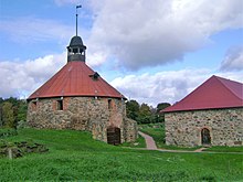
In the 9th century, the territory of Karelia went into the sphere of influence of Kievan Rus. In the 12th century, after the collapse of Kievan Rus, Karelia became part of another ancient Russian state — Novgorod Republic. The town of Korela (present Priozersk in the Leningrad region) became its center. In 1227, Novgorod prince Yaroslav Vsevolodovich baptized Karels in the Orthodox faith. Veps also became Orthodox Christians.
At the end of the 13th century, Swedes seized part of the land in the western Karelia, where they founded the fortress of Vyborg (1293). However, their further advance was stopped by Russians and Karels. In 1478, Karelia together with other lands of Novgorod Republic was annexed to the Russian state (the Moscow State). In the late 16th — early 17th centuries, Swedes continued to expand eastward. According to Stolbovsky Treaty of 1617, Russia lost the Karelian Isthmus.
More historical facts…
During the reign of Peter the Great, several mining plants were built on the territory of Karelia. During the Great Northern War of 1700-1721, these plants played an important role providing the Russian army and navy with guns, rifles and other equipment. Later, Petrovsky Plant (1703) became the town of Petrozavodsk, which literally means “Peter’s plant”. In accordance with Nystadt Peace Treaty of 1721, the Karelian Isthmus returned to Russia.
In 1809, after the Russian-Swedish “Finnish” War, the Russian Empire captured Finland that received the status of the Grand Duchy of Finland. In 1812, Alexander I, as a gesture of goodwill, gave the duchy the territory of “Old Finland” — the western part of Karelia captured by Russia as a result of wars against Sweden.
During the First World War, as the Black and Baltic seas were blocked by the enemy, it was decided to build a railroad from Petrozavodsk to a newly built sea port on the eastern shore of the Kola Bay (present Murmansk) to be able to deliver military supplies sent by the Entente Allies. July 25, 1923, Karelian Autonomous Soviet Socialist Republic was established.
By the end of the 1930s, Karelia was producing about 5% of all timber products in the USSR, 5% of paper, 25% of skis, 80% of feldspar and quartz, 30% of granite. Prison labor was widely used. The first Soviet labor camps were opened here — SLON (Solovki prison camp), Belbaltlag, Soroklag. Prisoners built the White Sea-Baltic Canal, Segezha Pulp and Paper Mill, Pindushskaya shipyard and others objects.
After the Soviet-Finnish war of 1939-1940, Karelian ASSR was transformed into the Karelian-Finnish Soviet Socialist Republic. During the Second World War, a large part of the territory of Karelia was occupied by Finnish and German troops. In 1956, Karelia again became an autonomous republic within the RSFSR (the Russian Soviet Federative Socialist Republic).
By 1950, the economy of the region reached the pre-war level. Lumber from Karelia played an important role in the reconstruction of destroyed towns and villages in the European part of the USSR. November 13, 1991, Karelian Autonomous Soviet Socialist Republic received its current name — the Republic of Karelia.
Pristine nature of Karelia
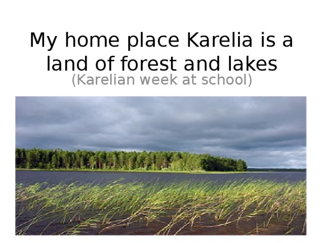
Karelia — the land of lakes
Karelia landscape
Author: Dmitry Galushkin
Karelia forest
Author: Kulyov Nikita
Karelia features
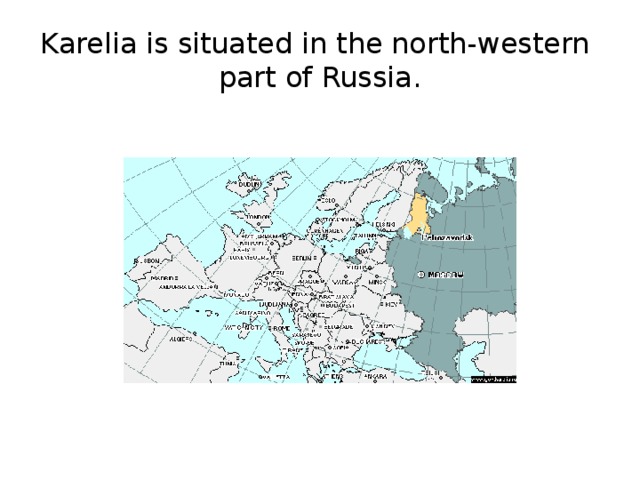
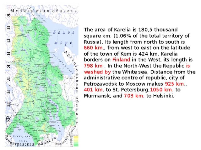
The Republic of Karelia is situated in northern Europe, in the north-western part of Russia. In the north-east the region is washed by the White Sea. The western border of Karelia (798 km) is the state border of the Russian Federation and Finland, the European Union.
The weather in Karelia is changeable. The climate is mild with plenty of rainfall. Winters are snowy, usually without severe frosts. Summers are short and warm, with plenty of rainfall. The average temperature in February is minus 9-13 degrees Celsius, in July — plus 14-16 degrees Celsius.
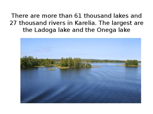
Karelia has about 60,000 lakes, including the two largest lakes in Europe — Ladoga and Onega. Other large lakes: Nook, Pyaozero, Segozero, Syamozero, Topozero, Vygozero, Yushkozero. The White Sea-Baltic Canal (228 km) connects the basins of the Baltic and White seas.
The national composition according to the 2010 census: Russians (82.2%), Karels (7.4%), Belarussians (3.8%), Ukrainians (2%), Finns (1.4%), Veps (0.5%). The largest cities in Karelia are Petrozavodsk (275,000), Kondopoga (31,000), Kostomuksha (29,000), Segezha (27,000).
There are about 27,000 rivers in the region. The largest rivers are Vodla (149 km), Kem (191 km), Onda (197 km), Unga, Chirka-Kem (221 km), Kovda, Shuya, Suna with Kivach and Vyg waterfalls.
Forests cover about 85% of the territory of Karelia. The main minerals are iron ore, titanium, vanadium, molybdenum, precious metals, diamonds, mica, building materials. The economy of Karelia is based on metallurgy, mining, wood and paper industries. Because of the low population density, the road network is not much branched.
Historical and cultural identity of Karelia, which distinguishes it from other regions of Russia, is determined by cultural heritage of four indigenous peoples historically living in this region — Karels, Finns, Veps, Russians.
The borderline location of Karelia has often brought it to the foreground of major events in European history. Karelia has always been influenced by Western, in particular Scandinavian countries, which affected the culture and the mentality of its inhabitants. Today, this region can become an economic and cultural bridge between East and West.
The official language in Karelia is Russian. At the same time, there are peoples in the region whose written language is based on the Roman alphabet — these are Karels and Veps.
Karelia tourism
Karelia, having a favorable geographical location, unique natural and recreational resources, centuries-old cultural and historical heritage, is attractive for Russian and foreign tourists. Karelia is one of the most famous Russian territories in international tourism thanks to the presence of unique architectural, cultural and historical sites on the islands of Kizhi, Valaam and Solovki. They are included in the list of UNESCO World Heritage Sites and are a national treasure of Russia.
Karelia is the birthplace of Karelian-Finnish epic “Kalevala” (literary monument of world importance). There are preserved ancient Karelian, Vepsian, Pomor villages with distinctive architecture that are of great interest for fans of ethnographic tourism.
Almost one million hectares, or more than 5% of the total area of the region, are protected areas: the national parks “Paanajarvi” and “Vodlozersky”, “Kalevalsky”, the natural park “Valaam Archipelago”, preserves “Kivach” and “Kostomukshskiy”, 46 nature reserves, 108 natural monuments.
Karelia attracts tourists with its pristine nature, low population density and competitive prices. In summer this region is popular with lovers of water tourism, travelers on bicycles and cars, fishermen and hunters. Recently equestrian tourism has begun to develop. In winter you have an opportunity to engage in all types of skiing, take part in a safari on dog or reindeer sledding, take a trip on snowmobiles.
Tourists visiting the western part of the republic, declared the border area, should have identification documents in possession for a possible passport control.
Karelia scenery
Summer in Karelia
Author: Sokolov Alexey
Karelia scenery
Author: Andrey Malyshev
Rafting in Karelia
Author: Sergey Ashmarin
The main attractions of Karelia
- Kizhi Museum-Reserve on Kizhi Island in Lake Onega — the world famous monument of wooden architecture,
- Valaam Monastery on Valaam Island in Lake Ladoga,
- Solovki historical and cultural complex on Solovetsky Islands,
- The resort “Marcial Waters” — the first Russian spa resort, founded by decree of Peter the Great in 1719,
- Assumption Church (1774) in Kondopoga,
- The architecture of the town of Sortavala — northern Art Nouveau, neo-classicism, functionalism,
Kivach Falls, - Staryy Olonets and old Karelian huts in the village of Bolshaya Selga,
- Ancient villages: Sheltozero, Kinerma, Man’ga, Rubcheila, Korza,
- The architectural ensemble of Ilyinsky churchyard and Murom Monastery,
- The sites related to “Kalevala”: Voknavolok, Kalevala (Ukhta), Voinitsa,
- Military and historical attractions: the line of defense “Medvezhyegorsk”, “Mannerheim Line”,
- Kivach waterfall on the Suna River,
- Ruskeala waterfalls on the Tohmajoki River,
- Ruskeala marble quarry,
- Yukankoski waterfall on the Kulismayoki River,
- Kumio waterfall, 70 km north-west of Voknavolok,
- Northern Ladoga skerries,
- Mountain Vottovaara,
- White Sea petroglyphs — ancient pictures carved into the rocks near Belomorsk,
- Onega petroglyphs — images of the Neolithic period near Pudozh.
|
Republic of Karelia |
|
|---|---|
|
Republic |
|
| Республика Карелия | |
| Other transcription(s) | |
| • Finnish | Karjalan tasavalta |
| • Livvi | Karjalan tazavaldu |
| • Karelian Proper | Karjalan tašavalta |
| • Vepsian | Karjalan tazovaldkund |
|
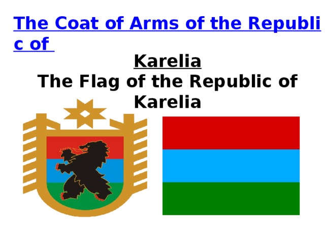
Flag Coat of arms |
|
| Anthem: Anthem of the Republic of Karelia | |
 |
|
| Coordinates: 63°49′N 33°00′E / 63.817°N 33.000°ECoordinates: 63°49′N 33°00′E / 63.817°N 33.000°E | |
| Country | Russia |
| Federal district | Northwestern[1] |
| Economic region | Northern[2] |
| Capital | Petrozavodsk |
| Government | |
| • Body | Legislative Assembly[3] |
| • Head[5] | Artur Parfenchikov[4] |
| Area
[6] |
|
| • Total | 172,400 km2 (66,600 sq mi) |
| • Rank | 20th |
| Population
(2021 Census)[7] |
|
| • Total | 533,121 |
| • Estimate
(2018)[8] |
622,484 |
| • Rank | 70th |
| • Density | 3.1/km2 (8.0/sq mi) |
| Time zone | UTC+3 (MSK |
| ISO 3166 code | RU-KR |
| License plates | 10 |
| OKTMO ID | 86000000 |
| Official languages | Russian[10] |
| Website | http://www.gov.karelia.ru |
The Republic of Karelia (Russian: Респу́блика Каре́лия, romanized: Respublika Kareliya; Russian pronunciation: [rʲɪˈspublʲɪkə kɐˈrʲelʲɪ(j)ə]; Karelian: Karjalan tašavalta; Livvi: Karjalan tazavaldu; Finnish: Karjalan tasavalta; Veps: Karjalan Tazovaldkund, Ludic: Kard’alan tazavald), also known as just Karelia (Russian: Каре́лия, Ка́рьяла; Karelian: Karjala),[12] is a republic of Russia situated in Northwest Russia.[12] The republic is a part of the Northwestern Federal District, and covers an area of 172,400 square kilometres (66,600 square miles), with a population of 533,121 residents.[7] Its capital is Petrozavodsk.
The modern Karelian Republic was founded as an autonomous republic within the Russian SFSR by the Resolution of the Presidium of the All-Russian Central Executive Committee (VTsIK) on 27 June 1923 and by the Decree of the VTsIK and the Council of People’s Commissars of 25 July 1923, from the Karelian Labour Commune. From 1940 to 1956, it was known as the Karelo-Finnish Soviet Socialist Republic, one of the union republics in the Soviet Union. In 1956, it was once again made an autonomous republic and remained part of Russia following the dissolution of the Soviet Union in 1991.
Etymology[edit]
«Karelia» derives from the name of the ethnic group—Karelians. The name «Karjala» has unknown origins, however, it is theorised that it may come from the Proto-Finnish word karja, meaning «herd», which was borrowed from the Proto-Germanic harjaz («army»); the ending -la means «earth».[13]
Geography[edit]
The republic is in the northwestern part of Russia, between the White and Baltic Seas. The White Sea has a shoreline of 630 kilometers (390 mi). It has an area of 172,400 km2 (66,600 sq mi). It shares internal borders with Murmansk Oblast (north), Arkhangelsk Oblast (east/south-east), Vologda Oblast (south-east/south), and Leningrad Oblast (south/south-west), and it also borders Finland (Kainuu, Lapland, North Karelia, Northern Ostrobothnia, and South Karelia); the borders measure 723 km. The main bodies of water next to Karelia are the White Sea (an inlet of the Barents Sea) to the north-east and Lake Onega and Lake Ladoga both shared with neighboring Oblasts to the south. Its highest point is the Nuorunen peak at 576 m (1,890 ft).
Geology[edit]
As a part of the Fennoscandian Shield’s ancient Karelian craton, most of the Republic of Karelia’s surficial geology is Archaean or Paleoproterozoic, dated up to 3.4 billion years in the Vodlozero block. This area is the largest contiguous Archaean outcrop in Europe and one of the largest in the world.
Since deglaciation, the rate of post-glacial rebound in the Republic of Karelia has varied. Since the White Sea connected to the World’s oceans uplift along the southern coast of Kandalaksha Gulf has totaled 90 m. In the interval 9,500–5,000 years ago the uplift rate was 9–13 mm/yr. Before the Atlantic period, uplift rate had decreased to 5–5.5 mm/yr, to then rise briefly before arriving at the present uplift rate is 4 mm/yr.[14]
Rivers[edit]
There are about 27,000 rivers in Karelia.[citation needed] Major rivers include:
- Vodla River (Vodlajoki, 149 km)
- Kem River (Kemijoki, 191 km)
- Kovda River (Koutajoki)
- Shuya River (Šuojogi)
- Suna River (Suunujoki) with Kivach Falls (Kivatšun vesiputous)
- Vyg River (Uikujoki)
Lakes[edit]
A lake in the Republic of Karelia
There are 60,000 lakes in Karelia. The republic’s lakes and swamps contain about 2,000 km³ of high-quality fresh water. Lake Ladoga (Finnish: Laatokka) and Lake Onega (Ääninen) are the largest lakes in Europe. Other lakes include:
- Nyukozero (Nuokkijärvi)
- Pyaozero (Pääjärvi)
- Segozero (Seesjärvi)
- Syamozero (Säämäjärvi)
- Topozero (Tuoppajärvi)
- Vygozero (Uikujärvi)
The lakes Ladoga and Onega are located in the south of the republic.
Islands[edit]
White Sea coast:
- Oleniy Island
- Chernetskiye Island
- Kamestrov Island
- Kuzova Archipelago
- Shuy Island
- Kutulda Island
- Perkhludy Island
- Lesnaya Osinka Island
- Kotkano Island
- Vygnvolok Island
- Tumishche Island
- Sum Island
- Razostrov Island
- Sedostrov Island
- Myagostrov Island
- Zhuzhmuy Islands
- Kondostrov Island
In Lake Onega:
- Bolshoy Klimenetsky Island
In Lake Ladoga:
-
Vossinoysari Island
- Valaam Island
- Mantsinsaari Island
- Lunkulansaari Island
National parks[edit]
- Vodlozero National Park
- Kalevala National Park
- Paanajärvi National Park
Natural resources[edit]
The majority of the republic’s territory (148,000 km2 (57,000 sq mi), or 85%) is composed of state forest stock. The total growing stock of timber resources in the forests of all categories and ages is 807 million m³. The mature and over-mature tree stock amounts to 411.8 million m³, of which 375.2 million m³ is coniferous.
Fifty useful minerals are found in Karelia, located in more than 400 deposits and ore-bearing layers. Natural resources of the republic include iron ore, diamonds, vanadium, molybdenum, and others.
Climate[edit]
The Republic of Karelia is located in the Atlantic continental climate zone. The average temperature in January is −8.0 °C (17.6 °F) and +16.4 °C (61.5 °F) in July. Average annual precipitation is 500–700 mm.[15]
Administrative divisions[edit]
Administrative and territorial division:16 districts (including 3 national districts), 2 city okrugs. 21 urban settlements, 85 rural settlements (including 3 Vepsian rural settlements).[16][17][18]
History[edit]
Middle ages[edit]
The Karelian people and culture developed during the Viking Age in the region to the west of Lake Ladoga. Karelians were first mentioned in Swedish sagas around the 10th century. Russians first mentioned Karelians in 1143, they called Karelians «Korela».[19]
Sweden’s interest in Karelia began a centuries-long struggle with Novgorod (later Russia) that resulted in numerous border changes following the many wars fought between the two, the most famous of which is the Pillage of Sigtuna of 1187. In 1137 the oldest documented settlement was established, the modern-day city of Olonets (Aunus).[20] Karelians converted to Orthodox Christianity in 1227.[21] The Karelians’ alliance with Novgorod developed into domination by the latter in the 13th century, when Karelia became a part of Novgorod under the name of Obonezhie pyatina as an autonomy. Later Karelia had anti-Novgorod revolts in the 13th and 14th centuries.
Later Karelia became a part of Muscovy when Novgorod was annexed in the second half of the 15th century.
During the Great Northern War (1700–1712) the modern-day capital of Karelia, the city of Petrozavodsk was founded as a cannon factory by Peter the Great.[22]
19th century[edit]
On September 9(21) 1801 Olonets Governorate was created by order of Alexander I.[23]
Early 20th century[edit]
Union of White Sea Karelians
In 1906 the Union of White Sea Karelians (Vienan karjalaisten liito) was created; it advocated for equal rights for minorities and democratization.[24] It stopped existing in 1911 after its leaders were deported to Siberia. It later influenced Karelian intelligentsia which led to the creation of the Uhtua Republic.
In 1918 White Karelia declared independence from Russia, creating the Uhtua Republic. In 1920 Finnish forces in the south occupied Olonets, creating a puppet government, which was crushed by the Red Army in the same year. The Republic of Uhtua was crushed in December 1920.
Soviet Karelia[edit]
On June 8, 1920 Karelian Labour Commune was created. In 1921 an insurrection was started as a last attempt to restore the Uhtua Republic, but it was crushed by the Red Army, many Karelian, Finnish, and some Russian families left for Finland with only some returning to Soviet Karelia, they were later repressed under Stalin.[25] In 1923, the KLC became the Karelian Autonomous Soviet Socialist Republic (Karelian ASSR).
In the 1930s Finnish communists, who fled to Karelia, were purged. People of Finnish and Karelian nationality were also subject to repressions. Despite being 3% of the population, over 41% of all repressed in Karelia were Finns, 27% were Karelian, and 25% were Russian.[26] Karelia has one of the biggest burial sites of Stalinist purges in Russia – Sandarmoh, where possibly thousands of victims were executed.
Winter War[edit]
During the Winter War, a Soviet puppet government was created in occupied territories. The Finnish Democratic Republic was to incorporate most of Finland’s pre-war territories plus some western parts of the KASSR. Some members of the FDP government were also members of the KASSR government.[27]
After the Moscow Peace Treaty territories of the Karelian Isthmus were transferred to the newly created Karelo-Finnish Soviet Socialist Republic. After the evacuation of Finnish Karelia, the new territories were left unpopulated, so migrants from Belarus, Ukraine, Russia, and other Soviet republics moved in. To this day, this area has one of the lowest percentages of Karelian and Finnish populations in the Republic.
World War II[edit]
After the beginning of the Great Patriotic war, mass rallies were held on the territory of the republic, at which the inhabitants of Karelia declared their readiness to stand up for the defense of the Soviet Union. Workers of the Onega Tractor Plant wrote “We will work only in such a way as to fully meet the needs of our Red Army. We will double, triple our forces and crush, destroy the German fascists».[28]
On 24 June 1941, after the German army crossed Zapadnaya Dvina, Finnish president Risto Ryti announced declaration of war on the Soviet Union.[28] The Finnish army crossed the Soviet border on 1 July.[29]
Soon after the evacuation of border regions began, On July 3, a republican evacuation commission was created. At its first meeting, it was decided to evacuate children under 14 out of Petrozavodsk. The same decision also refers to the evacuation of 150 families of leading party and Soviet workers in Karelia. Those residents who could work had to remain in the harvest and defense work.[30]
In grey, Finnish occupied territories
By September the Finnish army already reached Petrozavodsk and captured Olonets.[29] Petrozavodsk offensive began on 20 September. To protect the city, the 7th Army under the command of General K.A. Meretskov was directly subordinated to the Headquarters of the Supreme Commander.[31]
On September 30, the position of the defenders of the city deteriorated sharply. The Finnish army managed to break through Soviet defenses and cut the highway to Kondopoga in the area of the Sulazhgorsky brick factory. In the south Finns came close to the city outskirts. On October 1, due to the threat of encirclement, an order was received from the command to withdraw the main units defending the city.
The fighting near Petrozavodsk allowed the authorities to evacuate most of the civilian population and a significant part of the production capacities. In total, more than 500 thousand people were evacuated from the republic to the east. Petrozavodsk University was temporarily relocated to Syktyvkar.[29]
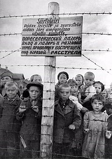
After the capture of Petrozavodsk, the capital of Soviet Karelia was transferred first to Medvezhyegorsk, then to Belomorsk. Less than 90 thousand people remained in the occupied territory, half of which are representatives of the Finno-Ugric peoples: Karelians, Vepsians, and Finns. The Finnish administration has officially recognized them as a «kindred» population. The rest received the status of «unrelated» people.[29] Most of them have been put into concentration camps, along with communists and people who could not speak Finnish or karelian.
Former prisoners of the camps recalled that the staff often treated them more harshly than was supposed to according to the instructions. According to them, the Finns in the presence of children shot prisoners, and beat women, children, and the elderly. One of the prisoners told the Finnish historian Helga Seppel that before leaving Petrozavodsk, the invaders shot several young people for unknown reasons.[29]
During the occupation, Petrozavodsk was renamed to Äänislinna.
Only a few territories of the KFSSR managed to escape the Finnish occupation: the Belomorsky, Loukhsky, Kemsky, Pudozhsky regions, as well as part of the Medvezhiegorsky, Tungudsky and Ukhta regions. By 1942, about 70 thousand people lived here.[30]
After the end of the Siege of Leningrad Soviet army was ordered to liberate Karelia.
On 21 June 1944 Svir-Petrozavodsk operation started. On 27 June the Finnish army left Petrozavodsk. By August the Soviet army reached pre-war borders.
Post-war[edit]
After the end of World War II, the Karelian Isthmus was incorporated into the Leningrad Oblast and the city of Alakurtti was transferred to Murmansk Oblast.
After normalization of diplomatic relations between USSR and Finland the status of the Karelo-Finnish SSR was changed back to the Karelian ASSR in 1956. After this Karelian, Veps, and Finnish languages began a decline in usage due to the lack of any support from the state and lack of education.[32]
The transformation of the KFSSR into the Karelian ASSR was supposed to show that the USSR did not have aggressive goals against Finland.[33]
In 1978 Korean airlines Boeing 707-321B was shot down over Murmansk oblast and landed near Louhi.
Present-day[edit]
In August 1990 KASSR declared its sovereignty as an autonomous part of the Russian Federation.[34] And later changed its name to the Republic of Karelia in 1991.
In 2004 Veps National Volost was transferred to Prionezhsky District.
In 2006 a racial conflict and later riot started in Kondopoga after a fight between locals and Caucasian immigrants led to 2 deaths.[35] This caused an exodus of Muslims from Karelia.
In 2011 a plane crashed near the village of Besovets killing 47 people.
Politics[edit]
Seat of the Legislative Assembly of Karelia.
The highest executive authority in the Republic of Karelia is the Head of the Republic. The acting Head of the Republic is Artur Parfenchikov, who was elected in February 2017 and later re-elected in 2022.
The parliament of the Republic of Karelia is the Legislative Assembly comprising fifty deputies elected for a four-year term.
The Constitution of the Republic of Karelia was adopted on 12 February 2001.
Demographics[edit]
Population: 533,121 (2021 Census);[36] 643,548 (2010 Census);[37] 645,205 (2002 Census);[38] 791,317 (1989 Census).[39]
Settlements[edit]
|
Largest cities or towns in the Republic of Karelia 2010 Russian Census |
|||||
|---|---|---|---|---|---|
| Rank | Administrative Division | Pop. | |||
 Petrozavodsk  Kondopoga |
1 | Petrozavodsk | Prionezhsky District | 261,987 |  Segezha  Kostomuksha |
| 2 | Kondopoga | Kondopozhsky District | 32,987 | ||
| 3 | Segezha | Segezhsky District | 29,631 | ||
| 4 | Kostomuksha | Town of republic significance of Kostomuksha | 28,436 | ||
| 5 | Sortavala | Town of republic significance of Sortavala | 19,235 | ||
| 6 | Medvezhyegorsk | Medvezhyegorsky District | 15,533 | ||
| 7 | Kem | Kemsky District | 13,051 | ||
| 8 | Pitkyaranta | Pitkyarantsky District | 11,429 | ||
| 9 | Belomorsk | Belomorsky District | 11,217 | ||
| 10 | Suoyarvi | Suoyarvsky District | 9,766 |
Vital statistics[edit]
Largest cities of the Republic of Karelia.
| Average population (×1,000) | Live births | Deaths | Natural change | Crude birth rate (per 1,000) | Crude death rate (per 1,000) | Natural change (per 1,000) | Fertility rates | |
|---|---|---|---|---|---|---|---|---|
| 1970 | 714 | 11,346 | 5,333 | 6,013 | 15.9 | 7.5 | 8.4 | |
| 1975 | 723 | 12,748 | 6,086 | 6,662 | 17.6 | 8.4 | 9.2 | |
| 1980 | 741 | 12,275 | 7,374 | 4,901 | 16.6 | 10.0 | 6.6 | |
| 1985 | 770 | 13,201 | 8,205 | 4,996 | 17.1 | 10.7 | 6.5 | |
| 1990 | 792 | 10,553 | 8,072 | 2,481 | 13.3 | 10.2 | 3.1 | 1.87 |
| 1991 | 790 | 8,982 | 8,305 | 677 | 11.4 | 10.5 | 0.9 | 1.62 |
| 1992 | 788 | 7,969 | 9,834 | −1,865 | 10.1 | 12.5 | −2.4 | 1.46 |
| 1993 | 782 | 7,003 | 11,817 | −4,814 | 9.0 | 15.1 | −6.2 | 1.30 |
| 1994 | 774 | 6,800 | 13,325 | −6,525 | 8.8 | 17.2 | −8.4 | 1.26 |
| 1995 | 767 | 6,729 | 12,845 | −6,116 | 8.8 | 16.7 | −8.0 | 1.24 |
| 1996 | 760 | 6,461 | 11,192 | −4,731 | 8.5 | 14.7 | −6.2 | 1.19 |
| 1997 | 753 | 6,230 | 10,306 | −4,076 | 8.3 | 13.7 | −5.4 | 1.15 |
| 1998 | 747 | 6,382 | 10,285 | −3,903 | 8.5 | 13.8 | −5.2 | 1.18 |
| 1999 | 740 | 6,054 | 11,612 | −5,558 | 8.2 | 15.7 | −7.5 | 1.12 |
| 2000 | 732 | 6,374 | 12,083 | −5,709 | 8.7 | 16.5 | −7.8 | 1.18 |
| 2001 | 725 | 6,833 | 12,597 | −5,764 | 9.4 | 17.4 | −7.9 | 1.25 |
| 2002 | 717 | 7,247 | 13,435 | −6,188 | 10.1 | 18.7 | −8.6 | 1.33 |
| 2003 | 707 | 7,290 | 14,141 | −6,851 | 10.3 | 20.0 | −9.7 | 1.32 |
| 2004 | 696 | 7,320 | 13,092 | −5,772 | 10.5 | 18.8 | −8.3 | 1.31 |
| 2005 | 686 | 6,952 | 12,649 | −5,697 | 10.1 | 18.4 | −8.3 | 1.24 |
| 2006 | 676 | 6,938 | 11,716 | −4,778 | 10.3 | 17.3 | −7.1 | 1.22 |
| 2007 | 667 | 7,319 | 11,007 | −3,688 | 11.0 | 16.5 | −5.5 | 1.28 |
| 2008 | 659 | 7,682 | 11,134 | −3,452 | 11.7 | 16.9 | −5.2 | 1.35 |
| 2009 | 651 | 7,884 | 10,599 | −2,715 | 12.1 | 16.3 | −4.2 | 1.58 |
| 2010 | 644 | 7,821 | 10,471 | −2,650 | 12.1 | 16.2 | −4.1 | 1.58 |
| 2011 | 641 | 7,711 | 9,479 | −1,768 | 12.0 | 14.7 | −2.7 | 1.60 |
| 2012 | 640 | 8,027 | 9,804 | −1,777 | 12.6 | 15.4 | −2.8 | 1.71 |
| 2013 | 636 | 7,553 | 9,285 | −1,732 | 11.9 | 14.6 | −2.7 | 1.65 |
| 2014 | 634 | 7,816 | 9,245 | −1,429 | 12.3 | 14.6 | −2.3 | 1.74 |
| 2015 | 631 | 7,731 | 9,648 | −1,917 | 12.2 | 15.3 | −3.1 | 1.76(e) |
Ethnic groups[edit]
According to the 2021 Census,[40] ethnic Russians make up 86.4% of the republic’s population, ethnic Karelians 5.5%. Other groups include Belarusians (2.0%), Ukrainians (1.2%), Finns (0.7%), Vepsians (0.5%), and a host of smaller groups, each accounting for less than 0.5% of the total population.
| Ethnic group |
1926 census | 1939 census | 1959 census | 1970 census | 1979 census | 1989 census | 2002 census | 2010 census | 2021 census1 | |||||||||
|---|---|---|---|---|---|---|---|---|---|---|---|---|---|---|---|---|---|---|
| Number | % | Number | % | Number | % | Number | % | Number | % | Number | % | Number | % | Number | % | Number | % | |
| Russians | 153,967 | 57.2% | 296,529 | 63.2% | 412,773 | 62.7% | 486,198 | 68.1% | 522,230 | 71.3% | 581,571 | 73.6% | 548,941 | 76.6% | 507,654 | 82.2% | 407,469 | 86.4% |
| Karelians | 100,781 | 37.4% | 108,571 | 23.2% | 85,473 | 13.0% | 84,180 | 11.8% | 81,274 | 11.1% | 78,928 | 10.0% | 65,651 | 9.2% | 45,570 | 7.4% | 25,901 | 5.5% |
| Belarusians | 555 | 0.2% | 4,263 | 0.9% | 71,900 | 10.9% | 66,410 | 9.3% | 59,394 | 8.1% | 55,530 | 7.0% | 37,681 | 5.3% | 23,345 | 3.8% | 9,372 | 2.0% |
| Ukrainians | 708 | 0.3% | 21,112 | 4.5% | 23,569 | 3.6% | 27,440 | 3.8% | 23,765 | 3.2% | 28,242 | 3.6% | 19,248 | 2.7% | 12,677 | 2.0% | 5,579 | 1.2% |
| Finns | 2,544 | 0.9% | 8,322 | 1.8% | 27,829 | 4.2% | 22,174 | 3.1% | 20,099 | 2.7% | 18,420 | 2.3% | 14,156 | 2.0% | 8,577 | 1.4% | 3,397 | 0.7% |
| Vepsians | 8,587 | 3.2% | 9,392 | 2.0% | 7,179 | 1.1% | 6,323 | 0.9% | 5,864 | 0.8% | 5,954 | 0.8% | 4,870 | 0.7% | 3,423 | 0.5% | 2,471 | 0.5% |
| Others | 2,194 | 0.8% | 20,709 | 4.4% | 29,869 | 4.5% | 20,726 | 2.9% | 19,565 | 2.7% | 21,505 | 2.7% | 25,734 | 3.6% | 16,422 | 2.7% | 17,434 | 3.7% |
| 1 61,498 people were registered from administrative databases, and could not declare an ethnicity. It is estimated that the proportion of ethnicities in this group is the same as that of the declared group.[41] |
Languages[edit]
Currently Russian is the only official language of the republic. Karelian, Veps, and Finnish have been officially recognized languages of the republic since 2004, and they are de jure supported by the government.[42] In early 2000s Karelian and Veps language nests were created in Petrozavodsk, Kalevala, Tuksa and Sheltozero,[43] but were later shut down.[44] Now native languages of Karelia have little support from the government.[32]
Finnish was the second official language of Karelia from the creation of the Karelian Labour Commune up until the dissolution of the Soviet Union.[45] Thereafter there were suggestions to raise Karelian as the second official language, but they were repeatedly turned down.[46][42]
Religion[edit]
The Karelians have traditionally been Eastern Orthodox. Lutheranism was brought to Karelia during Sweden’s conquest of Karelia and was common in regions that then belonged to Finland. Nowadays Lutherans can be found in most big settlements but they remain a minority.[49]
Catholics have one parish in Petrozavodsk.[50]
The Petrozavodsk Jewish Religious Community was registered in 1997.[51]
Karelian Muslims were organized into Karelian muftiate in 2001.[52]
According to a 2012 survey,[47] 27% of the population of Karelia adheres to the Russian Orthodox Church, 2% are unaffiliated Christians, and 1% are members of Protestant churches. In addition, 44% of the population declared to be «spiritual but not religious», 18% is atheist, and 8% follow other religions or did not answer the question.[47]
Economy[edit]
The remains of the Onega Tractor Plant
Karelia’s economy is based on forestry, mining, tourism, agriculture, fishing[53] and the paper industry.
Despite being 0,4% of Russia’s population, 65–70% of all Russian trout is grown in the Republic, 26% of iron ore pellets, 20% of paper, 12% of wood pulp and cellulose.
Karelia’s gross regional product (GRP) in 2007 was 109.5 billion rubles.[54] The Karelian economy’s GRP in 2010 was estimated at 127733.8 million rubles.[citation needed] Karelia’s GRP in 2021 was 176 billion rubles.[53] This amounts to 291,841 rubles per capita, which is lower than national average.
The largest companies in the region include Karelsky Okatysh ($1319755601 of revenue in 2021), Segezha Pulp and Paper Mill ($86897488 of revenue in 2021), OAO Kondopoga ($20366599 of revenue in 2021).[55]
In the structure of the gross regional product in 2017, the main types of economic activity were:mining – 17.6%; manufacturing industries – 16.9%; transportation and storage – 11.8%; wholesale and retail trade; repair of motor vehicles and motorcycles – 9.8%; public administration and military security; social security – 8.7%.[56]
A fast fiber-optic cable link connecting Finnish Kuhmo and Karelian Kostomuksha was built in 2007, providing fast telecommunications.[54]
Industry[edit]
Forestry[edit]
The Segezha Pulp and Paper Mill
The forest and wood processing sector dominates industrial activity in Karelia. A large number of small enterprises carry out timber logging whereas pulp and paper production is concentrated in five large enterprises, which produce about a quarter of Russia’s total output of paper.[57] Three largest companies in the pulp and paper sector in 2021 were: OAO Kondopoga (sales of $369314325), Segezha Pulp and Paper Mill ($221317040) and RK-Grand (Pitkäranta Pulp Factory) ($78750849).[55]
The timber industry complex of Karelia produces 28% of the republic’s industrial output.[58]
Mining[edit]
Karelia is a region with a lot of natural resources, from gold to metals.[59][60]
In 2007, extractive industries (including extraction of metal ores) amounted to 30% of the republic’s industrial output.[54] There are about 53 mining companies in Karelia, employing more than 10,000 people.[61] One of the most important companies in the sector is AO Karelian Pellet, which is the 5th largest of Russia’s 25 mining and ore dressing enterprises involved in ore extraction and iron ore concentrate production. Other large companies in the sector were OAO Karelnerud, Mosavtorod State Unitary Enterprise, and Pitkjaranta Mining Directorate State Unitary Enterprise.[15]
Energy[edit]
The Harlu hydroelectric plant
As of 2021, there were 29 powerplants, of them 21 were hydroplants and 8 thermal power plants.[62]
Agriculture[edit]
Due to Karelia’s climate, only 1,2% of the land is used for farming. Most of the farmland is located on podzol.[63]
20 agricultural organizations employing 2.3 thousand people. Animal husbandry is the leading branch of agriculture in the Republic, the main areas of which are dairy cattle breeding, pig breeding, broiler poultry farming, and fur farming.[64]
Annually agricultural enterprises of the region produce up to 59 thousand tons of milk. Based on its natural and climatic conditions, the plant growing industry is focused on the production of feed for livestock, the bulk of potatoes and vegetables are grown in small forms of management.[64]
Fishing[edit]
Fishing enterprises of Karelia produced 91.9 thousand tons of aquatic biological resources in 2021.
In the Barents Sea and the Atlantic Ocean, 89.9 thousand tons of aquatic biological resources were caught, of them 34.6 thousand tons of cod and haddock, 34.1 thousand tons of blue whiting, 18 thousand tons of mackerel and 1.1 thousand tons of northern shrimp. 306 tons of fish were caught in the White Sea and 612 tons of kelp and fucus were harvested. The catch of freshwater fish amounted to 1.1 thousand tons.[65]
Tourism[edit]
Karelia is popular for international and domestic tourism.
Traditional, active, cultural and ecological types of tourism are popular among tourists.[66]
Karelia attracts ecotourists with its nature and wilderness[67] and low population density. During the summer water tourism is also popular among many tourists.
Cultural tourism is also a big part of Karelia’s tourism economy. The region attracts many tourists with its wooden architecture, local culture, and traditions.
Karelia also has the first Russian health resort – Martial Waters (1719).
Foreign trade[edit]
The economy of Karelia is export-orientated. By the volume of exports per capita, Karelia is among the leading regions of Russia. More than 50% of manufactured products (and up to 100% in several industries) are exported.[53]
The Republic’s main export partners in 2001 were Finland (32% of total exports), Germany (7%), Netherlands (7%), and the United Kingdom (6%).[15] Main export products were lumber (over 50%), iron ore pellets (13–15%) paper and cardboard (6–9%) and sawn timber with (5–7%). Many of Karelia’s companies have received investments from Finland.[15]
Transportation[edit]
Railroad[edit]
Karelia is a strategically important railroad region due to the fact that it connects Murmansk with the rest of Russia by Kirov Railway, which was electrified in 2005.[68]
There are also railways connections with Finland in Värtsilä and Kostomuksha, but they are not electrified.
All Karelian district capitals are connected by railroad, except for the Kalevalsky district and Prionezhsky district, which do not have a capital.
In total, Karelia has 1915 km of railways.[69]
Water communications[edit]
Water communications connect Karelia with the Barents, Baltic, Black, White and Caspian Seas.
Whitea sea-Baltic Canal was built in the 1930s to connect the Baltic and White seas. The 227 km long canal was built by the prisoners. Even though it has 19 locks, the canal cannot pass vessels with a draft of more than 5 meters.[70] The canal is a part of the Volgo-Baltic Waterway.
There are also river ports on the coast of the White Sea, there were plans to upgrade them to ocean ports but they were deemed too expensive.[71]
Highways[edit]
Automobile highway R-21 «Kola» crosses Karelia and connects Murmansk Region and Murmansk seaport with St. Petersburg and Moscow.
E105 European highway also goes thru Karelia.
Other highways connect with Finland in Louhsky district Värtsilä and Kostomuksha.
Many of Karelian roads are still unimproved.[72]
Air transportation[edit]
Petrozavodsk Airport is the only working airport in Karelia as of 2022.[73]
There are other airports, such as Kalevala or Kostomuksha, but they are not used or used by firefighters.[74]
Culture[edit]
Karelia is very culturally diverse region that was influenced by Finno-Ugric, Slavic and Scandinavian cultures.
Literature[edit]
Karelia is sometimes called «the songlands», as Karelian poems constitute most of the Karelo-Finnish epic Kalevala and many of Russian Bylinas were documented in Pudozh.[75]
The written literature of Karelia was formed at the beginning of the 20th century. In the 1930s Karelian and Veps languages gained a writing system, but during the Stalinist repressions many books in veps and Karelian were burned and cultural figures were deported.[76]
After the creation of the Karelian Labour Commune many American and Canadian finns moved to Karelia and began creating new literature. Many Karelians could understand Finnish so some authors, such as one of the most famous Karelian writers Antti Timonen, started to write in Finnish.[77]
Art[edit]
Karelian art history begun with Petroglyphs, which were created around 6,500 years ago.[78] They became a UNESCO World Heritage Site, listed in 2021.[79]
Icon painters were the first professional artists of Karelia.[80]
Karelia has become a source of inspiration for many famous artists of the 19th–20th century such as: Ivan Shishkin, Arkhip Kuindzhi, and N. K. Roerich.
-
Ivan Shishkin, In the wild north… (1891)
-
Arkhip Kuindzhi, Ladoga (1873)
-
N. K. Roerich Pomors. Evening (1907)
Architecture[edit]
Church of the Transfiguration, Kizhi
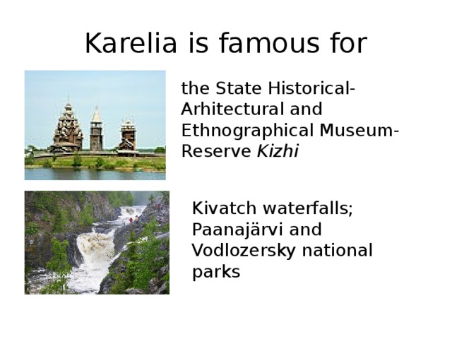
Karelia is famous for its wooden architecture. Karelian architecture developed under the strong influence of Novgorod architecture.[81] Examples of Karelian architecture are collected in the Kizhi Pogost Museum.
Later Karelian architecture was influenced by Finns, especially after the creation of the Karelian Labour Commune.
Music[edit]
Kantele is the most famous traditional Karelian musical instrument. In Kalevala the mage Väinämöinen makes the first kantele from the jawbone of a giant pike and a few hairs from Hiisi’s stallion.
In 1939, the Symphony Orchestra of the Karelo-Finnish State Philharmonic was founded.[82]
Throughout the years, many Karelian, Russian, Veps, Finnish and Pomor choirs were created, such as the Karelian choir «Oma pajo» in 1990, which is still active.[83]
Museums[edit]
State Historical, Architectural and Ethnographic Museum-Reserve «Kizhi»[84]
National Museum of the Republic of Karelia[85] (including Sheltozero Veps Ethnographic Museum, Museum «Marcial Waters» and Museum of the Karelian Front in Belomorsk[86])[84]
«Valaam Research, Church-Archaeological and Natural Museum-Reserve»
Museum of Fine Arts of the Republic of Karelia[85][87]
Museum of the History of Public Education of the Republic of Karelia
Sheltozero Veps Ethnographic Museum
Theaters[edit]
Musical Theater of the Republic of Karelia
National Theater of the Republic of Karelia
State Puppet Theater of the Republic of Karelia
Drama Theater of the Republic of Karelia «Creative Workshop»[85]
Non-state author’s theater «Ad Liberum»[88]
-
Musical Theater of the Republic of Karelia
-
National Theater of the Republic of Karelia
-
State Puppet Theater of the Republic of Karelia
-
Drama Theater of the Republic of Karelia «Creative Workshop»
-
Non-state author’s theater «Ad Liberum»
Holidays[edit]
Along with Russian holidays, Karelia has its official public holidays as well as unofficial holidays.
Official[edit]
| Date | Name | Russian name | Remarks |
|---|---|---|---|
| April 18 | Day of firefighters of the Republic of Karelia | День пожарной охраны Республики Карелия | Holiday celebrating Karelian fire defense became official in 1998.[89] |
| May 31 | Day of cultural workers of the Republic of Karelia | День работника культуры Республики Карелия | Holiday celebrating Karelian workers in the culture industry, became official in 2000[90] |
Summer[91] (Official June 
|
Republic of Karelia day (Republic Day) | День Республики Карелия | Holiday celebrating creation of the Karelian Labour commune, became official in 1999[92] |
| September 16 | Day of formation of the trade union movement in Karelia | День образования профсоюзного движения в Карелии | Holiday celebrating Karelian trade unions and worker’s rights, became official in 2011[93] |
| September 30 | Day of the liberation of Karelia from fascist invaders | День освобождения Карелии от фашистских захватчиков | Holiday celebrating liberation from Finnish occupation during WW2[94] |
Unofficial[edit]
Religious[edit]
| Date | Name | Karelian name | Russian name | Remarks |
|---|---|---|---|---|
| January 7 to January 18 | Winter religious Holidays | Vierissänkesk, Sv’atkat, Sunduma | Зимние святки | Celebrations after Christmas |
| January 19 | Baptism | Vieristä, Vieristy, Vederis | Крещение | Prelude to Maslenitsa |
| May 6 | Saint George’s Day | Jyrin päivä, Jyrrinpäivy, Kevät Jyrgi | Егорьев день | |
| May 22 | Nikola Veshny | Pyhä Miikkula, Miikkulan päivä, Miikkulanpäivy, Mikula | Никола Вешний | Day celebrating Saint Nicholas |
| End of July | Bowl of Ukko | Ukon vakka | Чаша Укко | Ancient pre-Christian agricultural holiday |
| July 7 | Ivan’s Day | Iivnanpäivä, Iivananpäivy, Ivananpäivä | Иванов день | Holiday celebrating summer solstice |
| From the end of Ivan’s day before Saint Peter’s day | Summer religious holidays | Kezäsv’atkat, Kesäsvätkat | Летние святки | Prelude to Saint-Peter’s day |
| July 12 | Saint Peter’s day | Petrunpäivä, Pedrunpäivy, Pedrunpäivä | Петров день | Celebrations before harvest |
| August 2 | Elijah’s day | Il’l’anpäivä, Il’l’anpäiväy | Ильин день | |
| August 31 | Frol’s Day | Frolan päivä | Фролов день | Local holidas of livestock protection |
| End of October | Kekri | Kekri, Kegri | Кегри | Ancient autumn festival |
| December 25 | Christmas | Rostuo | Католическое Рождество | Western Christmas is celebrated by Karelian Finns |
| References[95] |
Hyperborea Festival in Petrozavodsk
Cultural[edit]
| Region | Date | Name | Russian name | Remarks |
|---|---|---|---|---|
| All of Karelia | April | Day of Karelian and Vepsian writing | День карельской и вепсской письменности | Cultural holiday of karelians and vepsians[96] |
| February | Kalevala Day | День Калевалы | Day celebrating national epic Kalevala[97] | |
| February | International Mother Language Day | Международный день родного языка | ||
| Autumn | Kegri | Кегри | Gained government support in 2022[98] | |
| Belomorskyi | November | Holiday of Pomors of the Karelian coast «Nikola Zimniy» | Праздник поморов Карельского берега «Никола Зимний» | Pomor holiday |
| Kalevalskyi | June | International holiday of Ukhta Karelians | Международный праздник Ухтинских карел | North Karelian holiday |
| Kemskyi | August | Indian Summer in the Kem Pomorye | Бабье лето в Кемском поморье | Pomor holiday |
| Day of the Dead Poduzhemsky villages | День погибших подужемских деревень | Day remembering abandoned villages of North Karelia | ||
| May | Holiday of men’s craft «Oars on the water» | Праздник мужских ремесле «Весла на воду» | ||
| Louhskyi | June | Interregional holiday «Hello, Kestenga!» | Межрегиональный праздник «Здравствуй, Кестеньга!» | North Karelian holiday |
| August | Holiday «Fairytale ship Korguev» | Праздник «Сказочный корабль Коргуева» | Holiyday in Chupa | |
| August | Holiday «Old Woman Louhi’s Day» | Праздник «День старухи Лоухи» | Holiday celebrating Kalevala | |
| August | Kanšallenen puku ompelos | Каншалленен пуку омпелуш | Holiday in Sofporog | |
| Muyezerskyi | March | Interdistrict cultural and sports festival «Winter fun» | Межрайонный культурно-спортивный праздник «Зимние забавы» | Holiday in Muyezersky |
| Karelian-Finnish friendship holiday of the village of Ondozero and the village of Yolyolä (Finland) | Карело-финский праздник дружбы села Ондозеро и деревни Ёлёля (Финляндия) | |||
| Olonetskyi | May | Ecological festival «Olonets – goose capital» | Экологический фестиваль «Олония-гусиная столица» | Holiday in Olonets |
| December | Olonets Father Frost Games | Олонецкие Игры Дедов Морозов | Holiyday challening people pretending to be Ded Moroz or Talviukko | |
| Petrozavodsk | February | Международный зимний фестиваль «Гиперборея» | International winter festival «Hyperborea» | Ice sculpture festival[99] |
| Prionezhskyi | Prionezhsky song wreath | Прионежский песенный венок | ||
| Elonpuu (Tree of life) | Древо жизни | Veps holiday[100] | ||
| Pryazhinskyi | March | «Kulyan kižat» | «Кюлян кижат» | Holiday in Vedlozero |
| Holiday of Karelian culture | Праздник карельской культуры | Holiday in Kinerma | ||
| Pudozhskyi | June | Interregional holiday «Dawns of Pudozh» | Межрегиональный праздник «Зори Пудожья» | Holiday in Pudozh |
| June | Holiday of Russian epic culture «In the land of the epic» | Праздник русской эпической культуры «В краю былинной» | Holiday in Semenovo | |
| Segezshky | June | Ethnocultural holiday «Voitsk festivities» | Этнокультурный праздник «Воицкие гуляния» | Holiday in Nadvoitsy |
| References[95] |
See also[edit]
- Karelian Isthmus
- Music of Karelia
- Sami music
- Pegrema
References[edit]
- ^ Президент Российской Федерации. Указ №849 от 13 мая 2000 г. «О полномочном представителе Президента Российской Федерации в федеральном округе». Вступил в силу 13 мая 2000 г. Опубликован: «Собрание законодательства РФ», No. 20, ст. 2112, 15 мая 2000 г. (President of the Russian Federation. Decree #849 of May 13, 2000 On the Plenipotentiary Representative of the President of the Russian Federation in a Federal District. Effective as of May 13, 2000.).
- ^ Госстандарт Российской Федерации. №ОК 024-95 27 декабря 1995 г. «Общероссийский классификатор экономических регионов. 2. Экономические районы», в ред. Изменения №5/2001 ОКЭР. (Gosstandart of the Russian Federation. #OK 024-95 December 27, 1995 Russian Classification of Economic Regions. 2. Economic Regions, as amended by the Amendment #5/2001 OKER. ).
- ^ Constitution, Article 32
- ^ Official website of the Republic of Karelia. Artur Olegovich Parfenchikov
- ^ Constitution, Article 46.
- ^ Федеральная служба государственной статистики (Federal State Statistics Service) (21 May 2004). «Территория, число районов, населённых пунктов и сельских администраций по субъектам Российской Федерации (Territory, Number of Districts, Inhabited Localities, and Rural Administration by Federal Subjects of the Russian Federation)». Всероссийская перепись населения 2002 года (All-Russia Population Census of 2002) (in Russian). Federal State Statistics Service. Retrieved 1 November 2011.
- ^ a b «Оценка численности постоянного населения по субъектам Российской Федерации». Federal State Statistics Service. Retrieved 1 September 2022.
- ^ «26. Численность постоянного населения Российской Федерации по муниципальным образованиям на 1 января 2018 года». Federal State Statistics Service. Retrieved 23 January 2019.
- ^ «Об исчислении времени». Официальный интернет-портал правовой информации (in Russian). 3 June 2011. Retrieved 19 January 2019.
- ^ Official throughout the Russian Federation according to Article 68.1 of the Constitution of Russia.
- ^ «Карельский государственный архив новейшей истории. Путеводитель». Приложение «Административно-территориальное устройство Республики Карелия». 2003.
- ^ a b «Karelia». Encyclopedia Britannica.
- ^ «Karelia». Online Etymology Dictionary. 10 October 2017. Archived from the original on 15 August 2021.
- ^ Romanenko, F.A.; Shilova, O.S. (2011). «The Postglacial Uplift of the Karelian Coast of the White Sea according to Radiocarbon and Diatom Analyses of LacustrineBoggy Deposits of Kindo Peninsula». Doklady Earth Sciences. 442 (2): 544–548. doi:10.1134/S1028334X12020079. S2CID 129656482.
- ^ a b c d «Republic of Karelia». Russia: All Regions Trade & Investment Guide. CTEC Publishing LLC. 2003.
- ^ «Закон Республики Карелия от 03.07.2020 № 2483-ЗРК «О преобразовании муниципальных образований «Сортавальское городское поселение» и «Хелюльское городское поселение» Сортавальского муниципального района Республики Карелия и о внесении изменений в отдельные законодательные акты Республики Карелия»«. Официальный интернет-портал правовой информации. 3 July 2020. Archived from the original on 3 July 2020.
- ^ «ЗАКОН РЕСПУБЛИКИ КАРЕЛИЯ от 1 декабря 2004 года N 824-ЗРК». Электронный фонд правовых и нормативно-технических документов. 1 December 2004. Archived from the original on 16 November 2020.
- ^ «ЗАКОН РЕСПУБЛИКИ КАРЕЛИЯ от 1 декабря 2004 года N 825-ЗРК». Электронный фонд правовых и нормативно-технических документов. 1 December 2004. Archived from the original on 27 March 2017.
- ^ «Рождение народа». Кирьяж. Retrieved 24 August 2022.
{{cite web}}: CS1 maint: url-status (link) - ^ Кочуркина, С.И.; Куспак, Н.В.; Мамонтова, Н.Н.; Платонов, В.Г. (1994). Древний Олонец. Ин-т языка, лит-ры и истории Карельского науч. центра РАН. Петрозаводск. ISBN 9785201077280.
- ^ «Основные исторические даты и события». Карелия Официальная. Archived from the original on 24 August 2022. Retrieved 24 August 2022.
- ^ «Петрозаводск». Академик.
- ^ «Эволюция административно-территориального устройства Карелии в XVIII — начале XX века // Ученые записки Петрозаводского государственного университета. Серия: Общественные и гуманитарные науки.2013. февраль. № 1 — С.12–18» (PDF). uchzap.petrsu.ru. Archived from the original (PDF) on 29 November 2020. Retrieved 24 August 2022.
- ^ Левонтьев, П.Р. (2008). «УХТА НА ПЕРЕЛОМЕ ВЕКОВ (УХТИНСКАЯ РЕСПУБЛИКА)». Войница.
{{cite web}}: CS1 maint: url-status (link) - ^ Usatševa, J.V. (2021). ITÄ-KARJALAN PAKOLAISET TIE KOTIIN (in Karelian). Petroskoi: Periodika. ISBN 978-5-88170-394-3.
- ^ Takala, Irina (2018). «THE GREAT TERROR IN KARELIA».
- ^ «Павел Степанович Прокконен». Карелия СССР. Retrieved 26 August 2022.
{{cite web}}: CS1 maint: url-status (link) - ^ a b Макуров, В.Г. «Карелия в Великой Отечественной войне 1941—1945 гг. Исторический очерк». Объекты историко-культурного наследия Карелии. Retrieved 26 August 2022.
{{cite web}}: CS1 maint: url-status (link) - ^ a b c d e Лисаков, Евгений. Лукьянова, Мария (ed.). «Карельский фронт». Республика. Retrieved 26 August 2022.
{{cite web}}: CS1 maint: url-status (link) - ^ a b Саввина, Карина. «Война: Карелия 1941–1945 гг». Regnum. Retrieved 26 August 2022.
{{cite web}}: CS1 maint: url-status (link) - ^ «Оборона Петрозаводска. 1941 год». Объекты историко-культурного наследия Карелии. Retrieved 26 August 2022.
{{cite web}}: CS1 maint: url-status (link) - ^ a b Yarovoy, Gleb (21 February 2020). ««Вызывайте переводчика». Как коренные народы борются за сохранение языка». Север.Реалии.
- ^ «Общественно-политическая жизнь в республике (часть 2)». Русский Север. Retrieved 26 August 2022.
{{cite web}}: CS1 maint: url-status (link) - ^ Shtepa, Vadim (8 August 2012). «Забытый День республики». СТОЛИЦА на Онего.
- ^ «Началось оглашение приговора по делу о драке в Кондопоге». РАПСИ. 10 March 2010. Retrieved 24 August 2022.
{{cite web}}: CS1 maint: url-status (link) - ^ Russian Federal State Statistics Service. Всероссийская перепись населения 2020 года. Том 1 [2020 All-Russian Population Census, vol. 1] (XLS) (in Russian). Federal State Statistics Service.
- ^ Russian Federal State Statistics Service (2011). Всероссийская перепись населения 2010 года. Том 1 [2010 All-Russian Population Census, vol. 1]. Всероссийская перепись населения 2010 года [2010 All-Russia Population Census] (in Russian). Federal State Statistics Service.
- ^ Russian Federal State Statistics Service (21 May 2004). Численность населения России, субъектов Российской Федерации в составе федеральных округов, районов, городских поселений, сельских населённых пунктов – районных центров и сельских населённых пунктов с населением 3 тысячи и более человек [Population of Russia, Its Federal Districts, Federal Subjects, Districts, Urban Localities, Rural Localities—Administrative Centers, and Rural Localities with Population of Over 3,000] (XLS). Всероссийская перепись населения 2002 года [All-Russia Population Census of 2002] (in Russian).
- ^ Всесоюзная перепись населения 1989 г. Численность наличного населения союзных и автономных республик, автономных областей и округов, краёв, областей, районов, городских поселений и сёл-райцентров [All Union Population Census of 1989: Present Population of Union and Autonomous Republics, Autonomous Oblasts and Okrugs, Krais, Oblasts, Districts, Urban Settlements, and Villages Serving as District Administrative Centers]. Всесоюзная перепись населения 1989 года [All-Union Population Census of 1989] (in Russian). Институт демографии Национального исследовательского университета: Высшая школа экономики [Institute of Demography at the National Research University: Higher School of Economics]. 1989 – via Demoscope Weekly.
- ^ «Национальный состав населения». Federal State Statistics Service. Retrieved 30 December 2022.
- ^ «ВПН-2010». www.perepis-2010.ru.
- ^ a b Karelian, Vepps, and Finnish languages have got the state support in the Republic of Karelia The Official Web Portal of the Republic of Karelia (2004)
- ^ «Информация о деятельности языковых гнезд в Карелии и результатах работы финно-угорского Проекта «Языковое гнездо»«. Finnoug. 21 November 2014. Archived from the original on 12 March 2019.
- ^ «Рабочая группа минрегиона РФ похоронила «языковые» гнезда в России». Finugor. 6 March 2012. Archived from the original on 26 February 2013.
- ^ Karjalan ASNT:n Perustuslaki (in Finnish). Petroskoi: Karjala-Kustantamo. 1980. p. 162.
- ^ Vesti Karelia (14 July 2016). «Государственный статус карельского языка вызвал споры депутатов». YouTube.
- ^ a b c «Arena: Atlas of Religions and Nationalities in Russia». Sreda, 2012.
- ^ 2012 Arena Atlas Religion Maps. «Ogonek», № 34 (5243), 27/08/2012. Retrieved 21/04/2017. Archived.
- ^ «Карельское пробство». Евангелическо-Лютеранская Церковь Ингрии. Retrieved 13 September 2022.
{{cite web}}: CS1 maint: url-status (link) - ^ «Католики в Карелии». Католики в Карелии. Retrieved 13 September 2022.
{{cite web}}: CS1 maint: url-status (link) - ^ «Иудаизм». КАРЕЛИЯ ОФИЦИАЛЬНАЯ. Archived from the original on 1 February 2013.
- ^ «РОЦЕНТРАЛИЗОВАННАЯ РО ДУХОВНОЕ УПРАВЛЕНИЕ МУСУЛЬМАН РЕСПУБЛИКИ КАРЕЛИЯ (КАРЕЛЬСКИЙ МУХТАСИБАТ)». РБК. Retrieved 13 September 2022.
{{cite web}}: CS1 maint: url-status (link) - ^ a b c «Главное о регионе – Республика Карелия». Оценка регулирующего воздействия (in Russian). Retrieved 24 August 2022.
{{cite web}}: CS1 maint: url-status (link) - ^ a b c «The Republic of Karelia in 2007». Helsinki School of Economics.
- ^ a b «Выписки ЕГРЮЛ и ЕГРИП, проверка контрагентов, ИНН и КПП организаций, реквизиты ИП и ООО». СБИС (in Russian). Retrieved 24 August 2022.
- ^ «Республика Карелия». Инвестиционный портал регионов России. 2017. Retrieved 24 August 2022.
{{cite web}}: CS1 maint: url-status (link) - ^ «Regional characteristics. Republic of Karelia». Helsinki School of Economics.
- ^ Лесной план Республики Карелия. Том 1 (in Russian). 2010.
- ^ «Republic of Karelia, Russia». Mindat. Retrieved 24 August 2022.
{{cite web}}: CS1 maint: url-status (link) - ^ Matthis, Simon (16 February 2021). «Karelia Republic may become one of centers of mining in Russia in years to come». Mining Metal News. Retrieved 24 August 2022.
{{cite web}}: CS1 maint: url-status (link) - ^ «Mining industry of the republic has summed up its work in the first six months of the year». Republic of Karelia. Retrieved 3 August 2009.
- ^ «РАСПОРЯЖЕНИЕ Главы Республики Карелия,Page 53» (PDF). 30 April 2021. Retrieved 24 August 2022.
{{cite web}}: CS1 maint: url-status (link) - ^ «Сельское хозяйство Республики Карелия». Archived from the original on 14 May 2012. Retrieved 2 February 2012.
- ^ a b «Общая информация о сельском хозяйстве Республики Карелия». Агросоветник. 6 June 2015. Retrieved 24 August 2022.
- ^ «Почти 90 тысяч тонн рыбы выловили карельские рыбаки за три квартала этого года». Республика. 8 November 2021. Retrieved 24 August 2022.
{{cite web}}: CS1 maint: url-status (link) - ^ «Karelia». Karelia. Tourism portal. Retrieved 24 August 2022.
{{cite web}}: CS1 maint: url-status (link) - ^ «Karelia Travel Guide». 56 Parallel. Retrieved 24 August 2022.
{{cite web}}: CS1 maint: url-status (link) - ^ Bennett, Mia (28 October 2015). «The Kirov Railway: A shot of steel through northwest Russia». CRYOPOLITICS. Retrieved 31 August 2022.
{{cite web}}: CS1 maint: url-status (link) - ^ Fomina, Elena. Lukjanova, Maria (ed.). «Железная дорога». Республика. Retrieved 31 August 2022.
{{cite web}}: CS1 maint: url-status (link) - ^ Fomina, Elena. Lukjanova, Maria (ed.). «Беломорско-Балтийский канал». Республика. Retrieved 31 August 2022.
{{cite web}}: CS1 maint: url-status (link) - ^ Bershtein, Maxim (20 August 2018). «Беломорский порт: построить можно – но не ясно, зачем». MKRU. Retrieved 31 August 2022.
{{cite web}}: CS1 maint: url-status (link) - ^ Leonov, Dmitry (27 August 2019). «Дороги Карелии». Планета Дорог. Retrieved 31 August 2022.
{{cite web}}: CS1 maint: url-status (link) - ^ «Единственный аэропорт Карелии закроется на месяц в октябре». Итерфакс. 4 September 2019. Retrieved 31 August 2022.
{{cite web}}: CS1 maint: url-status (link) - ^ «Аэропорты Карелии». Аэропорты России. Retrieved 31 August 2022.
{{cite web}}: CS1 maint: url-status (link) - ^ Novikov, Y. A. (2007). «Об истоках пудожской былинной традиции». Электронная библиотека публикации о музее-заповеднике «Кижи».
- ^ Mishin, Armas (22 March 2007). «Современная культура вепсов». Финно-угорский информационный центр. Archived from the original on 28 July 2017.
- ^ «Финская национальная литература». Фольклорно-литературное наследие Русского Севера. 23 September 2011. Archived from the original on 30 November 2020.
- ^ Lobanova, Nadezhda. «Karelian Rock Art». Karelia. Tourism portal.
- ^ «Petroglyphs of Lake Onega and the White Sea». UNESCO World Heritage Centre. 8 November 2021.
- ^ Plotnikov, V. I. (1958). «Первые профессиональные художники — уроженцы Карелии // Труды карельского филиала Академии наук СССР. Вопросы истории Карелии. Выпуск Х. 1958. С.50-6» (PDF). resources.krc.karelia.ru. Archived (PDF) from the original on 24 September 2017.
- ^ Orfinskyi, V. P. (1972). Деревянное зодчество Карелии. Leningrad: Stroyizdat.
- ^ «История». Карельская государственная филармония.
- ^ «Концерт Oma pajo в честь 30-летия». Центр народного творчества и культурных инициатив. 2 March 2021.
- ^ a b «Museums in Karelia». Karelia. Tourism portal.
- ^ a b c «Государственные, автономные и образовательные учреждения, подведомственные Министерству культуры РК». Карелия официальная. Archived from the original on 20 January 2015.
- ^ Prokhorov, Ilja (20 November 2020). «Музей Карельского фронта». Respublika.
- ^ «The Museum of Fine Arts of Republic of Karelia». russianmuseums.
- ^ «AdLiberum». Vkontakte.
- ^ «Закон Республики Карелия от 5 февраля 1998 г. 258-ЗРК «Об установлении Дня пожарной охраны Республики Карелия»». Законодательное собрание Республики Карелия. Archived from the original on 24 July 2010. Retrieved 5 May 2012.
- ^ «Закон Республики Карелия от 28 сентября 2000 г. 430-ЗРК «Об установлении Дня работника культуры Республики Карелия»». Законодательное собрание Республики Карелия. Archived from the original on 24 July 2010. Retrieved 5 May 2012.
- ^ «День Республики Карелия 2022: Полная программа». ГТРК Карелия. 26 August 2022. Retrieved 28 August 2022.
{{cite web}}: CS1 maint: url-status (link) - ^ «Закон Республики Карелия от 27 апреля 1999 г. N 346-ЗРК «Об установлении Дня Республики Карелия»». Законодательное собрание Республики Карелия. Archived from the original on 27 July 2010. Retrieved 5 May 2010.
- ^ «Об установлении Дня образования профсоюзного движения в Карелии». Карелия Официальная. Archived from the original on 6 June 2014. Retrieved 5 May 2012.
- ^ «Закон Республики Карелия от 21 октября 2011 г. N 1535-ЗРК «Об установлении Дня освобождения Карелии от фашистских захватчиков»». Законодательное собрание Республики Карелия.
{{cite web}}: CS1 maint: url-status (link) - ^ a b Елына, Э.Г. «Традиционные карельские праздники». Центр Народного Творчества и Культурных Инициатив. Retrieved 28 August 2022.
{{cite web}}: CS1 maint: url-status (link) - ^ Parfenchikov, A.O. «Поздравление Главы Республики Карелия А.О.Парфенчикова с Днем карельской и вепсской письменности». Официальный интернет-портал Республики Карелия. Retrieved 3 September 2022.
{{cite web}}: CS1 maint: url-status (link) - ^ ««Вселенная Калевала»: Карелия и Финляндия отмечают день народного эпоса». RGRU. 28 February 2021. Retrieved 3 September 2022.
{{cite web}}: CS1 maint: url-status (link) - ^ «О внесении изменений в сводную бюджетную роспись Республики Карелия предусмотрев на 2022 год в целях организации и проведения в 2022 году сельскохозяйственной ярмарки в рамках праздника Урожая-Дня Кегри». Официальный интернет-портал Республики Карелия. 14 September 2022. Retrieved 20 September 2022.
{{cite web}}: CS1 maint: url-status (link) - ^ «Праздники и события». Карелия туристический портал. Retrieved 28 August 2022.
{{cite web}}: CS1 maint: url-status (link) - ^ Sidorkin, Valery (17 August 2012). «Шелтозерское древо». Гудок РЖД ТВ. Retrieved 3 September 2022.
{{cite web}}: CS1 maint: url-status (link)
Sources[edit]
- Верховный Совет Карельской АССР. №473-ЗРК 30 мая 1978 г. «Конституция Республики Карелия», в ред. Закона №1314-ЗРК от 16 июля 2009 г «О внесении изменений в Конституцию Республики Карелия». Опубликован: отдельной брошюрой. (Supreme Soviet of the Karelian ASSR. #473-ZRK May 30, 1978 Constitution of the Republic of Karelia, as amended by the Law #1314-ZRK of July 16, 2009 On Amending the Constitution of the Republic of Karelia. ).
External links[edit]
Wikivoyage has a travel guide for Karelia.
- (in English, Russian, and Finnish) Official website of the Republic of Karelia
- (in English, Russian, and Finnish) Karelia.ru web server
- (in English, Russian, and Finnish) Heninen.net – various information about Karelia
- Information about Karelians
- Tracing Finland’s eastern border-thisisFINLAND
- Saimaa Canal links two Karelias-thisisFINLAND
- ProKarelia (also available in other languages)


- Entertainment & Pop Culture
- Geography & Travel
- Health & Medicine
- Lifestyles & Social Issues
- Literature
- Philosophy & Religion
- Politics, Law & Government
- Science
- Sports & Recreation
- Technology
- Visual Arts
- World History
- On This Day in History
- Quizzes
- Podcasts
- Dictionary
- Biographies
- Summaries
- Top Questions
- Week In Review
- Infographics
- Demystified
- Lists
- #WTFact
- Companions
- Image Galleries
- Spotlight
- The Forum
- One Good Fact
- Entertainment & Pop Culture
- Geography & Travel
- Health & Medicine
- Lifestyles & Social Issues
- Literature
- Philosophy & Religion
- Politics, Law & Government
- Science
- Sports & Recreation
- Technology
- Visual Arts
- World History
- Britannica Classics
Check out these retro videos from Encyclopedia Britannica’s archives. - Demystified Videos
In Demystified, Britannica has all the answers to your burning questions. - #WTFact Videos
In #WTFact Britannica shares some of the most bizarre facts we can find. - This Time in History
In these videos, find out what happened this month (or any month!) in history. - Britannica Explains
In these videos, Britannica explains a variety of topics and answers frequently asked questions.
- Student Portal
Britannica is the ultimate student resource for key school subjects like history, government, literature, and more. - COVID-19 Portal
While this global health crisis continues to evolve, it can be useful to look to past pandemics to better understand how to respond today. - 100 Women
Britannica celebrates the centennial of the Nineteenth Amendment, highlighting suffragists and history-making politicians. - Britannica Beyond
We’ve created a new place where questions are at the center of learning. Go ahead. Ask. We won’t mind. - Saving Earth
Britannica Presents Earth’s To-Do List for the 21st Century. Learn about the major environmental problems facing our planet and what can be done about them! - SpaceNext50
Britannica presents SpaceNext50, From the race to the Moon to space stewardship, we explore a wide range of subjects that feed our curiosity about space!
Презентация на тему: » Karelia is the tourist region. Information about Karelia Karelia is region of lakes, forests and bogs. There are many towns and countries in Karelia.» — Транскрипт:
1
Karelia is the tourist region
2
Information about Karelia Karelia is region of lakes, forests and bogs. There are many towns and countries in Karelia. Petrozavodsk is the capital of republic. Petrozavodsk was founded in 1703 by Peter 1. Karelia is situated in the north of Russia. Karelia borders Finland, so Karelia is the perspective region for development of the tourism.
3
Waterfall Kivach Kivach is found on the Suna. The Height of the fall of water on Kivache is 10.7 metre. Four ledges are seen on the first flow.
4
5
6
7
8
Reservation Kivach The «Kivach» is located in the south part of Karelia, near the Kondopoga. It was founded in The Area of the reservation is 10,5 thous. ga. Many different animals live there.
9
10
Paanajrvi The National park «Paanayarvi» is located in the northwest of the republic Karelia. The Beautiful landscapes, rich vegetable and animal world, possibility to repose in the primordial silence.
11
12
13
14
15
16
ИНФОРМАЦИЯ ДЛЯ КОНТАКТОВ , Россия, Республика Карелия, Лоухский район, п.Пяозерский ул.Дружбы 31 Телефоны Общий отдел (814-39) Туристический отдел (814-39) Тел/факс (814-39)
17
Kostomukshskii It is located in the northwest of Karelia beside borders with Finland. Reservation was founded in 1983, area 47.5 thous. ga.
18
19
20
21
Valaam It is the great monument of national Karelian culture.
22
23
Kizhi It is island in Karelia. Many people go there, because it is very popular place in the world.
24
25
26
27
28
29
30
Others famous places
31
32
33
The end
In the west Karelia borders upon Finland, in the south – upon Leningradskaya and Vologodskaya regions, in the north – upon Murmanskaya and in the east – upon Arkhangelskaya regions. In the northwest, the republic is washed by the White Sea. The western border of Karelia coincides with the frontier of the Russian Federation and its length is 726 km.
On the 1st of January 2005 the population of Republic Karelia was 703.1 thousand people (1939 — 468.9; 1979 — 732.1; 2000 — 765.1; 2002 — 716.7), with 75.5% living in cities and urban-type communities.
A third of the population lives in the capital city of the republic — Petrozavodsk. The population density of Karelia is 4 people per square kilometer.
The national structure of the population is the following: Russians – 76.6 per cent, Karelians – 9.2 per cent, Belorussians – 5.2 per cent, Ukrainians – 2.7 per cent, Finns – 2 per cent, Vepps – 0.75 per cent.
The republic includes 18 self-governing territories. Each self-governing territory is headed by a mayor, who is elected according to the Constitution of Karelia through direct secret voting. There are 3 cities of republican significance in Karelia (Petrozavodsk – 266.4 thousand people, Kostomuksha – 30.3 thousand people, Sortavala – 34.6 thousand people) and 15 regions.
Most part of the territory of the republic is an undulating plain with pronounced traces of glacier activity. The wavy surface of the land still holds traces of the ancient mountains. Karelia is often called a “stony lake-forest land”, which stresses the main elements of the landscape.
More than 49 per cent of the area is covered with forests (the main species are pine-tree and fir-tree), 25 per cent is water surface. There are more than 60 thousand lakes and 27 thousand rivers in Karelia. The largest are lake Ladoga (17.7 thousand sq.km.) and lake Onego (9.9 thousand sq. km.). The largest rivers are Vodla (400 km), Vyg, Kovda, Kemi, Suna and Shuja. The total length of the water chain is almost 83 thousand km.
More than 50 kinds of minerals are found in Karelia. The minerals are: iron ore, vanadium, molybdenum, rare metals, diamonds, mica, construction materials (granite, marble, diabase), clay, appatit-carbonate ore and asbestos.
The Republic of Karelia has a favourable economic and geographic location and huge mineral reserves. It is close to the central highly-industrialized regions of Russia and Western Europe. It also has a developed water-transport system.
Karelia is one of the most famous Russian territories in international tourism for it’s unique architectural, cultural and historical sites located on Kizhi, Valaam and Solovetskie islands, which are included in the UNESCO World Heritage List.
The historical and cultural peculiarity of Karelia, which differs it from the other regions of Russia, is made by the cultural heritage of it’s four indigenous populations : Karelians, Finns, Russians and Vepps. Living together for more than ten centuries, they’ve created a unique and original culture.
Karelia is the birthplace of the famous Karelo-Finnish epos «Kalevala» — a literature monument of world significance. Here ancient Karelian and Vepps settlements, which are of great interest for the fans of ethnic tourism, are still kept protected.
Petroglyphs are more than five thousand years old. These are rock carvings created by ancient hunters and fishermen, samples of ancient written language and culture.
Annually in the end of July the largest in Russia Onego regatta of cruiser yachts is held on the Onego lake. It is a national championship of the sailing sport. Administrations of the regions of the northwest Russia work together to allow foreign sporty vessels to enter the territorial waters of the Russian Federation.
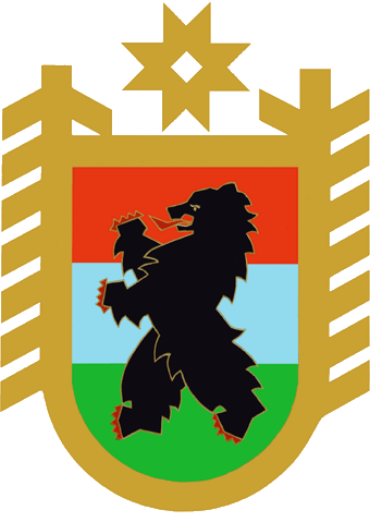
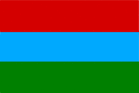
Karelia is located in the north-west of Russia, north of St. Petersburg. Karelia is a republic within Russia: it has its own emblem, flag and anthem. Russian and foreign tourists have long laid eyes on this region due to its picturesque nature and historical and architectural monuments. The tourist season in the republic is not limited to three summer months – tourists continuously travel to Karelia throughout the year. Karelia is good for fans of active tourism and those who love quiet travelling with the family.

About 50% of the territory of the republic is covered with forest, and a quarter by water. Karelia is the land of lakes, incredibly, there are more than 61 thousand of them, and another 27 thousand rivers and 29 reservoirs. The lakes Ladoga and Onega are the largest lakes in Europe.
The Republic of Karelia is conventionally divided into 5 districts: the only large city – Petrozavodsk, Lake Onega, Priladozhie, Belomorye and the northern part of the region bordering Finland.
Priladozhie (Ladoga lakeside)
Priladozhie is a southern region of Karelia with a very beautiful nature. The climate is mild, and the forests and cliffs are classic, Karelian. Tourists come here to see the ancient town Sortavala, the picturesque islands of the Valaam archipelago and the monastery.
Very interesting is the center of the Sortavala where the old layout has been preserved. Despite the fact that the whole city can be bypassed in an hour, almost every house here has historical and architectural value.

The Valaam Archipelago is one of the most famous cultural sites in Karelia. The natural park (created in 1999) includes several picturesque islands. On the largest of them there is the old Valaam (Preobrazhensky) Monastery, the first mention of which dates back to 1329.

Valaam island, St. Nicholas Skete. Source: Wikpedia.

Valaam (Preobrazhensky) Monastery. Source: Wikipedia.

Valaam Monastery inside. Source: Flickr.
Ruskeala Mountain Park, an old marble canyon that has been experiencing its rebirth since 2005, is also located in Priladozhie. Marble for St. Isaac’s Cathedral in St. Petersburg was taken from this beautiful place, and now guests can admire not only steep slopes and turquoise water, but also spectacular lighting and caves.


Ruskeala Mountain Park at night
Lake Onega
Lake Onega is the most popular place among tourists. Here we find the famous petroglyphs, the world famous Kizhi reserve, and the surroundings of Medvezhiegorsk – the notorious graves of victims of political repression. The Murom Monastery and Vodlozersky National Park deserve a visit as well.

Murom Transfiguration Monastery. Source: Wikipedia.
Petroglyphs
The petroglyphs – the Neolithic rock paintings are the most famous monument of Karelia. These cave paintings dated between the 4th and first millennia BC depict deers, fish, marine animals and people. Some of them reach three meters high. They are found along the shore of Lake Onega over a length of 20.5 km, in total there are about 1,200 drawings.
Kizhi
Kizhi, an island on Lake Onega, is a small but world-famous open-air museum showing the wooden architecture of the Russian North. The Kizhi architectural ensemble, consisting of two churches and a bell tower, is on the UNESCO World Cultural and Natural Heritage List. Numerous wooden constructions from other areas were also brought there.
The Church of the Transfiguration that was built in 1714 is one of the outstanding monuments of traditional wooden architecture of Karelia and the North of Russia. According to legend, the church with a height of 37 meters was built without a single nail. Although nails were still used to create domes.

Church of the Transfiguration in Kizhi. Source: Wikipedia.
The museum exposition is constantly widened with items brought from ethnographic expeditions. For tourist, there is an interactive folklore program “Music of the Northern Village”, visitors can also get acquainted with the traditions of shipbuilding and participate in a master class in traditional crafts.
Petrozavodsk
Petrozavodsk is the capital of Karelia, it was founded in 1703. The history of the city is associated with the name of Peter I. Over the years of its existence, Petrozavodsk turned from a provincial town into an administrative, industrial and cultural center of the republic.
Petrozavodsk lies on the shores of Lake Onega and is famous for its not very long but rich history. The embankment of Lake Onega showcases the sculptures donated to the city by its twin cities.

The sculptures on the embankment of Lake Onega

Lake Onega embankment in summer. Source: Wikipedia.
Also in the city there are several cathedrals and an impressive private art gallery “Doll House”.

In addition, you can go to the picturesque suburbs: Svyatozero, Kokkoilo, Sampo mountain and Marcial Waters.
Marcial Waters
Marcial Waters is the first resort of Russia founded by Peter the Great in 1719 on the basis of iron mineral springs with unique healing properties. The resort operates year-round.

The main building of the sanatorium Marcial Waters. Source: Wikipedia.
Kivach waterfall
Kivach waterfall (11 meters high) is one of the most popular tourist sites, its water falls down in cascades from small ledges. Around the waterfall the Natural Reserve Kivach was created. A unique biosystem that developed on the territory of this small park attracts biologists from all over the world.

Solovki
In the north, Karelia is bordered by the White Sea. The main tourist attractions here are the Solovetsky Islands, the Solovetsky Monastery and the unique Neolithic labyrinths (4th to 1st millennia BC) which is still a mystery to scientists. There was also the largest labor camp of the 1920s for political prisoners.

Neolithic labyrinths of Solovki. Source: pikabu.ru.

Solovetsky Monastery
Closer to the border with Finland you can explore the towns of Kostomuksha and Kalevala, as well as the Paanajärvi National Park and Kostomuksha Nature Reserve. This area is the least explored by travelers because getting to these places is not easy.

Tourism in Karelia
Karelia attracts tourists primarily with environmentally clean nature, low population density and competitive prices. However, the tourist industry in the republic is still in its infancy.
In summer, Karelia is popular among lovers of water tourism, travelers on bicycles and cars, fishermen and hunters. Cruise ships of various companies cross the Ladoga and Onega lakes. The best time to travel to the lakes is the second half of summer – the weather is warm and the water is already suitable for swimming.

Rafters in rafting boat
In winter time in Karelia there is an opportunity to engage in all kinds of skiing, take part in a dog or reindeer safari, make a trip on snowmobiles. Travel agencies offer a variety of itineraries with sightseeing, historical and cultural monuments. Since January 2012, the international dog sled race “Over the Land of Sampo” is held annually. Equestrian tourism is developing too.
The main treasure of Karelia is the forests that are called the lungs of Europe. A unique climate and a combination of natural conditions contribute to the general health improvement. On the territory of the republic there are several large sanatoriums.
To get to Karelia, you can use any convenient way: go by train to various cities of the region, arrive there by bus or fly to the main city of Petrozavodsk. In Petrozavodsk there is an opportunity to rent a car.
Karelia hotels
Karelia offers a variety of opportunities for staying: from campgrounds to good hotels. Hostels and campgrounds are very cheap, but the conditions are truly spartan. For those traveling together, it is more convenient to rent an apartment or live in a guest house. There are a lot of hotels in Karelia, from 10 to 100 EUR per night. For a group of 4-10 people it makes sense to rent a cottage (150-200 EUR per day).
Souvenirs
The most popular Karelian souvenirs are the products made of Karelian birch (from key chains to boxes and watches). The wood gives an unusual pattern and color to the finish. Another popular material is shungite – black stone with a characteristic metallic luster and healing properties is used to make bracelets, rosaries, beads, balls and pyramids. In addition, it is included in the composition of special creams that help with diseases of the musculoskeletal system.
A good gift for relatives would be Karelian herbal balm and various tinctures and jams made of local berries: cloudberries, cowberries, cranberries and shadberries.
Many are fascinated by Zaonezhskaya embroidery: simple and picturesque ornaments of red color on unpainted linen. The most practical gifts are towels, napkins, tablecloths and potholders.

Cuisine and restaurants of Karelia
Karelian cuisine is closely intertwined with the nature of the region. For a long time, local residents were engaged in fishing and picking berries, therefore these products occupy a special place on the table. Pies with fish, mushrooms, peas and turnip are very popular. Veal with vegetables in pots is called “Petrovsky meat”.

But the most famous dishes are the Karelian “kalitki” – a special type of open pies with a filling, and “kalarooka” – an unusual fish soup which is cooked in milk and sometimes passed through a layer of birch coal.

Karelian kalitki
Nowadays, finding Karelian restaurants is not so easy, although in Petrozavodsk there is a restaurant “Karelian Gornitsa” which positions itself as the first and only restaurant of Karelian cuisine in the world.
Описание презентации по отдельным слайдам:
-
1 слайд
KARELIA
Выполнила:
Зенькова Л.Н.
МБОУ СОШ №43 -
2 слайд
Geographical position
Karelia is called «the lungs» of Europe.About 26 per cent — with water with a great amount of lakes (63 thousand) and rivers (27 thousand). -
3 слайд
Woods
Woods occupy 88% of the wood-covered area. All woods are rich in berries and mushrooms. -
4 слайд
Karelian birch
Karelian birch is a short tree with uneven, bumpy or ribbed trunk. -
5 слайд
Lakes
There are more than 61 thousand lakes in Karelia.The size of the Karelian lakes is very different: it varies from small «forest lakes» to the largest lakes in Europe such as Ladoga and Onego.
-
6 слайд
Ladoga lake
Ladoga is the largest lake in Europe, it covers an area of 17,600 sq km.
Valaam Island is a very picturesque place of old Finland. -
7 слайд
Onego lake
Onego is the second largest lake in Europe.
The total amount of islands in Onego is 1650, The architectural monument of the world level — Kizhi Pogost, which is a calling card of Karelia, is situated on one of the islands -
8 слайд
Petroglyphs- were discovered on the granite cliffs along the eastern shore of the Onega Lake.
-
9 слайд
Kivach waterfall
Kivach Waterfall is the second largest after the Rhein flat land waterfall in Europe. The height of the waterfall is 10.7 meters.
Kivach waterfall was glorified by poets, artists and prose writers. It is the most famous waterfall of Karelia. -
10 слайд
The White Sea
The White Sea is a vast bay of Arctic Ocean.
The Petroglyphs of the White Sea are located in the mouth of the river Vyg in 6-8 km distance from the town of Byelomorsk. They are known under the name «Demon’s Footsteps» .The total number is about one thousand pictures. -
11 слайд
The Solovki is situated in the Onego gulf of the White Sea, 150 km from the Arctic Circle. In 1989 Solovki was recognized as one of the places worth of joining the preliminary World Heritage of UNESCO list.
-
12 слайд
Rivers
Large lakes are connected with channels and rivers. The amount of rivers in Karelia is also great — approximately 27 thousand, their total length is 83 thousand km.
The longest rivers are the Vodla river (400 kms) and the Kem river (360 kms). -
13 слайд
Martial Waters
On March 26, 1946 a museum of Peter I was founded on the decree of Soviet Government. It was opened on July 25, 1948.In the 1960s the museum was renamed into «Martial Waters». Since 1955 it is a branch of Karelian State Museum of Regional History.
Данная презентация содержит основную информацию о местоположении Республики Карелия, ее столице и главных достопримечательностях. Может быть использована в средней школе. На одном из слайдов представлена информация о Карелии в цифрах (протяженность, площадь и т.п.), что позволяет повторить числительные. Презентация может быть использована в рамках проведения тематической недели.
Вы уже знаете о суперспособностях современного учителя?
Тратить минимум сил на подготовку и проведение уроков.
Быстро и объективно проверять знания учащихся.
Сделать изучение нового материала максимально понятным.
Избавить себя от подбора заданий и их проверки после уроков.
Наладить дисциплину на своих уроках.
Получить возможность работать творчески.
Просмотр содержимого документа
«Презентация «My home place is Karelia» »
My home place Karelia is a land of forest and lakes
(Karelian week at school)
Karelia is situated in the north-western part of Russia.
The Coat of Arms of the Republic of Karelia The Flag of the Republic of Karelia
The area of Karelia is 180,5 thousand square km. (1.06% of the total territory of Russia). Its length from north to south is 660 km ., from west to east on the latitude of the town of Kem is 424 km. Karelia borders on Finland in the West, its length is 798 km . In the North-West the Republic is washed by the White sea. Distance from the administrative centre of republic, city of Petrozavodsk to Moscow makes 925 km ., 401 km . to St.-Petersburg, 1050 km. to Murmansk, and 703 km. to Helsinki.
Population of the Republic of Karelia is 684.200 people.
- Official language in Karelia is Russian.
- The republic is a multinational subject of the Russian Federation. Representatives of 213 nationalities live there.
- Karelians are 9.2%
- Karelian is a native tongue for some people.
There are more than 61 thousand lakes and 27 thousand rivers in Karelia. The largest are the Ladoga lake and the Onega lake
Petrozavodsk is the capital of Karelia
Petrozavodsk is the center of culture and professional art in Karelia, the largest establishments of culture are concentrated there: libraries, museums, theatres, concert halls, educational institutions, creative unions and scientific organizations
Karelia is famous for
the State Historical-Arhitectural and Ethnographical Museum-Reserve Kizhi
Kivatch waterfalls; Paanajärvi and Vodlozersky national parks


